Monthly Archives: August 2019

Abiquiu Lake, NM AUG 25, 2019

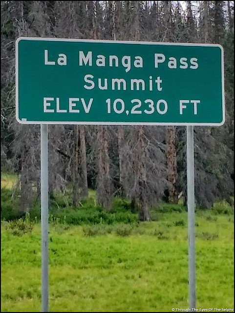
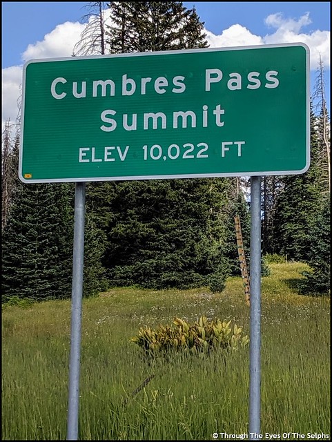
We said a sad farewell to beautiful Colorado and headed to New Mexico. We drove over two passes, our last two passes of the summer. 20190823_111523IMG_20190823_161322

The road was an open range area and we had to watch carefully for cattle in the roadway. IMG_20190823_162730IMG_20190823_16273820190823_112957

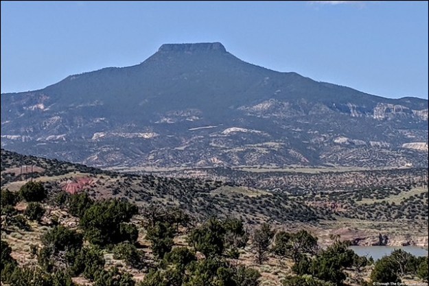
As we neared our campground it looked more and more like New Mexico landscape, just beautiful! IMG_20190827_134649IMG_20190827_134931IMG_20190827_135216IMG_20190827_135222IMG_20190827_135320IMG_20190827_135332IMG_20190827_135355IMG_20190827_135948

We had a four night reservation at the Abiquiu Lake Reservoir in the Riana section campground, a COE (Corps of Engineers) facility. We were last here in Sept, 2017. IMG_20190827_142715EFFECTSIMG_20190827_143025IMG_20190827_143436IMG_20190827_143358

I remembered this sign and wasn’t any happier to see it now than I was the last time. Luckily, none were spotted. Whew! But I would be lying if I said I wasn’t on guard every time I stepped out the door. IMG_20190827_143127

Boy was it hot with temperatures in the mid 90’s. It didn’t take us long to miss Colorado even more. 

Abiquiu Lake is a reservoir of water impounded from the Rio Chama River by the earth-filled Abiquiu Dam. The Rio Chama River is a major tributary of the Rio Grande River. We drove over the dam and could see the water in the reservoir is significantly down this visit. IMG_20190827_104002IMG_20190827_104009IMG_20190827_141457IMG_20190827_142122IMG_20190827_142116

Next up: A week long visit to Santa Fe to attend the Family Motor Coach Association Amateur Radio Fall Rally 

Rio Grande National Forest, CO AUG 21, 2019

With just one stop left in Colorado we left Great Sand Dunes National Park and headed to our campground west of Antonito in the Rio Grande National Forest. We had a nice trip except a passing RV threw a rock up and chipped our windshield. This is the third chip in the windshield we have had since May. We will need to call Safelite once again when we reach Santa Fe in a couple weeks. 

Along the way we stopped in Alamosa to stock up on groceries at Walmart. We could see the sky starting to darken in the direction we were headed. Back on the road again we had a lengthy backup due to road construction that brought us to a standstill. The wind picked up and in the distance we saw streaks of lightning.

After the traffic delay we arrived at our campground and discovered a storm had hit thirty minutes before our arrival.  The ground was covered with pea size hail that blanketed the ground like snow and the temperature had plummeted to 48 degrees. We were very thankful that traffic backup delayed our arrival. IMG_20190823_105909IMG_20190823_110158

Ponderosa Campground is a small campground located in a canyon amid tall mountains and is right along a river. It is a popular campground for those who enjoy fishing with many people returning year after year. It was a puzzle to me why people would stand for hours fishing when it is a catch and release campground. To each his own but if you can’t even eat what you catch, why bother? 20190823_170907

We had a nice campsite right along the river and it was very relaxing to see and hear the river. Those fishing didn’t hesitate to enter our campsite to access the river but it didn’t matter since it was entertaining to watch them.  With daytime highs in the low 70’s and lows in the upper 30’s to low 40’s, the weather was perfect. IMG_20190823_10592020190823_16522720190823_165401

After an enjoyable and relaxing four night stay it was time to say farewell to Colorado. We spent six weeks in western Colorado and will certainly miss the cool temperatures, beautiful views and excellent drinking water. 

Next up: New Mexico and hot temperatures once again 

Great Sand Dunes NP & Preserve, CO AUG 16, 2019

We enjoyed our time in Dillon and hated to leave the cool mountain temperatures, but it was time to move south. The journey was not a piece of cake since we had to cross over three mountain passes including Poncha Pass, Trout Creek Pass and Hoosier Pass which was at an elevation of 11,539 and at the Continental Divide. IMG_5129IMG_513120190816_120509IMG_5133

Our destination was Great Sands National Park and Preserve. This national park is located in the middle of nowhere. We had very limited Verizon but Bill was able to improve the signal with our cell phone booster. IMG_5134

Open this image up so you can zoom into the big picture.great sand dunes np

We stayed at a private campground right outside the park entrance with great views of the sand dunes and the Sangre de Cristo Mountains in the distance. IMG_5157IMG_20190819_114420IMG_20190819_113133

The park was first named a National Monument in 1932 and was designated a National Park in 2004. The park is comprised of 107,342 acres with the preserve protecting an additional 41,686 acres. The dunes cover thirty square miles. We stopped by the Visitors Center and saw an interesting movie about the park. IMG_20190820_112158

These sand dunes are the highest in North America both in height and elevation. Some of the dunes are up to 750 feet tall. Who would have thought the highest sand dunes in North America would be found more than a thousand miles from any ocean beach?? The sand dunes have been building and shifting for eons due to the San Luis Valley’s unique wind patterns which trapped the sand along the west face of the Sangre de Cristo Mountain Range. 20190817_143021

The park guide basically says most of the sand comes from erosion of the San Juan Mountains over 65 miles to the west where the sand grains are shattered by freezing and thawing and then tumbled by winds and streams. Larger grains of sand and pebbles also come from the Sangre de Cristo Mountains. Sand and sediment from both mountain ranges washed into a huge lake that once covered the valley floor. As the lake was reduced, southwesterly winds bounced the sand grains against the Sangre de Cristo Mountains where they were trapped by the tall mountain ranges. Northwesterly storm winds blast through mountain passes piling the sand back on itself which creates North America’s tallest sand dunes.

Each spring the Medano and Sand Creeks carry snow melt  through the park at the base of the dunes. The water recycles sand and provide a lifeline for the plants and animals in the park. In late spring and early summer the creeks are swollen and we saw pictures of children swimming and playing in the water. Now, in late summer, the creeks are almost dried up. You can see in the pictures wet looking places where the creeks are almost dry. But still enough water to get our feet wet. It is all so amazing! IMG_5178IMG_514220190817_144811IMG_5144

There were people climbing up the dunes and the park rented sleds and sandboards for sliding down. But with sand temperatures up to 150 degrees in the summer, we passed on hiking the dunes. The dunes were very hot and absolutely no shade. 

There were some fabulous sunsets from our campsite. Hard to decide which ones to include! These were taken during two sunsets. IMG_5147IMG_5161IMG_5169IMG_5185a

These two pictures occurred during sunset facing north over the dunes. IMG_5182aIMG_5191a

While this was a fascinating national park and we are really glad we visited, it is very remote and probably not a park we would return to in the future. 

Next up our last stop in Colorado 

Dillon, CO AUG 13, 2019

This blog posting is as much about the journey as it is about the destination. 20190813_105039

We left too hot Grand Junction and headed east to cooler temperatures. Following the Colorado River we saw amazing rock formations that are much like you would see in New Mexico and Utah.  20190813_10544220190813_10574820190813_11110120190813_11121620190813_11181020190813_111931

Along the roadside every quarter to half a mile we saw wildlife ramps that had been constructed so animals could easily escape the busy highway and not get trapped. 20190813_11225120190813_115634

People were out enjoying the river by fishing, kayaking or in some of the more rocky areas whitewater rafting. 20190813_11584820190813_11585220190813_12090820190813_123901

We drove through two tunnels constructed in the sides of mountains. It is always amazing to think of all the hard labor that goes into constructing these tunnels. 20190813_12093020190813_12430020190813_124310

We passed by the city of Vail, elevation 8,150 feet.  Since Grand Junction had an elevation of 4,600, we were climbing higher and hopefully to cooler temperatures. We noticed all the condominiums, homes and lodges built along the mountainside in this popular ski resort. Visible were the ski slopes, now a beautiful green instead of white with snow. 20190813_13152620190813_13340220190813_13360820190813_13371920190813_13375520190813_133825

Up, up, up we climbed on I-70 until we finally reached Vail Pass Summit at 10,603 feet. 20190813_135625At this point we started to drop down a little to our destination of Dillon, Colorado, elevation 9,087.  We stayed at White River National Forest campground just outside of town for three nights. We were so happy to have cooler temperatures. Our first night the temperature got down to 37 degrees with daily highs in the low 70’s. Perfect! IMG_20190815_163835

The towns of Dillon, Silverthorne and Frisco all run together and are ski resorts with tourism as their main economy. It is a thriving, bustling area with many big name stores and restaurants. Since it was busy in August, I can only imagine what it is like in the winter during ski season. We were amazed at the homes perched right on the edge of the mountains. IMG_511720190813_142303

Dillon Dam and Reservoir, a large freshwater reservoir, has a 25 mile shoreline with a walking /biking path that appeared to be heavily used. It is a reservoir for the city of Denver. The dam diverts water through a 23.3 mile tunnel under the Continental Divide to Denver. During the Great Depression when many Dillon people could not pay their property taxes, the Denver Water Board acquired most of the water rights in the area. In 1956 the Denver Water Board told the remaining citizens of Dillon that a dam was going to be built and they had until 1961 to sell their property and leave. The dam construction began in 1961 and was completed by 1963. The Denver Water Board set aside 172 acres for the new town of Dillon. The citizens and businesses were responsible for moving their own homes and structures. Many chose not to and the population shrank to 57. Today Dillon’s population is 904 not counting the nearby towns of Silverthorne and Frisco. With that sad history, it is so nice to see the thriving community today. 20190813_14222620190813_141751IMG_5115IMG_5127

One day we drove the car on Interstate 70 to the nearby Eisenhower – Edwin C. Johnson Memorial Tunnel which at 11,158 feet is one of the highest vehicle tunnels in the world. It is also the longest mountain tunnel and highest point in the interstate highway system. It is a two bore four lane vehicular tunnel under the Continental Divide in the Rocky Mountains. We first headed eastbound through the tunnel named for Edwin C. Johnson the  Colorado former governor and state senator. We then turned around and drove through the westbound bore which is named the Eisenhower Tunnel after President Dwight Eisenhower, for whom the Interstate System is also named. The Eisenhower Tunnel was built first and took five years to be be completed in 1973. The Johnson Tunnel took four years, was completed in 1979 and was one of the last major pieces of the country’s interstate system. Each tunnel is just shy of 1.7 miles long. The tunnels are sloped at 1.64% grade and have a steep approach of 7% grade on one side and 6% on the other. The tunnel has a clearance of 13 feet 11 inches. In 2012 approximately 28,000 vehicles passed through the tunnel bores each day, or 10.7 million vehicles per year. During construction of each tunnel bore, there were three fatalities in the Eisenhower bore and four in the Johnson tunnel bore. IMG_5088IMG_5090IMG_5093IMG_5096

Next up: Great Sand Dunes National Park and Preserve, CO

Grand Junction, CO AUG 9, 2019

We left Black Canyon of the Gunnison National Park and headed north to Grand Junction, Colorado, pop 59,000. We dropped from 9,400 ft to 4,600 ft and boy did it get hot!! During our time in Grand Junction the temperatures hovered in the low to mid 90’s. We sure did miss those mountain temperatures! 

On the way to Grand Junction we passed interesting sand formations. 20190808_12342420190808_12544820190808_12552020190808_125525

We stayed five nights at the James Robb State Park, a very nice Colorado state park, but there was absolutely no shade and it was HOT! 

One day we crossed the Colorado River and made the short drive to the Colorado National Monument, designated a National Monument in 1911. IMG_20190812_154419IMG_5022

The Monument is 32 square miles of rugged canyon terrain with towering red sandstone monoliths that rise 2,000 feet above the Grand Valley. The colors come from the minerals in the rocks as well as the kinds of lichens and chemical compounds that coat the rocks. IMG_5035

We stopped by the Visitors Center where unfortunately the movie was broken, but we did enjoy their exhibits. It was interesting to read that the Colorado National Monument Area was formed in part by strong earthquakes along the Redlands Fault 40 to 70 million years ago that lifted the layers of sedimentary and metamorphic rocks above the Grand Valley. Erosion has carved the steep walls and flat bottomed canyons. IMG_5028

We drove the 23 mile Rim Rock Drive with breathtaking scenery, tunnels, hairpin curves and eighteen overlooks. The road was begun in 1931 with most of it being done by the Civilian Conservation Corps (CCC) between 1933 and 1942. Construction was halted during WWII and finally completed in 1950.  Due to its cultural significance the road is on the National Register of Historic Places. The road was carved out of solid rock without the benefit of heavy equipment like bulldozers or backhoes. After blasting rock apart they removed rubble by hand or guided horses pulling small dump carts on rails.  About 39,000 cubic yards of rock were removed EVERY MILE to make way for the road bed! During construction of one of the tunnels nine men were killed when a huge slab of overhanging rock gave way. IMG_5030IMG_5032IMG_5038

We especially liked the 450 foot tall Independence Monument where every Fourth of July there is a tradition of climbers ascending the Monument to raise the American flag.

IMG_5048

Side View Of Independence Monument

20190809_101429

20190809_10013920190809_100339

We also liked the Grand View overlook with the Kissing Couple formation.  Do you see them kissing? 20190809_101228

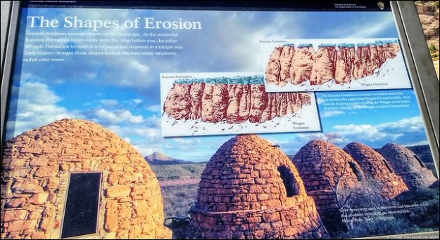
These interesting formations, shaped by erosion, are called Coke Ovens. 20190809_10433520190809_10294520190809_102929IMG_5070_stitch

Also we liked the mummy in the side of the cliff. Do you see it? IMG_5074IMG_5078IMG_5079IMG_5082IMG_508620190809_10432520190809_11260120190809_11273420190809_11280720190809_114338IMG_20190809_114733IMG_20190809_114813

On Saturday Bill attended the Grand Junction Amateur Radio Hamfest. It was a very small Hamfest but Bill always enjoys meeting and talking with other amateur radio enthusiasts. IMG_20190810_093249IMG_20190810_090230

Next stop: Dillon, CO and cooler weather!

Black Canyon of the Gunnison NP, CO AUG 2, 2019

Our time at Ridgway State Park came to an end after six days but we really could have used another two or three days to see everything. Every afternoon we had a rainstorm which hampered our hiking and exploring. There were trails in Ridgway State Park we never got to experience. But our reservation came to an end and we had another reservation waiting at our next destination. 

Next up was Black Canyon of the Gunnison National Park in southwestern Colorado. Formerly designated a National Monument in 1933, it became a National Park in 1999.  IMG_20190802_152647IMG_20190802_154930The Black Canyon is 48 miles long with astonishingly steep walls that rise more than 2,700 vertical feet from the Gunnison River at the base of the canyon. A combination of hard rocks, uplifting, ancient volcanoes and erosion have all played a part in shaping the canyon. It took about two million years to shape the canyon as it is seen today. Fourteen miles of the deepest part of the Canyon are located in the National Park. The narrowest part of the Canyon is 1,100 feet across the top and only forty feet across at the riverbed bottom. IMG_4865IMG_4870IMG_4879IMG_488020190803_135602

The Gunnison River drops over 2,000 feet through the 53 mile canyon. During spring runoff the water can fluctuate from 3,000 to 12,000 cubic feet per second. Water at just 5,000 cubic feet per second can carry rocks up to two feet across and weighing almost 700 pounds. This erosive energy from the river carves the canyon walls deeper faster than it erodes the sides wider. This is what causes the Black Canyon to be much deeper than it is wide. But even at that level of power the canyon only changes about a hair’s width each year. The erosion has been slowed somewhat by construction of dams upstream. IMG_4944IMG_4950IMG_4959

We went to the Chasm View overlook which has the greatest descent of the Gunnison River in the canyon where it drops 240 feet per mile. IMG_4947IMG_4960

The cliff rock is composed of two billion year old metamorphic rock, some of the oldest rock on Earth. It is so steep some parts of the canyon only receive 33 minutes of sunlight a day and the walls are often in shadow making them appear black, hence the name Black Rock Canyon. Gunnison comes from Captain John Gunnison who came to the area in 1853 leading an expedition in search of a route across the Continental Divide for a railroad from St Louis to San Francisco. He was killed by Ute Indians and the river was named in his honor. 

The Ute Indians were the first to live in the canyon long before the first Europeans. They referred to the river as “much rocks, big water” and avoided the canyon due to superstition. 

We camped on the South Rim where there is a Visitors Center and a seven mile paved road with twelve overlooks of the canyon. Most overlooks had a hike to each viewpoint, some short and some longer. Since we were staying six nights in the Park, we were able to take our time. While not terribly hot, at 8,320 feet the sun was very intense. 

We stopped by the Visitors Center with amazing views of the canyon and watched a short movie. IMG_4963

Over the next several days we worked our way along the overlooks. All of the overlooks had dramatic views. From high above we could hear the Gunnison River below, often with whitewater. Definitely not a river you could safely raft in the park. 

One overlook was the Painted Wall, which at 2,300 feet is the highest cliff in Colorado. If the Empire State Building stood on the canyon floor, it would reach only slightly halfway to the top of the cliff. The patterns in the wall were created more than a billion years ago when molten rock was squeezed into fractures and joints of the existing rock, then cooled and hardened. IMG_4979

Another day we took a different drive in the park, the East Portal Road, with a 16% grade and hairpin curves. The road took us down over 2,000 feet to the Gunnison River and two dams. This section of the river was much tamer and could be easily navigated by boat. IMG_4932IMG_4898

Our main reason for driving this road was to see the beginning of the Gunnison Tunnel, built from 1905 to 1909 to carry water to the town of Montrose and the Uncompahgre Valley. Back then the area was suffering from a water shortage due to the influx of settlers. Working underground using only candlelight and manual labor, it took the tunneling crew almost a year to bore through 2,000 feet of water filled rock. IMG_4900IMG_4904The work was so physically demanding and dangerous, even though the pay and benefits were good, men only stayed an average of two weeks before quitting. Twenty six men were killed during the four years of construction. The tunnel was completed in 1909, stretched 5.8 miles and cost three million dollars. The dam is used to fill the tunnel when water is low in the river. The tunnel can carry 495,000 gallons every minute. The Gunnison Tunnel was honored as a Civil Engineering Landmark joining others such as the Statue of Liberty and the Golden Gate Bridge. IMG_4905IMG_4930

Further down East Portal Road is the Crystal Dam built in 1978.  It is a unique structure because it curves from side to side and from top to bottom which gives it exceptional strength. Unfortunately the road to the Crystal Dam was closed and we couldn’t see it close up. IMG_4910IMG_4912IMG_4916IMG_4927

We often saw deer in the park and campground. Because deer often give birth in the campground and are fiercely protective of their fawn, dogs and other pets are not allowed outside each campsite from June 1 to Aug 10th. This year the pet ban was extended to Aug 26th due to late fawning. You are not allowed to carry your dogs in your arms or walk them in the campground outside of your designated campsite. IMG_20190802_160718IMG_20190804_192002IMG_20190807_112233

On our last day in the park we drove to nearby Cimarron to see a restored train that was part of the railroad built in 1882 to pull trains through western Colorado. Here we saw Locomotive #278, its coal tender, a boxcar, and caboose standing atop the last remaining railroad trestle along the Black Canyon of the Gunnison route.  The trestle was constructed in 1895. In 1881 a railroad line was built through the Black Canyon. It took Irish and Italian laborers a year to carve through the tough terrain. It cost $165,000 per mile. In 1882 the first passenger train passed through the canyon. It was said that there were probably not more than a quarter mile of straight track through the canyon. Due to the difficulty in operating and maintaining the track, it was abandoned in the early 1950s.  IMG_5005IMG_5021IMG_5019

Not far from the train display was another dam, the Morrow Point Dam, a 468 foot tall concrete double arch dam. It is the first dam of its type built by the U.S. Bureau of Reclamation and was constructed from 1963-1968. IMG_5016IMG_20190802_204551

Next up:  more time in beautiful Colorado