Category Archives: Hiking

hiking

Billings, Montana AUG 11, 2020

We drove from Lewistown to Billings (pop 104,000) for a one week stay. The weather during our stay was hot, with temperatures reaching 100 degrees on our last day! 

Billings most striking feature is the Rimrock, a natural feature rising 500 feet above the Yellowstone Valley. Legend says that in 1837 two Crow warriors, dressed in their finest and singing death songs, rode a solid white blindfolded horse over Sacrifice Cliff from the Rimrocks. They did this to appease their gods in order to halt the spread of smallpox among their people. The Native Americans call the cliff “The Place Where the White Horse Went Down“. The Crow, who had no immunity to the disease, had contracted smallpox from the people of the American Fur Trading Company. The disease caused great loss to the Crow people between 1837-1838. IMG_20200814_142111

The Rimrocks sandstone formations were formed 80 million years ago. The Western Interior Seaway, where Billings is today, slowly rose and fell over time, leaving behind compressed sand that became this massive formation. The Yellowstone River has been cutting into it for a million years, leaving a canyon in the bedrock. IMG_20200814_144013

We drove along the top of the Rimrocks with nice views of the city of Billings below. MVIMG_20200814_143927

Then we visited Riverfront Park where we found a geocache and got a glimpse of the Yellowstone River. We had several views of the Yellowstone River flows through Billings. IMG_20200814_155839IMG_20200814_152617

We also stopped by Boothill Cemetery, the final resting place between 1877-1881 of three dozen individuals, many who died with their boots on. This is one of many such named cemeteries throughout the west. Buried in this cemetery was Muggins Taylor, the scout who brought the world the news of Custer’s last stand. There was a large rock memorial with quotes on each of the four sides.

Quote 1:
“This Monument Marks A Historic Site
Where Thirty-Five Lie Buried
For Fortune and Fame
Lost Their Lives Lost Their Game” 

Quote 2:
“Upon This Rugged Hill
The Long Trail Past 
These Men Of Restless Will
Find Rest At Last” 

Quote 3:
“The Stream Flows On But It Matters Not
To The Sleepers Here By The World Forgot
The Heroes Of Many A Tale Unsung 
They Lived And Died When The West Was Young” 

Quote 4: was unfortunately too worn to read IMG_20200814_154906

On Saturday we drove to Red Lodge, Montana to begin driving the Beartooth Highway (All-American Highway) which goes from Montana into Wyoming. Charles Kuralt called this “the most beautiful roadway in America“. IMG_20200815_143822

IMG_20200815_125628-EFFECTS

Can You See The Bear’s Tooth?

It is also designated one of the most dangerous roads in America as it climbs to 10,947 feet with numerous switchbacks.

On our GPS you can see the five switchbacks which gain about four thousand feet. IMG_20200815_125116IMG_20200815_111529PANO_20200815_115105.vr

Completed in 1936, it provides views of some of the most rugged and wild areas in the lower 48 states.  Along the way are visible twenty peaks over 12,000 feet, 950 alpine lakes, glaciers, Rocky Mountain goats, waterfalls and wildflowers. It took us eight hours to make the round trip drive with all the scenic overlooks. What a beautiful drive! IMG_20200815_121312IMG_20200815_122042IMG_20200815_131837IMG_20200815_122318IMG_20200815_131631IMG_20200815_130922

This is a herd of Rocky Mountain Goats, many are still shedding their coats. IMG_20200815_125852_1IMG_20200815_125854

MVIMG_20200815_141849

Pilot and Index Peaks

We saw Lake Creek waterfall and snagged a short video with sound. MVIMG_20200815_140748


Lake Creek Waterfall
Select this above link to see and hear the video. MVIMG_20200815_140844

We went to Crazy Creek waterfall and turned back for home. IMG_20200815_142828

We liked this old wrecker we found in one of the small towns we passed through. It looks like one of the cars (Mater) in the animated movie “Cars”. Mater is the rustiest, trustiest tow truck in Radiator Springs. IMG_20200815_165750
And an interesting sculpture as well! IMG_20200815_165828

After two wonderful months in Montana, it is time to move on to North Dakota. 

Next up: Medora, North Dakota 

Butte and Helena, Montana July 5, 2020

Leaving Bozeman we headed north to a small town (Basin) about thirty miles south of Helena for a ten day stay. 

One day we drove south to the town of Butte, Montana, pop 5,700. Butte was once known as the “richest hill on earth” because of the mineral wealth that made hundreds of men wealthy and gave jobs to thousands and thousands of immigrants. While gold and silver brought the first wealth to the area, it was copper that helped it earn its nickname. It produced more than 20 billion pounds of copper, more than any other in the United States. Due to the demand for copper during the industrial revolution, Butte had electricity before NYC and other major cities. At the turn of the century it was the richest and largest city in the northwest. By 1955 most of the high grade copper was gone so they turned to extracting ore, with 48 billion dollars worth of ore extracted. As of 2017, Butte has the largest population of Irish Americans per capita of any city in the United States. IMG_20200708_124548

Just outside of Butte we stopped at an overlook to get a geocache and noticed “Our Lady of the Rockies”, a 90 foot high statue of the Virgin Mary which sits on the Continental Divide and overlooks the town. It is a nondenominational tribute to motherhood that took six years to build and was airlifted into place in 1985. It is the third tallest statue in the United States. IMG_20200708_124522IMG_20200708_124533

Our main reason for coming to Butte was to hike on the Milwaukee Road Rail-Trail, a former railroad for the former Chicago, Milwaukee and St Paul Railroad which was converted to a walking and biking trail. This section of the railroad was one of the first in the country to be electrified, with Thomas Edison coming out to Butte to ride the railroad. IMG_20200708_141422IMG_20200708_143604

The trail includes two tunnels and a trestle and is 9.5 miles round trip. We made it to the two tunnels and then walked back for a total of five miles. We were tired!

IMG_20200708_144312

First Tunnel is 550 Feet Long

IMG_20200708_152224

Second Tunnel is 1,100 Feet Long

IMG_20200708_152107

Another view of the Longer Tunnel

We really wanted to walk to the trestle but ten miles was too much for us. So after we got back to the car we drove to see the trestle which is 600 feet long and rises 130 feet above the valley.  IMG_20200708_170026

We had one more stop to make at the grave of Evel Knievel, the stuntman and daredevil who was born and grew up in Butte. IMG_20200708_171743IMG_20200708_171533IMG_20200708_171554

Another day we drove north from our campground to Helena, the capital of Montana, pop 28,000. If you follow our blogs you know that visiting and touring capitol buildings is always on our list of things to do. Montana became a state and Helena, became the capital in 1889. IMG_20200710_111306-EFFECTS

In 1864 four tired and discouraged prospectors looking for gold stumbled down a gulch and decided to take one last chance to strike gold. On their last chance they hit gold and a town flourished. The area became known as “Last Chance Gulch”. Today that area is Helena’s main street. The gold rush lasted long enough for 3.6 billion dollars (in today’s dollars) of gold to be extracted from Last Chance Gulch over two decades, making it one of the wealthiest cities in the United States by the late 19th century. This wealth is evident by the grand Victorian mansions we saw today. By 1888 about fifty millionaires lived in Helena, more per capita than in any city in the world. Today the majority of people in Helena are Irish and Catholic. It is the fifth least populous state capital in the United States and the sixth most populous city in Montana. By the way, in the late 1970s when repairs were being made to a bank, a vein of gold was found under the bank’s foundation. Actor Gary Cooper, actress Myrna Loy and fashion designer Liz Claiborne are from Helena. 

We took the hour long “Last Chance Tour Train” for a historical tour of Helena. IMG_20200710_105943IMG_20200710_110638Originally built as a Shrine temple in 1920, the Helena Civic Center is now owned and operated by the City of Helena.

IMG_20200710_112704_1MVIMG_20200710_113115IMG_20200710_114125IMG_20200710_114320IMG_20200710_114418MVIMG_20200710_114604IMG_20200710_115219

After the train tour we did a self guided tour of the capitol building. The guided tours were canceled because of the pandemic and the capitol building was very quiet. Even the security desk was empty. IMG_20200710_120915
IMG_20200710_122002

This painting represents the Lewis and Clark Expedition in July 1805 arrival at the Three Forks (headwaters of the Missouri River). Sacagawea’s recognition of her people’s hunting grounds from which she had been abducted five years earlier. Clark (at left) and Lewis flank Sacagawea; to the right is her husband, interpreter Toussaint Charbonneau. At the far left are explorer John Colter and Clark’s African American slave, York.
IMG_20200710_123514On September 8, 1883, at Gold Creek (approximately half way between Helena and Missoula). Former president Ulysses S. Grant wields the sledgehammer that he will use to drive the last spike for Northern Pacific Railroad.
IMG_20200710_123938

Jeannette Rankin (1880–1973) became the first woman to serve in the United States Congress in 1916.

IMG_20200710_124345IMG_20200710_102703IMG_20200710_124006

We always look for the Liberty Bell and Ten Commandments at each capitol site. IMG_20200710_104745IMG_20200710_105827

We could see the sleeping giant in the distance. Do you see him? IMG_20200710_123720

Next we visited the beautiful Cathedral of St Helena completed in 1914. The stained glass windows were made in Munich, Germany. IMG_20200710_141104IMG_20200710_135943IMG_20200710_140104IMG_20200710_140215IMG_20200710_140705IMG_20200710_135953IMG_20200710_140123IMG_20200710_140342IMG_20200710_140508

Next up: Great Falls, Montana


Bozeman, Montana July 1, 2020

Leaving our campground in Gardiner, Montana just outside the Yellowstone NP, we headed north to Bozeman, Montana pop 49,000.  It is the fourth largest city in Montana and the home of Montana State University. 

Bozeman was named for John Bozeman who brought the first wagon train of settlers to this area and founded the town in 1864. He blazed the trail which later became known as Bozeman Trail which was the way west for many settlers and miners. The area was a sacred hunting area to Native Americans and there were constant attacks on the settlers. When John Bozeman was killed by the Sioux, his trail remained unused for nine years because of repeated attacks. Today the Bozeman area is one of the state’s prime agriculturally productive regions.

After an easy 90 minute drive we pulled into what turned out to be our least favorite campground this year. We are not picky and do not have high expectations, but this campground was situated between an interstate highway and a railroad track. If the constant traffic noise didn’t keep you awake, the train whistles would. Added to that was an almost nonexistent Verizon signal and a high price. We told ourselves it was only for six nights and could tolerate it that long.

When I was looking for geocaches in the area, I found one located at the Little Bear School House and Museum. The one room school house is made from logs, built in 1912 and was used until 1950. In 1998 it was opened as a museum with authentic desks, ink wells, writing slates, teacher’s desk, black boards and learning materials from the early 20th century. There were also antique lunch boxes and fountain pen collections and an antique merry go round. As a former teacher I was really looking forward to the visit. It was located ten miles outside of Bozeman. IMG_20200701_120011IMG_20200701_120530

We arrived to find it closed due to the pandemic. I had checked before we left and their Facebook page said it was open. Come on people, it is not that hard to update a website’s information. We tried to look in the windows but the bright sunlight and thick screens prevented us from seeing much. These pictures were taken through the windows. IMG_20200701_120250IMG_20200701_120308

The wooden walkway leading to the front door had the names of students who had attended the school. IMG_20200701_120024

On Sunday we drove thirty miles to Missouri Headwaters State Park where the Gallatin, Jefferson and Madison Rivers converge to form the Missouri River, the longest river in North America. IMG_20200704_140556

It flows 2,341 miles before entering the Mississippi River north of St Louis, Missouri. The Mississippi River is the second longest at 2,141 miles. If you add the lengths of the Missouri and Ohio Rivers to the Mississippi, it would makes the Mississippi River the third longest river system in the world. 

In 1805, Lewis and Clark camped at the Missouri River headwaters for three days and thought their exploration of the Missouri River to its source as one of the major goals of their expedition. Lewis and Clark agreed to named the three rivers:

  • the Jefferson River after President Thomas Jefferson,
  • the Madison River after Secretary of State James Madison, and
  • the Gallatin River after Secretary of the Treasury Albert Gallatin. IMG_20200704_142636

Sacagawea, the Shoshone woman who traveled with Lewis and Clark, had roots in this area. At the age of twelve, while camped here with her people, she was kidnapped by another tribe and taken to what is now North Dakota as a slave. Charbonneau, a fur trader, purchased her. Charbonneau was hired for the Lewis and Clark Expedition as an interpreter. He brought along Sacagawea with her infant son. Her presence helped convince the Native Americans of the group’s peaceful intentions. Later Sacagawea helped them find the Shoshones where she was reunited with her brother. The Shoshone agreed to sell them the horses they desperately needed to cross the mountains. The Shoshone asked for payment in guns which they needed to fight their enemies. IMG_20200704_144927

During the Civil War entrepreneurs started a small town here in hopes of establishing a major transportation center with steamships connecting with stage lines. This never took hold and the area became a ghost town before becoming a state park in 1951.  Here stands the remnants of the Gallatin City hotel, about 1862. IMG_20200704_140753

Over the centuries the three forks of the Missouri River was a natural crossroads and meeting place for many different Indian nations to come together. Later traveling bands of hunters used the area to meet, trade and camp. Today we saw it as a popular place for people to tube down the water, pandemic or no pandemic! IMG_20200704_143028IMG_20200704_151315

Next up was the nearby Madison Buffalo Jump State Park. This is an extremely small state park accessed on a gravel road. Neither state park we visited today was manned by any park rangers. We just put our entrance fee in an envelope in a box and continued on. IMG_20200704_153934

Starting two thousand years ago and used as recently as two hundred years ago, the Madison Buffalo Jump was used to kill buffalo. Before Indians acquired horses, they sometimes stampeded large herds of buffalo off this high limestone cliff and Indians waiting at the base killed them with spears. This was most often done in the fall of the year when buffalo cows were prime and the tribes were gathering food and supplies for the winter. Highly skilled young men trained for speed and endurance wore buffalo, antelope or wolf skins to lure the buffalo to the cliff. They would excite or frighten them into a stampede over the edge. Buffalo bones are still buried at the base of the cliff. We thought about hiking to the top of the cliff but gathering storm clouds convinced us otherwise. IMG_20200704_154915IMG_20200704_154336

Another day we visited the American Computer and Robotics Museum in Bozeman. Known as the oldest continually operating museum of its kind in the world and labeled by a Harvard professor as “Inch for inch, the best museum in the world”, and given that Bill is a computer engineer, you know we just had to visit! It is a museum of the history of computers, communications, artificial intelligence and robotics. IMG_20200701_143958MVIMG_20200701_140730IMG_20200701_141708r

With that said, I have to step aside and let Bill take over from here with this part of the blog!

The museum has many real items like one of Isaac Newton’s original book 1687, Philosophiæ Naturalis Principia Mathematica.  On loan is a Enigma Machine which the Germans believed was impossible to break but Alan Turing and his team in England developed technology to decrypt most of the German war messages during the war.

IMG_20200701_133351IMG_20200701_133343IMG_20200701_133701

IMG_20200701_135644

Alan Turing (1912-1954) ideas were used to create the modern computers and conceived of the field of “Artificial Intelligence”.

IMG_20200701_135611

John von Neumann (1903 -1957) was a mathematician regarded as the one of the greatest mathematician in modern history. He made major contributions to many fields. His concept of data and program stored in the computer memory space has become the de facto standard for most computers that exist today (called the von Neumann architecture).

Here are some of the many early personal computers of the 1980’s. IMG_20200701_141847IMG_20200701_141857IMG_20200701_141904IMG_20200701_142027

One of my favorite devices is the Curta four function hand held, mechanical calculator (about the size of a soup can.) Developed in the 1930 was built until electronic calculators in the 1970s displaced them. IMG_20200701_132910

Next up: Montana’s capitol area Helena and Butte city.

Yellowstone NP part 4 June 28, 2020

On our last day in Yellowstone NP we drove from our campground to Mammoth Hot Springs. On the way we passed the 45th parallel sign. IMG_20200627_092030

As we entered the village of Mammoth Hot Springs we were delighted to see a large herd of elk grazing in the traffic circle. We especially enjoyed seeing all the calves. IMG_20200627_092725MVIMG_20200627_092838IMG_20200627_092754

We continued on to the Mammoth Hot Springs terraces area. MVIMG_20200627_100856IMG_20200627_101630

Mammoth Hot Springs has mineral laden hot water from deep within the Earth’s crust which finds its way to the surface and builds beautiful tiers of cascading, terraced stone.  Hot water and gases ascend through limestone deposits, sculpting the rock.  Once exposed to the air, calcium carbonate from the limestone is deposited as a rock called travertine.  These hot springs do not erupt but instead build these spectacular terraces.  The terrace sculpting has been going on for thousands of years as thousands of gallons of water well up and deposit large amounts of travertine, or limestone, daily and as quickly as three feet per year! IMG_20200627_093730IMG_20200627_094605IMG_20200627_094707IMG_20200627_100314IMG_20200627_100616

We walked around the extensive boardwalk area, up and down many steps as we made our way around the area. Just beautiful! IMG_20200627_100840IMG_20200627_100958IMG_20200627_101150IMG_20200627_101308IMG_20200627_101313IMG_20200627_101416

Near the parking area is what they call “Liberty Cap”, a dormant hot spring cone 37 feet tall. The 1871 Hayden Geological Survey strangely named the cone after the peasant caps worn during the French Revolution. They were also depicted on early American coins. IMG_20200627_093722

The village of Mammoth Hot Springs is where the Yellowstone park headquarters is located and it has a village of stores, gift shops, a Visitors Center and a couple restaurants.  In the early days of Yellowstone National Park’s existence the park was protected by the U.S. Army from 1886 to 1918. From what you might wonder. From people damaging the geothermal areas and hunting the wildlife.  The original buildings of Fort Yellowstone such as the guardhouse, jail and soldiers’ barracks are preserved and still standing in Mammoth Springs today. IMG_20200627_101706IMG_20200627_101816IMG_20200627_102322IMG_20200627_105550

This concludes our time in Yellowstone NP. Next we continue our summer travels into Montana. 


Yellowstone NP part 3 June 24, 2020

Yellowstone is such an amazing national park. Whatever your interest, it has something for everyone. Geysers, hot springs, animals galore, gorgeous scenery and waterfalls. On our third day into the park we focused on waterfalls. IMG_20200627_105328

Yellowstone has a grand canyon. Not as huge or magnificent as THE Grand Canyon, but still fabulous and beautiful with not one but two magnificent waterfalls. The Grand Canyon of the Yellowstone River was created from a lava flow 484,000 years ago.  It is mainly made of rhyolite rock.  Past and current hydrothermal activity weakened and altered the rock, making it softer.  The Yellowstone River eroded these weakened rocks to deepen and widen the canyon, a process continuing today.  The canyon is twenty miles long, more than a thousand feet deep, and between 1,500 and 4,000 feet wide with two waterfalls. IMG_20200624_100902

One end of the canyon begins at the 308 foot tall Lower Falls which may have formed because the river flows over volcanic rock more resistant to erosion than rocks downstream.  The same is true for the 109 foot Upper Falls. IMG_20200624_100707IMG_20200624_110656

When we were here five years ago we hiked several trails around the falls and one strenuous hike with 13 switchbacks that took us to the top of the falls. This time the trail was closed due to the pandemic. Just one of many things still closed throughout the park. But we still had plenty to see and do to keep us busy. IMG_20200624_105630IMG_20200624_110752

Along with visiting the canyon we drove through Hayden Valley where we saw plenty more bison, some elk and a bear. IMG_20200624_141025IMG_20200624_142401

We didn’t get a picture of this bear since he was too far away to get a clear picture. IMG_20200624_123955IMG_20200624_123747

This area took us along Yellowstone Lake (elevation 7,733 feet) with stunning views of water with snow capped mountains in the distance. IMG_20200624_124355

We stopped at an area with rapids where we actually talked with a park ranger, our only real interaction with a ranger all week. He told us if we looked closely we could see fish. This time of year is when the water flows at its highest. The fish were waiting because they knew as the water flow decreased during the hotter summer months, it would be time to swim back to the lake. We enjoyed some time there, watching the fish near the surface occasionally jumping out of the water. Too fast to catch with a camera! MVIMG_20200624_132732IMG_20200624_132824

This hill side is called Roaring Mountain. On the hill side if you zoom in you can see two active steam vents. IMG_20200624_150410IMG_20200624_150855

We stopped at a mud volcano area with a nice boardwalk around the hot springs. There were plenty of signs warning people to stay on the boardwalk because thermal areas have a thin crust above boiling hot springs and scalding mud. Some of the pools are acidic enough to burn through boots! More than twenty people have been scalded to death and hundreds more badly burned or scarred because they left the boardwalks. Imagine our surprise when we saw three bison very close by as we reached the halfway point around the boardwalk. A ranger was there and stopped people from continuing to get close to the bison out of fear of them becoming agitated.  We saw this happen on our first day when a lady with a camera got too close, and we were glad of the strong fence.  One was rubbing against a small tree, evidently trying to rub off the last of his winter coat. IMG_20200624_135718

Another was drinking water from a small pool of muddy water, yuck!! IMG_20200624_135544

The third was actually inside a mud pot area and we wondered how hot the ground was on his hooves. Eventually another ranger came with yellow caution tape and stopped anyone from entering that area of the boardwalk.  IMG_20200624_135520

The elevation drops significantly by a waterfall on the Gardner River as we travel to Mammoth Hot Springs and eventually to the North Entrance at 5,314 feet. MVIMG_20200624_153847

Near this waterfall we saw a lone Dall sheep high on the hillside feeding on the grass. He was so high up it was difficult to get a clear picture. IMG_20200624_154120IMG_20200624_154219

The next day Bill took a half day white water rafting trip on the Yellowstone River with the Yellowstone River Raft Company located in Gardiner MT.  IMG_20200627_111804MVIMG_20200626_095218

They went right behind our RV and I was waiting to take his picture. IMG_20200626_103952IMG_20200626_104012~2

The river was running with a good volume/flow of 10,000 cubic feet per second. He had a great time/ride and was glad to add the Yellowstone River to the lists of rivers he has rafted. IMG_6614~2IMG_0815~2IMG_6604

Next up: Our last day in Yellowstone NP


Bryce Canyon N.P. May 8, 2020

We left Cedar City, Utah and traveled north on Interstate 15, still during the isolation rules of COVID-19 Pandemic. Since it was a short distance and we would be traveling over a steep pass, we decided I would follow behind in the car rather than towing. Look! There is Bill ahead of me with snow capped mountains in the distance. IMG_20200506_125325

We arrived at our campground near the tiny town of Panguitch, Utah. Its claim to fame is Butch Cassidy was born just down the road. Butch Cassidy and his gang once had their photograph taken in Panguitch. We last camped here in late August, 2015.  It is a no frills and very reasonably priced campground. We settled in for a two week stay. The first few days the temperatures were perfect during the day but too cold at night. One night the temperature got down to 21 degrees! We left the faucet dripping during the night and fortunately had no problems. 

Since our last visit here in 2015 we had been anxious to visit Bryce Canyon NP again. Of the five national parks in Utah, this was our favorite. While many Utah national parks remained closed, because of the virus, we were very fortunate to have Bryce reopen with some restrictions. The Visitors Center, most restrooms and most trails were closed. 

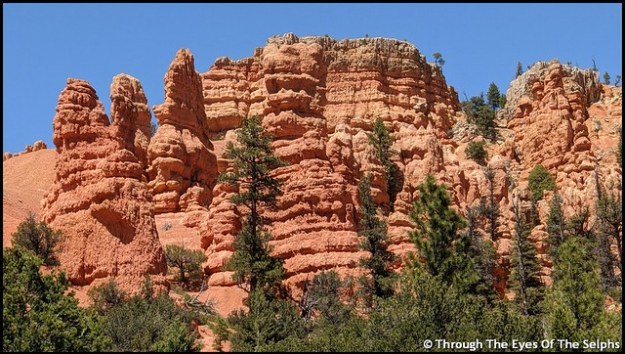
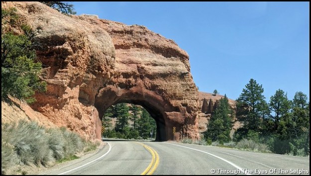
On Friday we made the 25 mile drive from our campground to Bryce Canyon. To get to Bryce Canyon we drove on Highway 12, The All American Road. We passed through Red Canyon, part of Dixie National Forest with its beautiful red sandstone and limestone formations and through two tunnels. IMG_20200508_140026IMG_20200508_140439IMG_20200515_162353-EFFECTSIMG_20200508_142051

The fee booth at the park entrance was not manned but they had maps and park information available. 

Our goal today was to do the eighteen mile scenic drive and stop at the fourteen overlooks. Bryce Canyon isn’t really a canyon but a plateau with a series of horseshoe shaped amphitheaters carved in the edges of the eroding plateau.  Bryce Canyon was settled by Mormon pioneers in the 1850’s and is named for Ebenezer Bryce, a Mormon settler who homesteaded the area in 1874. It became a national park in 1928.

Some viewpoints could be seen from the road while others required short walks, usually on paved walkways. The views were all amazing. Our favorite was the many hoodoos, which are towering rock formations sculptured over time by ice freezing and thawing, some as much as ten stories tall.  There are approximately 200 days of freezing/thawing at Bryce Canyon each year.  IMG_20200508_152548

It was fun to let our imaginations run wild and imagine faces or figures in the formations.  The Paiutes, original inhabitants of the area, believed that the rock figures were people turned to stone by angry gods.  If you look closely you can also see fairy tale castle formations. Iron oxide gives red, yellow and brown tints to the limestone. IMG_20200508_145640

One overlook was at 9,100 feet and it was very chilly. The number of tourists was low and it was nice to be able to drive through the park with very little traffic and no crowds at the overlooks. IMG_20200508_145744IMG_20200508_150116IMG_20200508_150148IMG_20200508_150238IMG_20200508_150314IMG_20200508_150443IMG_20200508_152218IMG_20200508_153110IMG_20200508_153217IMG_20200508_153235IMG_20200508_153320IMG_20200508_154015IMG_20200508_154043IMG_20200508_154144IMG_20200508_160624IMG_20200508_161030IMG_20200508_162234

The following Friday we went back to the park. This time there was a person at the fee booth with the window closed, not taking fees but handing out information through a slot. Unlike the previous Friday the Visitors Center was open with limited capacity but the theater was closed. We wanted to see the informative movie about the park we remembered from 2015, but since the theater was closed we didn’t stop. IMG_20200515_141150IMG_20200515_141200IMG_20200515_141606IMG_20200515_141611IMG_20200515_144258IMG_20200515_144434

There was more traffic than the previous Friday. We passed by the prairie dog natural habitat area with signs warning of wildlife crossings. A prairie dog ran out in front of us and we stopped. He ran to the center of the two lane road, got confused and stopped. He then ran toward our car. We were unable to move until he moved to one side or the other. An impatient driver behind us honked his horn, and when we didn’t move, he zoomed past us on our right hand side. Not knowing where the prairie dog was we held our breath that he didn’t get hit. Usually when somebody does something irresponsible like this there are no police around to see it. But fortunately there was a Ranger headed in the opposite direction and saw what happened. He made a u-turn, turned on his lights and pulled the driver over. The Ranger looked pretty annoyed when he stepped out of his car. I never can understand why people come to places like national parks and are so impatient and in such a hurry. As for the prairie dog, he ran to the side of the road and lived happily ever after! IMG_20200508_163834IMG_20200508_164532

Our main focus today was to walk the rim trail along the top of the canyon. When we were here five years ago we made the arduous hike on the Navajo Trail down into the canyon. On this day the Navajo Trail was closed indefinitely due to severe damage from winter weather. We talked with a Ranger who said they were going to have to call in a geologist for advice on how best to repair the popular trail. IMG_20200515_151127IMG_20200515_151140IMG_20200515_154702IMG_20200515_154944IMG_20200515_155054IMG_20200515_153837

Our last days in Panguitch were very windy with gusts up to 45+ mph. We delayed leaving by one day because of the windy conditions since we would have to go back over the pass on the way to our next destination. Most of Utah is now open for business but physical distance and masks are required.

Next up: Provo, Utah

Arizona, Nov 27, 2019

After leaving Big Bend National Park in Texas we headed west to Arizona. We spent a week in Benson, Arizona and a week in Tucson. 

While in Tucson we enjoyed beautiful sunsets and a stroll in the desert near our campsite. IMG_20191110_173215IMG_20191116_165743IMG_20191116_165649

Back in late September while attending the Albuquerque Hamfest I took and passed the General exam, raising my amateur radio license from Technician to General. I decided then I wanted to take the Extra exam to achieve the highest level amateur radio license. The fact that Bill is an Extra probably had something to do with it. Studying for the exam involved learning and memorizing over seven hundred questions about radio frequencies, antennas, policies, electrical components, etc. It was hard! I spent October studying and while we were in Tucson the amateur radio club there held testing on Nov 11th. I took the test and passed, only missing one question! Glad to know the brain and memory still works. I even got a celebration cake with my call sign on it. Thanks Bill! 20191114_155438

While in Tucson we also met the Walmart floor cleaning robot. We named him Robbie the Robot and had a good laugh at him. I saw a small boy, about three years of age, trying to talk to Robbie. So cute! 20191114_144127

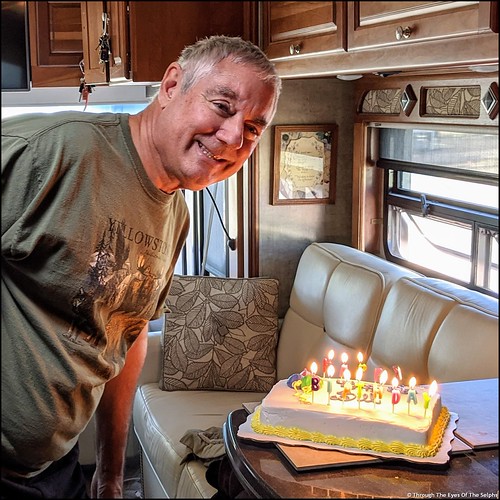
Next was Casa Grande, Arizona where Bill celebrated his birthday on November 22nd.  We will be celebrating Thanksgiving here before moving to Yuma on Dec 1st. IMG_20191122_153203IMG_20191122_153207_MPIMG_20191122_152212

Happy Thanksgiving everyone from Bill and Diane!! 

Big Bend NP Texas Oct 25, 2019

We left cold, windy Marfa and headed to Big Bend National Park located in southwestern Texas along the Rio Grande River and the boundary with Mexico. It is a long drive to Big Bend, one of the most remote and least visited national parks in the contiguous United States.  The nearest city is 75 miles away and there is no cell phone service and very limited WiFi which is only available at the park visitors centers. Conveniently there are two gas stations located in the park. IMG_20191026_130448

Big Bend gets its name from the 90 degree turn in the Rio Grande River near the southern tip of the park. The river is the natural border between the United States and Mexico which creates some complicated security issues for the Border Patrol in the area. We saw border patrol vehicles throughout the park.

We had a wide range of temperatures the week we were there with daytime highs ranging from a high of 97 to a high of only 67 degrees in a matter of days. A cold front blew in near the end of our seven day stay and we had winds of 25 to 35 mph for almost 24 hours. IMG_20191026_165109IMG_20191026_151058IMG_20191029_171452IMG_20191029_171521

One striking thing about this park is how big the park is and how far you have to drive to get from one side to the other. To get from the east side of the park to the west side is over fifty miles and takes an hour and a half. Because of the extreme heat in the summer, the high season here begins Nov 15th and runs to April 15th. The park is so large it has five visitors centers but only two were open this time of year. The park has a limited number of paved roads and many gravel and dirt roads. We learned from a park ranger that since they had just finished their rainy season, any unpaved roads were in too bad a shape to drive our Honda CRV. This was disappointing because it limited the amount of park we could explore. IMG_20191026_161551

The first day we visited Panther Junction Visitors Center and saw the park movie. IMG_20191026_13435120191026_155109

IMG_20191026_154323

Our First Texas View Of The Rio Grande River West OF The Park

During our time in the park we saw many roadrunner and sharp eyed Bill caught sight of a javelina along the side of the road. He managed to get a picture before it got spooked and ran off. We learned from the park movie that javelinas have a snout like a pig and smell like a skunk. IMG_20191027_164932

One day we drove to Santa Elena Canyon to do a hike into the canyon. When we arrived we discovered that the river bed that is normally dried up and must be crossed to reach the trail, was now covered in knee deep water. We seriously considered taking off our shoes and socks and walking across until we heard from others that there was thick deep mud we would have to plow through. We watched other people cross and when they emerged from the sludge it looked like they had on gray knee socks from the mud. No thanks. IMG_20191027_135815

We were content looking at the canyon from a distance. This canyon, like others in the park, had nearly vertical walls made primarily of limestone. IMG_20191027_135527IMG_20191027_140520

We drove the Ross Maxwell Scenic Drive enjoying the geologic splendor of the park. IMG_20191027_143838IMG_20191027_153213IMG_20191027_143435

We stopped by the Fossil Discovery Exhibit where we learned about the plants and animals that lived here millions of years ago. At one time a shallow sea covered Big Bend and much of Texas, leaving behind fossils of fish, sharks and swimming reptiles. As the water receded the area was inhabited by dinosaurs and giant alligators. IMG_20191026_171802IMG_20191026_172421

Over the years many fossils and bones have been discovered in the park. IMG_20191026_172516

Another day we drove an hour from our campground which was located in the park to the Chisos Basin section. To get to this area the car climbed two thousand feet above the desert floor. Here there is a lodge and the other visitors center which was open. We took a nice walk on a paved trail to the “Window View” with beautiful views of mountain vistas and the valley basin below. 20191029_15312520191029_15232920191029_15330420191029_163339

Near the end of our stay we drove to the hot springs section of the park. In the early 1900’s people began to come to the area to bathe in the hot springs. It was believed that the mineral springs had healing powers. The owner of the land recognized the potential monetary value of the 105 degree mineral springs and built a bathhouse and desert health resort. By 1927 the availability of automobiles and improved roads meant even more people visiting and so a store, post office and motel were added. In 1942 the landowner sold the land to the state of Texas. In 1944 Texas gave the land to the United States for a national park. 20191026_135024

The unpaved gravel road was very narrow and a little tricky to navigate but the Ranger assured us it was the one unpaved road still accessible. We parked and began the short trail to the springs. IMG_20191030_144448

We could see the remains of some of the buildings from this once prosperous community. IMG_20191030_142513

We arrived at the hot springs where three older women had arrived just ahead of us. They nonchalantly glanced at us and then proceeded to completely strip off their clothes and walk naked down into the springs. Any desire to go down and dip our toes in disappeared at that point. We didn’t stay long. IMG_20191030_144836_MP

Next up we drove to the Boquillas Canyon overlook with more spectacular canyon and Rio Grande river views. IMG_20191030_154528

Across the river, we could see the Mexican town of Boquillas. There is a border water crossing there that is open several times a week. 

We enjoyed our time in Big Bend National Park. It had been on Bill’s bucket list for several years. We probably would not return mainly because it is so remote and takes so much driving time to get there.

On the way back west in one small Texas town a crowd of people had stopped along the train tracks, some with cameras on tripods. We wondered what they were waiting for and then Bill remembered seeing on the El Paso TV news about the 150th anniversary of the Union Pacific’s Big Boy No. 4014, the world’s largest steam locomotive. It was doing a “Great Race Across the Southwest” run with stops in El Paso, San Antonio and Houston. We stopped along the roadside and snapped a few pictures as it went by. Great timing! IMG_20191101_14322320191101_143439

This ends our summer travels which took us to Monument Valley and into Colorado before making our way back down to New Mexico and Texas. 

Next up we are headed back west to spend some time in Tucson and Casa Grande before spending the winter once again in Yuma, Arizona. 

Black Canyon of the Gunnison NP, CO AUG 2, 2019

Our time at Ridgway State Park came to an end after six days but we really could have used another two or three days to see everything. Every afternoon we had a rainstorm which hampered our hiking and exploring. There were trails in Ridgway State Park we never got to experience. But our reservation came to an end and we had another reservation waiting at our next destination. 

Next up was Black Canyon of the Gunnison National Park in southwestern Colorado. Formerly designated a National Monument in 1933, it became a National Park in 1999.  IMG_20190802_152647IMG_20190802_154930The Black Canyon is 48 miles long with astonishingly steep walls that rise more than 2,700 vertical feet from the Gunnison River at the base of the canyon. A combination of hard rocks, uplifting, ancient volcanoes and erosion have all played a part in shaping the canyon. It took about two million years to shape the canyon as it is seen today. Fourteen miles of the deepest part of the Canyon are located in the National Park. The narrowest part of the Canyon is 1,100 feet across the top and only forty feet across at the riverbed bottom. IMG_4865IMG_4870IMG_4879IMG_488020190803_135602

The Gunnison River drops over 2,000 feet through the 53 mile canyon. During spring runoff the water can fluctuate from 3,000 to 12,000 cubic feet per second. Water at just 5,000 cubic feet per second can carry rocks up to two feet across and weighing almost 700 pounds. This erosive energy from the river carves the canyon walls deeper faster than it erodes the sides wider. This is what causes the Black Canyon to be much deeper than it is wide. But even at that level of power the canyon only changes about a hair’s width each year. The erosion has been slowed somewhat by construction of dams upstream. IMG_4944IMG_4950IMG_4959

We went to the Chasm View overlook which has the greatest descent of the Gunnison River in the canyon where it drops 240 feet per mile. IMG_4947IMG_4960

The cliff rock is composed of two billion year old metamorphic rock, some of the oldest rock on Earth. It is so steep some parts of the canyon only receive 33 minutes of sunlight a day and the walls are often in shadow making them appear black, hence the name Black Rock Canyon. Gunnison comes from Captain John Gunnison who came to the area in 1853 leading an expedition in search of a route across the Continental Divide for a railroad from St Louis to San Francisco. He was killed by Ute Indians and the river was named in his honor. 

The Ute Indians were the first to live in the canyon long before the first Europeans. They referred to the river as “much rocks, big water” and avoided the canyon due to superstition. 

We camped on the South Rim where there is a Visitors Center and a seven mile paved road with twelve overlooks of the canyon. Most overlooks had a hike to each viewpoint, some short and some longer. Since we were staying six nights in the Park, we were able to take our time. While not terribly hot, at 8,320 feet the sun was very intense. 

We stopped by the Visitors Center with amazing views of the canyon and watched a short movie. IMG_4963

Over the next several days we worked our way along the overlooks. All of the overlooks had dramatic views. From high above we could hear the Gunnison River below, often with whitewater. Definitely not a river you could safely raft in the park. 

One overlook was the Painted Wall, which at 2,300 feet is the highest cliff in Colorado. If the Empire State Building stood on the canyon floor, it would reach only slightly halfway to the top of the cliff. The patterns in the wall were created more than a billion years ago when molten rock was squeezed into fractures and joints of the existing rock, then cooled and hardened. IMG_4979

Another day we took a different drive in the park, the East Portal Road, with a 16% grade and hairpin curves. The road took us down over 2,000 feet to the Gunnison River and two dams. This section of the river was much tamer and could be easily navigated by boat. IMG_4932IMG_4898

Our main reason for driving this road was to see the beginning of the Gunnison Tunnel, built from 1905 to 1909 to carry water to the town of Montrose and the Uncompahgre Valley. Back then the area was suffering from a water shortage due to the influx of settlers. Working underground using only candlelight and manual labor, it took the tunneling crew almost a year to bore through 2,000 feet of water filled rock. IMG_4900IMG_4904The work was so physically demanding and dangerous, even though the pay and benefits were good, men only stayed an average of two weeks before quitting. Twenty six men were killed during the four years of construction. The tunnel was completed in 1909, stretched 5.8 miles and cost three million dollars. The dam is used to fill the tunnel when water is low in the river. The tunnel can carry 495,000 gallons every minute. The Gunnison Tunnel was honored as a Civil Engineering Landmark joining others such as the Statue of Liberty and the Golden Gate Bridge. IMG_4905IMG_4930

Further down East Portal Road is the Crystal Dam built in 1978.  It is a unique structure because it curves from side to side and from top to bottom which gives it exceptional strength. Unfortunately the road to the Crystal Dam was closed and we couldn’t see it close up. IMG_4910IMG_4912IMG_4916IMG_4927

We often saw deer in the park and campground. Because deer often give birth in the campground and are fiercely protective of their fawn, dogs and other pets are not allowed outside each campsite from June 1 to Aug 10th. This year the pet ban was extended to Aug 26th due to late fawning. You are not allowed to carry your dogs in your arms or walk them in the campground outside of your designated campsite. IMG_20190802_160718IMG_20190804_192002IMG_20190807_112233

On our last day in the park we drove to nearby Cimarron to see a restored train that was part of the railroad built in 1882 to pull trains through western Colorado. Here we saw Locomotive #278, its coal tender, a boxcar, and caboose standing atop the last remaining railroad trestle along the Black Canyon of the Gunnison route.  The trestle was constructed in 1895. In 1881 a railroad line was built through the Black Canyon. It took Irish and Italian laborers a year to carve through the tough terrain. It cost $165,000 per mile. In 1882 the first passenger train passed through the canyon. It was said that there were probably not more than a quarter mile of straight track through the canyon. Due to the difficulty in operating and maintaining the track, it was abandoned in the early 1950s.  IMG_5005IMG_5021IMG_5019

Not far from the train display was another dam, the Morrow Point Dam, a 468 foot tall concrete double arch dam. It is the first dam of its type built by the U.S. Bureau of Reclamation and was constructed from 1963-1968. IMG_5016IMG_20190802_204551

Next up:  more time in beautiful Colorado


Mesa Verde NP, CO July 16, 2019

We left Monument Valley and headed to Colorado and hopefully cooler temperatures. It was a beautiful drive with more rock formations and occasional farmland with horses and cattle. We were surprised to see some working oil pumps. 20190714_12572320190714_130203

Our destination was the McPhee Reservoir Recreation Area in the San Juan National Forest for a seven night stay. We had a lovely, private campsite with electric only located at an elevation of 7,200 feet. In the distance we saw snow capped mountains. IMG_20190715_155701

Near our campsite is an overlook of the reservoir.  Where you see water now is where at one time the lumber company town of McPhee stood. In the late 1920’s McPhee was Colorado’s largest lumber mill town with a population of 1,400 and produced over half of the state’s lumber output. In 1948 after a second major fire in a decade destroyed the sawmill, it was not rebuilt. Today the former lumber town is submerged by reservoir waters. 20190719_201653

One day we drove over to Mesa Verde National Park. As we were leaving our campground early in the morning we saw a very large herd of cattle being led down the road to another pasture. It was hard to get a good picture of the large herd because we were facing into the sun. IMG_20190716_070819

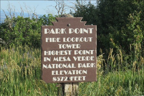
We were last at Mesa Verde National Park in 2015 (see link: Mesa Verde National Park, CO).  The 52,000 acre park is one of the country’s major archeological preserves with almost 5,000 archeological sites including 600 cliff dwellings. Mesa Verde, Spanish for “green table”, was the home of Ancestral Pueblo people for more than 750 years. IMG_20150517_110223 IMG_4506

They lived in the area from around 500 A.D. to 1276 A.D. It was approximately around 1200 when they began to build the cliff dwellings that Mesa Verde is best known for today. When a drought struck that lasted for twenty-four years, it eventually forced the people to leave the area and migrate to New Mexico and Arizona in search of water and better living conditions. IMG_4509

Last time we were here we drove the loop road where some of the larger cliff dwellings are viewed from a distance. In order to see the cliff dwellings up close you have to go on a park ranger led tour for the very reasonable fee of $5.00. IMG_20190716_095017IMG_20190716_095042IMG_20190716_100143IMG_20190716_094632IMG_4516

This time Bill decided he wanted to take the hour long tour of the largest cliff dwelling in the United States, Cliff Palace. He had a reservation for 9:30 A.M. in order to avoid the hottest part of the day. Even though we were now in southwestern Colorado we were still having afternoon temperatures in the upper 80’s. The tour was labeled as strenuous with steep, uneven stone stairs both going and coming and you had to climb four steep ten foot wooden ladders to access the cliff dwelling. I decided not to go and waited in a shady seating area while he was gone. It was the idea of the four steep ten foot wooden ladders that got to me. IMG_20190716_094517IMG_20190716_103253IMG_20190716_103247

Bill had a great time but he did say the walk out was pretty strenuous. He said the ranger did a nice job describing what everyday life was like at the Cliff Palace over 800 years ago. Cliff Palace consisted of about 150 rooms made of sandstone and mortar made of sand, clay and ash. Water had to be hauled in to make the mortar. It is almost inconceivable to imagine how they accomplished this herculean effort in twenty years. In addition to the 150 rooms they had 75 open spaces and 21 kivas, below ground circular rooms used for ceremonies and gatherings. IMG_20190716_101341IMG_20190716_101239

IMG_20190716_101231

Kiva – Round Room Without Roof

IMG_20190716_102739

Picture Taken From Window Of Three Story Tower – Shows Floor Logs


IMG_20190716_102758

After Bill’s tour we stopped at the archeological museum to see a movie about the park and view exhibits and artifacts on the Ancestral Puebloans. IMG_4524
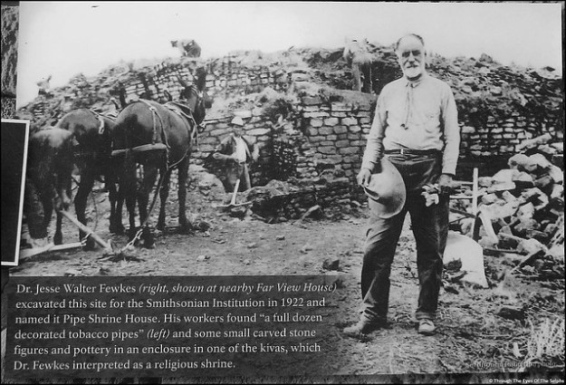
We stopped by the Far View Sites where homes were built on the top of mesas.

IMG_4521

Far View House

IMG_4528

Far View House Walls

IMG_4523

Kiva at Far View House

IMG_4527

Unique Stone In Outer Wall Of Pipe Shrine House

After a late lunch it was starting to get quite hot and we were very glad we had gotten an early start.

Mesa Verde National Park is an amazing place!

Next up: more exploring in southwestern Colorado