Category Archives: Private RV Campground

Private RV Campground

Oklahoma City, OK Sept 15, 2020

We left Pierre SD under rainy skies on a fast track to Oklahoma City. The weather quickly changed from sunny, hot weather in Pierre to rain, wind and falling temperatures.

We stopped to see the “Dignity of Earth and Sky” sculpture, conveniently located at a rest area off the interstate. The Native American woman is standing high on a bluff above the Missouri River. The star quilt is made of 128 diamond shapes in the colors of water and sky. The statue is 50 feet tall, weighs 12 tons and is made of hundreds of pieces of stainless steel. She honors the Native Nations of the Great Plains. I bet it would have been beautiful to see on a sunny day. IMG_20200907_120023MVIMG_20200907_120212

The welcome center had a Lewis and Clark exhibit. IMG_20200907_115935IMG_20200907_115236IMG_20200907_114937

By the time we reached our first overnight stop in Pickstown, South Dakota the wind was almost blowing us off our feet and it was cold. nebraska-welcome

The next morning we awoke to more rain and wind and headed to Stromsburg, Nebraska, also known as the Swede capital of Nebraska. The persistent rain followed us with high temperatures in the upper 40’s. Miserably damp and cold. It probably would have been a nice little town to explore if we had more time and the weather had been better. We were parked in their free RV park under trees and the heavy rain dripping off the leaves was loud throughout the night. IMG_20200909_093558IMG_20200909_113323

We were up early the next day and drove to McPherson, Kansas where we arrived in a driving rain. Horrible conditions for Bill to hook everything up outside. We were beginning to think we would never be warm or dry again. 

After several days we headed to Oklahoma City for a five night stay. The rain had finally stopped and it warmed up! IMG_20200914_140053IMG_20200915_084154IMG_20200914_164200

There were several places to visit in this busy capital city with lots of traffic. We first visited the Oklahoma City National Memorial, the site of the horrific bombing on April 19, 1995. It is a beautiful, moving memorial including “The Gates of Time” marking the moment of destruction at 9:02 AM. IMG_20200915_114622IMG_20200915_114923IMG_20200915_114859IMG_20200915_115153

The “Field of Empty Chairs” is arranged in nine rows reflecting the floors where the victims were located. The 168 chairs are each etched with the name of the person killed, including 19 smaller chairs representing children. IMG_20200915_115131IMG_20200915_115839IMG_20200915_121040

A “Survivor Wall” is located on the building’s only remaining walls with the names of more than 600 people who survived the blast. IMG_20200915_115608

Nearby was a statue entitled “Jesus Wept”. IMG_20200915_120832

Next we went to visit the Oklahoma state capitol building, another new one for us. IMG_20200915_111623IMG_20200915_105851IMG_20200915_110000IMG_20200915_110017IMG_20200915_110125IMG_20200915_110133

Well we sort of saw the building. All year the pandemic has handicapped our travel plans. This time it wasn’t the pandemic, but a $193 million multi year renovation. We were able to visit the building, but most of it was off limits. IMG_20200915_105256IMG_20200915_105135IMG_20200915_103708IMG_20200915_104728

More than 100 paintings, statues and busts had all been removed. We did the best we could to get a flavor for what the building looks like. I bet it will be beautiful when it is finished in 2022. IMG_20200915_105357IMG_20200915_105105IMG_20200915_105112MVIMG_20200915_105309IMG_20200915_105338

This is the only capitol building in the world surrounded by working oil wells. One well is called “Petunia #1” because it was drilled in the middle of a flower bed. IMG_20200915_110301IMG_20200915_105809

Another interesting place was the Centennial Land Run Monument” which commemorates the opening of unassigned land in the Oklahoma Territory in 1889. Over 50,000 men and women made a rush to claim the land. People who didn’t wait for the official opening of the land and illegally grabbed the land early were called “sooners”. The frenzied energy and emotion of the run was captured in bronze statues. It is one of the world’s largest group of bronze sculptures and features 45 figures. IMG_20200915_124202IMG_20200915_123732IMG_20200915_123855

Next up: Time for a Change and Exciting News


Pierre, SD Sept 4, 2020

Our next stop was Pierre, SD (pop 13,646).  It is the second smallest capital by population in the United States and a new capital for us to visit. IMG_20200906_145409

Our campground was actually across the Missouri River from Pierre in an area called Fort Pierre.   Our campground sat high on a bluff and our campsite had beautiful views of the Missouri River and Pierre. We could even see the dome of the capitol building in the distance. MVIMG_20200906_142534-EFFECTS

It was definitely a picturesque site and one we will always remember. When Bill went in the campground office to check in, he was handed an armful of tourist information. The Pierre Chamber of Commerce and Visitors Center had done an excellent job of providing information on the area including a detailed self guide of the Capitol building, a driving tour of the area, city maps, and lots of historical points of interest. I don’t ever remember a city doing such an excellent job of helping tourists get the most out of their visit. Well done Pierre!! 

This area was explored by the Lewis and Clark Corps of Discovery. IMG_20200905_160336

They spent the late summer and early fall of 1804 exploring what is now South Dakota. Their return trip in 1806 also brought them through the state. Can you visualize the immense herds of buffalo, deer, elk and antelope as well as pheasant and grouse they saw as they crossed the plains and grasslands? The state is full of Lewis and Clark historical sites and history, and the Pierre area is no exception. In September 24-28, 1804, Lewis and Clark met with the Teton Sioux. The success of this one meeting could have made or broken the success of the Expedition. IMG_20200906_144634IMG_20200906_144539IMG_20200905_161355

Today there are five Native American tribes living along the Missouri River. 

Pierre was founded in 1880 as gold prospectors and homesteaders flooded the Dakota Territory. In that same year the railroad first crossed the Missouri River here and Pierre grew as more people and goods crossed the state. South Dakota achieved statehood in 1889 and Pierre, located in the geographic center of the state became the capital. 

Before the establishment of the town of Pierre, the oldest established settlement in South Dakota was Fort Pierre, established in 1832.  It was the largest trading post and the site of the first US military post on the upper Missouri. 

Of course we had to visit the state capitol building which was built in 1910. It is a smaller version of the capitol in Montana with interior features of elaborate Greek and Roman design. Marble wainscoting and columns with a majestic staircase, terrazzo tile Italian floor, Victorian leaded glass, brass door fixtures and a 90 foot rotunda all come together to create a beautiful capitol building. IMG_20200905_133834

Even though currently there are no guided tours due to the pandemic, a friendly volunteer met us as we came through security. He spent time with us pointing out some of the special features. IMG_20200905_135711IMG_20200905_135500IMG_20200905_135507IMG_20200905_135549IMG_20200905_135737IMG_20200905_140358IMG_20200905_140744IMG_20200905_141931IMG_20200905_141942IMG_20200905_141955

All of the first ladies inauguration dresses and the current first man’s suit are captured in little boxes. IMG_20200905_135245IMG_20200905_135228MVIMG_20200905_135304

Outside the Capitol building is a memorial to World War II veterans with six bronze figures representing the military branches. IMG_20200905_143822IMG_20200905_143937

Throughout downtown Pierre is a Trail of Governors, 25 bronze statues of former South Dakota governors placed beginning in 2012 as a lasting legacy to their service to the state. Six more statues are set to be placed in the next couple years. The placement of the additional statues was hampered by the coronavirus. An informative brochure listed the location of each statue and interesting information about each governor. IMG_20200905_152759IMG_20200905_133858

One interesting piece of history is that in 1742 a French  explorer and his four sons led exploratory expeditions into the northern plains of North America. They sought to extend the range of the French further west with the goal of reaching the Pacific Ocean. When in the area of what is today Fort Pierre, they secretly placed a lead plate bearing the French coat of arms and text in Latin about the King of France. They placed the plate to claim the land for France.  The area was marked with a pile of rocks which they told the local Native Americans was merely to mark their passage in order to avoid suspicion. The plate lay undisturbed for 170 years until February, 1913 when a group of teenagers found the Verendryle plate. Down the hill from our campground is a historical marker where the plate was found. Flags of the US, France and South Dakota are flown at the site. IMG_20200906_143426IMG_20200906_142911IMG_20200906_142908

Around the Pierre area are several one room schoolhouses which I always enjoy viewing. The Sansarc School was used from 1910 to 1969. IMG_20200906_145711

Pierre’s first schoolhouse was built in 1881 and used as a school for one year with 18 students until a public school could be built. 

IMG_20200905_131724

The Oahe Chapel was built in 1877 and served as both a church and a schoolhouse for the Oahe Mission and the Sioux Indians. IMG_20200905_162130

The Oahe Dam, first begun in 1948, was dedicated in 1962 by President John Kennedy and is the 2nd largest rolled earth dam in the world. It is 245 feet high, 9,300 feet long with a width of 3,500 feet. Lake Oahe, South Dakota’s largest lake, was created by the dam and stretches 231miles from Pierre to Bismarck, ND. The Oahe Dam is one of four rolled earth dams along the Missouri River built between the 1940’s and 1960’s. The dams have helped ease flooding along the Missouri River, provided hydroelectric power as well as many recreational opportunities. IMG_20200905_160654IMG_20200905_160431

We saw a Quartzsite Border marker. From 1891 to 1892, there were 720 quartzite pillars placed ½ mile along the line between North and South. The boundary line was named the “quartzite border” and is the only state boundary designated in this way. IMG_20200905_150746

We certainly enjoyed our time in this picturesque, friendly capital city. 

Next up: Oklahoma City, Oklahoma 

Mobridge, SD Sept 2, 2020

Leaving Bismarck we were located east of the Missouri River, we drove south on the Lawrence Welk Highway. We passed through the tiny town of Strasburg, North Dakota (pop 410) close to the border of North and South Dakota. IMG_20200828_141315

Lawrence Welk was born in the German speaking community of Strasburg in 1903. He left school in the fourth grade to help on the family farm and did not learn to speak English until he was 21. It would be interesting to learn more about how he went from tiny Strasburg to the bright lights of Hollywood.

My mother’s favorite show was The Lawrence Welk Show. After it was no longer a weekly hit, it was shown on PBS. In my hometown of Charlottesville it came on once on Saturday and twice on Sunday, same show each time. My mother watched all three shows every week. It wasn’t that she liked Lawrence Welk that much. She loved the singers, dancers and the music. Thank you Lawrence Welk for the many hours of entertainment and joy you gave her each week! 

We crossed over into South Dakota and just like in Montana and North Dakota, we passed field after field of sunflowers and farmland with endless bales of hay waiting to be sold or used for feed during the long winter soon to come. IMG_20200901_121609IMG_20200902_141140

We saw on the local weather that some parts of Montana and Wyoming, including Yellowstone National Park will be getting snow by Labor Day. 

We arrived at our next stop, Herried, South Dakota (pop. 438) for a short two night stay. Our second day there the winds picked up with gusts well over 45 mph. We put the slides in and listened to the wind howl. One of the worst storms we have been in was in June, 2015 in the South Dakota Badlands where we had a thunderstorm with strong wind. I am not a fan of Midwestern weather! 

During our short stay in Herreid we drove to Mobridge, South Dakota to see the disputed grave of Sitting Bull and a marker honoring Sacajawea. No one knows for sure where either Sitting Bill or Sacajawea are buried. Both North and South Dakota claim to have the Indian chief’s remains. To access the memorial site we crossed the Missouri River and on the west side we entered the Standing Rock Indian Reservation. IMG_20200902_150357

According to the Lakota tribe, the Sitting Bull memorial is near the site of his actual camp. Regardless, the memorial is located in a beautiful location on a bluff overlooking the Missouri River. PANO_20200902_144954.vrIMG_20200902_144803IMG_20200902_144706

Below Sitting Bull’s memorial, close to the road and in a much less scenic location, is an obelisk marker honoring Sacajawea, which is the spelling used most often in the east and by the National Park Service. In the western states Sacajawea is spelled Sakakawea and is pronounced differently. It is believed she was buried somewhere near the site of old Fort Manuel about thirty miles north of here. IMG_20200902_145629IMG_20200902_145609

Next up: Pierre, capital of South Dakota 

Bismarck, ND Part 2 AUG 26, 2020

While in Bismarck we visited nearby Fort Abraham Lincoln State Park. Fort Abraham Lincoln was an infantry and cavalry post from which Lt Col George Custer led the 7th Cavalry to the Battle of the Little Bighorn in 1876. The fort provided protection for the railroad workers and survey crews from Indian attack. It also provided protection to settlements being established in the area.

Due to increased attacks by the Sioux, Congress authorized a cavalry post to the fort. Lt Col George Custer arrived in 1873 with six companies of the 7th Calvary.

The fort was abandoned in 1891 and local residents disassembled the fort for its nails and wood.  It is said that many old homes in the Bismarck area have lumber and pieces of the old fort in them. In 1907 President Theodore Roosevelt signed the land over to the state of North Dakota for a state park. IMG_20200829_113937

From 1934-38 the Civilian Conservation Corps (CCC) built a visitors center, roads, reconstructed blockhouses and placed cornerstones where fort buildings once stood. All 250 members of this CCC were Great War (World War I) veterans 

Also in the park the CCC replicated Mandan earthen lodges to recreate a Mandan village called “On-a-Slant Village”. IMG_20200829_115539IMG_20200829_124113

The original Mandan Village was established in the late 16th century and was inhabited until 1781.  It consisted of approximately 86 earthen lodges with a population of between 1,000-1,500 and was located where the Heart and Missouri Rivers come together. IMG_20200829_124043IMG_20200829_124132IMG_20200829_124318IMG_20200829_124414IMG_20200829_124454IMG_20200829_124517IMG_20200829_132207

In 1781 a smallpox epidemic killed over three out of every four villagers. After the epidemic the Mandan moved north.

The Lewis and Clark Expedition spent the winter of 1804-05 with friendly Mandan.  They stayed again in 1806 on their return trip. The Sioux eventually drove the Mandan from the area. IMG_20200829_115844

A reproduction of Custer’s house was built in 1989 in time for the state’s centennial celebration. Custer and his wife Libbie lived at Fort Abraham Lincoln from 1873 until Custer died at the Battle of the Little Bighorn in 1876. IMG_20200829_120742IMG_20200829_140706IMG_20200829_140920

We walked to one of three reconstructed blockhouses once used to defend the fort. I waited down below while Bill climbed a staircase followed by a steep ladder to the observation post. It was a beautiful day with great views including the capitol building in the distance, the only tall building in Bismarck. IMG_20200829_133622IMG_20200829_134002IMG_20200829_134019IMG_20200829_133702IMG_20200829_133726

Inside the blockhouse was a nest of baby swallows. We saw the mama bird flying in and out of the building. IMG_20200829_134134

While in the park we traveled down to the river where the Heart and Missouri Rivers converge. IMG_20200829_135445

Next we drove to Keelboat Park along the Missouri River with a 55 foot full scale replica similar to the keelboat used by Lewis and Clark. The Expedition’s keelboat carried a number of plants and animals collected on their journey including live magpies, a prairie dog, a prairie grouse hen, 108 botanical specimens, 68 mineral samples, pronghorn skeletons, insects, mice, and various animal hides. It also included a 45,000 word report to President Thomas Jefferson with descriptions of teepee, Indian myths and customs and other ethnological observations and maps. IMG_20200829_143805IMG_20200829_144111

Also in the park were unusual metal sculptures of Lewis, Clark and Sacajawea painted the colors of traffic lights. IMG_20200829_144411

Another sculptures is called “Thunderbirds”. To the Native Americans the thunderbirds are part of the Great Spirit who lives among us in the clouds. The thunderbirds bring lightning flashes from their eyes and produce thunder by the flapping of their wings. IMG_20200829_143459

We enjoyed our stay in Bismarck. 

Next up: South Dakota! 

Bismarck, ND Part 1 AUG 22, 2020

We left Medora and headed to Bismarck for a ten night stop. It continued to be very hot, with the heat spell finally ending a few days before we left. When the weather finally changed it went from very hot days to days with beautiful blue skies, pleasant temperatures and cool nights. At last! 

Along the way to Bismarck we saw signs of oil drilling, wind turbines and fields of canola and sunflowers. IMG_20200822_110144_1IMG_20200822_112131IMG_20200822_114322IMG_20200822_134603

Several roadside signs warned us to wear masks. IMG_20200822_110404

We also passed over the Missouri River where we saw a parade of boats celebrating President Trump. IMG_20200822_133249

We took these two pictures from our TV on our local news.IMG_20200822_224220MVIMG_20200822_224335

As you know by now, we also like to visit state capitol buildings. Since North Dakota is a new state for us, we had a new capitol building to visit. IMG_20200828_151749

IMG_20200828_151848

Statue Honoring Frontier Families

This capitol building was very different from others we have visited. Most of them are modeled after the US Capitol with columns and a dome. This capitol looked like an office building. With 19 floors, it was the only high rise building in the city of Bismarck (pop 61,000) and therefore easy to see wherever you are in the area.

The capitol tours were canceled because of the pandemic but we were allowed to take a self guided tour. After having our temperatures taken and answering three questions we were allowed through security. The building, built from 1932-1934, is just as plain on the inside as it is on the outside. Other than a series of photographs on walls on their North Dakota Hall of Fame hallway, there were no other statues, paintings or murals anywhere in the building. The Hall of Fame included Lawrence Welk, Angie Dickinson and Roger Maris to name a few. 

IMG_20200828_141315

Lawrence Welk

IMG_20200828_141445

Angie Dickinson

IMG_20200828_141357

Roger Maris

We saw the Senate and House of Representatives galleries.

IMG_20200828_143624

Senate Gallery

IMG_20200828_143615

Lobby

In the House of Representatives gallery the lighting called “Stars and Moon at Night” was very different. IMG_20200828_143533

These two pictures were taken from the 18th floor observation deck. IMG_20200828_142008IMG_20200828_142018

The elevators doors leading to the observation deck had raised sculptures representing pioneers. IMG_20200828_142539IMG_20200828_143049

North Dakota was the 39th state (1889), but at the time the seal was designed it was unknown when they would be granted statehood so the seal has 42 stars. IMG_20200828_143202IMG_20200828_143210

On the grounds of the capitol is a statue of Sacajawea (also spelled Sakakawea, a Lemhi Shoshone woman) and her baby son which was dedicated in 1910. IMG_20200829_150818

Mink (Hannah Levings) of the Arikara, Hidatsa, Mandan Nation posed as a model for the statue. IMG_20200829_150914

It is believed Sacajawea was sixteen years old when she first met Lewis and Clark in 1804. She was married to a French fur trapper by the name of Charbonneau. Her son was born in 1805 and traveled with her on the Lewis and Clark Expedition. It is believed she died just south of what is now the border of North and South Dakota in December, 1812 at the approximate age of 25 (believed to happen during childbirth). We recently learned that William Clark adopted Sacajawea’s son and they lived in St Louis. 

Next up: Bismarck Pt 2

Bison, Prairie Dogs & Horses, Oh My! AUG 18, 2020

After two months in Montana we entered into North Dakota, a new state for us. Unfortunately the very hot weather followed us. Our first stop was the tiny town of Medora, pop 128.  Our reason for coming here was to visit Theodore Roosevelt National Park. IMG_20200818_150523IMG_20200819_114704IMG_20200819_115655

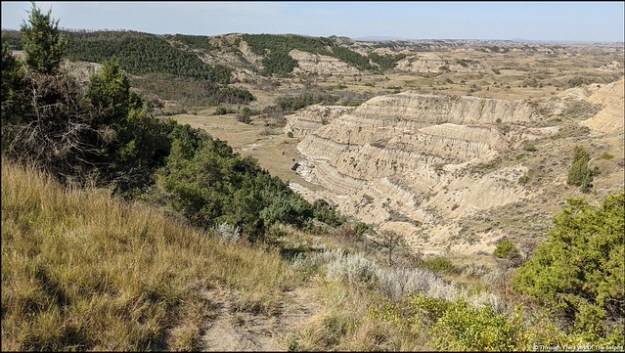
This 70,448 acre park, located in the badlands of North Dakota, became a national park in 1978.  The North Dakota Badlands were formed through large volumes of sediments of sandstone, siltstone, mudstone and clay being deposited into the plains. IMG_20200819_114944MVIMG_20200819_115017IMG_20200819_115156

Over time the Little Missouri River carved the terrain into many strange and brilliantly colored formations. Erosion from water and wind continues to shape the badlands today. Theodore Roosevelt first came to the badlands in 1883 at the age of 23 to hunt bison and experience adventure in the west. IMG_20200820_122721IMG_20200820_122725IMG_20200820_122910

After the tragic death of both his mother and wife only hours apart on February 14, 1884, he returned to this area to grieve in solitude. He liked the area so well he established a ranch and adopted a rancher’s lifestyle. Even though the ranch failed, his love for the beautiful rugged land brought him back time and again for the rest of his life. During his presidency he signed the 1906 Antiquities Act, proclaimed eighteen national monuments and worked with Congress to create five national parks, 150 national forests and dozens of federal reserves. This resulted in 230 million acres of protected land, earning him the name “Conservationist President”. IMG_20200819_150942

At the South Unit Visitors Center we saw Roosevelt’s cabin which had been moved to this site. IMG_20200820_134328IMG_20200820_134225IMG_20200820_134240IMG_20200820_134217

The park is divided into a North unit and a South unit. We spent the first day exploring the North unit which was located an hour from our campground. In the park was a fourteen mile scenic drive with colorful majestic formations. We also saw some bison. IMG_20200819_121326IMG_20200819_124158IMG_20200819_124327PANO_20200819_130223.vr

Another day we drove the South unit of the park with a 36 mile scenic drive. The entrance to this section was located less than a mile from our campground. We had a wonderful day seeing bison, prairie dog towns and herds of wild horses. IMG_20200819_144958IMG_20200819_150423IMG_20200819_150449IMG_20200820_110910

We saw many herds of bison, one of which walked down the middle of the road, passing on both sides of the car. This time of year is rut season for bison and they can be more volatile and quick to anger than usual. IMG_20200820_121200IMG_20200820_113925IMG_20200820_121258

IMG_20200820_105604

Taking A Dirt Bath

It was more than a little unsettling to have them so close, especially after seeing a news report on TV of a bison attacking a car and destroying a tire with his horns. IMG_20200820_121313

Click this link below to see our bison video. VID_20200820_121344

We also saw plenty of really cute prairie dogs as we passed through several prairie towns. IMG_20200820_102700

We loved seeing them pop up out of their holes and look around. Since they were very close to the road we had to be especially careful with driving. IMG_20200820_102959IMG_20200820_104157MVIMG_20200820_104318IMG_20200820_111743

Our favorite part of the day was, seeing several herds of wild horses. Theodore Roosevelt National Park is one of the few national parks where you can see free roaming horses. By the late 1800’s European settlement of the plains had reached the Dakota. Ranchers turned horses out on the open range to live and breed. When needed, they would round up horses and their offspring and use them as ranch horses. When the area that would become the park was fenced in 1954, they removed 200 branded horses. IMG_20200820_112946IMG_20200820_120728

A few small bands of horses eluded capture and went unclaimed. These horses continued to live free range in the park in stallion led groups. The park conducts roundups every three or four years and sells horses at public auction. IMG_20200820_130306IMG_20200820_130536

We were told this little foal was just two weeks old.

We had a short, hot but pleasant stay in Medora. IMG_20200820_132306

Next up: the capital city of Bismarck.


Billings, Montana AUG 11, 2020

We drove from Lewistown to Billings (pop 104,000) for a one week stay. The weather during our stay was hot, with temperatures reaching 100 degrees on our last day! 

Billings most striking feature is the Rimrock, a natural feature rising 500 feet above the Yellowstone Valley. Legend says that in 1837 two Crow warriors, dressed in their finest and singing death songs, rode a solid white blindfolded horse over Sacrifice Cliff from the Rimrocks. They did this to appease their gods in order to halt the spread of smallpox among their people. The Native Americans call the cliff “The Place Where the White Horse Went Down“. The Crow, who had no immunity to the disease, had contracted smallpox from the people of the American Fur Trading Company. The disease caused great loss to the Crow people between 1837-1838. IMG_20200814_142111

The Rimrocks sandstone formations were formed 80 million years ago. The Western Interior Seaway, where Billings is today, slowly rose and fell over time, leaving behind compressed sand that became this massive formation. The Yellowstone River has been cutting into it for a million years, leaving a canyon in the bedrock. IMG_20200814_144013

We drove along the top of the Rimrocks with nice views of the city of Billings below. MVIMG_20200814_143927

Then we visited Riverfront Park where we found a geocache and got a glimpse of the Yellowstone River. We had several views of the Yellowstone River flows through Billings. IMG_20200814_155839IMG_20200814_152617

We also stopped by Boothill Cemetery, the final resting place between 1877-1881 of three dozen individuals, many who died with their boots on. This is one of many such named cemeteries throughout the west. Buried in this cemetery was Muggins Taylor, the scout who brought the world the news of Custer’s last stand. There was a large rock memorial with quotes on each of the four sides.

Quote 1:
“This Monument Marks A Historic Site
Where Thirty-Five Lie Buried
For Fortune and Fame
Lost Their Lives Lost Their Game” 

Quote 2:
“Upon This Rugged Hill
The Long Trail Past 
These Men Of Restless Will
Find Rest At Last” 

Quote 3:
“The Stream Flows On But It Matters Not
To The Sleepers Here By The World Forgot
The Heroes Of Many A Tale Unsung 
They Lived And Died When The West Was Young” 

Quote 4: was unfortunately too worn to read IMG_20200814_154906

On Saturday we drove to Red Lodge, Montana to begin driving the Beartooth Highway (All-American Highway) which goes from Montana into Wyoming. Charles Kuralt called this “the most beautiful roadway in America“. IMG_20200815_143822

IMG_20200815_125628-EFFECTS

Can You See The Bear’s Tooth?

It is also designated one of the most dangerous roads in America as it climbs to 10,947 feet with numerous switchbacks.

On our GPS you can see the five switchbacks which gain about four thousand feet. IMG_20200815_125116IMG_20200815_111529PANO_20200815_115105.vr

Completed in 1936, it provides views of some of the most rugged and wild areas in the lower 48 states.  Along the way are visible twenty peaks over 12,000 feet, 950 alpine lakes, glaciers, Rocky Mountain goats, waterfalls and wildflowers. It took us eight hours to make the round trip drive with all the scenic overlooks. What a beautiful drive! IMG_20200815_121312IMG_20200815_122042IMG_20200815_131837IMG_20200815_122318IMG_20200815_131631IMG_20200815_130922

This is a herd of Rocky Mountain Goats, many are still shedding their coats. IMG_20200815_125852_1IMG_20200815_125854

MVIMG_20200815_141849

Pilot and Index Peaks

We saw Lake Creek waterfall and snagged a short video with sound. MVIMG_20200815_140748


Lake Creek Waterfall
Select this above link to see and hear the video. MVIMG_20200815_140844

We went to Crazy Creek waterfall and turned back for home. IMG_20200815_142828

We liked this old wrecker we found in one of the small towns we passed through. It looks like one of the cars (Mater) in the animated movie “Cars”. Mater is the rustiest, trustiest tow truck in Radiator Springs. IMG_20200815_165750
And an interesting sculpture as well! IMG_20200815_165828

After two wonderful months in Montana, it is time to move on to North Dakota. 

Next up: Medora, North Dakota 

Lewistown, Montana AUG 4, 2020

Our next stop in Montana was in the small town of Lewistown (pop 5,800) for a seven night stay. 

It continued to be very hot (mid 90s) but the hot spell finally broke our last couple of days here and we had some pleasant temperatures. One nice thing about Montana is that even though the summer days are very hot, it cools down quickly after sunset. The last couple of nights in Lewistown we had nightly lows in the middle 40’s.

No matter where we travel we always find interesting and unique places to visit. First we visited the National Register of Historical Places: Lewistown Satellite Airfield Historic District. This satellite airfield was constructed in Lewistown during World War II as one of four training facilities for B-17 Flying Fortress aircraft crew members. IMG_20200807_133431IMG_20200807_140351IMG_20200807_140030c

It included a small one story building constructed of concrete which was the storage site for the top secret Norden Bombsight used by the bombardiers during their training. The top secret Norden Bombsight is a synchronous stabilized bomb aiming device. Divided into two vaults, the Norden device was only accessible through bank vault doors. This Bombsight storage shelter which housed the Bombsight is one of the few such buildings left in the country. IMG_20200807_140336IMG_20200807_140320

The Lewistown satellite field was built as a satellite field for Great Falls Air Base and was completed in 1942. Squadrons were trained in the navigation of the B-17 as well as receiving gunnery and bombing practice. Once their training was finished, the men were sent to Europe. The Lewistown airfield was operated for twelve months between 1942 and 1943 and then deactivated. The historic district has 23 original structures still standing including the recreation building, large hangar, operations building, armament building and housing. Today the area serves as the town’s municipal airport. IMG_20200807_134309IMG_20200807_140131IMG_20200807_140103IMG_20200807_140224

The 1996 John Travolta movie “Broken Arrow” was filmed near Lewistown. Some of the more dangerous scenes were filmed along 40 miles of railroad track on the privately owned Central Montana Railroad. IMG_20200809_152329

The above trestle is not available by car. We had looked forward to riding the Charlie Russell Chew Choo dinner train which travels 56 miles through the countryside on a spur track built in 1912-1913. Unfortunately like so many other things this summer, the train ride was a casualty of the coronavirus and all trips for the rest of the summer season have been canceled. Here is a picture Bill took of the Chew Choo train sitting lonely without any riders. If we had been able to ride this train it would have gone over the trestle used in the movie. IMG_20200809_135518

Instead we had to settle for this nearby trestle. IMG_20200809_140118IMG_20200809_140230

On this end of the tracks was over 100 empty railroad cars used for petroleum oil. IMG_20200809_135529

Another day we stopped by Symmes Park for a geocache. It was a nice city park with a replica of the Statue of Liberty. This statue was erected in the early 1950s as part of a Boy Scout project across the country to help celebrate 40 years of scouting. There were more than 200 Liberty replicas put up around the country and Lewistown purchased one of them. MVIMG_20200807_145336

Also in Symmes Park was a LGM-30A Minuteman I missile. The Minuteman I missiles were placed in their silos in the early 1960s and in late 1966. This Minuteman I missile was placed here to commemorate the fifty Minuteman III intercontinental ballistic missiles deployed in this area. Underground silos containing the nuclear-warhead missiles are spread across northern Montana. IMG_20200807_145733IMG_20200807_145609c

The park also had a 240 mm Howitzer on display since 1959. It could shoot a 360 pound projectile fourteen miles! IMG_20200807_145950IMG_20200807_145925

Another beautiful park was Frank Day Park with a Labyrinth garden where we found another geocache. IMG_20200809_152152

Nearby were exhibits on the history of central Montana railroads. The first train arrived in Lewistown in late 1903. Due to the World War 1 years and Montana’s poor economy during the 1920s, expansion of the rail line into North Dakota was never completed. The railroad era in Lewistown ended in 2003. IMG_20200809_152259

On Sunday we visited the Veterans Memorial Park. We found a geocache here and enjoyed walking around the park. IMG_20200809_155342IMG_20200809_155200IMG_20200809_155702IMG_20200809_155742IMG_20200809_155803IMG_20200809_155845

It is one of the few veterans parks which has a statue to remember the mothers left behind. Very touching place to spend time. IMG_20200809_160051IMG_20200809_160040

We enjoyed our time in Lewistown in spite of the excessive heat. It is amazing to see all the interesting places that can be found in these small towns. We are often led to these places when searching for geocaches. 

Next up: Billings, our final stop in Montana

Great Falls, Montana July 21, 2020

We arrived in Great Falls, Montana, (pop 59,000) for a two week stay. Great Falls is the third largest city in Montana. IMG_20200803_131659

It is located along the upper Missouri River where the Lewis and Clark Expedition had to portage around five waterfalls in June 1805 and then again during their return trip in 1806. IMG_20200802_133342L&C Portage Route MTIMG_20200803_131817Within a 15 mile stretch of the Missouri River there is an elevation change of 500 feet. This very difficult 18 mile portage around the falls took over 31 days. This portage was one of the most difficult of their journey. Great Falls gets its name from these five waterfalls. Today the city is called “The Electric City” because each of the falls has a hydroelectric dam. 

We spent time exploring the different falls and dams that make up Great Falls. The falls look much different today than they did during the time of Lewis and Clark because they were altered by the construction of the dams. The falls which at one time was seen as a great obstacle by Lewis and Clark is now seen as of great benefit to supply energy and power to the city. 

Of the five falls, one is not accessible by car and one is submerged. We were able to visit the other three. IMG_20200725_110316

Great Falls/Ryan Dam was the first we visited. When first seen by Lewis and Clark, a measurement of the height was taken by Clark using a sextant and a rod using geometry. Clark estimated the height to be 97 feet and ¾ inches which is remarkably accurate to the 96 feet shown by recent electronic measurements. Clark was only off by a foot! IMG_20200725_111308rThe Big Falls Missouri River MT 1910

To best view the dam and falls we walked across a suspension bridge across the Missouri River to Ryan Island Park. The upper part of the falls were covered by the 1,336 foot Ryan Dam. At first the dam was called Volta Dam after the Italian Alessandro Volta for whom voltage was named. It was later renamed Ryan Dam. IMG_20200725_105958IMG_20200725_110123PANO_20200725_111525.vr

Next up was Rainbow Falls/Rainbow Dam. Captain Lewis referred to this as “Beautiful Cascade”. The dam was constructed in 1910. IMG_20200726_115412IMG_20200726_105423IMG_20200726_105659MVIMG_20200726_105711

The last falls we visited was Black Eagle Falls/Black Eagle Dam. This falls is 26 feet high and 600 yards wide and was the first to be dammed in 1890.  We viewed the falls and dam from the Black Eagle Memorial Island Park which was accessed across a bridge. IMG_20200725_124239IMG_20200726_122717

On the riverfront trail along the Missouri River was a statue of Lewis, Clark and Sacajawea. IMG_20200726_122751-EFFECTSIMG_20200726_122948IMG_20200726_123109IMG_20200726_110616

We also visited Giant Springs State Park, a beautiful state park. Clark first found this great spring in June, 1805 and called it the largest fountain or spring he ever saw. It is one of the largest freshwater springs in the United States. Over 150 million gallons of water flow from Giant Springs into the Missouri River everyday. MVIMG_20200726_111554IMG_20200726_112343IMG_20200726_112419

The springs are the source of the Roe River, which at one time was recognized by the Guinness Book of World Records as the shortest river in the world. Whether or not that record stands today, at only 201 feet in length it is definitely one of the shortest. The Roe River flows into the Missouri River, the longest river in the United States. IMG_20200726_111547IMG_20200726_111655IMG_20200726_112602

Next up we visited the Lewis and Clark Interpretive Center. It was disappointing that both the theater and entire lower level of the Center were closed due to the pandemic. IMG_20200726_114936IMG_20200726_120309IMG_20200726_120309(1)

There were still interesting exhibits and displays here about the Expedition. Meriwether Lewis wrote that he saw more buffalo in this area than he ever witnessed before. Buffalo was a staple diet for the local Native Americans and became a favorite meal for the members of the Expedition. IMG_20200726_115758IMG_20200726_115853

We stopped by the Great Falls Visitors Center which was closed but we did see a nice statue of Lewis, Clark, Sacajawea, York a slave and Seaman the dog. We also found a geocache there. IMG_20200726_135500

We found a nice police memorial nearby. IMG_20200726_135702

On another very hot day we drove to the Upper Portage Camp Overlook. This area overlooks the site of the 1805 Lewis and Clark Upper Portage Camp on the banks of the Missouri River. Even though the landscape has changed over the centuries, it was still a place where we felt a deep sense of history.

IMG_20200802_133524

A Reenactment Of The Boat; In the Background In the Trees Is the Campsite

While Clark directed the portage around the falls, at this site Lewis supervised the assembly of a boat they had hauled in pieces from Harpers Ferry, Virginia. Considered an experiment, the iron boat frame was designed by Lewis in 1803. The canoe shaped frame was 36 feet long and 4 ½ feet wide with nearly 200 pounds of iron strips connected with screws. It was further strengthened with willow limbs and covered with animal skins. It was designed to carry 8,000 pounds. Lewis’ crew labored for weeks preparing 28 elk and four bison hides. Unfortunately during a trial run the boat at first floated like a cork and then sank. Lewis was devastated by the failure and ordered the boat to be buried here.

They then quickly moved upstream and made two large cottonwood boats as a replacement. The iron boat and failed experiment was never mentioned in their journals. A replica of the boat experiment is located here today. 

Meanwhile at the Lower Portage Camp, Clark and the rest of the Corps of Discovery struggled around the five falls. Four times they loaded baggage into six canoes laid upon carts and then pushed and pulled the heavy loads across 18 miles of rugged terrain. They used sails to help them whenever strong winds allowed and endured brutal hail storms. At one point they documented hail as large as seven inches in diameter that bounced 12 feet and landed 30 feet away. It left them bruised and bloodied. They endured heat, rain, prickly pear cactus, and mosquitoes. Through it all Sacajawea, having recently been deathly ill, carried her four month old baby. 

The Expedition all gathered together at the Upper Portage to rest and plan the rest of their journey before leaving on July 13, 1805. They stockpiled meat, wrote lengthy journal entries, made detailed maps, and dug a cache to store items and equipment they wouldn’t need until their return trip when they camped here again from July 13-26, 1806. It was here they celebrated the nation’s 30th Independence Day on July 4, 1805 with a feast of bacon, beans, dumplings, and bison meat as well as singing and dancing. They wrote they fought off mosquitoes and grizzly bears that harassed them daily. 

We also found a geocache here after a long search in the hot sun. 

We enjoyed our time in this historic city except for the extremely hot temperatures. 

Next up: Lewistown, Montana

Cascade, Montana July 16, 2020

This blog posting is dedicated to our good friend and blog reader Bob M. who grew up in Great Falls and Helena. Bob, you have a really beautiful home state. We are certainly enjoying our time here! 

Our current stop was south of the tiny town of Cascade, Montana near the Missouri River about thirty miles south of Great Falls for a six night stay.

This is such a beautiful part of Montana. Interstate 15 goes back and forth over the Missouri River.

One day we went sightseeing and geocaching. We saw lots of fishing and people enjoying the water. MVIMG_20200716_133334IMG_20200716_144620IMG_20200716_144955IMG_20200716_145027

Bill found a geocache located at the 1930 Hardy Bridge which crosses the Missouri River. This bridge was used in the 1987 movie “The Untouchables”. This area was portrayed as Canada in the movie. During filming a sign saying “Welcome to Canada” hung from the bridge. After filming ended they left the sign on the bridge which really confused people traveling through the area! The sign is gone today. IMG_20200716_132551IMG_20200716_132603IMG_20200716_150747

On Sunday, July 19th we took a two hour boat trip with the Gates of the Mountains boat tour company. The marina is located on the Missouri River in the foothills of the Rocky Mountains between Helena and Great Falls. IMG_20200719_094659IMG_20200719_09531600000IMG_00000_BURST20200719100145261_COVER

In July of 1805, the Lewis and Clark Expedition traveled down this section of the Missouri River, marveling at the limestone cliffs at a height of 1,200 feet. The Expedition was traveling against the current as they sought the headwaters of the Missouri River. 00100lrPORTRAIT_00100_BURST20200719100346470_COVERIMG_20200719_100729IMG_20200719_100815IMG_20200719_102147IMG_20200719_103309IMG_20200719_103349IMG_20200719_110619IMG_20200719_105404

From a distance, the bends in the waterways made the great stone walls appear to block passage only to then open up like gates as the expedition approached. IMG_20200719_104707IMG_20200719_105545IMG_20200719_105514

Meriwether Lewis wrote in his journal, “I shall call this place: Gates of the Mountains”. 

Our boat was named Sacajawea 2. This tour boat company has been giving tours for over 100 years and the two hour tour was a great deal at only $14 a person (senior price). We saw four eagles, a huge eagle nest and bighorn sheep. IMG_20200719_103900IMG_20200719_103948IMG_20200719_113404IMG_20200719_113603

This actual boat was used in the Clint Eastwood 1974 movie “Thunderbolt and Lightfoot”. In the movie the boat was named “Idaho Dream” a mailboat on the Snake River. Several scenes were filmed on our section of the tour. As the guide pointed out the Snake River does not look like the Missouri River. MVIMG_20200719_111637

We also saw a Native American pictograph of a bison which was hard to see in the distance. IMG_20200719_104339

We also have rock formations that appear to be various animals.

IMG_20200719_103147

This Looks Like a Person

MVIMG_20200719_103512

Do You See an Elephant?

IMG_20200719_112802

This Looks Like Groot from the Marvel Movies

IMG_20200719_112903

Do You See a Monkey’s Face?

We stopped briefly at the Meriwether Picnic Area, named for the area where the Lewis and Clark Corps of Discovery camped on July 19,1805, exactly 215 years ago on the day we took the boat trip. IMG_20200719_110553IMG_20200719_111156IMG_20200719_111004

One evening from our campsite we could see a doe and her fawn. We love Montana! IMG_20200719_185038IMG_20200719_185029

Next up: Great Falls