Monthly Archives: May 2014

May 26, 2014 Brookings, Oregon

Goodbye California, Hello Oregon!  After five wonderful months in California we have reached Oregon. IMG_20140526_115804 In those five months we didn’t begin to scratch the surface of all there is to see and do in California, so we will be back in the fall!


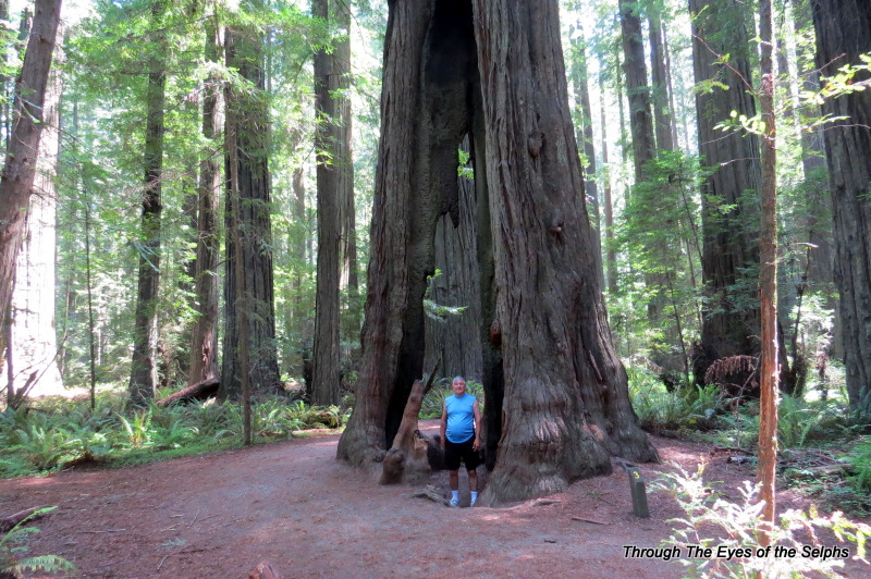
Brookings is a sweet little town of just under 7,000. IMG_0596 We entered the town on Memorial Day and Main Street was lined with American flags and POW flags.  We just love these patriotic small towns!  Due to its relatively mild climate and the fact that it gets more sun than any other Oregon coastal town because of its facing south position, Brookings is often referred to as “The Banana Belt of Oregon”.  Flowers bloom here all year and 90% of the country’s Easter lilies are grown here.  It is also home to many myrtle trees and coastal redwoods.  We found the townspeople here to be among the friendliest we have found in our travels.

While driving around the town we saw a sign for a historical marker.  It turns out that Brookings is the site of the only aerial attack on the U.S. mainland by the Japanese during World War 2.  Who knew!!! The amazing things we discover, and it didn’t take the quest for a geocache to find this one.   20140527_175023 20140527_174854


We stayed at Harris Beach State Park which is a beautiful park with views overlooking the Pacific.  It is unusual to find state parks with full hookups, but Oregon seems to have many.  This is the first state park we have been to that has an old fashioned ice cream truck with the ringing bell that goes around each evening selling ice cream and bagged ice.  They also have a “Courtesy Guide”IMG_0547 posted throughout the park.  The rangers have nightly programs on whales, seals and sea lions, medicinal plants, and tsunamis.  We learned that the Oregon coast is just beginning to get large amounts of debris from the 2011 earthquake in Japan.  They have set up large containers along some beaches and are asking people to pick up any debris they see and place it in the containers.  The ranger said that there was some damage in Brookings from the tsunamis in 2011, with nearby Crescent City, California receiving the most damage because the harbor there is more shallow.

We have been stunned by the unspoiled beauty of the Oregon coast. IMG_0601 IMG_0579 IMG_0568 IMG_0553 IMG_0545 IMG_0540 20140530_170916


One day we took a drive along the Samuel H. Boardman State Scenic Corridor which parallels the Oregon Coast Trail, a 362 mile hiking trail along the entire coast of Oregon.  We stopped at several scenic overlooks, some of which took us off the highway and onto small roads.

IMG_0566


We took several hiking trails to find geocaches and look at the shoreline, including Arch Rock

IMG_0551

Arch Rock


IMG_0567

Natural Bridges

and Natural Bridges.


On one geocache hike we saw a small waterfall far in the distance.  IMG_0572


As our week in Brookings was coming to an end we realized we had not spent enough time hiking in the state park where we were staying.  We hiked up a very steep hill where we found a geocache and magnificent views. IMG_0603 IMG_0556


IMG_0542


On our way back to our campsite we found a little squirrel scampering around with part of a paper plate in his mouth, stopping now and then to nibble the plate. IMG_0612 I am sure his digestive system is not going to like this lunch!


I hope to name a few facts about Oregon with each post.  Here are a few for this one:

1.  All Oregon gas stations are required to pump the gas for you.  There are no self service gas stations in Oregon.  (We might add that the gas is about fifty cents cheaper in Oregon than California so far!)

2.  Oregon contains more than 230 state parks and 13 national forests.

3.  Oregon has no sales tax.

4.  Oregon’s motto is “Oregon is for Dreamers”.

Just a Thought:  “I haven’t been everywhere, but it’s on my list”.


May 21, 2014 Trinidad and Crescent City, California

It was a very short drive to Trinidad, another stop on our way north as we wait for the weather to continue to warm up.  Trinidad is a quaint seaside city with a population of 367, making it one of California’s smallest incorporated cities.  No Walmart or McDonald’s here!!  Trinidad is known for its spectacular coastline which is part of the California Coastal National Monument.  The main economy here as you would guess is fishing.

Our campground was called “Sounds of the Seas” and it was appropriately named since we could hear seals barking most of the time and could see them swimming around in the cove three hundred feet below us.  We awoke each morning to the sound of their barking, yet the noise was not annoying or offensive but added to the ambience of the area.

Our first day there we decided to take a drive to the Redwood National Park and along the way we came across a herd of elk lounging in a meadow. IMG_0497 IMG_0500 We were able to get close and get some good pictures.  We laughed to think we hiked four miles to catch a glimpse of elk at Point Reyes National Seashore and yet we just stumbled across them out of the blue.  When we drove back home they were had moved about two miles down the road to another meadow.  We could see why them had “Elk Crossing” warning signs everywhere!


The next day we drove further north to Gold Bluffs Beach and Fern Canyon in Prairie Creek Redwoods State Park.  The dirt road down to the beach and canyon was a lovely drive but narrow with many potholes. IMG_0502 IMG_0501 We occasionally had to stop and pull over to the side of the road to let a car pass going in the other direction.


When we reached the parking area at the end of the road we noticed some people looking up into a wooded area.  We joined them and enjoyed watching a male elk having his lunch. IMG_0506


Fern Canyon was a lush canyon filled with ferns.  We had to cross several streams where the park service had put boards over the creek so we could walk across. IMG_0510 IMG_0508 We were thankful for the boards and enjoyed the serenity and beauty of the canyon.


On the way back down the road we came across a herd of male elkIMG_0514 IMG_0513 and then later a herd of females.  Notice that in one picture the elk has two birds riding on his back.  We were told by the ranger that at this time of year the male and females separate from each other since the females are preparing to have their calves.


Our time in Trinidad went by quickly and before we knew it the time had come to head to Crescent City, our last destination in California.  It was a short drive to Jedediah Smith Redwoods State Park, a beautiful park where we were able to camp in the middle of the redwoods.IMG_0533  We dry camped here and we were so deep in the forest that we were not able to use our solar panels or get satellite tv reception.  Jedediah Smith was a trailblazer and one of the first white men to reach California by land from the east.


A sign warning of bears greeted us at the registration boothIMG_20140526_145910 and Bill had to sign a paper saying he read the rules regarding proper food storage and would follow their rules.  They were not kidding when they said bears roam the campgrounds looking for food since each campsite was provided a metal food storage locker and a picnic table with a paper taped to it warning about leaving food out.

We spent our time in the Crescent City area hiking and geocaching in the beautiful park. IMG_20140525_160040 We both agreed that the redwood trees are a little more fabulous in Redcrest along the Avenue of the Giants since they seem to be larger in height and especially diameter.  But it is always amazing to be among the redwoods. IMG_0519


We were about 130 miles north of Redcrest and we noticed the forest seemed to be more damp with lots of moss covering the trails and trees. IMG_0525 The forests were certainly dense and it would not have surprised me to see a bear of mountain lion, but we saw neither.  We were told this area of California receives about one hundred inches of rain a year.  IMG_0521


One of our geocaches led us to a beautiful covered bridge built in the 1960’s and made of curved and laminated wood.  The process used is more often done in boat building. The roof, walls and floor were constructed as if it was a wooden boat. IMG_20140525_163922


After five months, it is hard to believe our time in California has come to an end, for now.  We are excited about reaching Oregon, but we love California and will return in the fall.


May 18, 2014 Eureka, California

We left Redcrest and made the short and easy drive north on Highway 101 to Eureka.  Now that we are no longer on California Highway 1, the road is much better!  We arrived at the Fairgrounds in Eureka which was a full hookup very reasonably priced campground.

Eureka has a population of around 27,000.  It has a rich history mainly based on the California Gold Rush mid to late 1800’s.  As thousands of people poured into the area in search of gold, their need for housing and the numerous redwood forests in the area provided a prosperous economy for northern California.  Lumber was manufactured and shipped from the region so the area became rich through lumber and shipping.  Many people in Eureka became wealthy which can be seen in the many large Victorian style homes.  There is a walking tour of all the historic homes in the area known as Old Town.  Two such homes are the William Carson Mansion and the “Pink Lady”.  The Carson Mansion, owned by William Carson who was the owner of a prosperous lumber company, is one of the most photographed and written about homes in California.IMG_20140520_200831 It  was sold in 1950 to the Ingomar Club which is a men’s club by invitation only.


The Pink Lady located across the street from the Carson Mansion, was built in 1889 by William Carson as a wedding gift to his son.  IMG_20140520_200712


As you may have guessed, Eureka received its name from the Greek word “Eureka” which means “I have found it” and was first used by the Greek mathematician Archimedes.  The gold rushers would say when they discovered gold and the name stuck for the town.

Eureka is also a very artsy town and home to hundreds of artists and we found a self guided walking tour of twenty murals painted on buildings throughout the town.  Here are a couple of our favorite which includes this mural, a tribute to architecture and the performing arts which is located on the side of a bank. IMG_20140520_201022 The mural measures 70 feet by 70 feet and is one of the largest murals in northern California.


The other is titled “Nature’s Bounty” and is made up of six 20 foot panels.  IMG_20140520_201454


We stayed here three nights and originally selected it because it was on our route north.  We were certainly glad we did since it turned out to be a charming, historical town.  We were even able to do some shopping at Walmart and Safeway, eat a couple meals out, grab some geocaches and Bill even managed to get a haircut.


May 11, 2014 Redcrest, California (Avenue of the Redwood Giants)

We reluctantly left the beauty of tiny Westport-Union State Beach Park and our magnificent ocean views (one interesting fact the host of this beach park told us is that this area is known as the “Blood Triangle” because more shark attacks happen in this part of CA than anywhere else in the world except Australia) and headed up California Highway 1. I have talked in previous posts about what a difficult road this is to drive on, but the drive from here to Redcrest was the last twenty-five miles of CA 1 and the worst of the worst with 10 MPH horseshoe curves and narrow roads with no shoulders or guardrails and sheer drop-offs. We turned away from the coast and the road became more mountainous and curvy. We finally reached the end of CA 1 and began driving on U.S. Highway 101. We drove almost the entire CA 1 north from San Diego which had been on our bucket list. We are glad we did because the beauty of the California coastline is unlike anything anywhere else. I think I will see those curves and drop-offs in my sleep for awhile.

At the junction of CA 1 and 101 we saw a sign for a drive-thru tree and since it was only a quarter mile away we decided to check it out. For the admission of $5.00 you get to drive your car through a redwood tree.  IMG_0358 IMG_0362 IMG_0363These large and tall trees are the “Coastal Redwoods”. What a tourist trap and we didn’t even waste time in the gift shop. One of those glad we did it but once is enough experiences. There are two more such trees in this area but we will skip those. As we drove into Redcrest on 101 we saw many little gift shops and tourist attractions all taking advantage of the popularity of the beautiful redwoods in this area of California. We have traded the beauty of the Pacific coast for the magnificence of the redwoods. Away from the coast the temperature has gone up about fifteen to twenty degrees and everywhere we saw forests and redwoods. Beautiful!

We arrived in our campground in Redcrest on the Avenue of the Giants.  Redcrest is another small town with a population of 112 and relies heavily on tourism. We had good cell phone service in the main area of Redcrest but not in the campground.

Our first full day there we drove to Shelter Cove which was about a ninety minute drive from our campground.  It had been recommended by a campground neighbor and some tourist brochures.   I guess we have been spoiled by the beauty of the Pacific coastline because a long drive over very winding and curvy roads which climbed and then descended over 2,200 feet,  we arrived at Shelter Cove and were disappointed by the lack of views and beach there.  It certainly did not begin to compare to what we had seen in our previous travels up CA 1.  We did see a lighthouse there which at one time was further up the coast at Cape Mendocino. IMG_0364 The lighthouse was built in 1868 and lighthouse keepers had to take a small tender boat out to the lighthouse.  Due to the isolation this lighthouse was not a favorite of lighthouse keepers and it seems that men who did not follow orders or needed to be disciplined were sent to this lighthouse.  In 1948 the lighthouse was dismantled and moved into storage.  In 1999 it was moved and restored to Shelter Cove.

Before leaving Shelter Cove we did manage to find one geocache and saw some deer up close. IMG_0380 IMG_0371


The weather certainly warmed up with temperatures in the upper eighties and low nineties for several days.  This was quite a shock after the cool temperatures we experienced along the coast!  Avenue of the Giants is a thirty-mile 2-lane scenic driveIMG_0387 on what was once U.S. 101 surrounding by 51,222 acres of magnificent redwood groves. IMG_0427 IMG_0426 IMG_0423 IMG_0403 It is said to be the greatest display of Coastal Redwoods in the 500 mile redwood belt.

IMG_0408 IMG_0398 IMG_0389 IMG_0381  While in Redcrest we spent several days driving along the scenic Avenue of the Giants which is parallel to U.S. 101 and is surrounded by Humboldt Redwoods State Park.  The state park, established in 1921 to protect these magnificent trees,  is the third largest California state park and includes the Rockefeller Forest which is largest remaining old growth redwood forest in the world.  With 53,000 acres, it has many trails to hike and we also found several geocaches.


One trail we walked was the Gould Grove Nature Trail which has the third largest known redwood tree in circumference.  We also tried to find a geocache which included a rare albino redwood tree which is one of only a couple dozen known to exist.  We didn’t really know what an albino redwood was supposed to look like and couldn’t find anything that we thought resembled one.  We stopped by the Visitors Center and asked one of the rangers.  He gave us a paper with directions and it seems they rarely give the directions out because people have been known to touch the tree and pull off leaves so they stopped publicizing its existence.  We quickly found the tree and it was not what we expected.  The needles/leaves of the tree are white instead of green.

IMG_0429 IMG_0430


The same day we hiked to the Women’s Federation Grove which was founded in the 1930’s by members of the California Federation of Women’s Clubs.  Here there are picnic tables made from thirty to forty foot long redwood logs.  Today the area can be used for picnics since there are also grills and restrooms.  The focal point of the grove is a covered four-sided fireplace

IMG_0433designed by Julia Morgan, who also was the architect for Hearst Castle.

Along the top of each fireplace is an inspirational message.  Here are a couple favorites:

IMG_0435 IMG_0434On this day we were the only ones there and it was truly peaceful and tranquil with a river flowing alongside.


Later in the day we took another trail which led us first IMG_0445 IMG_0444to the “Tall Tree”.


Later we walked to the “Giant Tree”.

IMG_0452 IMG_0451 IMG_0456  This area was also used in the filming of the Stars War movie “Return of the Jedi”.  Since the seasonal bridge had not yet been placed for the summer, we had to cross a 20 foot wide stream with water up over our ankles.  When we got back to the car we had to wring water out of our socks!  But it was well worth it to see the Giant Tree and this beautiful area.


The next day we drove along the Avenue of the Giants to Founders Grove Nature Trail where we saw many amazing redwoods including the Founders Tree and
IMG_0467

IMG_0463


IMG_0480


IMG_0478


the Dyerville Giant which fell in 1991. They think it had been standing for as long as 1,600 years and was taller, larger and older than any tree around it.  It was 370 feet tall which is two feet taller than Niagara Falls, was seventeen feet in diameter and fifty-two feet in circumference, and weighed over one million pounds.  When it fell it registered on the seismograph and the locals said it sounded like a train wreck.  What an amazing week we had!

IMG_0483 IMG_0491

May 8, 2014 Manchester and Fort Bragg, California

­Our three day stay at Manchester was quiet and relaxing. We spent some time working on the blog because it takes time for Bill to sort through all the pictures and decide which ones to include in each posting. He then edits them and all this takes time. I usually do most of the writing of the blog posts and rely on his pictures to refresh my memory. In Manchester our cell phone and internet reception was very poor so we were not able to do much planning or research for future travels.

Manchester, with a population of 462, was similar to Bodega Bay in that it also did not have any franchise restaurants or large stores. We did stop in at the local small country market which did include a tiny Ace Hardware in the back corner.

We spent our last afternoon in Manchester doing some geocaching and continued to find beautiful panoramic views and the Point Arena Lighthouse. IMG_0289


After Manchester our next stop was thirty-five miles north to Fort Bragg. As you can tell we try not to travel far on move days and we are taking our time heading north to give Mother Nature plenty of time to warm up. Our travel day was overcast with just enough rain to keep on the windshield wipers. One thing I have noticed in our travels is so many states have cities with the same name, and Fort Bragg is another example. Fort Bragg, CA was established in the 1850’s as a military outpost to maintain order for the Mendocino Indian Reservation. Today Fort Bragg is no longer a military fort and has a population of around 7,000. One exciting thing about reaching Fort Bragg was there was a Safeway where I did some much needed grocery shopping. Not since our last days in Mexico has the pantry and freezer been so empty!

We dry camped at MacKerricher State Park which is a beautiful park but we had no cell phone service or satellite TV due to heavy tree cover. We quickly set up camp and grab the umbrellas and rain jackets and headed down to the beach to a small cove where the ranger told us some seals had recently given birth. We were expecting to see many seals and we were a little disappointed to see just a few mother seals and pups on the rocks. IMG_0307 IMG_0309 IMG_0310 IMG_0314 IMG_0317 IMG_0321Since the weather

was cold and windy with showers, we didn’t stay long. I am always in awe of the great shots like these that Bill gets. The camera makes it look like we were much closer to the seals than we really were. The rangers warn people not to go near the seals because they are easily frightened and will desert their pups if frightened away.

The highlight of our stay in Fort Bragg was biking on the paved Ten Mile Coastal Trail. We were able to bike to the trail from our campsite and ride along the coast.

IMG_0333 It isn’t often that we get to bike that close to the beautiful Pacific Ocean! IMG_0324 IMG_0325 IMG_0329This trail was formerly a railroad track which was turned into a logging road and is now a walking/biking trail.


Our last day in Fort Bragg we walked on the beautiful boardwalkIMG_0339 IMG_0341 in MacKerricher


and came upon a mother seal and her pup just as they climbed out of the water and onto a rock to rest.  IMG_0348 IMG_0352


We left MacKerricher State Park and drove about twenty miles up the coast to a very small state park, Westport-Union Landing State Beach Park, where we dry camped about two hundred feet from the ocean atop a forty foot cliff. This is basically just a pull off the side of the road and camp where you want, and on this day there were two other campers in the park. It was very windy when we first arrived and a gorgeous day. We had spectacular views of the coastline and beach. On one side we saw the magnificent Pacific and on the other side we saw cattle grazing on the steep hillside. The park did have a campground host and he showed us some nests made by swallows. He said the swallows built this in less than two weeks and they had to do it one mouthful of mud at a time. Isn’t nature amazing!  IMG_0336 IMG_0338

May 5, 2014 Manchester, CA

We left lovely Bodega Bay and headed north up California Highway 1. This road gives breathtaking views of the Pacific coastline that is unlike any other, but the drive itself is mean with many curves that include several horseshoe turns.IMG_0273 I think those crazy Mexican roads helped prepare Bill for driving an RV on CA 1, and I am thankful we are traveling north instead of south since the southern route is against the coastline with rugged cliffs and steep drop offs. An RV heading south passed us and I swear the driver had a look of sheer terror on his face!

We stopped at Fort Ross State Historic Park IMG_0238which is one of the oldest parks in the California State Park System. This 3,386 preserve was North America’s southern most Russian settlement. Members of the Russian-American Company founded the Fort Ross Colony in 1812. The nearby Metini natives have lived in this area for centuries and did not seem to mind the Russian building their fort. Earlier history shows that in 1784 the first permanent Russian settlement was built in what is now Alaska.

In 1812 twenty-five Russians and eighty Alaskan Alutiiq natives built houses and a stockade with the purposes of growing wheat and other crops for Russians living in Alaska, hunting marine animals and trading with the Spanish. The fort was dedicated in August 1812 and named Fort Ross in honor of Imperial Russia, also called Rossilia.  IMG_0242 IMG_0245 IMG_0249


Fort Ross also has a chapel with a beautiful redwood vaulted ceiling

IMG_0248


as well as a windmill that was the first windmill in California.IMG_0240 IMG_0241 The fort also has the first glass windows in California. The grounds also contain a Russian cemetery. In December 1841 Fort Ross was sold to John Sutter and then in 1873 to George Call who established the Call Ranch. In 1903 the California Historical Landmarks Committee purchased the Fort Ross area from the Call family and the State of California acquired it in 1906.

Bill and I found this area very interesting since we never knew there was a Russian settlement this far south. We enjoyed touring the Visitor Center, seeing a movie about the history of the fort, and walking around the grounds. We also learned that a special Cultural Heritage Day is held in July where they hold religious ceremonies in the chapel.

I have mentioned in other posts that this coastal region can be extremely windy.  We came across this tree while walking on the grounds. IMG_0254 It is not unusual to see this trees along the coast. Fort Ross is certainly located in a beautiful setting!  IMG_0244


In the parking lot Bill spotted an RV with Florida tags so we walked over to chat with them. We are always happy to meet fellow RVers and this couple are also full timers. They too find CA 1 very difficult to drive on which included their dog getting very carsick. We learned they are following the same route as us for several months so hopefully we will meet up with them again.

While we were at Fort Ross we kept hearing the barking of seal in the distance. We drove a little farther up the coast and stopped at one of the many turnouts. Bill always scares me when he gets too close to a cliff in his quest for that perfect picture. It is hard to tell from this picture I took from a safe distance away, but he was standing at the top of a huge cliff IMG_20140504_153851looking over the side at some seals and their babies resting on some rocks.


He got some great pictures of the seals and their babies using his 50X zoom.  IMG_0255 IMG_0259 IMG_0260 IMG_0261 IMG_0266 IMG_0267


We also came across some seals lying on the beach where the Russian River meets the Pacific Ocean

IMG_0284 IMG_0283


and discovered a beautiful arch rock.

IMG_0236 IMG_0237 IMG_0234


IMG_0288


The seventy-mile drive from Bodega Bay to Manchester took almost three hours of driving time not including stops which tells you something about the difficulty of driving an RV on this road with many 20 MPH curves. We did enjoy the ocean views on one side and pasture land with cattle on the other. At one point we saw a field of sheep with lambs running after their mamas. Thankfully we arrived safely at our next stop in Manchester where we will stay for three days.

May 1, 2014 Bodega Bay, California

We left Santa Rosa and headed west and within a short time noticed the temperature dropping as we neared the coast. After a short drive we arrived at a nice county regional park in Bodega Bay where we would be staying for four days. Bodega Bay is a very small harbor village with beautiful views of the bay. We have found this area of Northern California has no Walmart or franchise restaurants that we are used to seeing. You will most definitely not find a McDonalds in this area of the state! While we were in Southern California we noticed that due to city/county ordinances, some Walmarts and grocery stores have done away with plastic bags and we have become accustomed to taking our own bags with us instead of paying ten cents for each paper bag. This is most definitely true for ALL of Northern California. We went in a McDonalds in San Francisco and there was a sign saying they charge ten cents for each paper bag they put your food in. Now that is taking “going green” a little to the extreme!!

We loved our campsite in Bodega Bay where we had a great view of the channel with boats passing by and plenty of waterfowl to observe. For the first time we noticed the beautiful wildflowers everywhere. IMG_20140501_150531 IMG_0160 IMG_0224


Our first day we drove up to the Bodega Bay Visitor Center and found out in 1963 the Hitchcock movie “The Birds” was filmed in Bodega Bay. We were told that last year they had a big 50th Anniversary celebration and Tippi Hedren, now 84 years old, visits Bodega Bay every year. The guide at the Visitor Center told us that around 8,000 people come here every year just because it is where the movie was filmed. We picked up a map with several locations to visit where they did filming for the movie. While in the area we rode past the schoolhouse shown in the movie, which is now a private home.  IMG_0214We also took a scenic drive along Bay Hill Road which is the same route that Tippi Hedren drove in the beginning of the movie and we were rewarded with some very picturesque scenery with the Pacific Ocean on one side and pastures with cattle grazing and calves running after their mothers. The road was narrow and very curvy and one we would have never taken without the map. We were very glad we did!  IMG_0222 IMG_0228 IMG_0218


We also rode up to tip of the peninsular Bodega Bay Head where they have magnificent views of the Pacific coastline. When we pulled up the parking lot was almost full and we noticed people with cameras standing and sitting on top of the cliff. IMG_20140501_144531Thinking something exciting was happening we hurried up there only to find that people spend hours here waiting for a whale or two to make an appearance. We are not quite that patient but we did enjoy the view!  IMG_20140501_144643 IMG_20140506_000729


The highlight of our visit to Bodega Bay was a visit to Point Reyes National Seashore ParkIMG_0171 that was only about 40 miles from Bodega Bay but took about an hour and a half due to the narrow and curvy roads both on California Highway 1 and inside the park. Our first stop was the Visitor Center where we read informational displays about the Coast Miwok Indians who were the first inhabitants of the area. We watched an interesting and informative movie on the history of the park that included English (Sir Francis Drake in 1579), Spanish and Mexican inhabitants in addition to the Indians. There have been generations of dairy farmers who have farmed the land and there are currently thirteen active ranches in the park. Throughout our drive around the park we saw cattle and crossed many cattle guards. President Kennedy signed legislation in 1962 making it a National Seashore Park and in 1966 Mrs. Lyndon Johnson formally dedicated the park to the American people.

The first thing we did after touring the Visitor Center was take a short walk on “The Earthquake Trail”. IMG_0165


They had blue stakes showing the location of the San Andreas Fault and at one point on the trail a twenty-foot movement had split a fence during the 1906 San Francisco earthquake.  IMG_0167 IMG_0166 IMG_0168


Next on our list was to drive to the Tule Elk Reserve. Before 1860 thousands of tule elk roamed the Point Reyes peninsula. Due to hunting they died out and in 1999 a herd was returned to the land. Today approximately 750 roam the land. We really wanted to see some elk and we had the mistaken impression all we had to do was drive to the edge of the reserve. Turns out it wasn’t nearly that easy. We came to the realization that if we wanted to see elk we would have to do some hiking so we found a popular trail and started out. The weather was sunny and fairly warm at the Visitor Center, but by the time we had driven ten miles to the reserve the weather was chilly, windy and foggy. We started down the trail and came upon a man who was carrying a huge elk antler on his back. He said they carry them out and grind them up and bring them back and spread them on the ground because the minerals are good for insects. Since we had seen a sign warning us not to collect antlers, we had to take his word for it.  We really wished we had thought to get his picture because it was really quite a sight to see!

After walking for a while along the narrow hilly trailIMG_0190 we saw some elk far in the distance. Definitely too far away to get a decent picture. IMG_0174We decided to hike a little further and came across two groups of hikers on their way back. Once group told us there were elk about 150 yards away. After walking what seemed to be much further than fifty yards we came to some more hikers who told us we would see them after about a five-minute walk. We continued on and walked much longer than five minutes. Either these hikers have a poor concept of time and distance or the elk were really on the move! When we reached the two-mile mark we decided to give up and head back.

Just at that point Bill looked to the left and saw a small herd lying down in the grass. They all turned their heads and looked right at him. The view was not perfect with the fog, but at least they were close enough to see them but Bill was able to enhance the pictures on his computer. IMG_0183 IMG_0187We left the trail and walked toward them to get a better look but stopped when one of them stood up in alarm. We didn’t want to scare them off.  We took some pictures and congratulated ourselves on finding them and not giving up. We headed back down the trail and Bill stopped suddenly and pointed ahead. There on the hillside happily grazing on grass and wildflowers was another group of twelve. They were close to the trail and did not seem alarmed at all by our presence, but we moved slowly and quietly so as not to alarm them.IMG_0199 IMG_0200 IMG_0194 IMG_0196 IMG_0201


During our elk hike we not only enjoyed seeing the elk but we saw beautiful fields of wildflowers and lovely views of the Pacific coast that would have been even more spectacular if it hadn’t been for the fog. IMG_0202


Even though it was foggy we decided to take a chance and drive up to the Point Reyes Lighthouse that is supposed to have breathtaking views of the area. Along the way we crossed more cattle guards and continued to see many cattle and calves nursing. One highlight for Bill was seeing the RCA Ranch and historic Radio Station KPH that was once at the forefront of communication technology. IMG_0211 IMG_20140506_000505 IMG_0205There was once here a wireless telegraph station where operators tapped out Morse code messages across the Pacific as far away as Hawaii. During World War II military and coast guard personnel used the property. The Radio Corporation of America (RCA) owned it and the park service acquired the property from RCA in 1999.


Today park personnel use the building as offices. IMG_0209


You may recognize the arched driveway of cypress trees leading to the house because it has been used in numerous car commercials. IMG_0210


We reached the lighthouse but just as we expected it was fogged in with heavy fog and we couldn’t see a thing. We drove the ninety minutes back to the campground marveling at all we had seen today!

We are finding that Northern California is simply enchanting!!