Monthly Archives: August 2015

August 24, 2015 Bryce Canyon, Utah

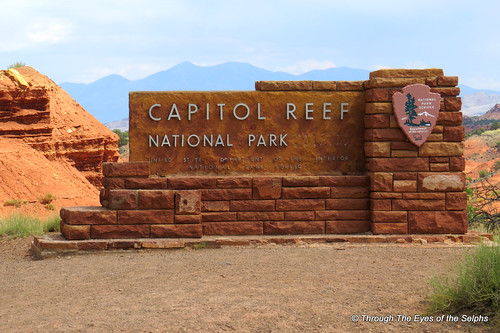
IMG_20150827_135957We left Torrey and Capitol Reef National Park and headed to Panguitch, Utah which is about 30 minutes from Bryce National Park.  Panguitch is a small town, population 1,500. Butch Cassidy and his gang was photographed here.

IMG_20150827_141108

Fire water wagon from years past

As expected we were directed to a site with absolutely no shade but we had excellent satellite reception and good WiFi and Verizon coverage.  Since this area is cooler than Moab we were not too concerned about the heat.IMG_20150827_140034IMG_20150827_143042

IMG_1138Just when I think it couldn’t get any more beautiful, we go to a new park and we are awe struck by its beauty.  The same was true for Bryce Canyon which really isn’t a canyon but a plateau with a series of horseshoe shaped amphitheaters carved in the edges of the eroding plateau.  Bryce Canyon was settled by Mormon pioneers in the 1850’s and is named for Ebenezer Bryce, a Mormon settler who homesteaded the area in 1874.  It became a national park in 1928.

To get to Bryce Canyon we drove once more on Highway 12, The All American Road, passing through Red Canyon with its beautiful red sandstone and limestone formations and through two tunnels.  IMG_1136IMG_1132IMG_1137Once inside the park we stopped by the Visitors Center to see a movie about Bryce Canyon.  We then drove an 18 mile one way scenic drive through the park with 14 viewpoints with views down into the amphitheater.   Some of the stops had overlooks alongside the road while others involved short hikes along paved trails.  The views at all the overlooks were amazing.  We saw many “hoodoos” which are towering rock formations sculptured over time by ice freezing and thawing, some as much as ten stories tall.  There are approximately 200 days of freezing/thawing at Bryce Canyon each year.  It was fun to let our imaginations run loose and imagine faces or figures in the formations.  The Paiutes, original inhabitants of the area, believed that the rock figures were people turned to stone by angry gods.  If you look closely you can also see fairy tale castle formations.  Iron oxide gives red, yellow and brown tints to the limestone.IMG_1139IMG_1140IMG_1142IMG_1143IMG_1151IMG_1156IMG_1158IMG_1162IMG_1168IMG_1167IMG_1174IMG_1176IMG_1177IMG_1179IMG_1185IMG_1186IMG_1192IMG_1193IMG_1194IMG_1195IMG_1196IMG_1198IMG_1164

Here is a video for you: https://youtu.be/bA-UUBM0rXc

Our goal is to return to the park and hike the popular Navajo Trail which will take us down into the amphitheater for a closeup view of the hoodoos.  More about that in the next blog.IMG_1200IMG_1201

August 18, 2015 Utah Scenic Highway 12

IMG_1122IMG_1118We continued to enjoy the cooler temperatures and beauty from our campsite near Capitol Reef National Park.  One day we took a break from the park and spent the day driving half of Utah State Highway 12, also called “Scenic Byway 12”, “The All-American Road” or “A Journey Through Time Scenic Byway” and known as one of the most scenic drives in America.  One website even called it the 2nd most beautiful highway in the world which I believe is a bit of an exaggeration!  The road took 40 years to complete and has Capitol Reef on one end and Bryce Canyon on the other.  IMG_1111IMG_1112IMG_1114IMG_1115IMG_1124IMG_1121Most of the land is public land as we drove through Dixie National Forest, the largest forest in Utah.  We saw bison, llamas, cattle and deer as we climbed to 9,636 feet. One section of the road was along a neck of the road no more than 30 feet across before dropping back down to Escalante where we stopped by the Grand Staircase-Escalante National Monument Visitor Center.

IMG_1110

Lady I am trying to cross here – move along please!

IMG_1126We enjoyed our time in Capitol Reef National Park and head next to Panguitch, Utah near Bryce Canyon where hopefully it will be even cooler!

August 17, 2015 Capitol Reef N.P. Utah

IMG_1092As beautiful as the area is, we were glad to leave Moab and head to Torrey where we would visit Capitol Reef National Park (NP).  Torrey is at a higher elevation than Moab, making it at least 10 to 15 degrees cooler.  We arrived at our campground in Torrey, a short drive from the park.  We settled under some trees which still allowed us satellite reception and we immediately noticed the cool refreshing breezes.  IMG_1108Quite a relief from our last campground with no shade.  Only complaint was no Verizon and the WiFi provided by the campground was spotty and unreliable.  At night we were able to sleep with the windows open and needed a light blanket!
Capitol Reef NP gets its name from the large sandstone domes that have eroded and resemble the U.S. Capitol building. A one hundred mile long wrinkle in the earth’s crust created 65 million years ago is filled with cliffs, gorges, canyons, arches and domes and is called the Waterpocket Fold.  This fold forms a reef like barrier limiting access in the park.   There are many dome like sandstone features in the park but one has been given the name Capitol Dome.

IMG_1101

Capitol Dome

IMG_1105

Castle

One of the prominently named landmarks in the park is The Castle.

There is an eight mile one way scenic drive that takes you down into the canyon where the temperature climbed to over 100 degrees.  Along this road are several dirt or gravel spur road that take you to overlooks or access to hiking trails.IMG_1096IMG_1099IMG_110620150817_10230920150817_102316

This is the first national park which has its own fruit orchards of apple, peach, cherry, pear and apricot trees left over from the days of the late 1800’s Mormon settlement called Fruita. Historic and heirloom fruit is grown here like the pioneer days.   In season you can enter designated orchards and eat for free as much fruit as you can hold.  Any you pick and take out of the orchard is $1.00 a pound.  While we were there apples were available for picking.  In the park are several historic pioneer settlements, still maintained as they were for 100 years, including farmhouse, barn, smokehouse and schoolhouse.

IMG_20150819_090434We walked the Grand Wash Trail which was a delightful flat trail with shady spots where the canyon walls shielded us from the sun.  We hiked to “The Narrows”, a really neat spot where the canyon walls closed in on us, making for some fun echoes.  After the hot steep trails in the other two parks, this trail was a welcome surprise with breathtaking canyon wall views.IMG_20150819_092837IMG_20150819_094453IMG_20150819_094023IMG_20150819_094817IMG_20150819_095132IMG_20150819_095541IMG_20150819_101645IMG_20150819_101808

August 15, 2015 Canyonlands N. P. & Dead Horse Point S.P. Utah

20150816_065519Our last day in Moab we set out very early to try to beat the heat.  The red rock walls surrounding our campsite were beautiful in the early morning light and at sunset as the sun lit up the walls to a bright red.  We had early morning guests to greet us as we were getting in the car.20150816_065759IMG_1013

IMG_1018

These Buttes are named after the Civil War ironclad ships

IMG_1020Canyonlands National Park and Dead Horse Point State Park were both about 45 minutes from Moab in the same direction so we decided to visit both in one day.

Canyonlands National Park, established in 1964 by President Lyndon Johnson, has canyons, mesas and buttes carved by the Colorado and Green Rivers and their tributaries.  There are four areas of the park with “Island In The Sky” being the most accessible, hike-able and favorite of tourists.  Island in the Sky sits atop a massive 1,500 foot mesa with beautiful views and a twenty mile scenic drive, making it truly feel like an island in the sky.IMG_1021IMG_1024IMG_1028IMG_1034

Once again we used Gypsy Guide as our tour guide as we drove the scenic drive through the park.  We were able to get in two hikes before the heat became unbearable by starting early.  First we did a short hike to Mesa Arch.

IMG_1058A much longer hike took us to the Grand View Point Overlook with amazing views.  We had to climb at times over “slickrock” which is the name the early settlers gave the rock because their horses’ metal shoes couldn’t grip the rocks’ surface.

IMG_1045

The trail is well marked with three square blocks

IMG_1046

Zoomed in view of Green River, the Colorado River was not view-able from the trail

IMG_1061IMG_1063IMG_1064IMG_1053

Here is a video of the view: https://youtu.be/smzHZQlX49s

IMG_1071

A jeep trail that leads to the Colorado River

IMG_1075On the way home we stopped by Dead Horse Point State Park.  The overlook, 2,000 feet above the Colorado River, provides breathtaking views of Canyonlands National Park in the distance.  From the viewpoint we could look across the canyon and see the cliff where Thelma and Louise drove their car off the edge at the end of their movie.  Legend says that around the turn of the century cowboys herded wild mustangs roaming the mesa top, surrounded by sheer cliffs on all sides, across the narrow neck of land only 40 yards wide and onto the point.  The neck was then fenced off with branches and brush to make a corral.  However one time, for some unknown reason the horses were left corralled on the water-less point where they died of thirst with the Colorado River within view below them.IMG_1080IMG_1085

IMG_1066

Colorado River

IMG_1081

Colorado River

IMG_1084

Movies filmed in Dead Horse State Park include “The Lone Ranger (2013), Mission Impossible II, Thelma and Louise”.
Here is a video of the view: https://youtu.be/cdQ6LFRX88w

Colorado River Trivia:

  • The Colorado River supplies water to the states of Utah, Colorado, Arizona, California, Nevada and New Mexico.  It starts as a small trickle of snowmelt high in the Colorado Rocky Mountains and begins a 1,450 mile journey through mountain canyons and three deserts.
  • More water is exported from the Colorado River’s 250,000 square mile basin than any other river basin in the world.
  • Seventy percent or more of its water is siphoned off to irrigate 3.5 million acres of crops.
  • At one time every drop of water was pumped or diverted to cities and farms in the U.S. and Mexico before it had a chance to reach the end of its 1,450 mile journey to the ocean.
  • Today that has been changed due to federal laws, court decisions, contracts and regulatory guidelines, including agreements between the U.S. and Mexico which allows Mexico to store water in U.S. reservoirs.

August 14, 2015 Arches National Park, Utah

We left Salt Lake City and headed to Moab, Utah.  We originally planned on staying in Salina, Utah overnight because of the long distance to Moab.  But when we stopped for lunch Bill felt we were making good time and decided he would like to continue the rest of the way to Moab.  We passed through some interesting scenery along the way.

We arrived in Moab with temperatures in the upper 90’s to 105 everyday.  We had looked at the weather forecast and were worried about the heat spell for the next week.  We knew from looking at the campground online that there was no shade.  With all that in mind we reduced our reservation from 7 to 4 days when we arrived.  Just as expected we were directed to a nice site which had no shade.  Even with two rooftop air conditioners it is impossible to keep up with the heat.

IMG_1008Moab, population 5,046, overlooks the Colorado River and is located in a valley surrounded by red cliffs and the La Sal Mountains.  It was a visited by Butch Cassidy and his Wild Bunch as well as author Zane Grey who used the town and surrounding area as the locale for many of his western novels.  There is a brochure devoted just to all the sites in Utah used in films starting in 1939 with “Stagecoach” starring John Wayne followed by “Wagon Master” in 1949 and “Rio Grande” in 1950 starring John Wayne and Maureen O’Hara.  In the Moab/Arches National Park area we have movies such as “The Hulk”, “Indiana Jones and the Last Crusade”, “Lone Ranger” (2013), “Star Trek” (2009), “Thelma and Louise”, “Transformers Age of Extinction”, “Mission Impossible 3” and many more!

In the 1950’s Moab was changed from a quiet agricultural town into a bustling mining and prospecting area with the discovery of uranium.  Today tourism is the main industry.

IMG_1007We had two reasons for coming to Moab.  One was to see Arches National Park and the other was to visit Canyonlands National Park.  We got up early the next morning hoping to beat the heat.  Our destination this day was Arches National Park located three miles from our campground.  We usually stop by the Visitors Center first but we were anxious to get started on our outdoor activities before it got too hot.  When we were in Hawaii we purchased several reasonably priced smartphone audio tours of each island from “Gypsy Guide”.  We felt they did an excellent job and it was like having a personal tour guide in the car.  So we were thrilled to discover Gypsy Guide had tours for both Arches and Canyonlands National Parks.  Bill hooked it up to the car’s Bluetooth so it could be played with the radio. The tour automatically advances based on your GPS location.IMG_0960

IMG_0963

Three Gossips

IMG_0964

Sheep Rock

Arches National Park contains the largest number of natural stone arches in the country with over 2,000.  The park also has beautiful red rock canyons, spires and balanced rocks.  Water and ice, extreme temperatures and underground salt movement over 100 million years are responsible for the beautiful sculptured sandstone rock.  The arches were formed by the weathering of openings in the vertical slabs of sandstone.  Park Rangers consider any opening extending at least three feet in any one direction to be an arch.

IMG_0970Our Gypsy Guide gave us a running commentary on the geology and history of the area as we drove the 36 mile round trip scenic road through the park.  We stopped at many overlooks and hiked to Balanced Rock and several arches, including Delicate Arch.  At Delicate Arch we had a choice of three hikes to see this famous arch.  There was a really short easy walk with a far away view, a moderate hike up a rather steep path over rock steps built into the pathway with a somewhat closer view, and a three mile strenuous hike for a close up view.  We chose the moderate hike and still had a view a long way from the arch.  I must say the appearance of the arch was rather anticlimatic since Delicate Arch is the unofficial symbol of Utah and seen on many of their license plates.  Whew it was hot!IMG_0972IMG_0975

IMG_0991

Normal View of Delicate Arch

IMG_0995

Zoomed view of Delicate Arch

IMG_0990IMG_0969IMG_1002IMG_0968IMG_1006IMG_1005

IMG_0986

Turret Arch

We stopped at a neat group of arches called the Windows area.  Bill asked a lady to take our picture.  We struck up a conversation with her and the others in her group.  It is always interesting to hear how extensively people from other countries have toured our country and how well they know English.  This group was from Italy.  She told us she was working at the NIH in Baltimore during the 9/11 attack and how badly she felt for our country.  Currently she is a professor at the University of Bologna, the oldest university in the world.  We love chance meetings with interesting people in our travels!

IMG_0983

Sunny Side of North Window

IMG_0984

South Window

IMG_0987

North and South Windows Together

The next day we stayed home and had a “hot day”, our equivalent of a snow day.  Both days the temperature reached 106 outside by late afternoon.  Too hot to go outside plus we wanted to let our bodies recover from the previous day’s hikes since we were hoping to do some hiking the next day at nearby Canyonlands National Park which will be the topic of our next blog.

Trivia:

  • In 1952 Charles Steen, a young geologist, discovered uranium deposits in the Moab area.  This resulted in a rush of miners to Moab increasing the population by five-fold.  By 1955 there were approximately 800 mines producing high grade ore and Moab was nicknamed “The Uranium Capital of the World”.  However by the mid 1970’s foreign competition and federal regulations put an end to domestic uranium mining.  Sixteen tons of uranium remnants formed a massive pile three miles outside of Moab.  Today trains transport these remnants in covered cars to a permanent disposal site 30 miles north of Moab.  We could see in the distance the long line of train cars waited to be loaded.
  • In 1964 one of the large rock towers in Arches National Park was used in a Chevrolet television commercial featuring a car and a Hollywood model.  The car and nervous model were placed atop the tower by helicopter.  After filming, heavy wind prevented the helicopter from landing to take them back down.  The frightened model had to spend hours stranded in the car waiting for the wind to die down.
  • Airplanes are not allowed to fly over Arches National Park because of concern the sound may damage or break the delicate features.  Breaking the sound barrier in and around Moab is forbidden.
  • Arches became a national monument in 1929 and was then designated a national park in 1971.  It is 76,519 acres or 119 square miles.


August 9, 2015 Antelope Island State Park, Utah

IMG_20150809_120534One of our RVing friends suggested we visit Antelope Island while we were in the Salt Lake City area.  It was about a 45 minute drive from our campground so we decided to dedicate one of our days to visit the island.IMG_0867IMG_0871
IMG_0869Antelope Island is the largest island in the Great Salt Lake.  The Great Salt Lake is the largest natural lake west of the Mississippi River.  The lake is a remnant of prehistoric Lake Bonneville which covered more than 20,000 square miles of land during the Ice Ages.  Water flows into the lake from four rivers, carrying 2.2 million tons of minerals into the lake each year.  Great Salt Lake has no outlet so water leaves only through evaporation, leaving high concentrations of minerals behind.  The salinity of the water is too high to support fish and other aquatic life, however brine shrimp, brine flies and algae thrive in the lake.  Because of the brine shrimp and flies, there are millions of migrating birds feeding off this food source. Nearly 80% of Utah’s wetlands surround Great Salt Lake, making its ecosystem one of the most important resources for migratory and nesting birds in North America.  The area has over 250 bird species with six to nine million birds migrating through each year.IMG_0874IMG_0878IMG_0879

IMG_0914The island is home to free roaming herds of bison, mule deer, pronghorn antelope and bighorn sheep as well as coyotes, bobcats, badgers and birds of prey.  While on the island we saw plenty of bison, one antelope, two mule deer, a hungry looking coyote and a ton of birds.  Antelope Island has more than 40 major freshwater springs that produce 36 million gallons of water each year which supports the wildlife and vegetation.  Twelve bison were brought to the island in 1893.  Today there is a herd of between 500 to 700.  In the fall some of the bison are rounded up and sold to national and state parks and ranches.  The pronghorn antelope are native to Utah and the island.  They are the fastest animals in North America and can reach speeds of up to 70 miles per hour.IMG_0883IMG_0885IMG_0923IMG_0886IMG_0922IMG_0888IMG_0893IMG_0895IMG_0918IMG_0897IMG_0906IMG_0908

Antelope Island comprises 28,022 acres and is 15 miles long and 4.5 miles across at its widest.  The oldest rocks on Antelope Island are some of the oldest anywhere in Utah.  Canyon rocks on the island are 1.7 billion years old which are the same age as rocks found at the bottom of the Grand Canyon.

Artifacts tell us that prehistoric people inhabited the island more than 6,000 years ago.  John Fremont and Kit Carson explored the island in 1845 and named the island after observing several pronghorn antelope grazing.  The first permanent residence on the island was established in 1848 and is Utah’s oldest Anglo built structure still standing on its existing foundation.IMG_0890IMG_20150809_120546

The beauty and wildlife of Antelope Island was beyond our expectations and it took us much of the day to see it all.  We even found two geocaches there!

August 8, 2015 Salt Lake City, Utah

IMG_20150813_113306

Salt Lake City

We made the short drive to a private campground located in North Salt Lake City, about six miles from downtown Salt Lake City which we could see in the distance.   What a difference these private campgrounds are from the state, national and forest campgrounds.  We had to get used to the narrow campsites with close proximity to neighbors that are found in most private campgrounds as well as traffic noise from the nearby freeway.

We settled in and then drove to the nearby Honda dealership to have maintenance done on the Honda.  We were very impressed with the people there.  Even though we were not local, just passing through the area and only having required maintenance done, we could not have been treated nicer.

Our first evening in the area we had a terrible storm with heavy rain and high wind.  Even though the forecast also called for severe lightning and hail, we didn’t experience any of that to our relief.

IMG_20150810_100703

Family History Library

We drove into downtown Salt Lake City on two separate days so Bill could do some research at the Family History Library.  The library was founded in 1894 and is one of the world’s largest genealogical libraries.  The collection mainly focuses on the United States, Canada, the British Isles and Europe, including Scandinavia, however there are genealogy records from other areas of the world.  While we were there many people of different nationalities walked through the door seeking information.  All Family History Library original records are kept at the Granite Records Vault in the mountains near Little Cottonwood Canyon.  Fortunately today many of the records are computerized.  Anyone is welcome to use the library and it is all free!  The library is 145,000 square feet and has more than 300 computers.  They have birth and death certificates, marriage licenses, census returns, property, probate and cemetery records.  HOWEVER, the Library’s collection focuses on people who lived before 1930 so you will need some older information on your family to begin.  I noticed they also have helpers throughout the library who speak other languages to help non-English speaking guests.

When we arrived we were given a first timer name tag and saw a four minute orientation movie (also available in many languages) about the five story library.  We were then ushered into a room full of computers where we were each given our own personal helper to get us logged in and to show us the ropes.  Create your account at familysearch.org then you can do about 99% of the research from the comfort of your home. There are over 4,500 branches of the library located around the world if you want assistance and/or if you want to use their equipment.  After about an hour of family research I had had enough and I went back to the lobby to work on our blog and read.  “… genealogy is the second most popular hobby in the U.S. after gardening, according to ABC News …”. Genealogy is really more Bill’s passion than mine.

IMG_0942

On May 15, 1829, Joseph Smith and Oliver Cowdery went into the woods

When he finished for the day we explored the downtown area some.  Salt Lake City was founded by the Mormons in 1847 and lies at the foot of the Wasatch Mountains.  It is a beautiful setting.  The Great Salt Lake lies to the northwest and the Great Salt Lake Desert to the west.  By the way, the name of the religion is The Church of Jesus Christ of Latter-day Saints.  Mormon is just a nickname.  Joseph Smith, Jr. said an angel entrusted him with golden plates inscribed with symbols which Smith translated into the Book of Mormon.  Smith advocated polygamy.  Although no more than 4% of the Mormons practiced polygamy, advocacy of it led to problems with non-Mormons wherever they tried to settle.  In search of a place where they could practice their religion without prosecution, they tried settling in Missouri and Illinois.  Smith was arrested, jailed and eventually shot to death.

After Smith’s death the church split into two groups with the group opposed to polygamy forming a “Reorganized Church” and returning to Missouri.  A larger group followed Brigham Young, the second president of the Mormon Church to Utah in 1847, establishing Salt Lake City.  By 1869 more than 60,000 Mormons had immigrated to Utah by covered wagon or handcart.  Also in 1869 the transcontinental railroad was completed linking Utah to both coasts.  They applied for statehood in 1849 but their request was not granted until 1896 after the church abolished polygamy.  By the 1900’s there were over 400 cities in Utah.

The streets downtown are laid out in a grid pattern fanning out from Temple Square, the spiritual and historical headquarters of the Mormon Church.  The streets were designed to be “wide enough for a team of four oxen and a covered wagon to turn around”.  The streets are named for their directional distance from the Temple, such as West Temple, North Temple, South Temple and then Main Street.  So one street south of South Temple is 100 South, next street is 200 South, etc.

IMG_0934

Utah State Capitol Building

With a population of 186,440, Salt Lake City is the state capital of Utah.  We stopped by the beautiful capitol building which sits high on a hill overlooking the city below. The Corinthian style building was completed in 1915 and resembles the National Capitol.

Temple Square is advertised as the number one tourist attraction in Utah.  Three of the buildings on the square were built by pioneers; the six-spired granite Salt Lake Temple which took 40 years to complete, the domed Tabernacle which is home to the Mormon Tabernacle Choir and organ, and the Assembly Hall.  Only church members may enter the Temple.  The Mormon Tabernacle Choir began with a small Choir in 1847, twenty-nine days after the first Latter-day Saint pioneers entered the Salt Lake Valley.  Today the choir has 360 members.  The Choir’s first radio broadcast took place in 1929.  Today their broadcast is the longest running continual network broadcast in the world.

IMG_0937

Mormon Assembly Hall

IMG_0943IMG_0945IMG_0947

IMG_0938

Domed Tabernacle Choir Building

IMG_0949We also drove by a small park wedged between two apartment buildings where we found the Mormon Pioneer Memorial park where Brigham Young and several members of his family are buried.  We were surprised to find Young’s grave in such a plain, isolated park not far from the capitol building. Young died in 1877.IMG_0953IMG_0950

IMG_0928

Eagle Gate

On the way to the capitol we passed under the 4,000 pound bronze eagle with a wingspan of 20 feet atop Eagle Gate.  The structure was erected in 1859 and at one time marked the entrance to Brigham Young’s farm.

Unfortunately Salt Lake City has the worst panhandling problem we have seen in our travels.  There are a large number of tourists in the Temple Square area and they are targets of the panhandlers.  While I was waiting for Bill in the lobby of the Family History Library, a lady came in complaining about a panhandler.  Security was called and from what I overheard, it is an ongoing problem with security called almost daily.  Bill and I were approached twice, once when leaving the library and in the parking lot two blocks from the library. Too bad Salt Lake City cannot solve this problem because it is such a turn-off for tourists in an otherwise beautiful city.

Like many cities, Salt Lake City does not have enough parking downtown and what they do have is pretty expensive.  One of the volunteers at the library gave us directions to a parking lot just a couple blocks from the library where the parking was only $1.00 an hour.  We were really glad to find that jewel!

Utah facts:

  • Seven national parks, 45 state parks, 6 national monuments, 8 national forests, 14 ski resorts
  • Population of 2,942,902
  • Symbol is the beehive representing thrift and industry
  • Origin of name is from the Native American Indian Tribe, the Utes

August 6, 2015 Willard Bay State Park, Willard UT

IMG_20150805_125655On our way to Salt Lake City we stopped for two nights at Willard Bay State Park.  There really   is not much to do here except enjoy the views of the water, but we needed a stopover point to break up the drive from Idaho to Salt Lake City.

IMG_20150805_160536Willard Bay State Park has nice long sites with full hookup ups, but it is unfortunately very close to the freeway and therefore has lots of traffic noise.  The positive with that is it is very easy access on and off the freeway.

While there we made the short drive to the Hill Aerospace Museum located at the Hill Air Force Base about five miles from Ogden, Utah.  The museum has more than 90 aircraft, Missiles and aerospace vehicles from around the world and is home of the Utah Aviation Hall of Fame. Ployer Hill was an Army Air Corps’ test pilot for more than 60 aircraft. IMG_0865During his test of a Boeing experimental aircraft, which became the B-17 Flying Fortress of World War II, he died at age 41. In 1939 the Ogden airfield was named Hill Field and now Hill Air Force Base.IMG_0844

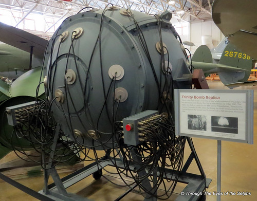
Four exhibits in the museum that are outstanding are the Willys Jeep, Link Pilot Trainer/Simulator, A-10 Thunderbolt/Warthog Aircraft, F-16 Fighting Falcon Aircraft and a Trinity Atomic Bomb Replica. Both aircraft are in service today.IMG_0845IMG_0846IMG_0848IMG_0847IMG_0861IMG_0851IMG_0854IMG_0858IMG_0856IMG_0849

We head next to Salt Lake City!

August 2, 2015 Arco, Idaho

IMG_0831It was a long travel day from West Yellowstone to Arco, Idaho with a stop along the way at the Walmart in Idaho Falls to restock supplies.  Arco is a tiny town with a population of 995 and was the first community in the world to be lit by electricity generated by nuclear power.  This occurred on July 17, 1955.  The area is nothing but sagebrush and open fields and the campground selection is very limited so we settled in at a KOA. The local high school paints their graduation year on the rocks above the city.IMG_0829IMG_0832

IMG_0828Our main reason for coming to this desolate area of Idaho was to visit the 750,000 acre Craters of the Moon National Monument and Preserve located eighteen miles southwest of Arco.  In 1924 President Calvin Coolidge used the 1906 Antiquities Act to proclaim the Craters of the Moon National Monument.  In 1923 geologist Harold T. Stearns described the area as “the surface of the moon as seen through a telescope…. where dark craters and the cold lava were nearly destitute of vegetation”.

IMG_0788While lava flows exist on the moon, astronauts confirmed that most lunar craters resulted from meteorite impacts, not from volcanoes.  But the Craters of the Moon are definitely of volcanic origin.  The vast amount of lava did not come from one volcano but from a series of deep fissures, known as the Great Rift, that cross the Snake River Plain.  Beginning 15,000 years ago lava welled up from the Great Rift to produce this vast area of rock.  The most recent eruption occurred 2,000 years ago and geologists believe future eruptions are likely.IMG_0789IMG_0790IMG_0794IMG_0795IMG_0826IMG_0827

IMG_20150803_114816

Satellite view of the lava flows

Years ago the Northern Shoshone Indians passed through this area on their annual migration from the Snake River to the Camas Prairie.  They left behind well worn trails and mysterious stone circles on top of the lava.  Archeological evidence and oral traditions indicate the Shoshones most likely witnessed some volcanic eruptions.

Craters of the Moon can be seen by satellite and we noticed it shows up on the local TV weather maps when we watch the weather.

In the 1800’s European-Americans in search of gold and farmland avoided the lava fields.  In the 1850s and 1860s pioneers followed the Goodale’s Cutoff of the Oregon Trail as an alternate route to avoid conflicts with the Shoshones and crossed through the northern edge of the lava fields.  Idaho was part of the Oregon Territory then.  In 1863 it became the Idaho Territory and a state in 1890.

In 1969 NASA Apollo astronauts learned about volcanic geology here in preparation for their moon missions.

IMG_0796

Splatter cone

After stopping by the Visitors Center we drove the Craters of the Moon Loop Road, stopping at various places along the route.  The final stop had a trail across the lava that led to several lava tubes or caves.  Entering the caves required some tricky rock scrambling so I was happy to leave the cave exploring to Bill.

IMG_0803

Indian Tunnel

IMG_0808

Indian Tunnel

IMG_0811

Indian Tunnel

IMG_0811

Indian Tunnel

IMG_0817

IMG_0812

Boy Scout Cave looking deep

IMG_20150803_140858

Entrance to Beauty Cave

IMG_0824

Beauty Cave

IMG_0833Also while in Arco we drove to see the Experimental Breeder Reactor #1 (known as EBR-1) at the Idaho National Laboratory.  On December 20, 1951 the reactor became the first nuclear reactor to generate a usable amount of electricity using atomic energy.  From that day until the day it was decommissioned in 1964, EBR-1 generated enough electricity to supply all the power for its own building whenever the reactor operated.

We took a guided tour through the building which explained how atomic energy is used to make electricity.  We had an excellent guide, a University of Idaho graduate student in psychology from the Ukraine.  We were surprised she didn’t have a degree in nuclear engineering.  There wasn’t a question asked she couldn’t answer in detail.IMG_0838IMG_0840

President Lyndon Johnson visited the site in 1966 during a ceremony dedicating EBR-1 as a registered National Historic Landmark.

Among many things our guide told us was that the nuclear waste materials from the Three Mile Island accident site was brought to Idaho to be stored.  It was often brought across the country by train in darkness because of protests by people in states who did not want the waste passing through their states, with some states forbidding the passage.

IMG_0842

Physicist Enrico Fermi was the genius behind the “breeder” concept, but Walter Zinn made it a reality.

The Idaho National Laboratory currently employs more than 8,000 people.IMG_0843

Who knew this desolate area of Idaho could hold such fascinating places!