Category Archives: Private RV Campground

Private RV Campground

Bryce Canyon N.P. May 8, 2020

We left Cedar City, Utah and traveled north on Interstate 15, still during the isolation rules of COVID-19 Pandemic. Since it was a short distance and we would be traveling over a steep pass, we decided I would follow behind in the car rather than towing. Look! There is Bill ahead of me with snow capped mountains in the distance. IMG_20200506_125325

We arrived at our campground near the tiny town of Panguitch, Utah. Its claim to fame is Butch Cassidy was born just down the road. Butch Cassidy and his gang once had their photograph taken in Panguitch. We last camped here in late August, 2015.  It is a no frills and very reasonably priced campground. We settled in for a two week stay. The first few days the temperatures were perfect during the day but too cold at night. One night the temperature got down to 21 degrees! We left the faucet dripping during the night and fortunately had no problems. 

Since our last visit here in 2015 we had been anxious to visit Bryce Canyon NP again. Of the five national parks in Utah, this was our favorite. While many Utah national parks remained closed, because of the virus, we were very fortunate to have Bryce reopen with some restrictions. The Visitors Center, most restrooms and most trails were closed. 

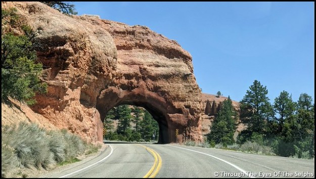
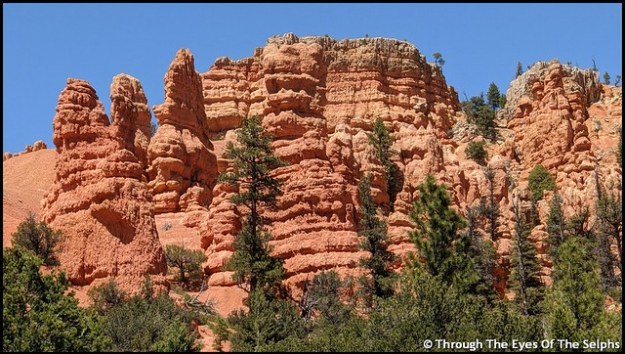
On Friday we made the 25 mile drive from our campground to Bryce Canyon. To get to Bryce Canyon we drove on Highway 12, The All American Road. We passed through Red Canyon, part of Dixie National Forest with its beautiful red sandstone and limestone formations and through two tunnels. IMG_20200508_140026IMG_20200508_140439IMG_20200515_162353-EFFECTSIMG_20200508_142051
The fee booth at the park entrance was not manned but they had maps and park information available. 

Our goal today was to do the eighteen mile scenic drive and stop at the fourteen overlooks. Bryce Canyon isn’t really a canyon but a plateau with a series of horseshoe shaped amphitheaters carved in the edges of the eroding plateau.  Bryce Canyon was settled by Mormon pioneers in the 1850’s and is named for Ebenezer Bryce, a Mormon settler who homesteaded the area in 1874. It became a national park in 1928.

Some viewpoints could be seen from the road while others required short walks, usually on paved walkways. The views were all amazing. Our favorite was the many hoodoos, which are towering rock formations sculptured over time by ice freezing and thawing, some as much as ten stories tall.  There are approximately 200 days of freezing/thawing at Bryce Canyon each year.  IMG_20200508_152548

It was fun to let our imaginations run wild and imagine faces or figures in the formations.  The Paiutes, original inhabitants of the area, believed that the rock figures were people turned to stone by angry gods.  If you look closely you can also see fairy tale castle formations. Iron oxide gives red, yellow and brown tints to the limestone. IMG_20200508_145640

One overlook was at 9,100 feet and it was very chilly. The number of tourists was low and it was nice to be able to drive through the park with very little traffic and no crowds at the overlooks. IMG_20200508_145744IMG_20200508_150116IMG_20200508_150148IMG_20200508_150238IMG_20200508_150314IMG_20200508_150443IMG_20200508_152218IMG_20200508_153110IMG_20200508_153217IMG_20200508_153235IMG_20200508_153320IMG_20200508_154015IMG_20200508_154043IMG_20200508_154144IMG_20200508_160624IMG_20200508_161030IMG_20200508_162234

The following Friday we went back to the park. This time there was a person at the fee booth with the window closed, not taking fees but handing out information through a slot. Unlike the previous Friday the Visitors Center was open with limited capacity but the theater was closed. We wanted to see the informative movie about the park we remembered from 2015, but since the theater was closed we didn’t stop. IMG_20200515_141150IMG_20200515_141200IMG_20200515_141606IMG_20200515_141611IMG_20200515_144258IMG_20200515_144434

There was more traffic than the previous Friday. We passed by the prairie dog natural habitat area with signs warning of wildlife crossings. A prairie dog ran out in front of us and we stopped. He ran to the center of the two lane road, got confused and stopped. He then ran toward our car. We were unable to move until he moved to one side or the other. An impatient driver behind us honked his horn, and when we didn’t move, he zoomed past us on our right hand side. Not knowing where the prairie dog was we held our breath that he didn’t get hit. Usually when somebody does something irresponsible like this there are no police around to see it. But fortunately there was a Ranger headed in the opposite direction and saw what happened. He made a u-turn, turned on his lights and pulled the driver over. The Ranger looked pretty annoyed when he stepped out of his car. I never can understand why people come to places like national parks and are so impatient and in such a hurry. As for the prairie dog, he ran to the side of the road and lived happily ever after! IMG_20200508_163834IMG_20200508_164532

Our main focus today was to walk the rim trail along the top of the canyon. When we were here five years ago we made the arduous hike on the Navajo Trail down into the canyon. On this day the Navajo Trail was closed indefinitely due to severe damage from winter weather. We talked with a Ranger who said they were going to have to call in a geologist for advice on how best to repair the popular trail. IMG_20200515_151127IMG_20200515_151140IMG_20200515_154702IMG_20200515_154944IMG_20200515_155054IMG_20200515_153837

Our last days in Panguitch were very windy with gusts up to 45+ mph. We delayed leaving by one day because of the windy conditions since we would have to go back over the pass on the way to our next destination. Most of Utah is now open for business but physical distance and masks are required.

Next up: Provo, Utah

Sheltering in Place Spring 2020

Hope you are all safe and well while sheltering in place. We spent most of March and all of April doing the same thing! 

We left Yuma, AZ on March 15th and spent a week in Quartzsite, AZ. We were then supposed to spend two weeks in Palm Springs, CA. But as we watched the events unfold in mid March it became very clear we needed a safer area to shelter in place. We were following the daily statistics on the progression of the virus around the country and knew Palm Springs with its high density population was not the safest place to stay. We canceled our reservation and chose Needles, CA, a very small town right across the border of Arizona and California. From our campsite we could look across the Colorado River and see Arizona. The Walmart where we ordered groceries online for pickup was located in Arizona, ten miles away. 

The campground did a nice job of protecting people by spacing everyone out so we didn’t have anyone near on either side of us. We were there a month, basically doing what everyone else was doing, watching the news, hoping for the end of the virus and for things to get back to normal. 

By mid April restrictions were still not being lifted and while we would have been content to stay in Needles longer, but we faced a new problem. A Mohave heat wave was forecast to hit the area with daily highs well over a hundred degrees. It is not easy to stay cool in an RV with those temperatures. It was time to move on. We decided to cancel our reservation in Las Vegas because the city has a large population and it was due the same hot temperatures.

We found a campground on Indian tribal land in Cedar City, Utah. We wondered if they were accepting new people there since the country was still under quarantine. We held our breath and called. Thankfully they gave us a reservation! Bill continue to binge watch the TV show Nash Bridges and completed it. IMG_20200430_133716

On April 22nd we left Needles and headed to Cedar City. The 280 mile drive was interesting as we left California, passed through Nevada, then a small corner of Arizona and finally into Utah. The traffic was light except for a little congestion around Las Vegas. As we entered Nevada there were traffic signs reminding people to shelter in place. IMG_20200422_103629IMG_20200422_103717_1IMG_20200422_140444

It was a lovely drive with snow capped mountains in the distance and the beautiful red rocks of Utah. IMG_20200422_142433IMG_20200422_142554IMG_20200422_142703IMG_20200422_142754IMG_20200422_142825IMG_20200422_143522

Utah is such a beautiful state! Utah has a website that all visitors must submit their information on upon entering. IMG_20200422_143600IMG_20200423_142954

We stayed at the Cedar City campground for two weeks. We had a no contact check-in process and once again they spread everyone out so there was distance between us. We had beautiful views of snow capped mountains from our campsite. IMG_20200424_142143IMG_20200424_142526

With pleasant temperatures in the 70’s, we felt very fortunate to be there. We had avoided the 110 degrees temperatures in Needles CA. While there we continued to isolate ourselves and ordered our groceries online for pickup from Walmart.  

We heard on the local news out of Salt Lake City that one day four Air Force F-35 planes would be flying over Salt Lake City to honor health care workers. The flight path would take them over Cedar City and then down to St George before flying back toward Salt Lake City. We waited outside during the time they were scheduled to fly over us. We were slightly disappointed because they flew so high they were barely visible but we could still hear them approaching. But still nice to see and hear! IMG_20200430_135751

Next up: Continuing our summer plans to Bryce Canyon, Utah

Arizona, Nov 27, 2019

After leaving Big Bend National Park in Texas we headed west to Arizona. We spent a week in Benson, Arizona and a week in Tucson. 

While in Tucson we enjoyed beautiful sunsets and a stroll in the desert near our campsite. IMG_20191110_173215IMG_20191116_165743IMG_20191116_165649

Back in late September while attending the Albuquerque Hamfest I took and passed the General exam, raising my amateur radio license from Technician to General. I decided then I wanted to take the Extra exam to achieve the highest level amateur radio license. The fact that Bill is an Extra probably had something to do with it. Studying for the exam involved learning and memorizing over seven hundred questions about radio frequencies, antennas, policies, electrical components, etc. It was hard! I spent October studying and while we were in Tucson the amateur radio club there held testing on Nov 11th. I took the test and passed, only missing one question! Glad to know the brain and memory still works. I even got a celebration cake with my call sign on it. Thanks Bill! 20191114_155438

While in Tucson we also met the Walmart floor cleaning robot. We named him Robbie the Robot and had a good laugh at him. I saw a small boy, about three years of age, trying to talk to Robbie. So cute! 20191114_144127

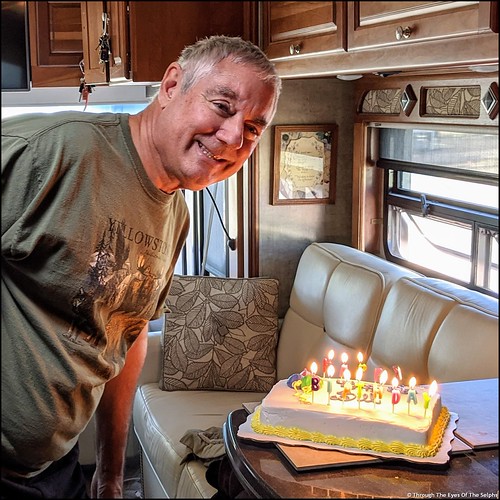
Next was Casa Grande, Arizona where Bill celebrated his birthday on November 22nd.  We will be celebrating Thanksgiving here before moving to Yuma on Dec 1st. IMG_20191122_153203IMG_20191122_153207_MPIMG_20191122_152212

Happy Thanksgiving everyone from Bill and Diane!! 

New Mexico & Texas, OCT 2019

After our visit to the Trinity Site we left Socorro and headed to Caballo Lake, New Mexico. We stayed a week at a small RV park owned by an 82 year old lady. It was one of the cleanest parks we have ever stayed at. Every afternoon she had Happy Hour on her covered veranda for everyone. She furnished snacks and each person brought something to drink. By snacks I am talking about meatballs in a delicious sauce, cheese and crackers, chips and guacamole, watermelon, cookies and cakes. Every day! After talking with other people we realized many of them come back for a visit year after year. I think these Happy Hours give the owner some social interaction and also enable everyone in the park to get to know each other. We can see why people come back year after year. 

Next up was Las Cruces, our last stop in New Mexico. When we arrived we unhooked the tow car and discovered the battery was dead. Using the RV, Bill was able to jumpstart the car. We took it to Walmart and since the battery was bad and still under warranty, they gave us another one. But we also learned that the alternator was bad. After learning it would be over $500 plus labor at the Las Cruces Honda dealer, we hired the Walmart mechanic to come to the RV park when he got off work and replace the alternator. For a total of $280 he picked up a new alternator at Autozone, took out the old one and put the new one in. 

After seven weeks, our time in New Mexico came to an end as we crossed into Texas. We took the bypass around the very congested El Paso and after overnighting in Van Horn, we stopped in Marfa, Texas for a three night stay. 

Our reason for spending three nights in Marfa was to visit three nearby places we wanted to visit. 

First up was the Fort Davis National Historic Site. Named after Secretary of War Jefferson Davis, it is one of the best remaining examples of a frontier military post and the role the military played in the settlement and development of the western frontier. IMG_20191023_102128IMG_20191023_102212

From 1854 until 1891 troops stationed at Fort Davis protected pioneers, freighters, mail coaches and travelers on the San Antonio-El Paso Road. The troops spent much of their time protecting area travelers from attack by Comanches and Apaches. During the Civil War the fort was first occupied by Confederate troops in the spring of 1861 until the summer of 1862 when Union forces took possession back. After the war ended the fort once again protected travelers on the San Antonio-El Paso Road from Indian attack. By June, 1891 the fort had outlived its usefulness and was abandoned. It became a National Historic Site in 1963. IMG_20191023_110253
During the summer months they have more activities and living history programs, but on this late October mid week visit things were very quiet. After watching a film at the Visitors Center, we enjoyed walking through the buildings that were open including the enlisted men’s barracks, the commissary, Officer’s kitchen, the post hospital and Officer’s Quarters.

IMG_20191023_111214

Enlisted Barracks

IMG_20191023_114511

Hospital Beds

IMG_20191023_114807

Operating Table

20191023_120148

Officer Housing For Two Families

In the kitchen there was a woman in period costume making chili, corn bread and banana bread over a wood burning stove. She was a little flustered because her wood fire had gone out and she had promised to provide lunch to the staff at the Visitors Center. 20191023_113516

The second attraction was the McDonald Observatory located 45 minutes from Marfa. The observatory is part of the University of Texas at Austin. IMG_20191023_124121

We had booked online a two and a half tour of the observatory. Before our tour started we looked around the Visitors Center and saw a movie. Our tour was a nice small group of fourteen and we had a fantastic tour guide. A former public school science teacher, it was quite obvious that she loves her job. After talking about the sun and showing us a live picture of the sun from one of the telescopes, we all boarded a shuttle bus to tour two telescopes. 20191023_145920

The first telescope we visited was located on Mt Locke which at 6,790 feet is the highest point on the Texas highway system. The view from there was beautiful. The Harlan J. Smith Telescope was completed in 1968 and supported NASA. This telescope’s mirror is 2.7 meters or 107 inches. IMG_20191023_162138IMG_20191023_153918

Our guide told us and showed us about how the telescope and dome moved. She talked about the mirror monthly maintenance which involves cleaning with dry ice. 

We all boarded the bus again to the summit of Mt Fowlkes (6,660 ft) to see the Hobby-Eberly Telescope dedicated in 1997. This telescope, after upgrades, is now tied with another telescope as the second largest optical telescope in the world (11-meter or 433-inch). IMG_20191023_16322020191023_163404IMG_20191023_165500
The mirror looks like a honeycomb made up of 91 hexagonal mirrors.

IMG_20191023_163604

Hexagonal Mirrors – The Curved Bars Are Reflections

IMG_20191023_165555

Our guide was so enthusiastic and eager to answer questions, our tour ended up lasting three hours instead of two and a half. Amazing to get such an interesting and informative tour for $7 (senior rate). IMG_20191023_165224

Mark you calendars – here is the time and places for the next Total Solar Eclipse. IMG_20191023_144009

Marfa is an interesting tiny Texas town. Most of the visitors, like us, pass through here on their way to Big Bend National Park. It has a very pretty courthouse and some interesting sounding restaurants, unfortunately for us most are only open on the weekend. IMG_20191023_095732

We did read about a Mediterranean food truck which had excellent reviews. Bill got a falafel called a Marfalafel named after the town. While Bill enjoys Mediterranean food, it was his first falafel and probably his last.  20191024_123122IMG_20191024_123158

Marfa is also known as having a phenomenon known as the Marfa ghost lights.  The town built a large viewing area outside of town with bathroom facilities and benches. One evening, just to say we did it, we drove to the viewing area and spent about thirty minutes looking for the lights. Other people there were convinced they saw the Marfa lights. We didn’t see anything that couldn’t be explained as man made such as lights from cars in the distance or radio towers. 
IMG_20191023_180434
Our last day in Marfa a cold front blew in. We had wind gusts up to 30 mph and that night a low of 27.  Time to move on! 

Next stop: Big Bend National Park, Texas

New Mexico, Sept 2019

Santa Fe RV Rally

We have had an enjoyable slow paced fall. In early September we attended a Family Motor Coach Association – amateur radio rally in Santa Fe, New Mexico. It was an enjoyable four days with eleven couples, a few we had met before and others for the first time. 20190901_18385320190901_184054

It was fun to see all the RVs with their antennas in the campground. IMG_20190903_103553

Santa Fe is a pretty little capital city. This was our third visit to the area. 

Albuquerque and Hamfest

Next up was a month in Albuquerque. We spent the time getting some medical appointments taken care of and working on travel plans for the rest of 2019 and 2020. IMG_20190918_140903

While we were here the Albuquerque amateur radio group had a three day Hamfest which we attended. I studied hard and was able to pass a test to update my amateur radio license from Technician to General operator class. Bill already has an Extra license, the highest level available. 20190921_155647

Trinity Site

Leaving Albuquerque we traveled south to Socorro, New Mexico for a four night stay. Our main reason for stopping here was to visit the nearby Trinity Site. The site is only open twice a year, the first Saturday in April and October. IMG_5192

We have wanted to visit this historic site for several years and this is the first time we have been in New Mexico at the right time. They only open the site twice a year because the site is located on the United States Army White Sands Missile Range where they often conduct missile tests. White Sands Missile Range is one of the most sophisticated test facilities in the world. IMG_5198

Since the site is only open twice a year, it can attract quite a few visitors. I had read that the site opens at 8:00 A.M. but that cars start lining up to get in as early as 6:30 A.M. Since we had an hour drive we left at 5:45 in darkness and heavy fog. It was so foggy we could hardly see to drive.  But even with the fog we arrived at 7:00 and there were about 25 cars in line in front of us. Instead of 8:00 they didn’t open the gate until 8:30 for reasons unknown. We had to pass through security and show our driver’s licenses and confirm we had no weapons or firearms. IMG_5212

The Trinity Site is where the first atomic bomb was tested early in the morning of July 16, 1945.  The 51,500 acre area where the 19 kiloton explosion occurred was designated a national historic landmark in 1975.  Several potential sites in California, Texas, New Mexico and Colorado were considered but this site was ultimately selected because it was already controlled by the government. It was part of the Alamogordo Bombing and Gunnery Range which had been established in 1942.  The area was secluded which provided secrecy and safety and was also close to Los Alamos where the atomic bomb was designed and built. 

The Trinity Site area where the bomb was placed and exploded is called “Ground Zero”.  It is reached by walking a third of a mile from the parking lot. IMG_5213IMG_5214IMG_5216IMG_5218IMG_5228

An obelisk made of lava stone marks the actual spot. IMG_5226IMG_5229IMG_5233IMG_5225IMG_5222

IMG_5227

This Is What Is Left Of One OF The Tower Legs


They had a replica of Fat Man, the bomb that was dropped on Nagasaki, Japan in 1945. This is the type of bomb tested at the Trinity Site. IMG_5234

We also took a bus from the parking lot to Schmidt/McDonald Ranch House. IMG_5208IMG_5204

This is where the plutonium core to the bomb, about the size of a briefcase, was assembled. IMG_5200

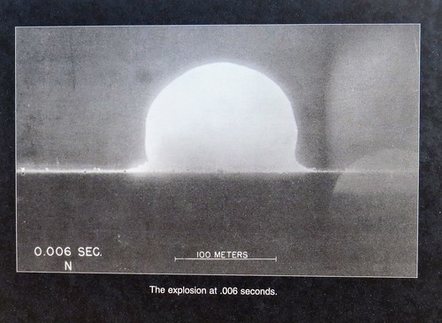
I was interested in the radiation levels at the Trinity Site. They say the radiation levels are very low with the maximum levels about ten times greater than the region’s natural background radiation. Many places on earth are naturally more radioactive than the Trinity Site. A one hour visit to the site will result in a whole body exposure of one half to one millirem. To put this in perspective, Americans receive an average of 620 millirem every year from natural and medical sources. A sequence of pictures taken that day were on display. IMG_5230IMG_5231IMG_5232

As we were leaving the Trinity Site we passed protesters from New Mexico.  They claim families in the area were affected by the testing in 1945 and never received any restitution. We were told the protesters gather every year. 

National Radio Astronomy Observatory – Very Large Array

After stopping home for lunch we decided to make a full day of sightseeing and drove up to see the Very Large Array. IMG_5236IMG_5239

They were having free admission since it was the first Saturday in October. The Very Large Array is one of the world’s premier astronomical radio observatories. It features 27 radio antennas in a Y shaped configuration. Each antenna is 82 feet in diameter and weighs 230 tons. Bill took a 50 minute guided tour of the facility and really enjoyed learning about these radio antennas. IMG_5238IMG_5243IMG_5244IMG_5237

The individual signals are merged to one picture and then colored to add perspective. Here is an example of one picture made from radio wave emissions from outer space. dwarf galaxy UGC5288 gas_large-1006x1024

Here is what radio waves are transmitted when pointed at Saturn. IMG_5240

The Next Generation Very Large Array is underway and will start construction of two hundred plus radio antennas to improve the sensitivity ten times. IMG_5248IMG_5245IMG_5246

We have just a couple more stops in New Mexico. 

Rio Grande National Forest, CO AUG 21, 2019

With just one stop left in Colorado we left Great Sand Dunes National Park and headed to our campground west of Antonito in the Rio Grande National Forest. We had a nice trip except a passing RV threw a rock up and chipped our windshield. This is the third chip in the windshield we have had since May. We will need to call Safelite once again when we reach Santa Fe in a couple weeks. 

Along the way we stopped in Alamosa to stock up on groceries at Walmart. We could see the sky starting to darken in the direction we were headed. Back on the road again we had a lengthy backup due to road construction that brought us to a standstill. The wind picked up and in the distance we saw streaks of lightning.

After the traffic delay we arrived at our campground and discovered a storm had hit thirty minutes before our arrival.  The ground was covered with pea size hail that blanketed the ground like snow and the temperature had plummeted to 48 degrees. We were very thankful that traffic backup delayed our arrival. IMG_20190823_105909IMG_20190823_110158

Ponderosa Campground is a small campground located in a canyon amid tall mountains and is right along a river. It is a popular campground for those who enjoy fishing with many people returning year after year. It was a puzzle to me why people would stand for hours fishing when it is a catch and release campground. To each his own but if you can’t even eat what you catch, why bother? 20190823_170907

We had a nice campsite right along the river and it was very relaxing to see and hear the river. Those fishing didn’t hesitate to enter our campsite to access the river but it didn’t matter since it was entertaining to watch them.  With daytime highs in the low 70’s and lows in the upper 30’s to low 40’s, the weather was perfect. IMG_20190823_10592020190823_16522720190823_165401

After an enjoyable and relaxing four night stay it was time to say farewell to Colorado. We spent six weeks in western Colorado and will certainly miss the cool temperatures, beautiful views and excellent drinking water. 

Next up: New Mexico and hot temperatures once again 

Great Sand Dunes NP & Preserve, CO AUG 16, 2019

We enjoyed our time in Dillon and hated to leave the cool mountain temperatures, but it was time to move south. The journey was not a piece of cake since we had to cross over three mountain passes including Poncha Pass, Trout Creek Pass and Hoosier Pass which was at an elevation of 11,539 and at the Continental Divide. IMG_5129IMG_513120190816_120509IMG_5133

Our destination was Great Sands National Park and Preserve. This national park is located in the middle of nowhere. We had very limited Verizon but Bill was able to improve the signal with our cell phone booster. IMG_5134

Open this image up so you can zoom into the big picture.great sand dunes np

We stayed at a private campground right outside the park entrance with great views of the sand dunes and the Sangre de Cristo Mountains in the distance. IMG_5157IMG_20190819_114420IMG_20190819_113133

The park was first named a National Monument in 1932 and was designated a National Park in 2004. The park is comprised of 107,342 acres with the preserve protecting an additional 41,686 acres. The dunes cover thirty square miles. We stopped by the Visitors Center and saw an interesting movie about the park. IMG_20190820_112158

These sand dunes are the highest in North America both in height and elevation. Some of the dunes are up to 750 feet tall. Who would have thought the highest sand dunes in North America would be found more than a thousand miles from any ocean beach?? The sand dunes have been building and shifting for eons due to the San Luis Valley’s unique wind patterns which trapped the sand along the west face of the Sangre de Cristo Mountain Range. 20190817_143021

The park guide basically says most of the sand comes from erosion of the San Juan Mountains over 65 miles to the west where the sand grains are shattered by freezing and thawing and then tumbled by winds and streams. Larger grains of sand and pebbles also come from the Sangre de Cristo Mountains. Sand and sediment from both mountain ranges washed into a huge lake that once covered the valley floor. As the lake was reduced, southwesterly winds bounced the sand grains against the Sangre de Cristo Mountains where they were trapped by the tall mountain ranges. Northwesterly storm winds blast through mountain passes piling the sand back on itself which creates North America’s tallest sand dunes.

Each spring the Medano and Sand Creeks carry snow melt  through the park at the base of the dunes. The water recycles sand and provide a lifeline for the plants and animals in the park. In late spring and early summer the creeks are swollen and we saw pictures of children swimming and playing in the water. Now, in late summer, the creeks are almost dried up. You can see in the pictures wet looking places where the creeks are almost dry. But still enough water to get our feet wet. It is all so amazing! IMG_5178IMG_514220190817_144811IMG_5144

There were people climbing up the dunes and the park rented sleds and sandboards for sliding down. But with sand temperatures up to 150 degrees in the summer, we passed on hiking the dunes. The dunes were very hot and absolutely no shade. 

There were some fabulous sunsets from our campsite. Hard to decide which ones to include! These were taken during two sunsets. IMG_5147IMG_5161IMG_5169IMG_5185a

These two pictures occurred during sunset facing north over the dunes. IMG_5182aIMG_5191a

While this was a fascinating national park and we are really glad we visited, it is very remote and probably not a park we would return to in the future. 

Next up our last stop in Colorado 

Monument Valley, UT July 13, 2019

We left Prescott, AZ and headed toward Monument Valley. After an overnight stop in Flagstaff we left Arizona and entered Utah. Even before we reached Monument Valley we began to see the majestic rock formations. 20190712_145822

The campground for our two night stay was a pricey, dusty campground with no shade. The choice of campgrounds is very limited in the area so they can all charge high prices for very basic services. At least it was a full hookup campground and when we saw the beautiful view of the formations from our site, it definitely took away some of the pain from the high cost. 20190712_183708

The last time we were here was in the fall of 2015 and we just drove up for the day.

IMG_20190713_102646

Looks Like A Indian Head With Feathers?

IMG_20190713_103017

Looks Like A Rabbit On The Right?

IMG_20190713_110250

Looks Like A Chicken On A Nest?

IMG_20190713_102651

Monument Valley is located on Navajo land and is part of the Navajo Tribal Park which was established in 1958 to preserve the environment.  Monument Valley sits at 5,564 feet above sea level and its 91,696 acres is located in both Arizona and Utah. The monuments or rock formations are natural structures created by erosion and range from 100 to 1,500 feet tall.  There was a $20 fee per car to enter the park and make the seventeen mile loop drive. The road is made of soft sand and dirt with deep ruts making it almost necessary to have a four wheel drive vehicle.

IMG_20190713_113256

Elephant Butte – Trunk On The Left

20190713_130141

Rain God Mesa – This Is Where Water Flowed Occasionally

20190713_130337

We Saw Horses In Many Areas

20190713_132142

Spearhead

IMG_20190713_122529

Merrick Mesa

IMG_20190713_123641

Camel Butte

20190713_115556(0)

East Mitten Butte, West Mitten Butte and Merrick Butte

IMG_20190713_130600

Totem Pole

IMG_20190713_131342

Balance Rock

IMG_20190713_133000

Thumb

IMG_20190713_133907

Battleship?

IMG_20190713_134653-EFFECTS

West Mitten Butte

It was fun as we drove around to see the names of the various formations, some reasons for the names more obvious than others. More popular formations are the mittens and the three sisters. The three sisters are supposed to be three nuns, with one nun being the teacher talking to her two pupils. IMG_20190713_124146-EFFECTSIMG_20190713_12445720190713_124651IMG_20190713_124238

We stopped by a couple visitors centers. One center had a nice display on the western movies directed by John Ford, many starring John Wayne. IMG_20190713_111522IMG_20190713_111508IMG_20190713_111847IMG_20190713_111719

The other center had an excellent display featuring the Navajo Code Talkers of World War II. The Navajo Code Talkers provided accurate, fast, sophisticated and secure means of communication during WWII. There were nearly 400 Navajo Code Talkers spanning six Marine divisions. They spoke in a code derived from their native language which baffled the Japanese and greatly helped win WWII in the Pacific.

Another popular place is located on the road leading away from Monument Valley. It is the setting of a scene from the movie “Forrest Gump” when Forrest was running through Monument Valley. There were many people who had stopped their cars on the side of the road so they could stand in the middle of the road and reenact the scene from the movie. Some stood in the road with cars and trucks approaching waiting until the last minute to get out of the way! I was glad Bill wisely chose to stand on the side of the road! 20190713_104541IMG_20190713_104304IMG_20190713_110319

20190714_113212

Mexican Hat

It was very hot in Monument Valley and we are headed next to Colorado and hopefully cooler temperatures! 20190714_12451220190714_115726  

IMG_20190713_204302

Sunset From Our Campsite


Prescott, AZ JUN 30, 2019

We spent the month of June in Prescott, AZ, elevation 5,300.  After the cool, rainy May in Show Low, Prescott was hot and dry.  South of Prescott is Phoenix, Yuma and Tucson all were really hot 100+ degrees!

Prescott claims to have the oldest and longest running rodeo dating back to July 4,1888 and was the first to charge admission. In 1964 Barry Goldwater launched his presidential campaign from the Prescott courthouse steps. IMG_20190705_144834

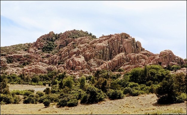
The nearby Granite Dells is known for large boulder outcroppings of granite and our campground was located near this area. While the campground was geographically unique in appearance, it was hot and very very dusty. IMG_20190627_154804IMG_20190627_155544IMG_20190629_145623-EFFECTSIMG_20190629_145659IMG_20190629_145556IMG_20190629_145411IMG_20190627_154901

Our time in Prescott was relaxed and low key. It was too hot to hike or even geocache. Bill enjoyed meeting Amateur Radio members in the Prescott area and became good friends with one member who helped Bill improve the radio antenna he uses on our RV. While we were in Prescott the annual radio event known as “Field Day” occurred and Bill and I attended two local events including a great barbecue. We had such a good time we forgot to take pictures!

Next up: Our summer travels pick up speed with a visit to Monument Valley, Utah


Show Low, AZ May 15, 2019

Beginning May 1st we spent six weeks in Show Low, AZ in the White Mountains of northeast Arizona. At an elevation of 6,400 feet we thought it would be a pleasantly cool place to spend some time in the spring without the need for air conditioning. After arriving we discovered the month of May in the White Mountains is known to be very windy. At the same time, we heard on the local weather that all of Arizona was experiencing 20+ temperatures BELOW normal. We didn’t need air conditioning but we sure needed the heat on. During our six weeks there we had winds almost every day of 25-30 mph with occasional gusts of 45+.  We had nighttime temps in the 30’s, more rainy days than we thought possible in Arizona and to our amazement we had snow on the 20th of May! IMG_20190520_145345

May 1st, the day we arrived was our eighth wedding anniversary and we celebrated with dinner at a steakhouse in Show Low. It was a very nice meal but I was really feeling under the weather. Five days later Bill insisted I go to the Urgent Care in Show Low where I was diagnosed with acute bronchitis. They gave me a breathing treatment and sent me home with lots of prescriptions. I don’t know if the elevation along with the cold rainy weather complicated things, but I was really down for the count and it took me most of May to recover.

Bill kept himself busy doing maintenance inside the RV such as cleaning vents, replacing the water and ice maker filters and flushing the hot water heater. He attended a few Show Low amateur radio events and enjoyed their nightly radio net call-ins.

As May turned to June it was like a switch was turned off and the winds died down. The weather warmed up and I was finally feeling better. With only a week left in Show Low, we wanted to spend some time exploring the area and doing some geocaching. IMG_20190607_144448

Show Low is an unusual name for a town. You may be wondering where the name came from and so were we! The answer came in a tiny little city park where we found statues of two men sitting at a table. In 1876 two ranchers by the last names of Cooley and Clark claimed and became partners in managing 100,000 acres of land in this area. As it became evident that the land could not support two families, neither man was willing to buy the other out. To settle the matter, the two men agreed to play a friendly card game of Seven Up at the kitchen table in Colley’s house across from where this small park stands today.  As the game neared completion, Cooley needed just one point to win. Clark held a three card and feeling he had nothing to lose said, “show low and you win the ranch”. Cooley drew the deuce of clubs and won the game. He renamed the ranch “Show Low” and today the main street through town is called Deuce of Clubs. 20190607_150205

Another day we walked the Mongollon Rim Trail, a nice easy paved trail with lovely views. The Mongollon (pronounced Muggy-Own) Rim is a topographical and  geological feature that cuts across Arizona and forms the southern limit of the Colorado Plateau. It extends 200 miles eastward and ends near the New Mexico border. While it can’t begin to be compared to the views at the Grand Canyon, it does have some nice far reaching views of the Plateau Country and Desert Canyon of Arizona with drops of up to 2,000 feet in places. After so much time inside it was nice to be outside and get some fresh air and exercise! IMG_20190607_161227

Show Low is a really nice town with small town friendliness while having the convenience of many stores and restaurants, including a Walmart Supercenter. We would not mind returning again, though we would wait until after the May windy season!

Currently we are in Prescott, AZ until mid July.