On July 3, we visited Copenhagen, Denmark. We left our last port three hours late due to high winds, but the captain managed to make up one hour and we arrived in Copenhagen only two hours late. The wind followed us with winds gusting up to 40 mph in Copenhagen. More on that later.
We decided to do the Hop On Hop Off Bus and fortunately they came right to the pier to pick up passengers. It ended up being a good deal since the ship was charging 16 euros round trip to take their shuttle bus the 20 minute ride into the city. Personally I think this is a service the cruise line should provide free of charge. Anyway, for just a little more, we got the ride into the city and the benefits of the Hop On Hop Off Bus.
I read that even though Denmark is the smallest of the four Scandinavian countries (Denmark, Sweden, Norway and Finland) the country of Denmark is one of the most advanced and progressive in the world. They have set the goal of being carbon neutral by 2025.
Denmark is just over 200 miles long and 75 miles wide. Very little of Denmark is much higher than 100 feet above sea level, with its highest point only rising to 567 feet.
Copenhagen, pop 605,000, is a city of monuments, statues, steeples, squares and pedestrian only streets. When crossing the street you need to watch out for the bike lane as well as the traffic lanes or you might very well be knocked over by a bike.

Christian IV (12 April 1577 – 28 February 1648) was King of Denmark and Norway
In the above statue Christian was know for many buildings with towers. In the statue the towers turn upside down are the reflections of the towers in the city’s canals and moats.

Christiansborg Palace


Copenhagen City Hall
Copenhagen, like many of the Scandinavian towns and cities, began as a small fishing village. By the middle of the 15th century it was the capital of Denmark. Today it has a very efficient bus service as well as electric trains and a subway.

Major Mode of Transportation is Bicycles
To us, Copenhagen did not have the WOW factor of many other cities we have visited such as Vienna and Stockholm. Perhaps if we had visited Copenhagen at the beginning of our trip instead of near the end, we would have felt more dazzled by the city. Instead the buildings, including the churches and palaces, seemed rather drab. There were many statues, but mostly of men on horses. Felt rather redundant by the end of the day. It was a day of contrasts.
We met the nicest employees of our summer travel at the Hard Rock Cafe, and the rudest bus driver of all our travels. My jaw dropped at his rudeness.
Our tour began by riding on the bus listening to the commentary about the city. Several headphone outlets didn’t work leaving people scrambling for seats with working outlets. Don’t get me started on that aggravation throughout the day as the buses were crowded making it more difficult to change seats. Bill said he counted five cruise ships in port today.

Lille Langebro a cycle and pedestrian bridge

We got off at the stop with the Marble Church and Rosenborg Castle.

Rosenborg Castle
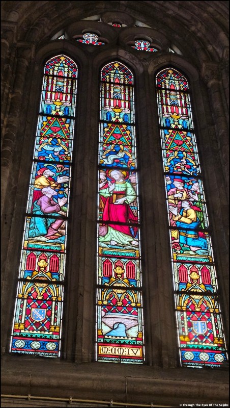
The Marble Church, also called Frederik’s Church, is not really made from marble, even though that was the original plan. The foundation was laid in 1749 but when the architect died, the plan was abandoned. In the late 1800s construction was started once again but due to a tight budget they were forced to switch from marble to limestone. The church finally opened in 1894, 145 years after the first stone was laid. 


We then walked over to the Amalienborg Palace because at noon every day they have the Changing of the Guards. Each day the Guards leave Rosenborg Castle and make the 30 minute walk over to Amalienborg Palace for the Changing of the Guards. By the time we got there, the crowd was three deep with people waiting to see it.

Lonely Guard Waiting For Replacement

Three Guards In This Area were relieved
The Amalienborg Palace is really made up of four identical palaces around an octagonal courtyard built between 1750 and 1760. The buildings are plain and not very attractive. Queen Margrethe II lives there in the fall and winter. Queen Margrethe has reigned as Denmark’s monarch for over 50 years and is Europe’s longest serving current female head of state. She was Denmark’s first female monarch since Margrethe I ruled from 1376-1412. 


Frederick V (1596 – 1632) was King of Denmark–Norway
After leaving the Castle we walked down to the harbor. It is here that we found the colorful houses along the water that Copenhagen is known for.

1,400 Seat Opera House

It was about this time that a sudden rainstorm came up. We had raincoats and umbrellas but it was raining so hard and the wind was gusting with such force, we still got wet. The wind was blowing so hard it turned our umbrellas wrong side out and they were almost yanked out of our hands but not broken. We managed to take refuge under some trees. People scattered and those sitting at outside cafes struggled to stay dry under umbrellas as waiters attempted to keep everything from blowing off the tables. It didn’t last long, just long enough to get everyone and everything soaked. Not pleasant with temperatures in the low 60s and a cold wind. The wind did help our pants dry quickly. 

Statue of Christian V (1646 –1699)
What is peculiar about this equestrian statue is the material could not hold the weight on three legs. The construction had to be strengthened, so a figure of a naked man crouched underneath the horse’s hoof was added.
After lunch we walked to the Hard Rock Cafe for Bill to get his tee shirt. If you are wearing a Hard Rock Cafe shirt, they give you a small discount on a new shirt. Bill forgot to wear his shirt but the cashier gave him the discount anyway. She was so nice. I laughed and told her I had plenty of pictures of him wearing a Hard Rock Cafe shirt to prove he owned one. 
After finding a geocache for Copenhagen, we caught the next HOHO bus at the closest stop and got off at our last location of the day, the famous statue of The Little Mermaid, inspired by Andersen’s fairy tale. Hans Christian Andersen lived in Copenhagen most of his life and wrote many of his fairy tales while living there. We had been warned the famous statue was small and it was. 
On July 4th we had our last day at sea. We wondered if the ship would do anything to recognize our Independence Day. The ship had an American flag cake on their dessert display in the lunch buffet and at dinner a nice display at the entrance to the dining room. It was nice to see they recognized an important American holiday. Especially considering there are very few Americans on this voyage. I think MSC is working hard to build up their American clientele. 
Next up: Tallinn, Estonia