Monthly Archives: June 2017

Federal Dam, MN June 29, 2017

We left Baudette under sunny skies and warmer temperatures and headed south.  Baudette was the northernmost campground location for our 2017 summer travels.

We talked about stopping in Bemidji to see the huge statue of Paul Bunyan and his Blue Ox.  Remember, legend has it that Blue Ox stomping through Minnesota is what caused the 10,000+ lakes to form.  20170701_124032We decided it wasn’t worth taking the RV towing the car off our route into Bemidji just to see a couple statues.  As luck would have it a bridge was out and we had to take a detour.  The detour took us right past the Bunyan and Blue Ox statues so I snapped a picture out of the window of the RV as we drove past.  20170629_115757We also noticed a sign saying that Bemidji was the first city on the Mississippi. 20170629_120000The Mississippi River is still narrow here approximately thirty miles from the Mississippi Headwaters.20170629_115833

We arrived at Leech Lake Recreation Area – Corps of Engineers Park, located in the very small city of Federal Dam MN.  Bill booked far enough ahead to get one of the few full hook up sites.  Leech Lake is Minnesota’s third largest inland lake and is located in the Chippewa National Forest.  One of three area Ojibwe Indian reservations is located at Leech Lake.IMG_20170630_211534IMG_20170630_211135IMG_20170630_211153

I was needing to do laundry and I was thrilled to find the campground had a laundry facility with what looked like new washers and dryers.  The best part was the washers and dryers were free!

IMG_20170701_114544While staying at Leech Lake we drove an hour to Itasca State Park near Park Rapids.  The park was established in 1891, making it Minnesota’s first state park.  It is the second oldest state park in the United States with only Niagara Falls State Park being older.IMG_20170701_134548

The park contains 32,690 acres, 220 campsites, cabins for rent as well as lodging at the historic Douglas Lodge.  Our main reason for visiting this park is because it is the headwaters of the Mississippi River.  With its source being Lake Itasca, it is here the Mississippi River begins its 2,552 journey to the Gulf of Mexico.  Minnesota has 694 miles of the Mississippi River, more than any other state.  It drains water into the Mississippi River from half the state.20170701_14120120170701_141037

We first stopped at the beautiful Visitors Center with many exhibits on the animals and plants in the park as well as the history of the area.  They had a nice display area honoring the Civilian Conservation Corps (CCC).  The CCC program in Minnesota alone trained 84,000 men in job skills and conservation.   They worked forty hours a week and were paid $30 a month of which $25 was sent home to help their families.  The remaining $5 could be used by the men for personal items.   They also received medical and dental care.  The Visitors Center also had informative displays about the mighty Mississippi River.IMG_20170701_121902IMG_20170701_122224

We drove the Main Park Drive as well as the ten mile paved Wilderness Drive throughout the park stopping at several interesting exhibits.

At the headwaters of the Mississippi River is a 44 foot long outlet dam so tourists can wade across the river in shallow water.  IMG_20170701_143658IMG_20170701_144132IMG_20170701_144204IMG_20170701_144248IMG_20170701_145220There is also a bridge constructed of one big log.IMG_20170701_144000

Approximately 7-8,000 years ago Native Americans hunted in this region.  They ambushed bison, deer and moose at the animals’ watering holes and killed them with stone tipped spears.  20170701_122016There is a bison kill site uncovered in 1937 during the construction of Wilderness Drive.  Ancient bison bones dating back 8,000 years ago were unearthed as well as knives, spears and scrapers.  A large skull is on display at the park Visitors Center.  20170701_122159We stopped by the bison dump site but there is nothing to see there today. We could imagine bison grazing at the watering hole with Indians approaching.

Five hundred to a thousand years ago Woodland Indians lived in this region.  They made clay pots and hunted with bows and arrows.  Their burial mounds are at the Itasca Indian Cemetery.  There is nothing really to see here either. Just a pathway with fencing on each side of over grown grassy areas.20170701_135920

In 1832 explorer Henry Schoolcraft, with the help of an Ojibwe guide, found the source of the Mississippi River at Lake Itasca.  He named the lake Itasca from the Latin words “truth” and “head”.20170701_121456

We stopped by a replica of the pioneer store and homestead site from the late nineteenth century, home of Theodore and Johanna Wegmann, early park pioneers.IMG_20170701_130918

There was also a Pioneer Cemetery with the graves of over a dozen early Itasca homesteaders.20170701_125946

In the late nineteenth century concerns over logging and the need to protect the pine forests for the enjoyment of future generations led to the establishment of the state park.  The park includes the virgin red pine, Minnesota’s state tree.  Some of the red pine in the park are over two hundred years old.  This park is one of the few places in the state that has preserved these pines from destruction.

Retreating glaciers 10,000 years ago left 157 lakes in the 3,000 acre park of different sizes.

Overpopulation of white-tailed deer is a problem in the park with a deer density of 15 to 17 per square mile compared with 4-10 per square miles in other areas.  Annual deer hunts have been held since 1940 in an attempt to curb the deer population.

In the winter the average temperature is -4 F with average snowfall amounts of 54.6 inches!

What a wonderful day in a beautiful park!

IMG_20170701_173606On the way home we stopped in Akeley to see another Paul Bunyan statue.  This one is over thirty feet tall!  It was erected in 1984.  Akeley advertises itself on its welcome sign as the birthplace of Paul Bunyan.  Interesting since Paul Bunyan is a folklore hero.  Seems at least ten towns from Maine to Wisconsin to Michigan to Minnesota claim the same thing.  Apparently blatant attempts to increase tourism, but it got us to stop.  And we did buy gas while we were there, so they got us!  And you really can’t blame a small town with a population of 1,100 to use tricks to get tourist dollars.  At least they didn’t charge us admission!

Our last day in Leech Lake, with the arrival of July 1st, Minnesota, the land of 10,000 lakes turned into the state from hell.  Mosquitoes arrived with a vengeance.  Our last night in Leech Lake Bill killed over thirty mosquitoes INSIDE the RV!  We hope as we head south away from the lakes the number of mosquitoes will decrease.

Next stop: Aitkin, MN as we continue south

Mississippi River Facts:

  • The Mississippi is the fourth longest river in the world.  Many small rivers and streams flow into the Mississippi with the Missouri and Ohio Rivers being the largest.  Together all these connected rivers and streams make up the largest river system in North America with a combined waterway length of more than 15,000 miles.  The Mississippi River drains water from 31 states and two Canadian provinces.  It begins as a small stream at Itasca State Park and is over two miles wide by the time it reaches the Gulf of Mexico.IMG_20170701_120913
  • A raindrop that falls in Lake Itasca will arrive at the Gulf of Mexico in about 90 days.IMG_20170701_120817
  • The length of the Mississippi has been shortened over time by over 200 miles due to channelization.
  • The river is 1,475 feet above sea level at Itasca State Park and at sea level when it enter the Gulf of Mexico.  Over half the elevation drop occurs in the first third of the journey before it leaves Minnesota.
  • The average surface speed of the river is 1.2 miles per hour.
  • Although the air temperature in the winter may reach -40 F, the rocky headwaters where the water flows from the lake into the river rarely freezes over because springs feed enough water into the lake so the river flows all year.
  • The volume of water leaving Lake Itasca is six cubic feet per second, about a bathtub full of water per second.  The volume of water when it reaches the Gulf of Mexico is 468,000 cubic feet per second, about 80,000 times more than when it started.
  • The Mississippi River watershed drains 41% of the continental United States, between 1.2 and 1.8 million square miles.
  • The Mississippi River touches ten states.

Baudette and NW Angle, MN June 27, 2017

As we drove from Kabetogama to Baudette we followed the Rainy River with views of Canada across the river.  We were glad to see sunny skies and warmer temperatures.  20170627_121912We settled in at a nice city campground.  This area of Minnesota is known as Lake of the Woods and Baudette is located in Lake of the Woods County.   Baudette is known as the Walleye Capital of the World.  Can you guess what a walleye is? IMG_20170628_145609There are no stoplights in the entire county.  Established in 1923, it is the youngest Minnesota county and there are only three and a half people per square mile.  There are two schools in the county.  One is just west of Baudette and serves preschool through 12th grade.  The other school is in Northwest (NW) Angle and serves children through sixth grade.

Our purpose for coming this far north in Minnesota was to visit the NW Angle, the northernmost point in the contiguous United States and the only place in the contiguous United States north of the 49th parallel at 49.3 degrees.  We had been to the southernmost point and the easternmost point in our travels, so we couldn’t pass this up.  Lake of the Woods has 14,552 islands and NW Angle is where the islands begin in the lake.

The thing is, in order to get to NW Angle, you have to drive to the top of Minnesota, enter Manitoba, Canada, exit Canada and re-enter Minnesota, about two hours each way from Baudette.  Which means you better have your passport handy and you have to deal with border crossings.  That never stops us, so off we went.

IMG_20170627_162205We passed into Canada after stopping at the border, showing our passports and answering the usual questions.  The Canadian border agent made us lower the back window and open the trunk.  He asked us several times if we knew anyone in Canada or were visiting anyone.  Then he sent us on our way.  After driving in Canada for about fifty miles we crossed back into Minnesota and arrived at NW Angle, population 119.  It is hard to believe this remote location is still part of Lake of the Woods County and part of Minnesota.  Signs directed us to Jim’s Corner where we had to check in with the U.S. border patrol.  This is where it really got different!  At Jim’s Corner there was a small shed.  Inside was a videophone.  IMG_20170627_164207IMG_20170627_180513There were two buttons on the phone.  One button had a U.S. flag symbol and the other button a Canadian flag.  We pushed the U.S. flag and spoke with a U.S. border patrol agent.  He asked us our names, birthdates and car tag.  Then the usual why and how long we were there questions.  We were then free to begin exploring the area​.  

IMG_20170627_162251NW Angle has a total land area of 596 square miles with 123 miles being land and 473 miles of water. Seventy percent of the land is held in trust by the Red Lake Indian Reservation, part of the Ojibwa tribe.  IMG_20170627_162325IMG_20170627_170057NW Angle was given to the U.S. by mistake during the Canada-U.S. border agreement in the Treaty of Paris.  A mapmaker’s error misrepresented the source of the Mississippi River which was an agreed upon boundary.  When the mistake was discovered, the British wanted to change the boundary in the Treaty of Ghent, but the U.S. refused to secede any land.

I must say NW Angle had the biggest black flies we have ever seen in our lives.  Whenever we stopped they immediately attacked the car with such intensity it was very unsettling.  The pings as they hit the windows and sides of the car was like something out of a  Sci Fi horror movie.  The really strange thing was the wind was blowing and whenever we got out of the car they didn’t bother us and didn’t bite.  They just attacked the car.IMG_20170627_170148

We had planned on finding some geocaches and at first I refused to get out of the car because of the flies.  But after Bill got out and convinced me the flies wouldn’t attack me, we both enjoyed finding the geocaches.  There was one geocache near this original single room schoolhouse.IMG_20170627_170235

We stopped at the smallest post office in the continental U.S.IMG_20170627_170659

Here is the one room schoolhouse which is the only school in NW Angle and the last remaining one room schoolhouse in the state. The school is K through sixth grade, has one teacher and twelve students, with enrollment and attendance varying seasonally.  29714055462_bc515bdb54_bSome children arrive by boat from nearby islands.  In the winter some students travel to school by snowmobile.

We found the northernmost marker which looked exactly like the marker in Key West, Florida except this one was blue.IMG_20170627_173231

In 1997 some residents of NW Angle suggested leaving the United States and becoming part of Canada.  This angered the leaders of the Red Lake Indian Reservation which holds most of the land.  The residents’ main gripe was what they considered to be unequal fishing regulations between the U.S. and Canada.  The NW Angle residents worked with their Congressman to get an amendment introduced to bring equity in the ways the two nations were treated under NAFTA.

After a couple hours exploring it was time to head home.  But first we had to go back to the shed at Jim’s Corner and check in with the Canadian patrol.  This time we pressed the Canadian flag symbol on the phone, but we were put on hold for almost twenty minutes.  We were very grateful we were waiting inside the shed and not outside with the flies.  There is a second phone outside in case there are people waiting.  Finally a Canadian agent came on the line and asked us almost the same questions we had been asked before.  She then gave us a four digit number to use in case we were stopped by Canadian police.  The number would prove we had checked in.

We left NW Angle and re-entered Canada.  Our drive through Canada back to the Minnesota border was uneventful.  When we re-entered the U.S. at the Canadian border we now had a real in person United States border agent.  He didn’t ask us to open the trunk, just wanted to know what we did in Canada and if we had anything to declare.  Very easy getting back in.

I read that the lack of in person border patrols at NW Angle has caused some safety concerns since 9-11.  It is possible to enter the area by car or boat without being easily detected.

We arrived back home after our six hour adventure.  And what an adventure it was!

This is the northernmost point in our 2017 summer travels.  When we leave Baudette we will head back south.

Next stop:. Leech Lake Recreation Area, MN

Voyageur National Park, MN June 25, 2017

Minnesota has certainly been cooler and wetter than we expected and things did not change as we moved from Ely northwest to Kabetogama, Minnesota and stayed at the Woodenfrog State Forest Campground.  We were there for two nights and both nights it got down into the forties.

After getting settled in our campsite we drove twenty five miles north to International Falls, population 6,400.  We were curious to see what the city was like and we were definitely underwhelmed considering it is a key port of entry and supply point for Ontario, Canada.  We drove to the International Bridge linking the United States and Canada and were disappointed to see just an ordinary bridge.  We didn’t even take a picture.  International Falls has a paper mill and there was a bad smell that permeated the area.

Next we visited the Smokey the Bear Park and found a geocache.  At 26 feet tall, made of steel and fiberglass and weighing 82 tons, it is the largest Smokey the Bear statue of its kind in the country.  It was unveiled in 1954.IMG_20170625_153902

We also found a geocache at Big Vic, a 30 foot statue of a voyageur, honoring the French-Canadian fur traders who once navigated the rivers and lakes in this rugged area of Minnesota.IMG_20170625_155855

Since we left Duluth we have had to rely on small local markets for groceries.  The choices are extremely limited and the prices high.  So I was happy to find that International Falls had a Super One grocery store and before heading back home we stopped for some groceries.

Our reason for coming to this area was to visit Voyageurs National Park, the only national park in Minnesota. The park is 218,000 acres with 30 lakes, 1,000 islands and 600 miles of bedrock shoreline between Minnesota and Canada.  There are four main lakes in the park which eventually drain into the Hudson Bay.  Lake levels are controlled by dams at the international border at Fort Frances, Ontario Canada and International Falls, MN as well as dams at Kettle Falls and Squirrel Falls on Namakan Lake.

Our campground was near the Kabetogama Visitors Center in Voyageurs National Park, one of three visitors centers.  The visitors centers are accessible for road, but the interior of the park is accessible only by water.IMG_20170625_143840  There are many resorts and private campgrounds near the park, but the campsites in the park are only accessible by boat.  We advance booked a boat tour since it is the only way to see the park.  In the summer the park can be accessed by motorboat, houseboat, canoe or  kayak.  In the winter it is accessible by snowmobile, snowshoe or cross country skis once the lakes freeze.  The Park Service plows miles of ice roads on Rainy Lake for ice fishing and wildlife viewing.  Voyageur National Park became a national park in 1975.

When we left the RV Monday morning to head to the boat it was 55 degrees, pretty chilly to be out on the water!  Not far from the campground Bill spotted a red fox on the side of the road, but it ran away before we could get a picture.

We boarded the pontoon boat with a park guide and a park employee driving the boat.20170626_09394120170626_09522120170626_135731  We were provided with binoculars  and a blanket which came in very handy for the next two hours.  We toured the park with views of Canada across the water.  We stopped at several locations to see bald eagles, birds and a loon which is the state bird of Minnesota.  IMG_20170626_101438IMG_20170626_105042IMG_20170626_10402220170626_10411620170626_111116IMG_20170626_111529IMG_20170626_141905IMG_20170626_144321IMG_20170626_144539We were amazed at all the bald eagle nests and the guide told us there are many more in the park we couldn’t spot.  We saw several fishing boats as well as some houseboats which the guide told us are available to rent from some concessionaires in the area.20170626_140950

We stopped at the Kettle Falls Hotel for lunch.  Built in 1913, the hotel was frequented by loggers, prospectors and commercial fishermen.  During Prohibition bootleggers took advantage of the hotel’s proximity to Canada and its remote location to smuggle liquor south of the border.  Legend has it that a Madam financed the construction of the hotel who later staffed the hotel with the “fancy ladies” who “entertained” the guests.  William E. “Big Ed” Rose, a timberman, sold his Kettle Falls holdings to Robert Sloan Williams in 1918 for $1000 and four barrels of whiskey. IMG_20170625_143924IMG_20170626_11585120170626_120145The hotel and restaurant was sold to the National Park service in 1977 and is operated jointly by the Park Service and a concessionaire.  The hotel is listed on the National Register of Historic Places.  Kettle Falls got its name from the naturally formed kettles in the bedrock below the falls.  The kettles were formed by hard rock being swirled around soft rock over thousands of years.

The hotel restaurant was understaffed and it seemed to take forever to get served lunch.  While we waited we walked around the hotel.  We noticed the badly slanting floor in the bar area.  When the hotel was built the owner wanted it done as cheaply as possible so they did not build a foundation.  The clay soil often accumulates water which builds up and can become mushy over time, causing the earth to sink.  The hotel floor sank creating a sloping floor for the entire bottom level of the hotel.  IMG_20170626_123754When the Park Service renovated the hotel in the 1970’s they decided to repair the foundation of the floor but preserve the sloping in order to preserve the uniqueness of the hotel. The original hotel had eighteen guest rooms but since the National Park Service acquired the property and brought it up to fire code it now has twelve guest rooms.  It is still being used as a hotel today and they had one room open to visit.  The hotel’s original owner furnished the hotel with second hand furnishings or castaway items.  It really is a high class hotel…notice the box fan for air conditioning and the fly swatter on the wall.   The hotel is not open in the winter because there is no heat upstairs and there are no televisions or Wifi either.20170626_12391720170626_12393020170626_124007

After lunch our guide led us on a short walk to the Kettle Falls Dam.  IMG_20170626_134737The falls are now under the dam.  There is a stake in the ground showing the boundary of the United States and Canada.  IMG_20170626_134953When standing at the Kettle Falls overlook and looking towards the dam, it is one of the only places in the continental United States where you look south to Canada.

We then boarded the boat for the trip back.  While we were walking to the dam it started to lightly rain.  IMG_20170626_135647We have learned that bright blue skies in Minnesota in the morning does not guarantee a day without rain.  It was a very cold ride back even with a blanket and coats.  Even though the boat was covered we occasionally felt the rain and the ride back was sometimes  rocky.  We saw the Minnesota’s state bird the Common loon.IMG_20170626_151430 By the time we got back we had been gone for six hours, four of which was on the water.  IMG_20170626_150057We were cold and glad to get back on land and in the warm car.  On the way home we saw a doe and her fawn. IMG_20170626_155638 

Next stop: Baudette, MN

Ely, MN June 23, 2017

We woke up to 48 degrees and a heavy fog on our travel day from Grand Marais to Ely, Minnesota.  By the time we were ready to pull out of the campground, the fog had lifted and we saw blue sky.

We headed south and west to Ely, MN.  The roads could have been worse, but they certainly could have been better too.  We said goodbye to Lake Superior, passing several small waterfalls along the side of the road.  The fields of wildflowers were lovely but unfortunately do not show up well when taking a picture from a moving vehicle.

Three hours later we arrived at Fall Lake Campground, a national forest campground in Superior National Forest.  Many campsites are not reservable so we got up at 6:30 AM to get there in plenty of time to secure a site, especially since campgrounds fill up very early in the summer the closer you get to the weekend.  We rarely get up that early, even on travel days!  Our early bird plans got us the worm since we were able to get a pull through site with 50 amp power.

IMG_20170624_150317Ely, population 3,400, is located at the gateway of the Boundary Waters Canoe Area Wilderness. The wilderness is a million acres of ancient forest and 1,500 waterways still untouched by civilization and is the largest wilderness area east of the Rockies.  The best way to experience it is by canoe like the Native Americans, trappers, fur traders and explorers did centuries ago. There are thousands of miles of canoe routes which are linked by rivers, lakes and portages.

The number one attraction in Ely is fishing with access to more than 5,000 lakes, streams and rivers in the area.  It is common to see fishing lodges, canoe outfitters, and many boats, canoes and kayaks everywhere.  It is said this part of Minnesota has some of the best fishing in North America.

Nicknamed “The End of the Road” because of its extreme north remote location, Ely was first home to the Ojibwe people in the late 1600’s, followed by the first French explorers in the early 1700’s.  Trapping and fur trade quickly grew and in the mid 1800’s the gold craze had begun.  Even though the region never produced gold, the precious metal iron ore was discovered.  Northern Minnesota’s early ore mines helped greatly with the needs of the nation’s steel industry.  Ore exploration led to the growth of the logging industry in the region. By the 1900’s recreational activities such as fishing, hunting and canoeing turned the area prevalently into a tourism industry.

Ely got its name from a rare rock formation known as Ely greenstone which formed more than two billion years ago when lava flows solidified underwater.  An outcropping of the Ely greenstone is visible in the town and is known as Pillow Rocks.IMG_20170623_162036

We enjoyed the many murals around town showing the rich history of the region.IMG_20170624_14405220170624_14334120170624_143238

On Friday we drove to the nearby town of Soudan to visit the Soudan Underground Mine State Park.  Our purpose for coming here was to take the underground mine tour.  IMG_20170623_10324020170623_104047We donned hardhats and rode the mine elevator shaft 2,341 feet underground.  IMG_20170623_112326IMG_20170623_112352We then boarded railroad cars that took us through a 3,000 foot tunnel deeper into the mine.  We climbed a narrow spiral staircase to reach Level 27 in the mine.  We had an excellent guide who talked about the process of mining iron ore as well as what working conditions were like for the miners. 20170623_112556He let us experience the mine without any lighting and then with a single candle. Miners had to provide there own lights and safety gear for many years. IMG_20170623_113802

During the gold rush of 1865, one prospector didn’t discover gold but he did discover iron ore which led to the mine opening in 1882. The mine is known as Minnesota’s oldest, deepest and richest iron mine and one of the richest iron ore deposits in the world.  The mine is 1.5 miles long and is part of the Vermilion Iron Range along the shore of Lake Vermilion.  It is called the Soudan Iron Mine and the ore from the mine was especially valuable because this ore had a high oxygen content that was used to make high quality steel in open-hearth furnaces.  Only this Minnesota mine and one other one in Michigan had this high oxygen content ore.  In 1962, technology changed and this type of ore was no longer economical.  Also the use of taconite pellets made from a low grade iron ore became popular.  Due to these two factors, the Soudan Mine closed in 1962. In 1965, US Steel donated the Soudan Mine to the State of Minnesota to use for educational purposes.20170623_10364820170623_104105

It was fascinating to be lowered in an 80-year-old electric mine hoist (elevator) and then travel in rail cars to tour the mine.  We really enjoyed our visit and had an even larger appreciation for what working conditions were like for miners in the nineteenth and early twentieth centuries.

IMG_20170623_161646After a picnic lunch in the car (cold and windy), we drove back to Ely and toured the International Wolf Center.  This is one of the top attractions in Ely and highly advertised.  We toured the facility with informative displays and sat in on a program on wolves.  We were a little disappointed they only had five wolves at the facility and we only saw three Arctic wolves visible behind glass.IMG_20170623_15585120170623_16003620170623_160240IMG_20170623_160508

Last year the center received two Arctic Wolves.IMG_20170623_143230

Here is what one of the new wolves look like today.IMG_20170623_155448

This is a collection of the wolf playing with his stick (animated).

Wolves are big animals.IMG_20170623_143636IMG_20170623_143645

On Saturday Bill attended the Ham Radio Field Day in Ely.  This once a year National Amateur Radio Field Day is held at public locations around the country.  The purpose of this event is to showcase amateur radio and allow people to experiment with electronics and radios.  In 2016 over 35,000 people from thousands of locations participated in Field Day.  Last year Bill participated with a group in New York.  Bill really enjoyed his time with the friendly Ely radio club. They entertainment Bill with stories of winter ice fishing and talked about the black bears they regularly feed.  One man spends the winter in Arizona at an RV park we are scheduled to visit in November so we will look him up!IMG_20170624_114850  

Next up:. Voyageur National Park and a boat ride

Ely recognitions:

  • 2016 “One of the World’s 9 Places to Go to Enjoy the Great Outdoors” (National Geographic)
  • 2014 “One of 10 Great Small Towns to Visit” (MSN Living Magazine)
  • 2012 “America’s Most Interesting Town” (Reader’s Digest)
  • 2009 “100 Best Adventure Towns” (National Geographic Adventure Magazine)
  • 2009 “One of the Top Best Small Towns in the Country” (Outside Magazine)

And many more not mentioned

Grand Marais, MN June 18, 2017

We left Duluth and drove up the North Shore Scenic Drive to Grand Marais, forty miles from the Canadian border.  Grand Marais, population 1,351 is a beautiful town situated on Lake Superior.  It has a summer vacation destination vibe with small tourist shops, restaurants, a few hotels and tons of gorgeous scenery.  There are no fast food restaurants or big stores located in Grand Marais.  Like the rest of Minnesota, it is a fisherman’s dream come true.20170619_13432920170619_134220IMG_20170619_133607

We stayed at a city campground/marina with beautiful water views.  The campground was a short walk from the small downtown area.  One day we strolled downtown and wandered along the waterfront.  Bill had a great fish lunch at the Dockside Fish Market where you can buy lunch or pick up fresh fish to take home.  Bill had fish and chips with what he said was delicious whitefish.  The only way to get it fresher was to go out with your own fishing pole!20170619_14221620170619_130722IMG_20170620_103636

Tuesday we drove forty miles up to Grand Portal State Park located right at the US/Canadian border. IMG_20170620_113532 In fact when we turned into the entrance to the park we could see the border crossing just ahead and the welcome to Minnesota sign for those arriving from Canada.  The state park, established in 1989, is actually located on the Grand Portage Indian Reservation.  The Native Americans lease the land to the state of Minnesota for $1 a year.IMG_20170620_114509IMG_20170620_11462620170620_114528

Our purpose for coming here was to see the High Falls, which at 120 feet is the tallest waterfall in Minnesota.  To view the Falls we walked an easy half mile along a beautiful boardwalk through a forest setting.IMG_20170620_120159

The High Falls were gorgeous and we could see the Pigeon River which is part of the international border between Canada and the United States.  Here, the Pigeon River is twenty miles of a series of treacherous cascades and waterfalls on its way to Lake Superior, making this section of the river completely unnavigable.  For this reason a “Grand Portage” was necessary.  In this case, the Portage consisted of a 8.5 mile foot path used to carry boats and supplies from Lake Superior to the Pigeon River.  It was followed by voyageurs (French for travelers) to Port Charlotte and the boundary waters separating Minnesota and Canada. Through this portage passed all the trade goods from Montreal and furs from the Canadian Northwest.  Along this 8.5 mile path voyageurs carried two 90 pound packs as well as their canoes.IMG_20170620_12132720170620_122501

Native Americans were the first to develop and use the portal from Lake Superior inland for centuries.  The Ojibwe called the portage “The Great Carrying Place”.  The Ojibwe people frequently traveled the portage carrying birch bark canoes and baskets of fish, garden seed, wild rice, and copper. The two oldest copper sites in North America come from the Lake Superior basin. When the French traders came in the 17th century the Native Americans showed them the portage which they then used to transport goods from large lake canoes to smaller canoes.  The Grand Portage was the earliest European presence in the Great Lakes region with the first documented travel along the Grand Portage in 1731.20170620_13211820170620_132407IMG_20170620_132421

Next we stopped at the nearby Grand Portage National Monument.  We saw an excellent movie on the history of the area, with an emphasis on the Native American viewpoint.  The Visitors Center also had interesting exhibits and displays.  We then walked down the hill to a reconstructed Ojibwe village and Voyageur Encampment reconstructed based on archeological excavations.  The furnishings are in the 1797 style.  The settlement consisted of a stockade, great hall, kitchen and warehouse.IMG_20170620_131434IMG_20170620_13163320170620_13192920170620_14022520170620_14021020170620_14042520170620_13590520170620_135926

In 1763 after the French and Indian War, France ceded Canada to Great Britain and the British took control of the fur trade away from the French. From 1784 to 1803 the North West Company, owned by Highland Scots, ran a very profitable fur trading operation in the Great Lakes area.  The company’s headquarters was located at Grand Portage and was the largest fur trade depot on the continent.  It was a profitable time for the Europeans as well as the Native Americans.  They got along well and traded goods each needed.  The Native Americans taught them how to build birch bark canoes and traded pelts and their immense knowledge of the area for glass beads, wool clothing, kettles, axes, firearms and liquor.  20170620_143240IMG_20170620_141537Some of the voyageurs even married Native American women.  Much of the settlement was empty most of the year as the men were out hunting, but every July they held the Rendezvous, an annual gathering when furs from wintering posts in Canada were delivered to Grand Portage.  20170620_13220820170620_132532

Hundreds of vogageurs came to the Grand Portage and it was a time of great celebration for the voyageurs as well as the Native Americans.  The North West Company shipped fur pelts originating from over 100 trading posts through the Grand Portage.  In the 1700 and early 1800’s, fur pelts were used for fashionable clothing.  Furs for hats made up more than 65% of all English fur imports.  Beaver pelts accounted for over 60% of total pelts traded in one season during the height of the Grand Portage between 1785-1802. The use of beaver pelts for hats severely depleted the beaver population in North America, Europe and Russia.  In 1793 alone 182,000 beaver pelts passed through the Grand Portage.  Beaver was considered the highest quality fur. The Rendezvous was when the voyageurs received their pay for the past year’s work and once the celebration ended the trappers headed out for another season of travel and trade.

The North West Company left the Grand Portage in 1803 when the new United States claimed the area in a border agreement with Canada.  The Company knew possibly doing business with the new United States led to issues of citizenship, licensing and import duties they wanted to avoid.  Their leaving the area after years of profitable trade with the Indians led to hard times for the Native Americans in what they called “The Starving Times”.IMG_20170620_143357

In the early 1800’s there was an intense and sometimes violent rivalry between the North West Company and the Hudson Bay Company for business.  The two companies merged in 1821 into the Hudson Bay Company.

In 1958 the Grand Portage Band of the Minnesota Chippewa tribe donated the land to the United States and it became a national monument.

On our last morning in Grand Marais, Bill took some great pictures of a sunrise and found a beaver friend swimming in the bay.IMG_20170621_050124IMG_20170621_050938IMG_20170621_050329
IMG_20170621_050333

IMG_20170621_050345

Beavers like to slap the water every now and then

IMG_20170621_051819

Here are two videos for you to select and view:


Next stop: Ely, Minnesota

Duluth, MN Part 2, June 16, 2017

On Friday we decided to drive from Duluth on what is called the North Shore Scenic Drive on Rt 61 along the shoreline of Lake Superior.  It was a beautiful day to enjoy the drive and the gorgeous scenery.IMG_20170616_120840

The Drive is 150 miles long from Duluth to Thunder Bay, Ontario with views of Lake Superior, glacier carved Sawtooth Mountains and Superior National Forest.  Along the way we suddenly spotted Bigfoot!!20170618_121048

We decided to only drive 55 miles and work our way back while stopping at points of interest.  Our first stop was at Tettegouche State Park where we took a short hike to an overlook with views of Lake Superior.20170618_12140820170618_124208

We had a picnic lunch at Palisade Head, an overlook 200 feet above Lake Superior.  We drank in the amazing views while enjoying lunch.IMG_20170616_123410IMG_20170616_123656

After lunch we found a geocache and Bill found a new friend!IMG_20170616_130011

IMG_20170616_132106Next we passed through the tiny towns of Silver Bay and Beaver Bay before stopping at Split Rock Lighthouse. The lighthouse, said to be the most visited spot on the North Shore, sits atop a sheer cliff 150 feet above Lake Superior and is one of the best preserved and most visited lighthouses in the country.  Split Rock Lighthouse was put into service in 1910.  It was built by the federal government because of a disastrous 1905 storm that sank or damaged 29 ships on Lake Superior.  This lighthouse was completely built from the lakeside because there were no roads at that time.  20170616_143221IMG_20170616_134424IMG_20170616_133838IMG_20170616_134226

IMG_20170616_134207

This is the light mechanism

In 1969 the lighthouse was decommissioned and deeded to the state of Minnesota.  It is a National Historic Landmark.  For a fee you can tour the lighthouse, a fog signal building, an oil house, three keepers’ houses, and storage barns.  The lighthouse and buildings appear as they did in the 1920’s.

Split Rock is also a 2,057 acre Minnesota state park but the lighthouse is maintained by the Minnesota Historical Society.

Then we drove to Gooseberry Falls State Park so we could hike to Gooseberry Falls.  It was an easy hike to the two beautiful falls.IMG_20170616_15110320170616_151055IMG_20170616_151957

On the way home we stopped at the Two Harbors Lighthouse which is now a bed and breakfast and the only operating lighthouse in Minnesota.  Built in 1892, it is on the National Register of Historic Places.IMG_20170616_104947

It was a really great day with three state parks, two lighthouses, a beautiful overlook and some amazing scenery.

IMG_20170617_115916Saturday, our last day in Duluth, we drove across the bridge to Wisconsin.  We wanted to visit Pattison State Park thirteen miles south of Superior, Wisconsin.  The park is the location of Big Manitou Falls, which at 165 feet is the highest falls in Wisconsin and the fourth largest waterfall east of the Rockies.  It is said to be the same height as Niagara Falls, just a lot skinnier.

We had to walk in a tunnel under the road and then it was an easy hike to the viewpoints.  The water flows from the Black River and gets its dark color from decaying leaves and roots of vegetation.20170617_115205IMG_20170617_115227IMG_20170617_115621

Here is a video below we made of the falls.

After viewing the falls we found a geocache hidden in a tree.20170617_121638

This state park was very pretty with 80+ handcrafted stone and log buildings and structures built in the 1930’s by the CCC.  We really enjoyed this park, as well as the three Minnesota state parks we visited the day before, all possible because of the hard work of the young men of the CCC (Civilian Conservation Corps).

We enjoyed our six days in Duluth.  There were lots of things left to do.  Until next time!

Lake Superior facts:

  • Lake Superior is the largest freshwater lake in the country, bigger than all the other Great Lakes combined. It is 350 miles long, 160 miles wide and has a surface area of 31,700 square miles
  • It contains 10% of the world’s fresh water with a volume of 440 trillion cubic feet
  • Average depth is 439 feet, with its deepest depth at 1,333 feet
  • Average water temperature is 42 degrees
  • There has been over 350 shipwrecks with more than 1,000 souls lost
  • Last time Lake Superior completely froze over was 1997, it was 90% frozen in 2013

Next stop:. Grand Marais, MN

Duluth, MN Part 1 June 12, 2017

On Monday we left Wild River State Park and headed further northeast to Duluth.  As we approached Duluth we had splendid views of Lake Superior.  Duluth with a population of 86,000, is located on Lake Superior and the St Louis River.  It is one of the largest inland seaports in the world and an important grain center.  All along the busy forty-nine miles of dock waterfront, you can see grain elevators, ore docks and shipyards.  Duluth has plenty of outside activities with more than 130 city parks, 178 miles of trails, and sixteen designated trout streams.IMG_20170612_153958

Duluth has a rich history.  In 1869, due to the booming lumber and mining industries as well as the arrival of the railroad, it was the fastest growing city in the United States. We crossed the railroad tracks to get to the campground and we saw this strange sign.IMG_20170614_132225

When we arrived at the campground it was 80+ degrees and sunny.  The next day it barely reached 50 degrees and was overcast with occasional rain showers.  

Wednesday was more of the same with a heavy fog blanketing the area and we heard occasional fog horns in the distance.  We didn’t want to spend another day at home missing all Duluth had to offer, so we bundled up and decided to visit two museums downtown.

The first was a very small museum called the Karpeles Manuscript Library Museum.  It was a museum we probably wouldn’t have taken time to visit on a sunny day, but on a cold rainy day it was great.  The library museum, housing one of the world’s largest private manuscript collections, is inside a former Christian Scientist Church. It had original manuscripts, documents and handwritten letters, including letters from the Wright Brothers, small collections of Egyptian carvings, old telephones, ship models, and Plains Indians Treaties.  Currently they have a special collection on Bob Dylan.  Dylan was born in Duluth and went to elementary school there.  There is a 1.8 stretch of road in Duluth named “Bob Dylan Way”.  The manuscript library had some of his personal handwritten letters, handwritten sheet music and a copy of his 2016 Nobel Prize in Literature.  We found out he was born Robert Zimmerman and changed his name to Bob Dylan.  They had a copy of the court order application to change his name.  IMG_20170614_150854IMG_20170614_151025IMG_20170614_151031IMG_20170614_152142IMG_20170614_152159

We learned the owners of the museum, David and Marsha Karpeles of California, also own museums in Jacksonville, FL, Buffalo, NY, Newburgh, NY, Tacoma, WA, Charleston, SC and Santa Barbara, CA.  The collections are rotated among the museums.  The Karpeles think that once someone has mastered textbooks and reference books in their field, they can then verify, analyze and extend their knowledge by examining and consulting original manuscripts written in an individual’s own handwriting.  The Karpeles see it as a way to see a person’s first thoughts since you can see on the documents thoughts and ideas crossed out, ideas added but left out in the final document, as well as additional thoughts added later between the lines.

20170614_160527Next we visited the Lake Superior Maritime Visitor Center.  Here they had informative displays on the history of Lake Superior shipping including replicas of ship cabins, an operating steam engine, scale models of ships and information on shipwrecks and bridges.  They also had interesting displays on the history of the Army Corps of Engineers.  We learned Congress authorized a Corps of Engineers in 1779 to support the Continental Congress.  Its first mission was the building of fortifications to defend Boston at the Battle of Bunker Hill.  After victory at Yorktown and peace in 1783, the Corps of Engineers was dissolved to save money.  IMG_20170614_155435IMG_20170614_155816IMG_20170614_160131

In 1802 President Thomas Jefferson signed legislation to organize and establish a Corps of Engineers to be stationed at West Point and to constitute a military academy.  They played a large role during the Civil War while building roads and railroad bridges, forts and batteries and destroying enemy supply lines.  In the 20th century the Corps of Engineers contributed much to military construction in supporting the U.S. Army and Air Force as well as works of a civil nature.  They helped with federal flood control, hydroelectric energy and the country’s leading provider of recreational facilities.

Corps of Engineers projects included:

  • In Washington DC
    • Construction of the Washington Monument
    • US Capitol dome
    • Lincoln Memorial
    • Library of Congress
    • Washington DC water supply system and subways
  • Panama Canal
  • Bonneville Dam
  • The Manhattan Project
  • Planning and construction of the Pentagon
  • Everglades Restoration Plan
  • Construction at the Kennedy Space Center

We decided to run to Walmart to get some supplies and it was actually faster and closer to the campground to cross the bridge to Superior, Wisconsin than go to the one in Duluth.  The ports of Duluth and Superior are called “Twin Ports”.  They are the leading bulk cargo transshipment ports on the Great Lakes-St Lawrence Seaway system.  More than forty million tons of bulk cargo are shipped in and out each season, the most of the Great Lakes and one of the top twenty nationally.

On Thursday the temperature rose and the skies cleared so we decided to tour the Duluth lakefront area.  We parked at Bayfront Festival Park and walked over four miles.  Along the way we saw a replica of the Statue of Liberty,IMG_20170615_131340IMG_20170615_131438

Minnesota Slip Bridge,IMG_20170615_132333

the Aerial Lift Bridge,IMG_20170615_13063820170615_133234

Korean and Vietnam War Memorials,IMG_20170615_135126IMG_20170615_135104

and Leif Erikson Park where Erikson made his legendary landing somewhere along the rocky shore in approximately 1,001 AD (almost 500 years before Columbus).  IMG_20170615_141712IMG_20170615_141725

IMG_20170615_132916We also found the Duluth’s Ten Commandments Monument.  In 1946 a judge, who was a member of the Fraternal Order of the Eagles, sentenced a sixteen year old boy to memorize the Ten Commandments.  This led local chapters of the Fraternal Order of the Eagles to to finance construction of over 4,000 tablet shaped granite monuments to be dispersed around the nation.  Two Minnesota granite companies produced the monuments and in 1957 the monuments were donated to public places around the country.  This was done at the same time as the release of the movie “The Ten Commandments” and some stars of the film attended various monument dedications around the country.  This monument was displayed in front of the Duluth City Hall for almost 47 years.  Due to a threatened lawsuit by the American Civil Liberties Union of Minnesota it was removed in May 2004 and put up for auction.  Local citizens rallied to raise money but the winning bid came from a church in Lakeville, MN.  The church gave the monument to a group of Duluth citizens who placed it here on private property in late 2004.  

We enjoyed the great walk on a nice paved walkway with magnificent views of Lake Superior.  Across the Lake we could see Wisconsin in the distance.IMG_20170615_135432IMG_20170615_142819

After our walk we drove across the Aerial Lift Bridge to Park Point which is the world’s longest freshwater sandbar, spanning seven miles.  This area is popular for swimming and beach lovers.  We saw a sign saying the water temperature that day was 51 degrees.  Yikes!

On the way home we were held up at the Aerial Lift Bridge while we waited for the Mesabi Miner ship to pass under the bridge.  We were thrilled because we were able to see this very unusual 386 foot long bridge in action.  It is an elevator bridge that spans the Duluth Ship Canal.  The support columns on either side have counterweights that balance the lifting portion of the bridge.  The bridge can be raised to its full clearance of 135 feet in about a minute and has a 1,000 ton lift span.  It was first raised in 1930 and is raised about 5,000 times a year. The Mesabi Miner is an American coal and iron ore carrier that operates on the upper four North American Great Lakes.IMG_20170615_154407IMG_20170615_155333IMG_20170615_155354

Next blog: More exploring along the Minnesota North Shore

Minnesota Facts:

  • The company Target’s headquarters is in Minnesota.
  • Famous people from Minnesota include Judy Garland, F. Scott Fitzgerald, Peanuts cartoonist Charles Shultz, Bob Dylan, Prince, novelist Sinclair Lewis, former wrestler, actor and governor Jesse Ventura, Loni Anderson, Richard Dean Anderson, James Arness (Gunsmoke) and brother Peter Graves (Mission: Impossible), Eugene McCarthy, former Vice President Walter Mondale, Harry Reasoner, Jane Russell, Marion Ross

Wild Water & Interstate State Parks, MN June 11, 2017

On Sunday we drove to Wild River State Park located north of Minneapolis/St Paul. They were calling for severe weather to pass through that area so we delayed our departure from Whitewater State Park an hour to allow time for the bad weather to pass.  Even so, along the way the sky became dark as night and we found a safe place to pull over for the rain to pass and the sky to brighten.

20170611_132838We passed through St Paul, crossing the Mississippi River, and since it was a Sunday the traffic was light.  Luckily we did not encounter any severe weather but at one point we saw what looked like snow along the side of the interstate. We realized it was hail from the earlier storm.20170611_132724

We arrived at Wild River State Park located along the St Croix River.  It is called Wild River State Park because it is named after the St Croix River’s designation as a “National Wild and Scenic River”.

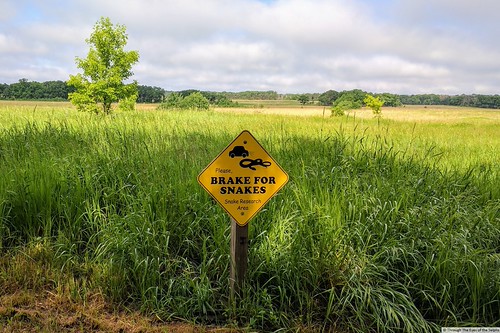
IMG_20170612_092130Upon arrival I was alarmed to see signs asking to brake for snakes, and we were not happy to find out that the earlier storm had knocked out power to the campground.  We were supposed to have an electric site but the power never came back on until about five minutes before we left.IMG_20170612_095237IMG_20170612_095140

On Monday we drove to nearby Interstate State Park​.  Established in 1895, Interstate State Park is made up of two parks, one in Minnesota and one in Wisconsin.  The Minnesota park is 1,330 acres and the Wisconsin park is 298 acres.  They​ both straddle the Dalles of the St Croix River, a deep basalt gorge with glacial and rock formations.

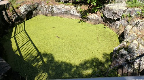
IMG_20170612_100930A billion years ago basalt rock formed here when lava escaped from a crack in the earth’s crust.  Ten thousand years ago, water from melting glaciers carved the river valley.  Within that melting water were fast moving whirlpools of swirling sand and water that wore deep holes in the rock, called glacial potholes.  There are more than 400 examples​ of the glacial potholes in the Minnesota park.  IMG_20170612_100503IMG_20170612_101827IMG_20170612_103426IMG_20170612_103109

We walked along the Glacial Pothole Trail where we could see some of the larger potholes.IMG_20170612_101153IMG_20170612_101204IMG_20170612_101347IMG_20170612_101442IMG_20170612_103025IMG_20170612_103031

This large pothole has stairs.IMG_20170612_102602IMG_20170612_102254IMG_20170612_102452IMG_20170612_102146

We then drove back to Wild River State Park, packed up and headed to Duluth.

Next stop: Duluth, Minnesota

Altura, Wabasha & Winona, MN June 8, 2017

IMG_20170609_154231Leaving Chester Woods County Park on Thursday, we continued traveling north through Minnesota’s dairyland.  We only had to drive a short distance to Whitewater State Park near Altura, Minnesota.  This is a lovely state park with lots of green areas and nice spacing between sites.

After getting settled into our spot, we decided to take a short hike in the park to Chimney Rock.  We crossed a pretty bridge with a little babbling creek beneath it.  The hike was rated as moderate and it definitely was not easy with many steps, some steps high and requiring stepping up high, not easy for someone with short legs like me.  Along the way I really wished I had brought along my walking sticks, but Bill is always willing to give me a helping hand.IMG_20170608_145345IMG_20170608_141441IMG_20170608_145157IMG_20170608_143154IMG_20170608_143101IMG_20170608_141341

20170609_103047On Friday we drove to nearby Wabasha to visit the National Eagle Center.  Wabasha is a lovely historic town, one of the oldest towns on the upper Mississippi River and the oldest continuous City in Minnesota.  Across the river you can see Wisconsin.  Wabasha is named after Sioux Nation Indian Chief Wapasha III.IMG_20170609_102740  It has over fifty buildings listed on the National Register of Historic Places.  Wabasha was called the “City of the Healing Waters” by Mark Twain.

The scenery along the riverwalk at the Eagle Center was lovely.20170609_10281520170609_104742

The writer of the movies “Grumpy Old Men” and “Grumpier Old Men” starring Jack Lemmon and Walter Matthau, had a grandfather who lived in Wabasha.  He thought the little historic river town was the perfect setting for the movie.  The town celebrates the “Grumpy Old Men Festival” the last Saturday of February each year.IMG_20170609_122730

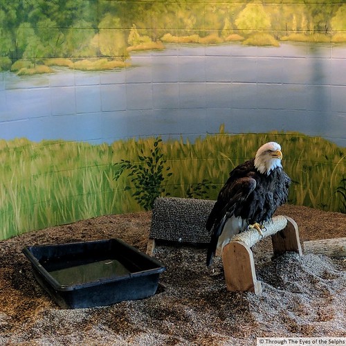
IMG_20170609_123555The National Eagle Center is dedicated to educating the public about eagles and caring for injured eagles brought to the center.  The center is an impressive two story building with floor to ceiling windows overlooking the Mississippi River.  We saw three bald eagles and a golden eagle.  We attended an excellent, informative show presented by a center volunteer.  The center also had many educational exhibits about these majestic raptors.  We really enjoyed our time there.IMG_20170609_10283120170609_10411420170609_104542(1)IMG_20170609_104001IMG_20170609_104011IMG_20170609_11331920170609_113435IMG_20170609_114115IMG_20170609_115053IMG_20170609_11491920170609_11572820170609_11582120170609_120024

20170609_122011After lunch at an Irish pub in Wabash, we decided to cross the bridge into Wisconsin and drive along the Mississippi River on what is called the “Great River Road”.  Along the way we saw limestone bluffs common in this part of Wisconsin and Minnesota.  This southeastern part of Minnesota is the only a part of the state that did not once have glacial activity.  A shallow sea covered much of North America, including southeastern Minnesota five hundred million years ago.  Sediment accumulated which turned into rock hundreds of feet thick.  The sea withdrew over four hundred million years ago and erosion has been cutting through the bedrock, creating these bluff lands.IMG_20170609_133345

Along the way we stopped in the tiny town of Alma, Wisconsin to see Lock and Dam #4, one of a series of many locks and dams along the Mississippi River.  It was not unusual to see population signs of 400 or less as we passed through these small towns.IMG_20170609_134635IMG_20170609_134653

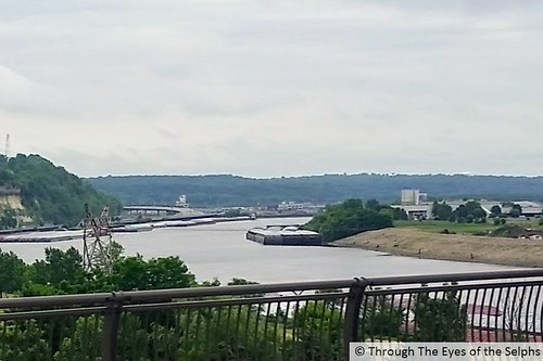
We crossed from Wisconsin back into Minnesota across a new 2,300 foot concrete bridge and ended our tour in the town of Winona.  It was founded in 1851 by a steamboat captain.  Winona profited early on from the lumber industry and by 1900 it claimed to have more millionaires per capita than any other place in the United States.  Today it still has a large number of architecturally significant historic buildings and grand homes. It is the largest Minnesota river town south of the Twin Cities.  While there we drove to the Garvin Heights Overlook where we stood on a 575 foot tall bluff with a fantastic view of Winona and the Mississippi River valley.  Another great day!IMG_20170609_143834PANO_20170609_143749

Saturday temperatures were forecasted to climb into the 90’s so we stayed close to home and visited the Whitewater State Park Visitors Center.  The only negative about the park is it sits deep down in a valley and therefore we had no cell phone service and therefore no internet.  The Visitors Center had WiFi so we checked our email while we were there.

Sunday we head further north to Wild River State Park near Center City, Minnesota.

Eyota, MN June 5, 2017

We left Forest City, Iowa and headed north towards Minnesota, another new state for us.  Even though Minnesota is known as “The Land of 10,000 Lakes”, the landscape between Iowa and southern Minnesota did not really change.  We continued to see farmland, silos and many wind turbines.  All beautiful scenery.

Our next stop was four nights at Chester Woods County Park in Eyota.  I wasn’t happy to see the signs at the park entrance warning of ticks and Lyme Disease.  It was a nice county park with electric only sites.  It was about a fifth full while we were there during the week.  I am sure it is full on the weekends.

IMG_20170606_111725One day we drove to Austin, MN to visit the SPAM Museum.  The museum included interactive exhibits and galleries on the history of the company, but was mainly dedicated to their product, SPAM.  We didn’t know what to expect but found the museum very interesting.  We were welcomed by a friendly greeter and then immediately someone came over to give us a free sample of their teriyaki SPAM.  Bill said it was good, I passed.20170606_115430IMG_20170606_114530IMG_20170606_11252520170606_112424

Hormel Foods Corporation is based in Austin, Minnesota.  It was founded in 1891 by George A. Hormel and named George A. Hormel & Company.  In 1993 the name was changed to Hormel Foods.  Today they have 40 manufacturing and distribution facilities.  They developed the world’s first canned ham in 1926.  20170606_112512Dinty Moore beef stew and Hormel Chili was introduced in 1935.  When the Federal Government abruptly ended a Depression era program to aid livestock farmers which left Hormel with 500,000 empty cans, they decided to sell beef stew.   They acquired the Dinty Moore name from another company and sold beef stew for 15 cents a can.  

20170606_114800When Hormel introduced their Hormel Chili Con Carne they organized a twenty piece Mexican song and dance troupe called The Hormel Chili Beaners to promote the product and give away samples.  They also offered double money back to anyone dissatisfied with their chili.  

SPAM luncheon meat was introduced in 1937.IMG_20170606_11222320170606_113217

In 1941 Congress passed the Lend-Lease Act, in which the U.S. agreed to provide “as much aid, short of war,” to the people of Great Britain, France and Russia.  In response, Hormel Foods supplied 15 million cans weekly.  By 1945 over 133 million cans (100 million pounds) of SPAM, had been shipped overseas to feed hungry soldiers and civilians. Nikita Khrushchev once said, “Without SPAM, we wouldn’t have been able to feed our army”.IMG_20170606_11240520170606_112959

In 1942, the Austin Hormel Foods facility became a War Facility with its workers photographed and fingerprinted and its perimeter fenced.  During World War Two, 1,961 Hormel employees went off to to serve with written promises they would have jobs when they returned.  By 1944 more than 90% of the canned food produced by Hormel Foods was destined for war operations.  Supplying food to troops has continued through the Korean, Vietnam and Persian Gulf Wars and recently in the Middle East.20170606_113404

SPAM Fun Facts:
  • SPAM can be stored in the can for up to five years.
  • SPAM is sold in 44 countries around the world.
  • Over 8 billion cans of SPAM products have been sold.
  • Guam is the largest consumer of SPAM with an annual average of 16 cans per person.  Hawaii is second.20170606_112611
  • The SPAM JAM Festival is one of Hawaii’s largest festivals every year.
  • There are now over thirteen varieties of SPAM.20170606_113204
  • SPAM products are made from six simple ingredients.IMG_20170606_114139
  • Hawaii consumes 8+ million cans a year, more SPAM products than any other state.  It is sold all over the islands including at 7-Eleven, McDonalds and Burger King.  
  • In 2015 the SPAM Portuguese Sausage was created for Hawaii.20170606_112914
  • Dwight Eisenhower said in a letter to Hormel Foods on their 75th anniversary, “I ate my share of SPAM along with millions of soldiers.  I’ll even confess to a few unkind remarks about it.  As former Commander in Chief, I officially forgive you of your only sin: sending us so much of it”.
  • A U.S. Marine on leave from the South Pacific once said, “You never fully realize how delicious and good SPAM really is until you taste it out here in the bottom of a fox hole”.
Minnesota Fun Facts:
  • Even though it is nicknamed “Land of 10,000 Lakes”, there are actually around 15,000 lakes in Minnesota.
  • Legend is that Paul Bunyan’s Blue Ox named Babe trampled the land leaving his footprints in the mud which created 10,000 lakes.  Along roadways throughout Minnesota are statues of Paul Bunyan and Babe.  The real geological story is the grinding force of advancing and retreating glaciers left behind beautiful lakes and vast, fertile prairie.
  • The state was built by immigrants from Scandinavia, Germany, Finland, and other areas of Europe.
  • Early settlers used prairie grass sod that was cut and stacked to build crude shelters.  Many lived in these for years until they could afford to build a wooden prairie home.  This is described​ in Laura Ingalls Wilder’s account in “Little House on the Prairie”.
  • Minnesota is known for formidable winters with intense cold and large amounts of snow.  The first snowmobile was used in Minnesota.
  • The first permanent settlement was in 1819 at Fort St Anthony, later renamed Fort Snelling.
  • In 1858 Minnesota became the 32nd state.
  • In 1863 Dr William Mayo started a medical practice in Rochester that later became the Mayo Clinic.