Category Archives: National Park or Forest

National Park or Forest

Grand Junction, CO AUG 9, 2019

We left Black Canyon of the Gunnison National Park and headed north to Grand Junction, Colorado, pop 59,000. We dropped from 9,400 ft to 4,600 ft and boy did it get hot!! During our time in Grand Junction the temperatures hovered in the low to mid 90’s. We sure did miss those mountain temperatures! 

On the way to Grand Junction we passed interesting sand formations. 20190808_12342420190808_12544820190808_12552020190808_125525

We stayed five nights at the James Robb State Park, a very nice Colorado state park, but there was absolutely no shade and it was HOT! 

One day we crossed the Colorado River and made the short drive to the Colorado National Monument, designated a National Monument in 1911. IMG_20190812_154419IMG_5022

The Monument is 32 square miles of rugged canyon terrain with towering red sandstone monoliths that rise 2,000 feet above the Grand Valley. The colors come from the minerals in the rocks as well as the kinds of lichens and chemical compounds that coat the rocks. IMG_5035

We stopped by the Visitors Center where unfortunately the movie was broken, but we did enjoy their exhibits. It was interesting to read that the Colorado National Monument Area was formed in part by strong earthquakes along the Redlands Fault 40 to 70 million years ago that lifted the layers of sedimentary and metamorphic rocks above the Grand Valley. Erosion has carved the steep walls and flat bottomed canyons. IMG_5028

We drove the 23 mile Rim Rock Drive with breathtaking scenery, tunnels, hairpin curves and eighteen overlooks. The road was begun in 1931 with most of it being done by the Civilian Conservation Corps (CCC) between 1933 and 1942. Construction was halted during WWII and finally completed in 1950.  Due to its cultural significance the road is on the National Register of Historic Places. The road was carved out of solid rock without the benefit of heavy equipment like bulldozers or backhoes. After blasting rock apart they removed rubble by hand or guided horses pulling small dump carts on rails.  About 39,000 cubic yards of rock were removed EVERY MILE to make way for the road bed! During construction of one of the tunnels nine men were killed when a huge slab of overhanging rock gave way. IMG_5030IMG_5032IMG_5038

We especially liked the 450 foot tall Independence Monument where every Fourth of July there is a tradition of climbers ascending the Monument to raise the American flag.

IMG_5048

Side View Of Independence Monument

20190809_101429

20190809_10013920190809_100339

We also liked the Grand View overlook with the Kissing Couple formation.  Do you see them kissing? 20190809_101228

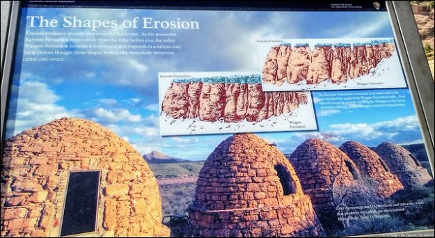
These interesting formations, shaped by erosion, are called Coke Ovens. 20190809_10433520190809_10294520190809_102929IMG_5070_stitch

Also we liked the mummy in the side of the cliff. Do you see it? IMG_5074IMG_5078IMG_5079IMG_5082IMG_508620190809_10432520190809_11260120190809_11273420190809_11280720190809_114338IMG_20190809_114733IMG_20190809_114813

On Saturday Bill attended the Grand Junction Amateur Radio Hamfest. It was a very small Hamfest but Bill always enjoys meeting and talking with other amateur radio enthusiasts. IMG_20190810_093249IMG_20190810_090230

Next stop: Dillon, CO and cooler weather!

Black Canyon of the Gunnison NP, CO AUG 2, 2019

Our time at Ridgway State Park came to an end after six days but we really could have used another two or three days to see everything. Every afternoon we had a rainstorm which hampered our hiking and exploring. There were trails in Ridgway State Park we never got to experience. But our reservation came to an end and we had another reservation waiting at our next destination. 

Next up was Black Canyon of the Gunnison National Park in southwestern Colorado. Formerly designated a National Monument in 1933, it became a National Park in 1999.  IMG_20190802_152647IMG_20190802_154930The Black Canyon is 48 miles long with astonishingly steep walls that rise more than 2,700 vertical feet from the Gunnison River at the base of the canyon. A combination of hard rocks, uplifting, ancient volcanoes and erosion have all played a part in shaping the canyon. It took about two million years to shape the canyon as it is seen today. Fourteen miles of the deepest part of the Canyon are located in the National Park. The narrowest part of the Canyon is 1,100 feet across the top and only forty feet across at the riverbed bottom. IMG_4865IMG_4870IMG_4879IMG_488020190803_135602

The Gunnison River drops over 2,000 feet through the 53 mile canyon. During spring runoff the water can fluctuate from 3,000 to 12,000 cubic feet per second. Water at just 5,000 cubic feet per second can carry rocks up to two feet across and weighing almost 700 pounds. This erosive energy from the river carves the canyon walls deeper faster than it erodes the sides wider. This is what causes the Black Canyon to be much deeper than it is wide. But even at that level of power the canyon only changes about a hair’s width each year. The erosion has been slowed somewhat by construction of dams upstream. IMG_4944IMG_4950IMG_4959

We went to the Chasm View overlook which has the greatest descent of the Gunnison River in the canyon where it drops 240 feet per mile. IMG_4947IMG_4960

The cliff rock is composed of two billion year old metamorphic rock, some of the oldest rock on Earth. It is so steep some parts of the canyon only receive 33 minutes of sunlight a day and the walls are often in shadow making them appear black, hence the name Black Rock Canyon. Gunnison comes from Captain John Gunnison who came to the area in 1853 leading an expedition in search of a route across the Continental Divide for a railroad from St Louis to San Francisco. He was killed by Ute Indians and the river was named in his honor. 

The Ute Indians were the first to live in the canyon long before the first Europeans. They referred to the river as “much rocks, big water” and avoided the canyon due to superstition. 

We camped on the South Rim where there is a Visitors Center and a seven mile paved road with twelve overlooks of the canyon. Most overlooks had a hike to each viewpoint, some short and some longer. Since we were staying six nights in the Park, we were able to take our time. While not terribly hot, at 8,320 feet the sun was very intense. 

We stopped by the Visitors Center with amazing views of the canyon and watched a short movie. IMG_4963

Over the next several days we worked our way along the overlooks. All of the overlooks had dramatic views. From high above we could hear the Gunnison River below, often with whitewater. Definitely not a river you could safely raft in the park. 

One overlook was the Painted Wall, which at 2,300 feet is the highest cliff in Colorado. If the Empire State Building stood on the canyon floor, it would reach only slightly halfway to the top of the cliff. The patterns in the wall were created more than a billion years ago when molten rock was squeezed into fractures and joints of the existing rock, then cooled and hardened. IMG_4979

Another day we took a different drive in the park, the East Portal Road, with a 16% grade and hairpin curves. The road took us down over 2,000 feet to the Gunnison River and two dams. This section of the river was much tamer and could be easily navigated by boat. IMG_4932IMG_4898

Our main reason for driving this road was to see the beginning of the Gunnison Tunnel, built from 1905 to 1909 to carry water to the town of Montrose and the Uncompahgre Valley. Back then the area was suffering from a water shortage due to the influx of settlers. Working underground using only candlelight and manual labor, it took the tunneling crew almost a year to bore through 2,000 feet of water filled rock. IMG_4900IMG_4904The work was so physically demanding and dangerous, even though the pay and benefits were good, men only stayed an average of two weeks before quitting. Twenty six men were killed during the four years of construction. The tunnel was completed in 1909, stretched 5.8 miles and cost three million dollars. The dam is used to fill the tunnel when water is low in the river. The tunnel can carry 495,000 gallons every minute. The Gunnison Tunnel was honored as a Civil Engineering Landmark joining others such as the Statue of Liberty and the Golden Gate Bridge. IMG_4905IMG_4930

Further down East Portal Road is the Crystal Dam built in 1978.  It is a unique structure because it curves from side to side and from top to bottom which gives it exceptional strength. Unfortunately the road to the Crystal Dam was closed and we couldn’t see it close up. IMG_4910IMG_4912IMG_4916IMG_4927

We often saw deer in the park and campground. Because deer often give birth in the campground and are fiercely protective of their fawn, dogs and other pets are not allowed outside each campsite from June 1 to Aug 10th. This year the pet ban was extended to Aug 26th due to late fawning. You are not allowed to carry your dogs in your arms or walk them in the campground outside of your designated campsite. IMG_20190802_160718IMG_20190804_192002IMG_20190807_112233

On our last day in the park we drove to nearby Cimarron to see a restored train that was part of the railroad built in 1882 to pull trains through western Colorado. Here we saw Locomotive #278, its coal tender, a boxcar, and caboose standing atop the last remaining railroad trestle along the Black Canyon of the Gunnison route.  The trestle was constructed in 1895. In 1881 a railroad line was built through the Black Canyon. It took Irish and Italian laborers a year to carve through the tough terrain. It cost $165,000 per mile. In 1882 the first passenger train passed through the canyon. It was said that there were probably not more than a quarter mile of straight track through the canyon. Due to the difficulty in operating and maintaining the track, it was abandoned in the early 1950s.  IMG_5005IMG_5021IMG_5019

Not far from the train display was another dam, the Morrow Point Dam, a 468 foot tall concrete double arch dam. It is the first dam of its type built by the U.S. Bureau of Reclamation and was constructed from 1963-1968. IMG_5016IMG_20190802_204551

Next up:  more time in beautiful Colorado


Rico & Telluride, CO July 26, 2019

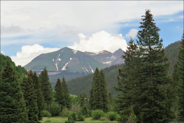
Leaving McPhee Reservoir Recreation Area, we drove an hour on the San Juan Skyway, called “Road to the Sky” to our next destination. Along the way we had beautiful views of the towering 14,000 foot San Juan Mountains and green rolling hillsides. 

We arrived at our campground, Cayton Campground in the San Juan National Forest for a six night stay. We had a very nice electric site along the Dolores River. At night we were lulled to sleep by the sound of softly flowing water. IMG_20190725_153505

The only drawback to this campground was we had absolutely no cell phone service which meant no internet. We were able to get satellite TV so we had news and weather. At an elevation of 9,400 feet, the daytime highs were in the low 70’s and nighttime lows in the mid 40’s.  A wonderful respite from the hot weather we had recently experienced. Each afternoon we had a brief thunderstorm or rain shower. IMG_20190725_153045

Our campsite had 50 AMP power and even though it worked, the 50 AMP power connector was cracked and potentially unsafe. The camp host brought a new one by and Bill offered to replace it. 20190723_123955

Six miles south of our campground was the tiny town of Rico. Twice we drove into town to use the internet access at the public library. Thank heavens for these friendly public libraries that are a big help to travelers like us. IMG_20190725_124100-EFFECTS

Rico was settled in 1879 as a silver mining town. At its peak Rico had a population of nearly 5,000. It had two dozen saloons and a thriving red light district. IMG_20190725_150448IMG_20190725_150425No longer a mining town, today it has a population of 266 and is made up of a main street with an inn, gas station, post office and town hall. 20190725_12072720190725_120802The public library is open four hours a day Monday through Saturday and is located in two rooms of the town hall building. I talked a bit with the librarian who said the public school in Rico closed last year due to declining enrollment. Today the parents have to take their children either 35 minutes north to the town of Telluride or an hour south to Dolores. Parents are responsible for getting their children to and from school. She said most parents work in Telluride and therefore their children go to school there. Quite different from most towns and cities in the United States where children just walk a block or less to catch the local school bus. The librarian said she wonders if the Rico library would ever close and expressed sadness that she no longer has children come by after school. She said the library summer reading program ended a couple years ago. Now she averages six or seven people who visit the library each day, less than fifty a week. The two times we visited we only saw two locals come in to use the library internet. I never saw anyone return a book or check one out. Very sad. We did note that after many many years of significant declining population, the population did rise by 65 people between 2000 and 2010. Maybe there is hope for this sweet little town. 

We visited the Rico post office while we were there and noticed it is also open only four hours a day but it had a steadier stream of traffic. 20190725_120743

On Friday we drove our car north to Telluride for the day. IMG_4611IMG_4622IMG_4625Also once a mining town, what a difference from Rico. With a population of 2,400, Telluride is a busy, active resort community similar to Vail. In the winter it is crowded with skiers staying in the many condominiums, resorts and hotels. In the summer people visit to enjoy the cool weather and gorgeous views. It is nicknamed the “Festival of the Rockies” because of the vast array of cultural events each summer. The name Telluride came from gold telluride minerals found in parts of Colorado. Strangely, telluride minerals were never found in Telluride but zinc, lead, copper, silver and other gold ores were mined there. IMG_4687

One of the best things about Telluride was the FREE gondola rides. We have been on several gondola rides in our travels and they are usually pretty pricey. This is the first free gondola ride we have ever seen and according to Telluride it is the first and only free gondola public transportation in the United States. It was begun in 1996 to address air quality concerns by keeping cars off the eight mile route between Mountain Village and Telluride. Since 1996 it has transported over forty million people. 20190726_142021

We read it is best to park at the free parking garage at Station Village and ride a gondola down to Telluride because street parking is very limited in Telluride. We parked the car at Station Village, elevation 9,545 and rode a gondola to Mountain Village Resort, elevation 9,540. IMG_4664IMG_4632We got off there and got another gondola which took us to Station St Sophia, elevation 10,535 and then continued down to Telluride, elevation 8,750. The whole trip took about thirty minutes. All the gondola workers were extremely friendly and helpful. The tricky thing about gondolas is they never completely come to a stop so you have to quickly jump on and off. Pets, bikes and skis are all allowed on the gondolas. It was interesting to see how the bikes are attached to the outside of the gondolas. 20190726_155906The Big Mountain Enduro bike event was going on during our visit. Bikers ride the gondola up the mountain and they ride bike trails to the bottom. IMG_4636IMG_4639

As we descended to Telluride we could see the town In the distance IMG_464820190726_15273220190726_153028IMG_4649as well as beautiful Bridal Veil Falls, at 365 feet the tallest waterfall in Colorado. IMG_4667IMG_4669

Every Friday they have a Farmers Market with fresh fruits and vegetables, baked goods and beautiful flowers. 20190726_14453020190726_144920We found a geocache at the Galloping Goose, a unique hybrid vehicle that was a truck and train combination.  It was powered by a truck engine that rode on train tracks beginning around 1930. It ran on gasoline and carried both passengers and freight until 1951. We noticed the hybrid buses around town today are nicknamed Galloping Goose.  IMG_4665We really enjoyed walking around Telluride! IMG_467220190726_144419

We caught the gondola back from Telluride to Station St Sophia and got off and walked around the area. In the summer this is a popular area for bike riders to ride up and down the steep slopes. IMG_4676IMG_4679IMG_4686We went in the Nature Center where they had the biggest container of sunscreen I have ever seen. It was freely available to everyone. At 10,535 feet, you burn quickly. By this time our ears were stopped up and I was starting to feel some altitude sickness. I was lightheaded, slightly nauseous and my skin was clammy. We still had to ride two more gondolas to get back to the parking garage. I was dragging by the time we got back to the car. But after drinking an entire bottle of cold water from the cooler, I was feeling much better. We drove into Telluride and had a nice dinner. I think just the act of chewing food helped our ears recover. We both agreed this was the most fun we have had in awhile! 

The mountain views and alpine meadows were beautiful. IMG_4696IMG_4697IMG_4703

IMG_4699

Lizard Head Peak

Next up: Ridgway, CO

Canyons of the Ancients NM, CO July 20, 2019

During our time at McPhee Reservoir Recreation Area, along with visiting Mesa Verde National Park, we also visited other nearby Pueblo dwellings. Down the road from our campground was the Canyons of the Ancients National Monument Visitors Center. We stopped there and watched a movie and picked up a map of Pueblo dwellings within driving distance. IMG_20190716_141257IMG_20190716_14021820190720_122133

The next morning we set out for a day of exploring along part of the 116 mile road named Trail of the Ancients, the only National Scenic Byway in America dedicated solely to archaeology. The first place we visited was Lowry Pueblo, an ancient pueblo site with forty rooms and eight circular kivas. IMG_4540IMG_4541IMG_4551IMG_4555IMG_4557

A roof has been placed over the main dwelling to preserve it. We were able to walk inside for a close up view. IMG_4543IMG_4544IMG_4548IMG_4549

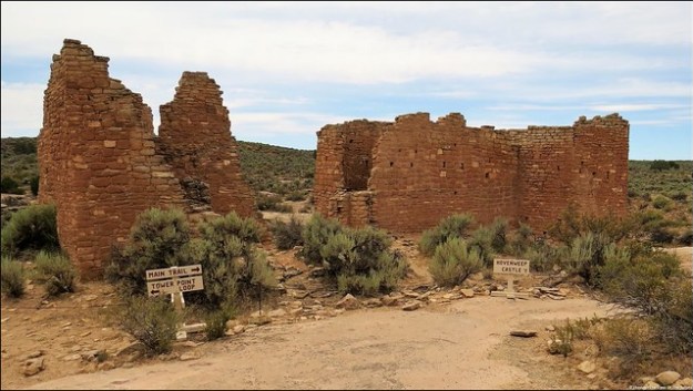
Next we drove to Hovenweep National Monument which lies in both Colorado and Utah.  Hovenweep is a Ute Indian word meaning “deserted valley” which adequately describes the area. There are many multi room dwellings, small cliff dwellings and towers scattered over the canyon slopes. These were constructed by Ancestral Puebloans more than 700 years ago, around the same time as Mesa Verde. Like at Mesa Verde, extended droughts forced the people to abandon the area around 1300 A.D. IMG_455920190720_115011IMG_4562IMG_456020190720_130335

We first stopped at the Visitors Center and watched a movie before taking the Little Ruin Trail to see some of the dwellings and towers. They believe the towers could have been used as storage silos for crops, defensive forts or for ceremonies. IMG_4575IMG_4573IMG_4572IMG_4582IMG_4584IMG_4591IMG_4589IMG_4590IMG_4595IMG_4597IMG_4598

When we returned from our hike we saw a very interesting talk on coyotes by a Ranger. 20190720_122255

We certainly enjoyed our time in southwestern Colorado. IMG_4602IMG_4603IMG_4605IMG_4610

Next up: Rico, CO and cooler temperatures at last

Colorado Tidbits:

  • There are 58 peaks in Colorado 14,000 feet above sea level, more than any other state.
  • Colorado’s nickname is the Centennial State because Colorado was admitted into the union in 1876, the centennial anniversary of the United States.

Mesa Verde NP, CO July 16, 2019

We left Monument Valley and headed to Colorado and hopefully cooler temperatures. It was a beautiful drive with more rock formations and occasional farmland with horses and cattle. We were surprised to see some working oil pumps. 20190714_12572320190714_130203

Our destination was the McPhee Reservoir Recreation Area in the San Juan National Forest for a seven night stay. We had a lovely, private campsite with electric only located at an elevation of 7,200 feet. In the distance we saw snow capped mountains. IMG_20190715_155701

Near our campsite is an overlook of the reservoir.  Where you see water now is where at one time the lumber company town of McPhee stood. In the late 1920’s McPhee was Colorado’s largest lumber mill town with a population of 1,400 and produced over half of the state’s lumber output. In 1948 after a second major fire in a decade destroyed the sawmill, it was not rebuilt. Today the former lumber town is submerged by reservoir waters. 20190719_201653

One day we drove over to Mesa Verde National Park. As we were leaving our campground early in the morning we saw a very large herd of cattle being led down the road to another pasture. It was hard to get a good picture of the large herd because we were facing into the sun. IMG_20190716_070819

We were last at Mesa Verde National Park in 2015 (see link: Mesa Verde National Park, CO).  The 52,000 acre park is one of the country’s major archeological preserves with almost 5,000 archeological sites including 600 cliff dwellings. Mesa Verde, Spanish for “green table”, was the home of Ancestral Pueblo people for more than 750 years. IMG_20150517_110223 IMG_4506

They lived in the area from around 500 A.D. to 1276 A.D. It was approximately around 1200 when they began to build the cliff dwellings that Mesa Verde is best known for today. When a drought struck that lasted for twenty-four years, it eventually forced the people to leave the area and migrate to New Mexico and Arizona in search of water and better living conditions. IMG_4509

Last time we were here we drove the loop road where some of the larger cliff dwellings are viewed from a distance. In order to see the cliff dwellings up close you have to go on a park ranger led tour for the very reasonable fee of $5.00. IMG_20190716_095017IMG_20190716_095042IMG_20190716_100143IMG_20190716_094632IMG_4516

This time Bill decided he wanted to take the hour long tour of the largest cliff dwelling in the United States, Cliff Palace. He had a reservation for 9:30 A.M. in order to avoid the hottest part of the day. Even though we were now in southwestern Colorado we were still having afternoon temperatures in the upper 80’s. The tour was labeled as strenuous with steep, uneven stone stairs both going and coming and you had to climb four steep ten foot wooden ladders to access the cliff dwelling. I decided not to go and waited in a shady seating area while he was gone. It was the idea of the four steep ten foot wooden ladders that got to me. IMG_20190716_094517IMG_20190716_103253IMG_20190716_103247

Bill had a great time but he did say the walk out was pretty strenuous. He said the ranger did a nice job describing what everyday life was like at the Cliff Palace over 800 years ago. Cliff Palace consisted of about 150 rooms made of sandstone and mortar made of sand, clay and ash. Water had to be hauled in to make the mortar. It is almost inconceivable to imagine how they accomplished this herculean effort in twenty years. In addition to the 150 rooms they had 75 open spaces and 21 kivas, below ground circular rooms used for ceremonies and gatherings. IMG_20190716_101341IMG_20190716_101239

IMG_20190716_101231

Kiva – Round Room Without Roof

IMG_20190716_102739

Picture Taken From Window Of Three Story Tower – Shows Floor Logs


IMG_20190716_102758

After Bill’s tour we stopped at the archeological museum to see a movie about the park and view exhibits and artifacts on the Ancestral Puebloans. IMG_4524
We stopped by the Far View Sites where homes were built on the top of mesas.

IMG_4521

Far View House

IMG_4528

Far View House Walls

IMG_4523

Kiva at Far View House

IMG_4527

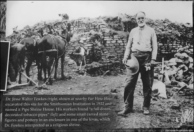
Unique Stone In Outer Wall Of Pipe Shrine House

After a late lunch it was starting to get quite hot and we were very glad we had gotten an early start.

Mesa Verde National Park is an amazing place!

Next up: more exploring in southwestern Colorado

Grand Canyon NP South Rim Part 2 APR 25, 2019

Grand Canyon National Park has a great free shuttle bus service. Since private vehicles are not allowed in the Hermit’s Rest western area of the Park between March 1 and November 30th, it is the only way to get around and see the area. The buses arrive at each the many stops throughout the Park every 10 to 15 minutes and the bus drivers are friendly and helpful. The first eight seats are reserved for seniors or the disabled and the drivers are pretty aggressive about keeping those seats available for those who need it. The buses are well utilized and stay very crowded and a few times we had to stand which wasn’t a big deal to us. As I mentioned in the last post, the Park was very busy the week after Easter. Most of the people we heard talking on the buses or trails were non-English speaking tourists.

One day we walked part of the thirteen mile paved path along the Canyon rim. In the distance we could see snow on the mountains (San Francisco Peaks) near Flagstaff.  IMG_20190424_134720We had a view of all the buildings that make up the Grand Canyon Village which includes the Visitors Center, lodges, restaurants, a grocery store and a train depot. IMG_20190424_135047PANO_20190424_135414.vrAs we walked along the rim we could see all the trails that lead down into the canyon. We could see people like tiny ants walking on the trails. As you look at the pictures look for all the trails. IMG_20190424_135618Also look for glimpses of the Colorado River. In how many pictures can you spot a piece of the river at the bottom? IMG_20190424_13155220190424_13250220190424_13274420190424_132900IMG_20190424_13503220190424_141703

After walking on the trail and enjoying the views we hopped on a bus and rode to Hermit’s Rest, the westernmost point and end of the bus line. Hermit’s Rest was built in 1914 and is another Canyon structure designed by architect Mary Jane Colter. It was built as a rest stop for tourists who came by train to visit the area years ago. img_20150505_152001a

Another day we took the bus to several popular viewpoints. It was easy to hop on and off the buses since we knew another one would be along in 10 to 15 minutes. IMG_20190426_140555IMG_20190426_14355420190426_14445200006IMG_00006_BURST20190426134308One stop was Powell Point where there is a large granite memorial to Major John Wesley Powell. In 1869 Powell led one of the first documented explorations down the Colorado River through the Grand Canyon. He led another exploration in 1872. 20190426_133916IMG_20190426_134050IMG_20190426_134020

We also stopped at Hopi Point, Mohave Point and Pima Point, all with amazing views. Do you see the trails and Colorado River in the pictures? IMG_20190426_135833IMG_20190426_144010IMG_20190426_135933IMG_20190426_135925IMG_20190426_143957

We loved our five days in Grand Canyon National Park and can’t wait to go back. IMG_20190424_135142

Next up: We are currently in Show Low in the White Mountains of northeastern Arizona for the month of May.

Grand Canyon NP South Rim, part 1, APR 24, 2019

The week after Easter we visited the South Rim of Grand Canyon National Park for five days. 20190422_125006We didn’t realize it when we made the reservation, but the week before and the week after Easter are very busy in the park. We knew that to be true by the long line of cars waiting at the entrance gate to enter the park. We last visited Grand Canyon in 2015 and this time we stayed at the same campground inside the park. I was delighted to see elk roaming free throughout the campground, just like last time. 20190422_170133IMG_20190422_172348These Rocky Mountain elk were brought to the park from 1913-1928 from Yellowstone National Park. They appear to be tame and unafraid of people or cars. Regardless of how tame they are, we obeyed the rules and kept our distance and didn’t feed them. 20190422_174618

We couldn’t wait to get to popular Mather Point for our first view of the Canyon. One of the Seven Wonders of the World, there are no words to adequately describe the Grand Canyon. Amazing, vast, awe inspiring, beautiful are words that do not do it justice. It is hard to comprehend that the Colorado River carved this magnificent canyon. IMG_20190425_145521The canyon is 277 miles long, four to 18 miles in width and one mile deep. IMG_20190423_143350IMG_20190423_14352620190423_143536IMG_20190423_144807

The Colorado River flows below at an average speed of four miles per hour. The river averages 300 feet wide and 100 feet deep. It flows through the Canyon and eventually empties into the Gulf of California in Mexico. From the rim of the Canyon the Colorado River is small and hard to see. However there are whitewater areas that make rafting on the river challenging and dangerous. The depth of the Canyon erodes about the width of a sheet of paper each year, so the Canyon is continually changing. IMG_20190425_132216

The Grand Canyon became a national park in 1919 so this is the 100th anniversary of the 1.2 million acre park. 20190423_152136Recently there have been three deaths in the park due to people falling to their death. The day after we arrived we heard a 70 year old woman fell to her death. Some people ask why the park rangers can’t do more to prevent this from happening. The park is huge and with over six million visitors a year, there is no way the park service can prevent accidents from happening. There are warnings everywhere about not getting close to the edge. The Grand Canyon can be a dangerous place and people have to accept responsibility for their actions. In the five days we were there we observed people doing crazy, dangerous things. And in all cases it was because of picture taking. A few times I had to walk away for fear of seeing a tragedy I wouldn’t be able to forget. No picture is worth risking your life. IMG_20190423_145040

Most of the areas of the park can be reached by their free shuttle buses. But Desert View Watchtower has to be driven to by car. So one day we made the 25 mile trip to the eastern most developed section of the park to see the tower and the beautiful views of the Canyon. The four story 70 foot stone tower was built in 1932 and designed by architect Mary Elizabeth Jane Colter. 20190425_120815IMG_20190425_121119-EFFECTSIMG_20190425_121654IMG_20190425_121627-PANO

We climbed to one of the lookout points in the tower and then had a picnic lunch. 20190425_12331420190425_124825

We really enjoyed the drive there and back because there are scenic viewpoints along the way. As we started home, heavy clouds began to form which can dramatically change the lighting and appearance of the Canyon. No two days there are the same. IMG_20190425_131343-EFFECTSIMG_20190425_132228IMG_20190425_140634

Next up: part two of our visit to Grand Canyon National Park

Boulder City, NV APR 12, 2019

Leaving Lake Havasu City we drove to Boulder City, Utah for a six night stay. Boulder City (pop 15,600) is a lovely city which was built in 1931 to house workers contracted to build Hoover Dam, formerly called Boulder Dam. 20190413_150655Previously, men who hoped to work on the Dam were living with their families in tents and shacks on land chosen as the site of the Dam. The town was built by the Bureau of Reclamation as the “Boulder Canyon Project Federal Reservation”.  Federal rangers maintained law and order on the “reservation”. Boulder City is very rare in that it was fully planned under government supervision. The town was designed to house around 5,000 workers and the status of the workers was reflected by the size and location of their house. Commercial development was restricted and severely limited by a stern, iron fisted city manager. There was no provision for schools at first because it was assumed only single men would be working on the Dam. No hospital was built for years with injured workers taken to nearby Las Vegas. When a hospital was eventually built, it was a number of years before females were allowed to be admitted.  Visitors to Boulder City had to go through a gatehouse, and gambling was prohibited. Today, Boulder City is one of only two Nevada cities which prohibit gambling. Alcohol was prohibited until 1969. Las Vegas had campaigned to have the workers housed in Las Vegas but because of its rowdy, risqué reputation, it was passed over in favor of Boulder City. Today Boulder City is very proud of its nickname “Home of Hoover Dam”. The federal government gave up control of Boulder City in 1959 when it was incorporated.

We visited the Boulder City-Hoover Dam Museum located inside the historic Boulder Dam Hotel. The hotel, built in 1933, is on the National Register of Historic Places. 20190413_150536

In the 1930’s and 1940’s the hotel was the accommodation for Shirley Temple, Betts Davis, Howard Hughes, Will Rogers, Boris Karloff and other celebrities who came to see the Dam being built. The museum had an excellent movie and exhibits on life in Boulder City in the 1930’s as well as the construction of the Dam.  Working conditions were hard and treacherous to say the least. Because of a fine of $3,000 for every day the construction ran over deadline, the men were pushed to the limit and often competitions were used to push the men even harder. 20190413_13514720190413_135544Occurring in the days immediately after the Great Depression, men were afraid to complain of unbearable heat and working conditions for fear of being fired. Only American citizens could work on the Dam which essentially meant whites only. In 1932 only a few African Americans were hired but were not allowed to live in Boulder City. This changed after Franklin Roosevelt was elected.20190413_13512820190413_13502320190413_135556IMG_20190413_14030020190413_134902

We enjoyed walking around the town doing some geocaching. Evidence of the town’s history was everywhere. 20190413_150356

IMG_20190413_144457

34 Ton Water Runner Converts Water Power To One Generator

One day we drove to the nearby Lake Mead National Recreation Area. This is the nation’s first national recreation area and the largest reservoir in the country. It was formed by the Hoover Dam in 1935 and provides water to twenty million people and farmland in Arizona, California and Nevada as well as some to Mexico. The Lake has not reached full capacity since 1983 due to water demands and drought. In August, 2017 it was only at 40%.

Our main reason for going there was to hike the Historic Railroad Trail. IMG_20190415_122735This trail is a portion of the former railroad route that carried supplies from Boulder City to Hoover Dam during construction of the Dam. The trail is no longer a railroad but has been replaced with crushed rock. Along the trail are panoramic views of Lake Mead. 20190415_123839Hikers pass through five tunnels approximately 300 feet in length and 25 feet in diameter. The trail can take you all the way to Hoover Dam but on this day we had to stop at tunnel three because the tunnel was closed due to unstable conditions. Since it was a hot sunny day with no shade on the trail, we were okay with turning around at that point. We had walked 10,000 steps by the time we returned to the car. 20190415_12590020190415_123435IMG_20190415_123702

We then drove to Hoover Dam. Back in Jan, 2015 we visited Hoover Dam and took a tour of the facility. This time we wanted to stop at the visitor area at the Mike O’Callaghan-Pat Tillman Memorial Bridge which is the first concrete-steel composite bridge in the United States and the widest concrete arch in the Western Hemisphere. IMG_20190415_141507At 880 feet above the Colorado River it is the second highest bridge in the United States and the world’s highest concrete arch bridge. IMG_20190415_142635IMG_20190415_143317IMG_20190415_143255The bridge connects Arizona and Nevada.  The visitor’s area, in Nevada was super busy with limited parking. I did the musical chairs game with all the other cars trying to find a parking spot. In the meantime Bill walked up the steep trail to the top of the Bridge. It was a very windy day and when he walked out onto the bridge he took his sunglasses off because he was afraid they would blow off his face! IMG_20190415_142510IMG_20190415_142145He took some great shots of Hoover Dam from the top of the bridge. IMG_20190415_142156

We then drove from Nevada over the dam to the Arizona side to have another look at this marvelous structure.

IMG_20190415_145237

Hoover Dam from the Arizona Side With Memorial Bridge in the Distance

Another day we hiked around the Nature Discovery Trail and Rock Garden. We loved the beautiful rocks, desert flora and giant statues of desert animals. Plaques gave interesting facts about the animals and flora. Did you know jackrabbits can run up to forty miles an hour or that the roadrunner can survive its entire life without drinking water but receives moisture from its prey? 20190413_15225920190413_15273720190413_15262620190413_153051

We finished the day by finding a geocache at the Nevada State Railroad Museum. We not only found a geocache but some great old trains too. IMG_20190413_155028

Railway Post Offices (RPO) were used to transport and sort mail using the hanging mail bag system. RPO were started in the 1830’s and ended in 1950’s. IMG_20190413_160306IMG_20190413_160526IMG_20190413_160534

We had a wonderful time in Boulder City.

Here is the link to our previous visit to Hoover Dam where we took the inside tour January 27, 2015 Boulder City, Nevada

Next up : Valley of Fire State Park, Nevada

Redcrest, CA SEPT 27, 2018

While in Eureka on the California coast we ran the heat in the mornings and evenings and usually wore a jacket.  We left Eureka and headed inland. Remember when we talked about how chilly it was on the Oregon coast but if we had moved just an hour inland we would have been too hot? We followed U. S. Highway 101 south as it curved inland away from the coast. Our destination was Redcrest to spend several days seeing the majestic redwood trees. When we were outside preparing to leave Eureka we had on jackets. By the time we moved inland and reached Redcrest it was 88 degrees. Whew! What a difference. Time to switch from heat to AC. (Yes, we know our family and friends in Florida are laughing at our complaining about 88 degrees!)

We were last here in May, 2014 and pulled into the same RV park as before in tiny Redcrest, pop 112. It is a nice park but has absolutely no Verizon service.

Here we traded the beauty of the Pacific coastline with the magnificence of the redwoods.  And magnificent they are! IMG_4225

We spent our time driving along a road called “The Avenue of the Giants“ and hiked several trails in Humboldt Redwoods State Park, California’s third largest park and containing Rockefeller Forest, the world’s largest remaining contiguous old-growth forest of coast redwoods. 20180928_163540

Our first hike was on the Greig-French-Bell Trail.  This trail is located in the fog prone northern edge of the park and therefore has a lush ground cover. This particular area is so visually striking it is often used as the setting for movies and TV commercials. IMG_20180928_124855IMG_4232IMG_4235IMG_4243

The most well known landmark on the trail is the Girdled Tree where in 1901 the bark was mostly removed and sent to San Francisco so the people there could see what redwoods looked like. IMG_4241

We hiked for well over an hour along the many meandering paths along the trail. Of the trails we hiked it was the least well marked and most overgrown. This was also a great time of year to visit the park since none of the trails were crowded. This is the very end of their tourist season. IMG_4252

IMG_4246

This is not a trail, it is a large fallen tree!

Next up was the most famous trail in the park, Founders Grove. It is described as an ancient forest and one of the greatest forests on earth. 20180928_144757IMG_4253

One highlight was the Dyerville Giant, a redwood that once stood here for as long as 1,600 years. At the time it was taller, larger and older than any other tree around it.  It was 370 feet tall which is two feet taller than Niagara Falls, was seventeen feet in diameter, fifty-two feet in circumference and weighed over one million pounds. When it fell in 1991 it registered on the seismograph and the locals said it sounded like a train wreck. 20180928_150211IMG_4257IMG_20180928_154426-EFFECTSIMG_20180928_160237

Along this trail we also walked the Mahan Plaque Loop. IMG_4254IMG_20180928_145322IMG_20180928_145527IMG_20180928_152639

IMG_4259

Some giant redwood trees shatter when they fall

IMG_4261IMG_20180928_154516

Our final trail was the Rockefeller Loop Trail. This forest grove is dark and very dense. It had started to lightly rain while we were walking on this trail and we hardly felt any raindrops thanks to the redwoods being our natural umbrellas. IMG_4271IMG_4270IMG_4272IMG_4276IMG_4279IMG_4284IMG_4286IMG_4291IMG_4297

We had a wonderful time among these majestic giants. But now it is time to return to the coast. IMG_20180929_114041

Interesting facts:

  • Due to climate change and other factors, Coast Redwoods now only grow naturally in a narrow 40 miles wide and 450 mile long strip from southern Oregon to southern Monterey County in California.
  • Initially, J.D. Rockefeller did not want the forest named after his family, he donated millions of dollars to save these trees. Until 1951 it was known as the Bull Creek-Dyerville Forest. IMG_4267IMG_4268IMG_4277
  • Redwoods are so immense they live simultaneously in three climatic zones. The base, the stem and the crown are in three separate zones.
  • Redwoods need great amounts of moisture. This area of California has 65 inches per year average rainfall plus moisture from summer fog.
  • A very large redwood can release up to 500 gallons of water into the air each day. The redwoods are being affected by the ongoing California drought.
  • It may take 400 years or more for a decaying tree to become integrated into the forest floor.
  • Redwood roots grow only a few feet down into the soil but can grow laterally a hundred feet or more. Their roots can intertwine, helping each other stand up.
  • Redwoods live a long time because they have few enemies. They have a thick fire resistant bark and lack resin.
  • The scientific name for Coast Redwood is Sequoia sempervirens which means “ever living”.

Bandon, OR SEPT 9, 2018

We decided to leave Florence two days early because in our sightseeing travels we stumbled across a really great place to camp right near the beach. The price was certainly right at $12.50 a night with our America the Beautiful senior pass. IMG_4010

Horsfall Beach Campground, a national recreation area campground, was a great place with tall sand dunes. Only problem was they blocked the view of the ocean. We didn’t mind too much since great views of the beach was easily accessible just a short walk from our door. It is also a favorite place for ATV enthusiasts who enjoy racing up and down the dunes. IMG_20180907_142458IMG_3994IMG_3995IMG_3998IMG_4004

While we were there we drove thirty miles to the Dean Creek Elk Viewing Area to see beautiful elk grazing in the meadows. IMG_4011IMG_4017IMG_4035IMG_4015IMG_4016

We certainly enjoyed our two days camping near the sand dunes!

On Sunday we moved further south to Bullards Beach State Park in Bandon, Oregon. We crossed over the beautiful Conde McCullough Memorial Bridge, built in 1936 and once the longest bridge along the coast. We can certainly see why Highway 101 is also called “The Pacific Coast Scenic Byway”. IMG_4045

We were last at Bullards Beach in 2014 and we enjoyed exploring the Bandon area once again. Located in the state park is Coquille River Lighthouse built in 1896.  Located adjacent to the river and lighthouse, it is only forty feet tall and was last operable in 1939. IMG_4053IMG_4047IMG_4055

We enjoyed visiting Old Town Bandon again where Bill returned to the same Bandon Fish Market from 2014 and had some fish and chips. Back in 2014 there was a wonderful bakery owned by an elderly couple and I was really looking forward to going back there. Sadly, it is now out of business. IMG_4052IMG_0614

Bandon is known as the “Cranberry Capital of Oregon” and its main export is cranberries. There is an Ocean Spray plant in Bandon  that receives, cleans and ships from 300,000 to 400,000 pounds of cranberries per day during the peak of the harvest season which is September through November. One interesting tidbit is that when some of the workers work in the bogs they walk on stilts to keep from crushing the berries. The whole process of planting to harvesting is quite fascinating but too detailed to go into on the blog.  We remembered seeing the cranberry bogs last time we were here in June, 2014 and they looked like this. IMG_0615

Don’t know whether it is the very dry weather or time of year, but this time they looked like this. IMG_4097

The beaches here are very popular with rock-hounds since they are strewn with agates, jasper and other semiprecious stones.  In recent years shifting sands have revealed the remains of sunken ships. More than hundred ships, including a 1918 steamship, have shipwrecked in this area.  In fact this area is known as the “Storm Watching Capital of the World”. The beaches with their amazing rock formation sometimes experience winds at hurricane force speed, hurtling sprays of water upon the rocks and shore, sometimes 200 yards straight up.  We could see the power of the ocean with the huge amount of driftwood that lay on the beaches. We read an article where a woman described how people go to the beach and build forts and structures out of the driftwood to be enjoyed during the spring, summer and fall, knowing it will all be destroyed by the winter storms. IMG_4051

One day we drove the scenic Beach Loop Drive, stopping at one of our favorite places we remembered from our last visit called Face Rock State Scenic Viewpoint. Here you can see a rock in the shape of a woman’s face. IMG_4068There is a legend to go with Face Rock which was first told by Old Indian Mary, a member of the Coquille Native American tribe.  Legend has it that Seatka, an evil spirit of the ocean, caused all the storms that blew up and down the coast. If Seatka could cause a person to gaze into his eyes, he would possess their soul forever. Chief Siskiyou and his tribe came to the ocean to feast on the great quantities of seafood. His daughter, Princess Ewauna, failed to heed her father’s warning to stay away from the sea.  Seatka captured her and carried her away. She turned her face away so he would not possess her soul and she turned to rock, with her face forever turned northward toward the moon. If you look closely at the picture you can see her face turned with her hair to the left and her nose and mouth visible to the right. IMG_4060

Speaking of Native American legends, we read that the town had almost been destroyed twice by fire, once in 1914 and 1936.  The second fire in 1936 devastated the town, destroying the entire business district and most of the residences. They do not know how the fires started, but the surrounding shrubs, dead leaves and trees quickly fueled the fire.  The people headed to the nearby beaches to escape the fire, with some people burying themselves in the sand to escape the flames. Legend has it when the white men took the land from the Native Americans, they put a curse on the town and that is why the town has almost been destroyed twice. IMG_4059IMG_4061IMG_4062IMG_406320180911_150020

Another day we drove to Cape Blanco Lighthouse which is the most western point in Oregon. This lighthouse built in 1870 is still an operational lighthouse and is the oldest operating lighthouse in Oregon. It is 256 feet high and can be seen for more than twenty miles out to sea.  IMG_4070IMG_4072IMG_4073IMG_4074IMG_4075IMG_4078

Next we drove to Port Orford which is geographically the westernmost incorporated city in the contiguous United States.  Established in 1851, it is the oldest platted town site on the Oregon coast. By the time we got to Port Orford the sea mist was rapidly moving in and we were unable to get good pictures.

Next up: Brookings, Oregon, our last stop in Oregon before returning to California.