Category Archives: Historic Landmark

Historic Landmark

June 30, 2014 Mount St. Helens, Washington

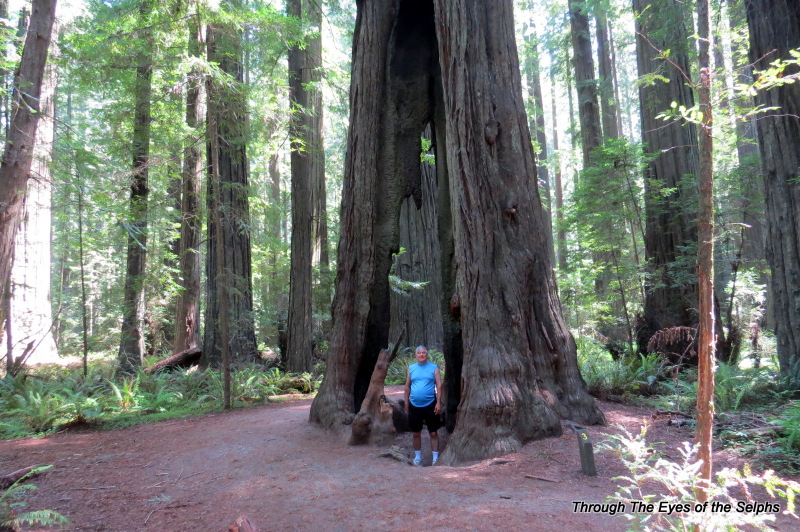
We left Bainbridge Island on June 29th which was the first year anniversary of our new life living on the road in our RV.  From the beauty of Picture Rocks and Sleepy Bear Dunes in Michigan, to walking among the Gila Cliff Dwellers in New Mexico, to camping among the giant saguaros in Arizona, seeing the breathtaking Pacific coastline, standing where Lewis and Clark looked out over the Pacific, walking and driving among the ancient redwoods, hiking the rain forests in Oregon, and seeing the power of Mount St Helens and majesty of Mount Rainier, what a truly magnificent year it has been!!  We can’t wait to see what delights our second year brings.

We spent one night on the road at a private campground in Olympia, the capital of Washington.  We got a peak at the capitol building as we passed by on the freeway.

Much of this drive was on Interstate 5, and it had been awhile since we had driven on a freeway. We hadn’t missed the freeway traffic over the past several weeks and it was not a welcome reunion.

We arrived at Seaquest State Park and to our surprise there was only one other RV parked in the full hookup section of the park. Since this is summer and the week of July 4th, we expected the park to be crowded. It remained empty during our entire stay, and when we drove through other parts of the campground they were also fairly empty. It was nice having that section of the park to ourselves, making for a nice quiet stay, very unusual for a state park in the summer. Our stay there was made even more relaxing by a lack of cell phone and internet reception in the park. Bill was able to get satellite tv.

The next day we drove 54 miles to MT ST Helens National Volcanic Monument on the Spirit Mountain Highway. We crossed the 2,340-foot-long Hoffstadt Creek Bridge, built to replace the original bridge after it was destroyed by a torrent of volcanic mud and rock traveling at speeds of more than 100 mph after the 1980 eruption. As we drove up the highway we could see the devastating effects of the 1980 eruption on the landscape and forests and the recovery efforts taking place with lots of tree plantings. After driving to an elevation of 4,200 feet we arrived at the Johnson Ridge Observatory, named for the volcanologist killed at this site.IMG_1083 IMG_1087 It was a very windy day, one of those days when you can’t keep a hat on and my visor blew across the walkway and was almost gone forever. Even though the wind was a bit of a nuisance, it blows all the clouds away that blocks visibility needed when viewing mountainous areas.


At the Johnson Ridge Observatory we saw live seismographs, geologic exhibits, and viewed an excellent movie on the eruption of MT ST Helens on May 18, 1980. The eruption was an incredible explosion with such force that it blew 1,313 feet off the north face of the volcano and blew smoke and ash 80,000 feet into the air. It released a mile wide avalanche that raised Spirit Lake by more than 200 feet and shattered forests like matchsticks. Morning became night in minutes, halting traffic for a hundred miles and covering parts of three states with a fine gray powder. Today MT ST Helens stands at 8,365 feet. IMG_1081 IMG_1086 IMG_1088 IMG_1092


IMG_1093


We attended two Ranger talks at the Observatory. During one talk the Ranger explained the difference between lava flows at MT ST Helens and those in Hawaii. The lava from ST Helens is a thicker, silt based gray lava whereas the ones in Hawaii are more fluid based and red. He talked about the 1980 eruption and gave demonstrations on how eruptions occur, to the delight of some school children present.

The second Ranger talk focused on how scientists watch for and monitor volcanic activity and predict future eruptions. Two months before the 1980 eruption, scientist noticed puffs of steam and ash, increased seismic activity, as well as a growing bulge on the north side that grew five feet a day. They knew it was a matter of WHEN, not IF, the volcano would erupt and took precautions, however fifty-seven people died during the eruption. Until then, the mountain had been asleep for 123 years.

MT ST Helens last erupted from 2004 to early 2008, leaving a 1,320 foot tall lava dome which is formed from the cooling of lava on the crater floor. The lava during this three and a half year eruption was enough to fill 36,800 Olympic swimming pools and replaced about 7% of the volume lost during the 1980 blast. While the mountain appears quiet, the watching and waiting continues.  IMG_1100 IMG_1095


While in the area we drove 45 minutes south to Vancouver, Washington to meet Bill’s friend Robert and his wife Sandy for dinner. Bill and Robert worked together in Florida about 15 years ago. It was nice for Bill to visit with old friends, and nice for me to meet new friends!

June 23, 2014 Nordland, Washington

We awoke to the sound of foghorns.  While not as bad as the sound of rain, it is not a welcome sound on move day.  By the time we ate breakfast and prepared everything for the move, the fog had lifted and the skies were beginning to clear.

We traveled sixty miles east to Fort Flagler State Park on Marrowstone Island.  We never saw any clothing optional people regardless of what the sign said.IMG_1052


We also visited the little post office there to pick up some mail we had forwarded there.  IMG_1017


Fort Flagler State Park It is a nice little park where we had a full hookup site overlooking Puget Sound with snow capped mountains in the distance.  While we saw cruise ships and barges at Salt Creek, here we saw mainly ferry boats. IMG_1053


The beach there was mainly rocks with a lot of driftwood.  IMG_1063 One favorite pastime of many of the campers staying at the park was kite flying, and everyday we saw several colorful kites flying over the water.


Fort Flagler was one of three forts in the area begun in 1897 to create a heavy artillery “triangle of fire” with 12 inch guns.  The goal was to protect the entrance of Puget Sound from enemy naval forces, protect the port cities of Seattle, Tacoma, Olympia and Everett, as well as the navy shipyard at Bremerton.  Fort Flagler was a military installation from 1899 to 1953, a period of time encompassing WW1, WW2, and the Korean Conflict.

Inside the park are barracks, officers’ quarters and a hospital used during World War 1 and  World War 2, as well as a museum housed in the Quartermasters Depot with a collection of military items along with a film about the fort’s history.  Wednesday morning we attended the Coastal Artillery tour which was a walking tour of the gun line which gave us a sense of military life and operations at the fort.  IMG_1013 IMG_1025 IMG_1031 IMG_1032


Bill loved this sign in the little museum there!  IMG_1016Another day we drove over to Port Townsend, voted one of the “Top 10 Coolest Small Towns in America” by Fox News, NBC News, Budget Travel, and Yahoo Travel.  The entire town is on the National Register of Historic Places and is one of only three Victorian seaports in the nation.

Settled in1851,  Port Townsend was a bustling seaport, lumber and fishing town in the 1880s and 1890s..  Town leaders and prosperous merchants built ornate homes and brick buildings downtown because of the promise of a railroad line through the town.  Unfortunately Seattle was chosen instead and the town never grew to the large city it had hoped to become.  Instead today it still has a Victorian charm that attracts visitors, artists and musicians.  The movie “An Officer and a Gentleman” was filmed in Port Townsend in 1981.  Some of those old historic brick buildings are now used as shops and restaurants.  Back in the 19th century there were gambling halls and secret tunnels where drunks were shanghaied, kidnapped and rowed out to ships where they were sold into forced labor.  Today those secret underground tunnels are the sites of underground cafes where tourists can experience the secrets of the past.  Also during the 19th century Port Townsend was a Customs station IMG_1047where every ship entering

IMG_1048


Puget Sound from a foreign dock had to dock first in Port Townsend. Now it is a little cafe.

We really enjoyed seeing the picturesque town with a view of Admiralty Inlet, and seeing some of the historic buildings dating from between 1860 and 1900,

IMG_1046 IMG_1049 IMG_1050


including the Victorian style Jefferson County Courthouse built in 1892 with its 124 foot clock tower.

IMG_1044  It is one of the two oldest courthouses in the state and still in use today.


Later in the day we drove over to Fort Worden State Park, which was one of the other triangle forts built between 1897 and 1911.  We drove around the grounds of the fort which included barracks as well as a balloon hanger that was built to house an experimental balloon observation post which failed, and a chapel, Alexander’s Castle which was built before the fort as served as a retreat for John Alexander, a clergyman from Port Townsend.  The fort also had a building which once served as a hospital, a workshop, a gymnasium, a guardhouse, a theater which was one of the newer buildings at the fort, as well as a Band Barracks where the Coast Artillery band rehearsed every day and slept there at night.  Anytime of the day a soldier could pass by the building and here music being played.

We certainly enjoyed our stay at Fort Flagler State Park, especially our lovely view of the water!  Next we headed about an hour south to Bainbridge Island County Park, which included crossing the Hood Canal Bridge.  This bridge is 7,869 feet long and is the longest floating bridge in the world located in a saltwater tidal basin, and is the third longest floating bridge anywhere.  We had read about it earlier and we didn’t really know what to expect, especially in an RV, but it felt like any other bridge to tell you the truth.  20140627_101002


We stayed two nights on Bainbridge Island and once again we had a lovely view of the water where we could watch the ferry boats and cruise ships pass by. IMG_1080 IMG_1071 IMG_1066


The full day we were there we took a scenic drive around the island, which included a spectacular view of Seattle. 20140628_134257 Too bad it was not a bright sunny day so we could get better pictures for the blog, but it was still a great view.


We found one of the most interesting geocaches on the island which was called “Dr Who’s Sibling”.  Since Bill is a huge fan of Dr Who, we were excited to find this one.  I will only say that it involved an out of order pay phone.  While it was not a Tardis like Dr Who’s, it was close enough and all Dr Who fans will get the joke.  20140628_150755

June 12, 2014 Ilwaco, Washington

We awoke to the sound of showers which is becoming a more frequent occurrence in this part of the Pacific Northwest.  We prefer not to pack and move in the rain, but you do what you have to do on move day.  It was not a steady rain but intermittent showers, so it could have been worse.

This was an especially exciting day because we were finishing our time in Oregon and entering Washington, the Evergreen state.  We passed through Oregon rather quickly in our quest to finish our travels before the cold weather returns in October.  We will continue our travels in central and eastern Oregon in the coming weeks and months, as we return south.

We traveled up Highway 101, also known as the Pacific Coast Byway.  The two lane road became more and more winding as we headed north, with farmland and cattle along the roadside.  We passed through many small villages advertising upcoming chainsaw sculpting contests and rodeos coming to town.  We saw a small lumberman museum but didn’t take the time to stop.  I suffer from motion sickness which doesn’t usually affect me in the RV, but for some reason this road made me feel very nauseous and we had to pull over while I took some Dramamine and waited for my stomach to settle.

We reached the large port town of Astoria, the northernmost Oregon city on Highway 101.  Astoria, the oldest settlement west of the Rockies, dates back to the winter of 1805-1806 when the Lewis and Clark Expedition made camp at nearby Fort Clatsop.  We crossed the four mile long Astoria-Megler Bridge which joins Oregon and Washington and is the longest continuous three-span, through truss bridge in the world.  When it was finished in 1966 it completed Highway 101 and made it an unbroken link between Canada and Mexico.  The Welcome to Washington sign is located about two thirds of the way across the bridge.

We arrived at our destination, Cape Disappointment State Park near Ilwaco, Washington.  Ilwaco is a small fishing village near the mouth of the Columbia River.  This area was named Cape Disappointment by John Meares who was trying to find the mighty Columbia River. After a storm he turned his ship around just north of the cape without finding the Columbia and therefore named the area Cape Disappointment.  The area is far from a disappointment with its stunning ocean views and unspoiled beaches.

IMG_0767 We had a great campsite and certainly enjoyed staying in the park, even though we could not get cell phone service or satellite TV in the park.  It was amazing camping at the location where the Corps of Discovery had their first glimpse of the Pacific Ocean.  Our campground was located in the Cape Disappointment State Park which is also part of the Lewis and Clark National Historical Park.

The park had a nearby Lewis and Clark Interpretive Center and after settling in we stopped by for a visit.  It was a pretty steep walk from the parking lot but we were rewarded with beautiful views as the Center sits on a cliff with views of the Pacific Ocean and nearby Cape Disappointment Lighthouse. IMG_0771

The Center was built here because it was also the site of Fort Canby established in 1875 to protect the mouth of the Columbia River from enemies.  The fort continued to be improved until after World War II and there are still gun batteries visible in what remains of the fort.  At the Interpretive Center we were greeted by enthusiastic, friendly volunteers and enjoyed touring the Center and seeing the movie there.

IMG_0750

Since the Lewis and Clark National Historical Park is located in both Oregon and Washington, the next day we drove back across the bridge to Fort Clatsop in Oregon. This is where Lewis and Clark’s Corps of Discovery ended their 4,000 mile westward journey.

Here they built a fort and

IMG_0751rested during the winter of 1805 and 1806 before their journey home.  At Fort Clatsop the Park Service has a replica of the fort as well and an interpretive center and exhibit hall

IMG_0761with an excellent movie and many interesting exhibits about their journey.   It just so happened that the day we visited was Flag Day and they had a special flag ceremony down at the fort. IMG_0757 IMG_0759 Ranger Larry gave a dramatic retelling of how Francis Scott Key, after watching the bombardment of Fort McHenry during the War of 1812, wrote the poem “The Defence of Fort M’Henry” after which part of the lyrics later became our national anthem.  We then all sang “The Star Spangled Banner” together which was a very moving experience.  Ranger Larry pointed out that without Jefferson’s vision and the bravery of the Corps of Discovery led by Lewis and Clark, we would very likely have been standing on land owned by British Columbia rather than the United States.

While in Astoria we also rode on the historic Riverfront Trolley, a restored 1913 trolley that runs 4 miles along the Columbia River.

IMG_0762 For the big sum of $1 each we got to ride the trolley and listen as the conductor gave us information about the history and attractions in the area.

We also learned that the movie “The Goonies” was filmed in Astoria as well as “Kindergarten Cop”.  The conductor pointed out the elementary school used in the film.

IMG_0765

Some thoughts:

In the Eastern U.S. signs say “Hurricane Evacuation Route”.  In the Pacific Northwest the signs say “Tsunami Evacuation Route”.

In the Pacific Northwest a sign that says “Slide Area” can mean the hillside and rocks are sliding OR the road is sliding.  We saw a road that had slid off the side in our travels.

May 18, 2014 Eureka, California

We left Redcrest and made the short and easy drive north on Highway 101 to Eureka.  Now that we are no longer on California Highway 1, the road is much better!  We arrived at the Fairgrounds in Eureka which was a full hookup very reasonably priced campground.

Eureka has a population of around 27,000.  It has a rich history mainly based on the California Gold Rush mid to late 1800’s.  As thousands of people poured into the area in search of gold, their need for housing and the numerous redwood forests in the area provided a prosperous economy for northern California.  Lumber was manufactured and shipped from the region so the area became rich through lumber and shipping.  Many people in Eureka became wealthy which can be seen in the many large Victorian style homes.  There is a walking tour of all the historic homes in the area known as Old Town.  Two such homes are the William Carson Mansion and the “Pink Lady”.  The Carson Mansion, owned by William Carson who was the owner of a prosperous lumber company, is one of the most photographed and written about homes in California.IMG_20140520_200831 It  was sold in 1950 to the Ingomar Club which is a men’s club by invitation only.


The Pink Lady located across the street from the Carson Mansion, was built in 1889 by William Carson as a wedding gift to his son.  IMG_20140520_200712


As you may have guessed, Eureka received its name from the Greek word “Eureka” which means “I have found it” and was first used by the Greek mathematician Archimedes.  The gold rushers would say when they discovered gold and the name stuck for the town.

Eureka is also a very artsy town and home to hundreds of artists and we found a self guided walking tour of twenty murals painted on buildings throughout the town.  Here are a couple of our favorite which includes this mural, a tribute to architecture and the performing arts which is located on the side of a bank. IMG_20140520_201022 The mural measures 70 feet by 70 feet and is one of the largest murals in northern California.


The other is titled “Nature’s Bounty” and is made up of six 20 foot panels.  IMG_20140520_201454


We stayed here three nights and originally selected it because it was on our route north.  We were certainly glad we did since it turned out to be a charming, historical town.  We were even able to do some shopping at Walmart and Safeway, eat a couple meals out, grab some geocaches and Bill even managed to get a haircut.


May 11, 2014 Redcrest, California (Avenue of the Redwood Giants)

We reluctantly left the beauty of tiny Westport-Union State Beach Park and our magnificent ocean views (one interesting fact the host of this beach park told us is that this area is known as the “Blood Triangle” because more shark attacks happen in this part of CA than anywhere else in the world except Australia) and headed up California Highway 1. I have talked in previous posts about what a difficult road this is to drive on, but the drive from here to Redcrest was the last twenty-five miles of CA 1 and the worst of the worst with 10 MPH horseshoe curves and narrow roads with no shoulders or guardrails and sheer drop-offs. We turned away from the coast and the road became more mountainous and curvy. We finally reached the end of CA 1 and began driving on U.S. Highway 101. We drove almost the entire CA 1 north from San Diego which had been on our bucket list. We are glad we did because the beauty of the California coastline is unlike anything anywhere else. I think I will see those curves and drop-offs in my sleep for awhile.

At the junction of CA 1 and 101 we saw a sign for a drive-thru tree and since it was only a quarter mile away we decided to check it out. For the admission of $5.00 you get to drive your car through a redwood tree.  IMG_0358 IMG_0362 IMG_0363These large and tall trees are the “Coastal Redwoods”. What a tourist trap and we didn’t even waste time in the gift shop. One of those glad we did it but once is enough experiences. There are two more such trees in this area but we will skip those. As we drove into Redcrest on 101 we saw many little gift shops and tourist attractions all taking advantage of the popularity of the beautiful redwoods in this area of California. We have traded the beauty of the Pacific coast for the magnificence of the redwoods. Away from the coast the temperature has gone up about fifteen to twenty degrees and everywhere we saw forests and redwoods. Beautiful!

We arrived in our campground in Redcrest on the Avenue of the Giants.  Redcrest is another small town with a population of 112 and relies heavily on tourism. We had good cell phone service in the main area of Redcrest but not in the campground.

Our first full day there we drove to Shelter Cove which was about a ninety minute drive from our campground.  It had been recommended by a campground neighbor and some tourist brochures.   I guess we have been spoiled by the beauty of the Pacific coastline because a long drive over very winding and curvy roads which climbed and then descended over 2,200 feet,  we arrived at Shelter Cove and were disappointed by the lack of views and beach there.  It certainly did not begin to compare to what we had seen in our previous travels up CA 1.  We did see a lighthouse there which at one time was further up the coast at Cape Mendocino. IMG_0364 The lighthouse was built in 1868 and lighthouse keepers had to take a small tender boat out to the lighthouse.  Due to the isolation this lighthouse was not a favorite of lighthouse keepers and it seems that men who did not follow orders or needed to be disciplined were sent to this lighthouse.  In 1948 the lighthouse was dismantled and moved into storage.  In 1999 it was moved and restored to Shelter Cove.

Before leaving Shelter Cove we did manage to find one geocache and saw some deer up close. IMG_0380 IMG_0371


The weather certainly warmed up with temperatures in the upper eighties and low nineties for several days.  This was quite a shock after the cool temperatures we experienced along the coast!  Avenue of the Giants is a thirty-mile 2-lane scenic driveIMG_0387 on what was once U.S. 101 surrounding by 51,222 acres of magnificent redwood groves. IMG_0427 IMG_0426 IMG_0423 IMG_0403 It is said to be the greatest display of Coastal Redwoods in the 500 mile redwood belt.

IMG_0408 IMG_0398 IMG_0389 IMG_0381  While in Redcrest we spent several days driving along the scenic Avenue of the Giants which is parallel to U.S. 101 and is surrounded by Humboldt Redwoods State Park.  The state park, established in 1921 to protect these magnificent trees,  is the third largest California state park and includes the Rockefeller Forest which is largest remaining old growth redwood forest in the world.  With 53,000 acres, it has many trails to hike and we also found several geocaches.


One trail we walked was the Gould Grove Nature Trail which has the third largest known redwood tree in circumference.  We also tried to find a geocache which included a rare albino redwood tree which is one of only a couple dozen known to exist.  We didn’t really know what an albino redwood was supposed to look like and couldn’t find anything that we thought resembled one.  We stopped by the Visitors Center and asked one of the rangers.  He gave us a paper with directions and it seems they rarely give the directions out because people have been known to touch the tree and pull off leaves so they stopped publicizing its existence.  We quickly found the tree and it was not what we expected.  The needles/leaves of the tree are white instead of green.

IMG_0429 IMG_0430


The same day we hiked to the Women’s Federation Grove which was founded in the 1930’s by members of the California Federation of Women’s Clubs.  Here there are picnic tables made from thirty to forty foot long redwood logs.  Today the area can be used for picnics since there are also grills and restrooms.  The focal point of the grove is a covered four-sided fireplace

IMG_0433designed by Julia Morgan, who also was the architect for Hearst Castle.

Along the top of each fireplace is an inspirational message.  Here are a couple favorites:

IMG_0435 IMG_0434On this day we were the only ones there and it was truly peaceful and tranquil with a river flowing alongside.


Later in the day we took another trail which led us first IMG_0445 IMG_0444to the “Tall Tree”.


Later we walked to the “Giant Tree”.

IMG_0452 IMG_0451 IMG_0456  This area was also used in the filming of the Stars War movie “Return of the Jedi”.  Since the seasonal bridge had not yet been placed for the summer, we had to cross a 20 foot wide stream with water up over our ankles.  When we got back to the car we had to wring water out of our socks!  But it was well worth it to see the Giant Tree and this beautiful area.


The next day we drove along the Avenue of the Giants to Founders Grove Nature Trail where we saw many amazing redwoods including the Founders Tree and
IMG_0467

IMG_0463


IMG_0480


IMG_0478


the Dyerville Giant which fell in 1991. They think it had been standing for as long as 1,600 years and was taller, larger and older than any tree around it.  It was 370 feet tall which is two feet taller than Niagara Falls, was seventeen feet in diameter and fifty-two feet in circumference, and weighed over one million pounds.  When it fell it registered on the seismograph and the locals said it sounded like a train wreck.  What an amazing week we had!

IMG_0483 IMG_0491

May 5, 2014 Manchester, CA

We left lovely Bodega Bay and headed north up California Highway 1. This road gives breathtaking views of the Pacific coastline that is unlike any other, but the drive itself is mean with many curves that include several horseshoe turns.IMG_0273 I think those crazy Mexican roads helped prepare Bill for driving an RV on CA 1, and I am thankful we are traveling north instead of south since the southern route is against the coastline with rugged cliffs and steep drop offs. An RV heading south passed us and I swear the driver had a look of sheer terror on his face!

We stopped at Fort Ross State Historic Park IMG_0238which is one of the oldest parks in the California State Park System. This 3,386 preserve was North America’s southern most Russian settlement. Members of the Russian-American Company founded the Fort Ross Colony in 1812. The nearby Metini natives have lived in this area for centuries and did not seem to mind the Russian building their fort. Earlier history shows that in 1784 the first permanent Russian settlement was built in what is now Alaska.

In 1812 twenty-five Russians and eighty Alaskan Alutiiq natives built houses and a stockade with the purposes of growing wheat and other crops for Russians living in Alaska, hunting marine animals and trading with the Spanish. The fort was dedicated in August 1812 and named Fort Ross in honor of Imperial Russia, also called Rossilia.  IMG_0242 IMG_0245 IMG_0249


Fort Ross also has a chapel with a beautiful redwood vaulted ceiling

IMG_0248


as well as a windmill that was the first windmill in California.IMG_0240 IMG_0241 The fort also has the first glass windows in California. The grounds also contain a Russian cemetery. In December 1841 Fort Ross was sold to John Sutter and then in 1873 to George Call who established the Call Ranch. In 1903 the California Historical Landmarks Committee purchased the Fort Ross area from the Call family and the State of California acquired it in 1906.

Bill and I found this area very interesting since we never knew there was a Russian settlement this far south. We enjoyed touring the Visitor Center, seeing a movie about the history of the fort, and walking around the grounds. We also learned that a special Cultural Heritage Day is held in July where they hold religious ceremonies in the chapel.

I have mentioned in other posts that this coastal region can be extremely windy.  We came across this tree while walking on the grounds. IMG_0254 It is not unusual to see this trees along the coast. Fort Ross is certainly located in a beautiful setting!  IMG_0244


In the parking lot Bill spotted an RV with Florida tags so we walked over to chat with them. We are always happy to meet fellow RVers and this couple are also full timers. They too find CA 1 very difficult to drive on which included their dog getting very carsick. We learned they are following the same route as us for several months so hopefully we will meet up with them again.

While we were at Fort Ross we kept hearing the barking of seal in the distance. We drove a little farther up the coast and stopped at one of the many turnouts. Bill always scares me when he gets too close to a cliff in his quest for that perfect picture. It is hard to tell from this picture I took from a safe distance away, but he was standing at the top of a huge cliff IMG_20140504_153851looking over the side at some seals and their babies resting on some rocks.


He got some great pictures of the seals and their babies using his 50X zoom.  IMG_0255 IMG_0259 IMG_0260 IMG_0261 IMG_0266 IMG_0267


We also came across some seals lying on the beach where the Russian River meets the Pacific Ocean

IMG_0284 IMG_0283


and discovered a beautiful arch rock.

IMG_0236 IMG_0237 IMG_0234


IMG_0288


The seventy-mile drive from Bodega Bay to Manchester took almost three hours of driving time not including stops which tells you something about the difficulty of driving an RV on this road with many 20 MPH curves. We did enjoy the ocean views on one side and pasture land with cattle on the other. At one point we saw a field of sheep with lambs running after their mamas. Thankfully we arrived safely at our next stop in Manchester where we will stay for three days.

May 1, 2014 Bodega Bay, California

We left Santa Rosa and headed west and within a short time noticed the temperature dropping as we neared the coast. After a short drive we arrived at a nice county regional park in Bodega Bay where we would be staying for four days. Bodega Bay is a very small harbor village with beautiful views of the bay. We have found this area of Northern California has no Walmart or franchise restaurants that we are used to seeing. You will most definitely not find a McDonalds in this area of the state! While we were in Southern California we noticed that due to city/county ordinances, some Walmarts and grocery stores have done away with plastic bags and we have become accustomed to taking our own bags with us instead of paying ten cents for each paper bag. This is most definitely true for ALL of Northern California. We went in a McDonalds in San Francisco and there was a sign saying they charge ten cents for each paper bag they put your food in. Now that is taking “going green” a little to the extreme!!

We loved our campsite in Bodega Bay where we had a great view of the channel with boats passing by and plenty of waterfowl to observe. For the first time we noticed the beautiful wildflowers everywhere. IMG_20140501_150531 IMG_0160 IMG_0224


Our first day we drove up to the Bodega Bay Visitor Center and found out in 1963 the Hitchcock movie “The Birds” was filmed in Bodega Bay. We were told that last year they had a big 50th Anniversary celebration and Tippi Hedren, now 84 years old, visits Bodega Bay every year. The guide at the Visitor Center told us that around 8,000 people come here every year just because it is where the movie was filmed. We picked up a map with several locations to visit where they did filming for the movie. While in the area we rode past the schoolhouse shown in the movie, which is now a private home.  IMG_0214We also took a scenic drive along Bay Hill Road which is the same route that Tippi Hedren drove in the beginning of the movie and we were rewarded with some very picturesque scenery with the Pacific Ocean on one side and pastures with cattle grazing and calves running after their mothers. The road was narrow and very curvy and one we would have never taken without the map. We were very glad we did!  IMG_0222 IMG_0228 IMG_0218


We also rode up to tip of the peninsular Bodega Bay Head where they have magnificent views of the Pacific coastline. When we pulled up the parking lot was almost full and we noticed people with cameras standing and sitting on top of the cliff. IMG_20140501_144531Thinking something exciting was happening we hurried up there only to find that people spend hours here waiting for a whale or two to make an appearance. We are not quite that patient but we did enjoy the view!  IMG_20140501_144643 IMG_20140506_000729


The highlight of our visit to Bodega Bay was a visit to Point Reyes National Seashore ParkIMG_0171 that was only about 40 miles from Bodega Bay but took about an hour and a half due to the narrow and curvy roads both on California Highway 1 and inside the park. Our first stop was the Visitor Center where we read informational displays about the Coast Miwok Indians who were the first inhabitants of the area. We watched an interesting and informative movie on the history of the park that included English (Sir Francis Drake in 1579), Spanish and Mexican inhabitants in addition to the Indians. There have been generations of dairy farmers who have farmed the land and there are currently thirteen active ranches in the park. Throughout our drive around the park we saw cattle and crossed many cattle guards. President Kennedy signed legislation in 1962 making it a National Seashore Park and in 1966 Mrs. Lyndon Johnson formally dedicated the park to the American people.

The first thing we did after touring the Visitor Center was take a short walk on “The Earthquake Trail”. IMG_0165


They had blue stakes showing the location of the San Andreas Fault and at one point on the trail a twenty-foot movement had split a fence during the 1906 San Francisco earthquake.  IMG_0167 IMG_0166 IMG_0168


Next on our list was to drive to the Tule Elk Reserve. Before 1860 thousands of tule elk roamed the Point Reyes peninsula. Due to hunting they died out and in 1999 a herd was returned to the land. Today approximately 750 roam the land. We really wanted to see some elk and we had the mistaken impression all we had to do was drive to the edge of the reserve. Turns out it wasn’t nearly that easy. We came to the realization that if we wanted to see elk we would have to do some hiking so we found a popular trail and started out. The weather was sunny and fairly warm at the Visitor Center, but by the time we had driven ten miles to the reserve the weather was chilly, windy and foggy. We started down the trail and came upon a man who was carrying a huge elk antler on his back. He said they carry them out and grind them up and bring them back and spread them on the ground because the minerals are good for insects. Since we had seen a sign warning us not to collect antlers, we had to take his word for it.  We really wished we had thought to get his picture because it was really quite a sight to see!

After walking for a while along the narrow hilly trailIMG_0190 we saw some elk far in the distance. Definitely too far away to get a decent picture. IMG_0174We decided to hike a little further and came across two groups of hikers on their way back. Once group told us there were elk about 150 yards away. After walking what seemed to be much further than fifty yards we came to some more hikers who told us we would see them after about a five-minute walk. We continued on and walked much longer than five minutes. Either these hikers have a poor concept of time and distance or the elk were really on the move! When we reached the two-mile mark we decided to give up and head back.

Just at that point Bill looked to the left and saw a small herd lying down in the grass. They all turned their heads and looked right at him. The view was not perfect with the fog, but at least they were close enough to see them but Bill was able to enhance the pictures on his computer. IMG_0183 IMG_0187We left the trail and walked toward them to get a better look but stopped when one of them stood up in alarm. We didn’t want to scare them off.  We took some pictures and congratulated ourselves on finding them and not giving up. We headed back down the trail and Bill stopped suddenly and pointed ahead. There on the hillside happily grazing on grass and wildflowers was another group of twelve. They were close to the trail and did not seem alarmed at all by our presence, but we moved slowly and quietly so as not to alarm them.IMG_0199 IMG_0200 IMG_0194 IMG_0196 IMG_0201


During our elk hike we not only enjoyed seeing the elk but we saw beautiful fields of wildflowers and lovely views of the Pacific coast that would have been even more spectacular if it hadn’t been for the fog. IMG_0202


Even though it was foggy we decided to take a chance and drive up to the Point Reyes Lighthouse that is supposed to have breathtaking views of the area. Along the way we crossed more cattle guards and continued to see many cattle and calves nursing. One highlight for Bill was seeing the RCA Ranch and historic Radio Station KPH that was once at the forefront of communication technology. IMG_0211 IMG_20140506_000505 IMG_0205There was once here a wireless telegraph station where operators tapped out Morse code messages across the Pacific as far away as Hawaii. During World War II military and coast guard personnel used the property. The Radio Corporation of America (RCA) owned it and the park service acquired the property from RCA in 1999.


Today park personnel use the building as offices. IMG_0209


You may recognize the arched driveway of cypress trees leading to the house because it has been used in numerous car commercials. IMG_0210


We reached the lighthouse but just as we expected it was fogged in with heavy fog and we couldn’t see a thing. We drove the ninety minutes back to the campground marveling at all we had seen today!

We are finding that Northern California is simply enchanting!!

April 25, 2014 Santa Rosa, California

We awoke to the sound of rain which normally wouldn’t have been a big deal but since today is a move day for us, it wasn’t a welcome sound.  Luckily by the time we headed outside to do our outdoor departure preparations, the rain had stopped.  We made the short drive through fairly heavy traffic across the Golden Gate Bridge towards Santa Rosa and once again the rain started up making for poor visibility with the fog.  The trip to Santa Rosa took about an an hour and a half and when we pulled into the campground the clouds were dark and threatening and we did get more wind and rain later in the day. Our time so far in Northern California has certainly included some chilly days.  As Mark Twain said, “The coldest winter I ever saw was the summer I spent in San Francisco.”

Our main reason for stopping in this area was so Bill could attend the taping of several audio shows at the TWIT (“This Week in Tech”) studio in Petaluma, about a twenty minute drive from our campground. 20140429_161120 The web site for TWIT is here http://twit.tv if you are interested in their technology based discussions. Bill has listened to the owner and host of TWIT, Leo Laporte, since 1999.  Leo and his team tape these free shows every week such as “The Tech Guy” and “This Week in Google”.  They can be watched live or downloaded later to your listening device.  Bill downloads the TWIT audio programs (called netcasts) on his phone.  While we were in the area Bill was able to attend five tapings which included a call-in help radio show, the weekly summary TWIT show, a show on android phones, “This Week In Windows” and “This Week in Google”. Three of the taping were recorded in Leo’s office and Bill was allowed to sit by his desk.

20140427_152223

Sunday’s TWIT – two co-hosts were skyped in

There were tourists in the audience from Australia and Canada watching the Sunday taping.

20140427_140718

TWIT has adopted fez hats


Monday our plans including visiting Muir Woods and Sausalito.  It was actually easier to drive there from Santa Rosa than from our campground outside of San Francisco.

The drive to Muir Woods National Monument was easy until the last 10 miles which then turned into narrow, steep, and curvy roads.  Parking is at a premium at Muir Woods and since the parking lot is small and is it a popular place, it is not unusual to have to park a mile or so away from the entrance.  Luck was on our side this day and we secured a parking spot in the closest lot as someone was pulling out and we drove in.

Muir Woods is a coastal redwoods forest with towering redwoods which can be seen as you walk along a boardwalk or take hikes through the forest.  The coastal redwoods only grow on a 500 mile strip of Pacific Coast from southern Oregon to Big Sur CA because they need moisture from fog to flourish.  Most ancient coastal redwoods have been cut, but some are protected in national and state parks.  Redwoods can reach a height of 379 feet and be 2,000 years old.  In Muir Woods the tallest tree is 252 feet tall and some are at least 1,000 years old.   Most are between 500 and 800 years old.   IMG_0124 We listened to an informative ranger talk on the history of the park.  In 1905 William Kent purchased the 611 acres of land for $45,000 with the idea of preserving it for the enjoyment of his family and friends because he was alarmed at the amount of forest being destroyed by logging companies.  After the devastating 1906 earthquake, the need for redwood to rebuild was at a premium and logging companies began to take even more redwood forest land.  They wanted Kent’s land and filed an injunction to acquire the land due to need for the wood.  The courts agreed with the logging companies and ordered the land turned over.  Kent contacted President Theodore Roosevelt and offered to donate 295 acres of the land to the federal government if it would be protected.  Roosevelt agreed and it became a national monument.  Kent asked that it be named after john Muir, a wilderness advocate.  Muir was also responsible for convincing Roosevelt to set aside land which became Yosemite, the Grand Canyon, and Mt Rainier national parks.

“In every walk with nature, one receives far more than one seeks.”  John Muir

We walked along the boardwalk IMG_0102 IMG_0101 IMG_0100 IMG_0096 IMG_0093and took a mile trail which led us further up into the trees which was very serene and we could see the people walking on the boardwalk below us.  IMG_0123 IMG_0117 IMG_0115 IMG_0113 IMG_0109 IMG_0107 IMG_0099 IMG_0097

In 1945 delegates from all over the world met in San Francisco to establish the United Nations. On May 19 they traveled to Muir Woods to honor the memory of President Franklin Roosevelt who had died a month earlier.  President Roosevelt believed in the value of national parks as a source of inspiration, and it was hoped that the beauty and serenity of Muir Woods would inspire the delegates to pursue world peace as they met to establish the United Nations.  A plaque quoted the thoughts of one of the delegates, “Persons who love nature find a common basis for understanding people of other countries, since the love of nature is universal among man of all nations.” 

We would strongly agree with John Muir since it has been while hiking and exploring nature that we have met many people from other countries.

After our time at Muir Woods which included a picnic lunch, we drove to Sausalito.  It is a picturesque little town, but a bit too much of a tourist trap for us.  If you like to shop, this is the  place to be. IMG_0137 We enjoyed walking downtown and took in the views of San Francisco across the bay, but we were eager to move on.

Next we drove to Hawks Hill which included a steep climb and more winding roads IMG_0152 after which we were rewarded with a gorgeous panoramic view of the San Francisco area, including Alcatraz, the Golden Gate Bridge and the San Francisco skyline. IMG_0141 IMG_0134 IMG_0131 IMG_0130 We thought the view from Twin Peaks our first day in San Francisco was amazing, but this view definitely blew us away.  We continued driving which including going down an 18% grade, and came to a former missile site.  We drove by the Nike Missile Site SF-88 which is a former Nike Missile launch site at Fort Barry.  It opened in 1954 and was intended to protect the population and military installations in the San Francisco area during the Cold War.  It closed in 1974 and is now part of the Golden Gate National Recreation Area.  The visitors center there is open Thursday thru Saturday.  Unfortunately for us today was a Monday.  We then rode down to Rodeo Beach where just like everywhere in this area, there were surfers out catching waves.  The sand in this part of California is brown and coarse and not the soft white sand we are more familiar with in Florida and southern California.

April 24, 2014 Alcatraz, San Francisco, California

We really looked forward to touring Alcatraz Island.  Luckily we went online ahead of time and bought our tickets which included the ferry ride over and back because tickets usually sell out a week or more in advance.  For example when we went on Thursday there was a sign at the ticket office that the next available tour was Sunday.

Once again we rode BART into the city and our first goal of the day was to ride a cable car.  When we went into the city the first time, the line to ride the cable car near the BART station was very long and we didn’t want to take the time to wait.  Luckily today the line was shorter and we only had to wait about 10 minutes.  As the cable car fills up you have to wait for the next one to come by.  We wanted to catch it at the BART station and ride it to Fisherman’s Wharf.  At $6.00 one way, we wanted to get our monies worth! Once the cable car arrived it was very interesting to see how the conductors get out and turn the car around.   The ride was really cool as we sat sideways while the car climbed up and down hills. IMG_0055 Once we got off at the end of the line, Fisherman’s Wharf,IMG_20140424_103037 IMG_0064we walked down to Pier 33 which is where we caught the Alcatraz ferry. IMG_0068The ride over was quick and it wasn’t too cold to sit on top and see the beauty of the area.

The island is owned by the National Park Service and they had a very interesting and informative tour which included a self guiding tour using an audiotape with former Alcatraz inmates, correctional officers and residents reminiscing about their time there.  The tape was very well done and it was nice to be able to pause the audio if we wanted to spend longer in an area.  It was both fascinating and very sad to spend time there.  Fascinating to hear about the history of the island and prison, but very sad to see how the men lived there and spend their last days.    As we pulled up to “The Rock”, I imagined what must have gone through the mind’s of the men as they arrived here and saw the desolate island and large guard tower and lighthouse.. IMG_0083 IMG_0072 Several times the audiotape mentioned how the men could look out the windows at San Francisco just across the bay and see what they were missing.  On New Year’s Eve, if the wind was blowing just right, they could hear the party goers celebrating the New Year.  Yes, these were hardened criminals, including Al Capone, but it still struck me as very very sad.

The island has an interesting history including being an army fortress and a military prison.  It became a famous maximum security federal penitentiary in 1934, many people who worked at the prison also resided on the island, including the children of the workers who would ride a ferry each day to and from school.  One such child, now grown, talked about growing up on the island and how it was a really a nice childhood in which children of the workers all played and went to school together.  They did not see or come in contact with the prisoners, though occasionally they would hear them if they caused a ruckus.  There is a theater area on the island with a 17 minute film detailing the history of Alcatraz.

The prison closed on March 21, 1963 due to deteriorating buildings including a lack of a sewage system and high operating costs.  One interesting fact was that several Native Americans from 1969-1971 took over and occupied the island in an attempt to take back some federal land.  IMG_0075 IMG_0073

The main area to explore was the Cell House and we had to walk up four rather steep hills from the dock to get there.   IMG_0084

IMG_0078

One prisoner per cell

In the 29 years that Alcatraz was open, 36 prisoners tried to escape.  All but 5 were recaptured or otherwise accounted for.  Three who were never found were immortalized in the Clint Eastwood movie “Escape From Alcatraz” in 1962.  The two main reasons why escape was practically impossible was the strong currents and very cold water which surrounded the island.  An interesting and rather humorous tidbit is that in 1974 at the age of 60, fitness guru Jack LaLanne swam from just outside the perimeters of Alcatraz to the Fisherman’s Wharf handcuffed, shacked and towing a 1,000 pound boat!  He wanted to leave directly from the Alcatraz pier but the prison refused to allow him to come onto the island for security reasons.

After taking the ferry back to shore we caught a streetcar back to BART and rode home, grateful for such a fascinating experience.


April 23, 2014 Walking the Golden Gate Bridge, San Francisco, California

One thing we wanted to do while in San Francisco was walk across the Golden Gate Bridge.  I did some research and found out where we could park.  Even though the day was beautiful and sunny, knowing how the weather in San Francisco is windy and the fog rolls in quickly and the temperature drops in a matter of minutes, we bundled up in layers including hats and scarfs and headed to the bridge.  There was a very nice visitors center and paid parking lot at the south end of the bridge.  Many people walk or ride their bikes across and there is a nice wide walkway which walkers and bikers share.  As it turned out it really wasn’t that cold and the views were beautifulIMG_0025 IMG_0026 IMG_0037 IMG_0033including a view of Alcatraz.  IMG_0040We saw surfers in the water belowIMG_0027 and watched a helicopter fly under the bridge. IMG_0046 Another dream marked off the bucket list! IMG_0050