Category Archives: Historic Landmark

Historic Landmark

October 25, 2014 San Juan Capistrano

We left Huntington Beach and drove the short distance inland to Caspers Wilderness Regional Park in San Juan Capistrano.  It is hard to find a campground with available space on the weekend, so we settled on this campground for a three night weekend stay.  It turned out to be a great campground at a reasonable price with spacious sites where we could hear coyotes howling at night.

On Saturday we drove into town to the Mission San Juan Capstistrano.  This mission was founded on All Saints Day, November 1, 1776 by Spanish Catholics. IMG_2685  It is a beautiful mission and is the oldest building in California, the site of the oldest ironworks in the state, the oldest winery in the state. IMG_2697  In 1812 a massive earthquake destroyed the Great Stone Church and the ruins of the church are visible today.  Ruins such as these are usually only seen in Europe and these are the only such ruins in the United States. Because of the Great Stone Church’s decay the walls and ceiling were not rebuilt. Today there is a new chapel and school next door.

A close-up view of the ruins of Mission San Juan Capistrano's "Great Stone Church," destroyed by earthquake in 1812

A close-up view of the ruins of Mission San Juan Capistrano’s “Great Stone Church,” destroyed by earthquake in 1812

A view of the ruins of Mission San Juan Capistrano's "Great Stone Church," destroyed by earthquake in 1812. These bells are located where the bell tower stood.

A view of the ruins of Mission San Juan Capistrano’s “Great Stone Church,” destroyed by earthquake in 1812. These bells are located where the bell tower stood.

IMG_2688

The two original small bells and copies of the large bells from the destroyed bell tower

The two original small bells and copies of the large bells from the destroyed bell tower

The two original small bells and copies of the large bells from the destroyed bell tower

The two original small bells and copies of the large bells from the destroyed bell tower

Located in the Serra Chapel is its spectacular retablo, a masterpiece of Baroque art, the altarpiece was hand-carved of 396 individual pieces of cherry wood and overlaid in gold leaf in Barcelona and is estimated to be 400 years old. It was originally imported from Barcelona in 1806 for the Los Angeles cathedral but was never used and was installed in the Serra Chapel around 1924. This chapel is still being used today.

The centerpiece of the chapel is its spectacular retablo which serves as the backdrop for the altar

The centerpiece of the chapel is its spectacular retablo which serves as the backdrop for the altar

The centerpiece of the chapel is its spectacular retablo which serves as the backdrop for the altar

The mission is most famous for the return of the swallows each spring on March 19th, Saint Joseph’s Day.  Swallows always return to their nest and they return to the town from March until October when they fly south to Argentina for the winter.  Each spring the entire town celebrates the return of the swallows with a parade and celebration.  One problem the mission and town are encountering is that during efforts to preserve the mission ruins, some of the swallow nests were destroyed and many swallows stopped coming to Capistrano.  The mission has tried various ways to persuade the birds return, including building fake nests, creating mud puddles to provide nesting materials, and throwing ladybug, their favorite food, on the ground to entice them to come back.  Nothing has worked.  Some swallows do return to the town each spring but are choosing to build their nests in the eaves of downtown buildings, under freeway overpasses and along creek beds.  Experts say Southern California is seeing a sharp decline in swallows due to urban sprawl.

In 1939 songwriter Leon Rene wrote a love ballad called “When the Swallows Come Back to Capistrano” which was later recorded by The Ink Spots, Pat Boone, Glenn Miller and Gene Autry.

San Juan Capistrano was a lovely, quaint town and we enjoyed lunch on a balcony overlooking the town after taking a guided tour of the mission.  We had a really nice weekend stay in the area.

October 20, 2014 Huntington Beach, California Part 2

While staying at the Bolsa Chica State Beach campground in Huntington Beach, we decided to make the forty minute drive over to Yorba Linda to tour the Richard Nixon Presidential Library, Museum and Birthplace.

The library is located on the former site of the Nixon family nine acre citrus farm and includes the birthplace our 37th president.  We were able to tour the house where Nixon was born and lived as a small child.

Nixon was born and lived as a child in this very house on this very location

Nixon was born and lived as a child in this very house on this very location

The library and museum had many exhibits beginning with his birth and childhood to his years as a lawyer and naval officer as well as his early years in politics. IMG_20141023_125753 There were large exhibits on his years in the White House, including his foreign travels and diplomacy with China and the Middle East, IMG_20141023_141034 as well as space travel including the moon landing.  And yes, there was a large exhibit on Watergate.  Other presidential libraries had replicas of the Oval Office and how it was decorated during each presidency, but Nixon chose to have a replica of the Lincoln Sitting Room which is where he enjoyed working and spent a lot of his time.

This is the Lincoln sitting room, Nixon's favorite place to work on the second floor of the White House

This is the Lincoln sitting room, Nixon’s favorite place to work on the second floor of the White House

We were also able to climb aboard the Marine helicopter used by Kennedy, Johnson, Nixon and Ford and was the helicopter Nixon boarded when he departed the White House for the last time.

This is the helicopter that Nixon used when he left the White House for the last time

This is the helicopter that Nixon used when he left the White House for the last time

On display was also the armored limousine used during the Nixon presidency.  The grave markers for President and Mrs. Nixon are located near his birthplace. IMG_20141023_160013

It was very interesting to see the library and museum of this complex man during such a tumultuous time in history.

October 18, 2014 Huntington Beach, California

We left our beautiful campsite in Ventura, California after ten wonderful days overlooking the ocean where we could hear the waves crashing against the rocks and watch surfers riding the waves.  We drove south to Bolsa Chica State Beach Park in Huntington Beach.  While we could see the ocean, this campground was not nearly as nice as the county park at Ventura.  The camping sites were similar to a parking lot with sites very close together.  The worst part of this campground was its very close proximity to Highway 1, the Pacific Coast Highway.  Traffic noise was constant with only some relief in the early morning hours.  We have found that while the beach campgrounds offer beautiful views of the ocean, they are also located close to the Pacific Coast Highway and therefore have traffic noise.  The breathtaking views we enjoyed while driving along the coast earlier this year come at a cost to beach campers.  We did enjoy a few beautiful sunsets while we were there.

Sunset from the shores of Huntington Beach

Sunset from the shores of Huntington Beach

Sunset from the shores of Huntington Beach

Sunset from the shores of Huntington Beach

While in the area we decided to drive to Long Beach to do some sightseeing.  Our first stop was the USS Iowa battleship. IMG_2629  It is known as the Battleship of Presidents and is the only battleship on the West Coast.  She was the lead ship in her class of battleship and the fourth in the US Navy.  She is the last lead ship of any class of the U.S. battleships and was the only ship of her class to have served in the Atlantic Ocean IMG_2670 IMG_2669during World War II. During World War II she carried President Franklin D. Roosevelt across the Atlantic to Algeria for an important meeting in 1943 in Tehran with Winston Churchill and Josef Stalin.

President Roosevelt used the USS Iowa in 1943

President Roosevelt used the USS Iowa in 1943

They installed a bathtub and elevator on the ship to accommodate Roosevelt.  In 1944 she was sent to the Pacific Fleet where she shelled beachheads in advance of Allied amphibious landings.  She also served during the Korean War and was reactivated in 1984 in response to an expanded Soviet Navy.  The Iowa was decommissioned for the last time in 1990 and was moved to her current location in 2012. IMG_2626

IMG_2638

This is a 2,000 pound 16 inch shell

This is a 2,000 pound 16 inch shell

The USS Iowa guns shot 16 inch shells with six bag of powder

The USS Iowa guns shot 16 inch shells and six bag of powder

IMG_2658

Phalanx system protects the ship with firing 3,000 22 mm rounds per minute

Phalanx system protects the ship with firing 3,000 22 mm rounds per minute

The protected bridge area of the ship is a vault with 16 inch walls

The protected bridge area of the ship is a vault with 16 inch walls

The bridge is enclosed by 16 inch walls

The bridge is enclosed by 16 inch walls

Next we drove seven miles to the RMS Queen Mary  where we took a guided tour of the transatlantic ocean liner.

She primarily sailed on the North Atlantic Ocean from 1936 to 1967.  She was officially retired in 1967 and has been moored in Long Beach since October 31, 1967.  The ship now serves as a tourist attraction with a hotel, museum and restaurants.  The ship is on the National Register of Historic Places and is also listed as a part of the Historic Hotels in America.  In 2008 the ship was listed by Time Magazine as one of the 10 most haunted places in America.  The Queen Mary’s original professionally manned wireless radio room was removed and later an amateur radio room was created and is manned today by volunteers from a local amateur radio club.

Established in 1979, W6RO was the first permanent amateur radio station to be installed aboard a museum ship and is manned most days by volunteers

Established in 1979, W6RO was the first permanent amateur radio station to be installed aboard a museum ship and is manned most days by volunteers

Bill particularly enjoyed touring this room.  We learned during the ship’s tour that legend has it originally the ship was to be named the Queen Victoria but when ship representatives asked King George V if they could name the ship after Britain’s greatest queen, he assumed they were talking about his wife, Queen Mary, and no one had the nerve to tell him otherwise.

The one and only Queen Victoria - SORRY - Queen Mary cruiseliner

The one and only Queen Victoria – SORRY – Queen Mary cruiseliner

IMG_2671  It was interesting to hear how the ship had first class sections of the ship that were off limits to non-first class passengers.  Each afternoon, while the first class passengers were enjoying high tea, the other passengers were allowed access to one of the ships two swimming pools.  Of course each day the water had to be drained and refilled since the first class passengers could never swim in water where other passengers had been swimming!

We enjoyed our time in Long Beach touring these two historic and very different ships.

September 13, 2014 Carson City/Virginia City, Nevada

We certainly enjoyed our time in Carson City.  Even though it is the capital city of Nevada, the city itself was quiet, friendly and the traffic was unbelievably light.  They had plenty of restaurants, stores, an occasional casino, and we were able to do our Walmart grocery run before we left, but what amazed us was the lack of traffic, even during what would be normal rush hour times.  Both the capital building,IMG_2345 IMG_2343 completed in 1871, and the State Legislature building have beautiful silver colored domes visible throughout the city.  The Kit Carson Trail runs throughout the city.  IMG_2342  IMG_2344IMG_2346 IMG_2347

Before arriving in Carson City we spent one day and night in Reno for the purpose of getting some repairs done on the RV.  Reno was the closest place in our travels to have an approved repair facility.  Bill and I are not gamblers and the lure of the casinos and all that goes with it did not appeal to us, so one night and day was definitely enough in Reno.

On our last day in the area we decided to make the fifteen mile trip over to Virginia City. IMG_2350 Just the mention of Carson City and Virginia City took our minds back to one of our favorite childhood TV shows, “Bonanza”. IMG_2348 As we neared Virginia City we were surprised at the 15% grade climb to get up to the city.  Along the way we saw mining operations since they are still mining for some gold and mostly silver in the area. The mining operations is bringing the mountain down around them.

Comstock Mining harvesting gold and silver

Comstock Mining harvesting gold and silver

Comstock Mining harvesting gold and silver

Comstock Mining harvesting gold and silver

Chollar Mine shaft as seen from town

Chollar Mine shaft as seen from town

Virginia City itself was even more touristy than we expected with every gimmick imaginable to get money from the tourists.  There were carriage rides, train rides, ghost tours, souvenir shops, fake gunfights and saloons galore.  We walked the main street wooden promenade and tried to imagine what life was like in the days of our beloved Bonanza, but it was hard to  IMG_2373 IMG_2370 IMG_2363 IMG_2360 all imagine with all the tourist attractions.  The one attraction advertised that we really wanted to do was ride in a stagecoach with Bill riding shotgun.  I had read great reviews of this attraction beforehand.  When we arrived we were disappointed to learn it was one of the few attractions closed for the season.   Bill had to be content with having a beer in one of the saloons and imagine that Miss Kitty would come along.  OOPS!  Wrong western! IMG_2356

We managed to grab a geocache before heading back to the car and back to Carson City. One thing we really liked was every few feet along both sides of Main Street they had banners with the names of men and women from the area who have served our country.  In one storefront we saw a small memorial to Sept 11. IMG_2365 The Comstock Lode definitely had a huge impact on the area.  George Hearst, owner of the newspaper and father of William Randolph, became rich from the Comstock Lode.  Many people came to this area in search of gold and silver, but we believe many more left disappointed than wealthy. IMG_2375 IMG_2376


September 8, 2014 Lake Tahoe, California/Nevada

Carson City, the capital of Nevada, was our home base during our visit to Lake Tahoe.   We settled into a small no frills but very comfortable campground.  The owner was very nice and accommodating and we knew right off we had made the right decision to stay in Carson City which is about a twenty minute drive from Lake Tahoe.

Lake Tahoe is very pretty and South Tahoe is very much a resort area with casinos, hotels, restaurants, plenty of souvenir shops, and a lot of traffic.  We looked hard for a campground that could accommodate the size of our RV and was away from traffic noise.  Not being able to find anything that worked for us in Tahoe, we decided on Carson City.

A nice view on the pass from Carson City to South Lake Tahoe

A nice view on the pass from Carson City to South Lake Tahoe

We drove from Carson City to Lake Tahoe twice.  The first day we purchased an audio tour to use as we drove the seventy-two mile loop around the lake.  It gave us the history of the lake as well as some fascinating stories about some of its inhabitants over the years.  Lake Tahoe is basically made up of five distinct sections; South Shore which is the most touristy area, West Shore with private homes, Truckee River & Squaw Valley with its famous ski resort, North Shore with Tahoe City, and East Shore.  The traffic in South Tahoe was almost bumper to bumper and since this is off season, we could only imagine how bad it must be during the summer and busy ski season.

Lake Tahoe, named “Big Water” by the Washoe Indians, IMG_2254 has enough water to cover the entire state of California with fourteen inches of water.  The water in Lake Tahoe is said to be 97% pure, almost the same as distilled water.  It is twenty-two miles long and twelve miles wide, with one third of the lake in Nevada and two thirds in California. IMG_2270 IMG_2271  It is the third deepest lake in North America with an average depth of 989 feet.  It is fed by sixty-three streams and two hot springs. IMG_20140910_153135

Kayakers enjoying Lake Tahoe

Kayakers enjoying Lake Tahoe

Kayakers enjoying Emerald Bay

Kayakers enjoying Emerald Bay

Lake Tahoe's water is very clear

Lake Tahoe’s water is very clear

IMG_2287 IMG_2285

Lake Tahoe sits at an elevation of 6,229 feet in a valley between Sierra Nevada and the Carson Range.  The mountains surrounding Lake Tahoe are usually snow capped, but we did not see any snow since we were arriving in late summer.  The lakeshore gets an average of 125 inches of snow with the surrounding mountains getting an average of 300-500 inches.  The lake is also surrounded by three national forests; the Eldorado, the Humboldt-Tolyabe, and Tahoe. Since 25 percent of the lake is privately owned the lake was never able to become a National Park.

On our second visit to Lake Tahoe we took a narrated boat tour of the lake aboard the MS Dixie II paddlewheel boat. IMG_2304 IMG_2308

Having a party on Lake Tahoe

Having a party on Lake Tahoe

It was a leisurely trip out to Emerald Bay which is one of the most photographed places in the world.  Once we reached Emerald Bay

The famous Emerald Bay and Fannette Island

The famous Emerald Bay and Fannette Island

the boat entered the bay and circled around Fannette Island, the only island on Lake Tahoe.

Fannette Island

Fannette Island

Fannette Island with Mrs. Knight's Tea House at the top

Fannette Island with Mrs. Knight’s Tea House at the top

Fannette Island

Fannette Island

We were also able to get a great view of a castle named Vikingsholm.  It was built in 1929 as a summer home, and the owner and her guests would often be rowed over to the Tea House on the island for Sunday tea.  The castle is said to be one of the finest examples of Scandinavian architecture in the United States.  Today it is maintained by the California State Parks Foundation.

Vikingsholm is now a California State Park

Vikingsholm is now a California State Park

Vikingsholm is located at the head of Emerald Bay in Lake Tahoe, California

Vikingsholm is located at the head of Emerald Bay in Lake Tahoe, California

We loved seeing the beautiful Ponderosa pines along the lakeshore.  Back in the late 1800’s miners were lured to the area with the promise of gold and the discovery of the Comstock Lode (the first major discovery of silver ore in the United States).  As a result almost all the pines around the lake were cut down to support the mining industry needs in nearby Virginia City.  Most of the Ponderosa pines we see today are second generation plantings.

Castle Rock with highway tunnels

Castle Rock with highway tunnels

Kayakers enjoying Lake Tahoe

Kayakers enjoying Lake Tahoe

IMG_2305 IMG_2249

Lake Tahoe is beautiful but it doesn’t begin to compare to the majestic, breathtaking beauty of Crater Lake.

Some Lake Tahoe tidbits:

  • Lake Tahoe was originally called “Dao w a ga” by the Washoe tribe.  First pioneers mispronounced it as “Da ow” and the name was eventually changed to Tahoe because it was deemed easier to say.
  • Mark Twain loved Lake Tahoe calling it “the fairest picture the whole earth affords”.
  • The 1960 Winter Olympic games were held in Squaw Valley.  It was the first games to be televised and the first time the U.S. won a gold medal in ice hockey.
  • The Ponderosa house, used in the TV show, “Bonanza”, was moved when the show ended to the area and until recently was open for tours until it was sold.
  • If Lake Tahoe was drained, it would take 700 years for it to refill naturally.
  • The evaporated water from Lake Tahoe each day, could supply the daily water needs of the city of Los Angeles for five years.
  • Tahoe Tessie is a prehistoric fish which legend says lives in the lake.
  • Jacques Cousteau made a deep water dive in the mid 1970’s and when he came up he refused to share any of his underwater photos.  He said, “The world isn’t ready for what was down there”, and never spoke of it again.  Some speculate he came across someone in “cement shoes” since the Mafia loved Lake Tahoe, while others guess he saw Tahoe Tessie.
  • Speaking of the Mafia, the movie “Godfather II” was filmed at Lake Tahoe, as well as “The Bodyguard” with Kevin Costner and Whitney Houston.  Also filmed in Tahoe was “City of Angels” with Nicholas Cage and Meg Ryan.


August 7, 2014 Columbia River Gorge Part 2

Wow it was hot!  As much as we loved our site at the county park in Moro,

The little town of Moro, Oregon amid the trees and wheat fields as seen from our campground

The little town of Moro, Oregon amid the trees and wheat fields as seen from our campground

Mural on the side of a little cafe where we had breakfast in Moro, Oregon

Mural on the side of a little cafe where we had breakfast in Moro, Oregon

there was no shade and we cooked in the sun!  On our last day in the area we decided to drive up to Mt Hood and then come back through to the Gorge area, cross back over into Washington state, and see the gorge from that side.

Mt Hood, Oregon’s tallest peak at 11,245 feet, is a dormant volcano believed to

Mt Hood

Mt Hood

Zoomed in view of Mt Hood from the north side

Zoomed in view of Mt Hood from the north side

have been formed 11 to 14 million years ago.  Mt Hood has had at least four major eruptions during the past 15,000 years, with the most recent eruption occurring shortly before the arrival of Lewis and Clark in 1805.  Mt Hood has twelve glaciers and is the source of five main rivers which flow into the Columbia.  It is the second most climbed glaciated mountain in the world with the first being Mt Fuji in Japan.  We could see Mt Hood and Mt Adams from our campsite, though with the haze from the heat, it was not a clear view.  With the grandeur of Mt Hood and the magnificence of the Columbia Gorge, this area is quite a jewel!  We could only imagine what Lewis and Clark must have thought!

As we left the campground we continued to see the dry wheat fields and then canyons, IMG_1835 but the farther we drove we began to see glacier carved valleys with trees and vineyards.  We reached Timberline Lodge which at an elevation of 6,000 feet was the closest point we would get to Mt Hood.  This area has the longest ski season in North America and has the most night ski acreage in the United States.  We saw many people dressed for snowboarding and it seemed strange to see people in winter clothing on this very hot day.  Timberline Lodge, built in the 1930’s by the Works Progress Administration (WPA) and dedicated in 1937 by President Franklin Roosevelt, is a historical landmark and was featured in the movie “The Shining”.

Mt Hood from the south side skiing lodge

Mt Hood from the south side skiing lodge

The Hood Valley is a one of the finest fruit producing regions in the world due to the fertile volcanic soil and the area’s temperate climate.  Over 50% of America’s winter pears, as well as a large number of Bartlett pears come from this area.  It is also known for its magnificent Pippin apples.  We passed many orchards of apple and pear trees, as well as bushes full of blackberries.

As we continued our drive back from Mt Hood we noticed a geocache with an unusual name.  This geocache was in honor of a pioneer woman’s grave.  She continues to be a reminder of those pioneers who traveled west in search of a better life.  Today people still leave items in her honor at the gravesite.  This was just another one of those fascinating finds we would have never known about had it not been for geocaching! IMG_1856 IMG_1853 IMG_1855

We crossed from Oregon back into Washington

Washington State uses a profile of Washington's head for their state road signs

Washington State uses a profile of Washington’s head for their state road signs

to see the Gorge from the other side.  The views were IMG_1870 IMG_1883 IMG_1897 IMG_1904

This Falls was completely submerged by the Dalles Dam

This Falls was completely submerged by the Dalles Dam

IMG_20140810_180611

IMG_1886 IMG_1899 IMG_1902 magnificent.  We came to Stonehenge Memorial, built by a local entrepreneur to honor the soldiers of that area who had lost their lives in WW1.  It is a full scale replica of England’s Stonehenge and was completed between 1918 and 1929.  There are also memorials there to local soldiers who lost their lives in WWII, Korea and Vietnam.  We noticed that all the columns had plaques with the names of soldiers who died serving their country.  This Stonehenge sat high on a bluff with magnificent views of the Columbia River Gorge. IMG_1906 IMG_1913

We crossed the bridge back into Oregon and headed home for our final evening in Moro, marveling at what a beautiful area this turned out to be, knowing how glad we were to have made a stop here.

August 6, 2014 Columbia River Gorge

As I mentioned in the last post, the reason we came to this area of Oregon was to see the Columbia River Gorge.  The Gorge is a canyon of the Columbia River which stretches 80 miles and is up to 4,000 feet deep.  The Gorge is the only navigable route from the Cascades and the water from the Columbia River flows to the Pacific Ocean.  It is also the boundary between Washington and Oregon.  The Gorge is a federally protected scenic area and makes up the IMG_20140807_141245 IMG_20140807_141231Columbia Gorge National Scenic Area.  This area is the largest scenic area in the United States.  The way the Gorge was made is really quite amazing.  Thousands of years ago glaciers dammed up the waters of the Missoula River.  Over time the water built up until finally it was released from Montana with such force that it carved a canyon through the mountains as it roared toward the Pacific Ocean.

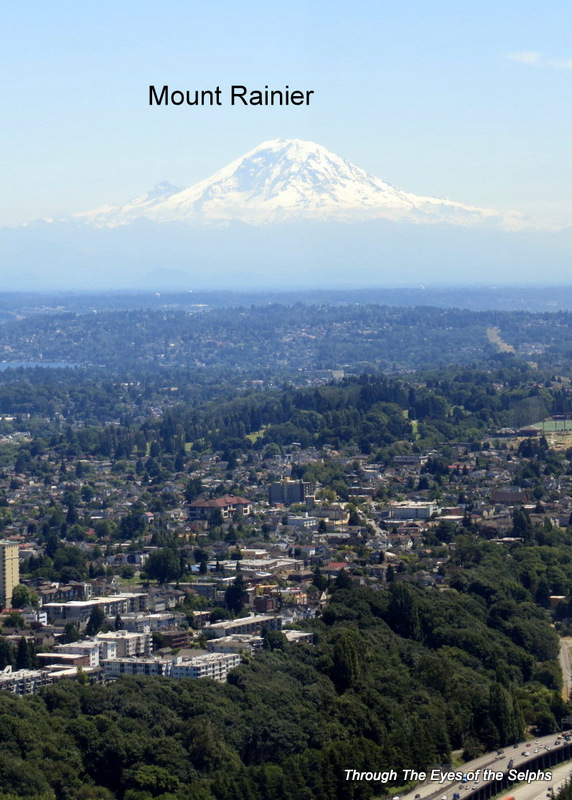
On our first day in the area we drove the Oregon Scenic Byway to see Multnomah Falls about a 90 minute drive from our campground.  On the Washington side of the Gorge we could see Mt Adams and on the Oregon side was majestic Mt Hood.

Zoomed view of Mt Adams in Washington

Zoomed view of Mt Adams in Washington

Mt Hood

Mt Hood

Zoomed view of Mt. Hood

Zoomed view of Mt. Hood

This Scenic Byway was built from 1913-1922 and was considered an engineering marvel at that time.  It was built in such a way as to showcase the waterfalls and beautiful spots through the Gorge and in the words of its engineer “not mar what God had put there”.  As we drove we could see smoke from the wildfires still burning, IMG_1732though they were closer to being contained.  The camp host had warned us this was a very popular attraction so we should avoid the weekend and get an early start.  We followed her advice but when we reached the parking lot for the falls it was full with lines of cars searching for a parking spot.  We ended up playing car tag where one of us would circle the parking lot while the other one would get out and walk up to the falls to take a look and then come back to the car and circle the lot while the other one took a turn.  What a pain!  Regardless, the falls was beautiful.  The upper falls drops 542 feet and the lower falls 69 feet, making it the tallest waterfall in the state of Oregon.  A sign at the waterfall says it is the second tallest year round waterfall in the United States, though some would argue with that distinction. IMG_1736

Multnomah Falls

Multnomah Falls

IMG_1747

A little farther down the road we came to Horsetail Falls which is supposedly in the shape of a horse’s tail.  It has a drop of 192 feet and was also beautiful.  There was not a long line of cars  so it was easier to view the waterfall and less hectic getting pictures.  Near the falls we had a nice picnic lunch in the shade.

Can you find Bill at Horsetail Falls?

Can you find Bill at Horsetail Falls?

Bill determined there was a geocache nearby and we not only found the geocache but blackberries on both sides of the road as far as the eye could see.  We sure wished we had a bucket or a large container in the car but instead filled up a baggie left over from lunch.  I made a delicious blackberry cobbler when we returned home! IMG_1774 IMG_20140808_133232

We then decided to stop at the Bonneville Lock and Dam on the way home.  Bonneville Lock and Dam was built and is operated by the U.S. Army Corps of Engineers and spans the Columbia River, linking Washington and Oregon.  It was the first federal lock and dam on the

8 dams on the Columbia-Snake River drop the water 730 feet

8 dams on the Columbia-Snake River drop the water 730 feet

Columbia and Snake rivers.  Construction began in 1933 and was dedicated by President Franklin D. Roosevelt in 1937.  It cost $88.4 million.  In 1986 it was placed on the National

Bonneville Dam First Powerhouse

Bonneville Dam First Powerhouse

View of the Bonneville Dam spillway

View of the Bonneville Dam spillway

Register of Historic Places.  As we drove in we went through a security checkpoint where a guard asked if we had any explosives or weapons.  Everyone who passes through is asked to open their car trunk for inspection.  They had a very nice visitors center where we watched

Bonneville Dam Visitors Center

Bonneville Dam Visitors Center

Generator turbine

Generator turbine

several interesting movies and looked at displays.  We learned that the dam supplies enough energy to meet the power needs of 900,000 homes.  They had nice observation decks to view the dam as well as the fish ladder.  We were fascinated with the fish ladder which was planned

Bonneville Dam fish ladder

Bonneville Dam fish ladder

by the Corps engineers to allow migratory fish to continue their migration from the sea, upstream to the tributaries of the Columbia and Snake Rivers.  There are actually workers whose job it is to spend all day counting fish!  This information is used by biologists and engineers to track increases and decreases in fish runs.  Between 700,000 and 1.5 million adult salmon and steelhead fish swimming upstream, and between 24 and 43 million salmon and other fish migrating downstream, pass through the Bonneville Dam in an average year!  At one point we went downstairs in the Visitors Center where we were then underwater and watched fish swim in the ladder by looking through underwater viewing windows.  Cool!

the fish ladder as seen from the underwater viewing window

the fish ladder as seen from the underwater viewing window

At the bottom are lampreys, really ugly fish

At the bottom are lampreys, really ugly fish

Diane thinks this fish is really ugly and creepy!

Diane thinks this fish is really ugly and creepy!

On our second day in Oregon the temperature really started to rise and it was around 100 degrees by the end of the day.  Seems the temperatures in Montana, Idaho and Washington were catching up with us.  The main objective for today was to visit the Dalles (pronounced Dowles) Dam which is completely located in Washington state.  We made a reservation for a

Exterior view of the Dalles Dam Powerhouse

Exterior view of the Dalles Dam Powerhouse

tour and headed over to the Visitors Center.  There were twelve of us scheduled for the free tour and a U.S. Army Corps of Engineers employee gave the hour and a half tour.  We were driven by trolley over to the dam where we could actually go inside the facility and see the

Generator room in the Dalles Dam

Generator room in the Dalles Dam

IMG_1818 generators supplying power.  The generating capacity is 1.8 million kilowatts, enough to light up two cities the size of Portland.  Here they had more fish ladders and we could walk on catwalks and see the fish going over or through the ladders.  Yes, they have fish counters here too!  They also had an underwater viewing window and while we were fish watching, a duck swam by!!  The guide did an excellent job of describing what goes on at this dam, which was built over a 5 year period with completion in 1957.  The Dam has a unique design in the shape of a backward “L” which takes advantage of the natural rock formation in the river.

Exterior view of the Dalles Dam fish ladder

Exterior view of the Dalles Dam fish ladder

Dalles Dam fish ladder as seen from the catwalk

Dalles Dam fish ladder as seen from the catwalk

On the way home we drove into the town of Dalles because the town had several murals along Main Street.  Dalles marks the end of the Oregon Trail, a trail known as the source of the greatest peacetime migration in history.  We chose three we particularly liked for the blog. IMG_1824 IMG_1822 IMG_1826  There is a strong Lewis and Clark influence in the state as we drove on roads marked “The Lewis and Clark Trail” and “The Oregon Trail” and we tried to picture what it must have looked like to Lewis and Clark as they paddled through the Columbia Gorge.  It is in this area they bartered with the Indians for horses, and it seems the Indians “saw them coming” so to speak and came out ahead on the deal as they forced Lewis and Clark to barter for three horses, two of which were not good horses in order to get one good horse.  I bet when Lewis and Clark traveled down the Columbia Gorge they must have been wondering where the elusive Pacific Ocean could be!

As we traveled home later in the day we were behind several fire vehicles who had spent the day fighting the nearby wildfires. IMG_20140809_165605 IMG_20140809_165832

August 5, 2014 Montana, Idaho and Washington, Oh MY!

We left Missoula, and with our visit to Glacier National Park completed, we headed once again west and south.  Over the next several months we will gradually make our way back south for the winter.  As we traveled through western Montana we marveled at all the open land with few houses in the distance.  We concluded that people must each own a lot of land since there was so much land and so few homes.  We continued to see cattle and horses on the dry, rocky farmland and little if any crops. It appeared it would take a lot of irrigation to grow much of anything.

I don’t know when, if ever, we have crossed through three states in one day, but we did today as we made our way through Montana, the north western tip of Idaho, and just over the border into Washington.

After one night stops in Spokane Valley and Kennewick where the daily temperatures approached 100 degrees, we headed west and south towards Oregon.  We had planned on staying two or more nights in Kennewick, but the campground was new and had absolutely no shade and we were cooking in the broiling sun.

As we headed west through Washington, we continued to marvel at the difference between eastern and western Washington.  Here in eastern Washington the grass was a golden brown surrounded by steep rocky cliffs.  Occasionally we would see some corn growing in areas where they had worked hard at irrigating the fields.  We saw many power lines, fields of wind turbines called wind farms, and long long trains racing beside us on tracks fairly close to the interstate.  While in Montana, Idaho and eastern Washington we often heard train whistles in the distance during the night.

Eventually we began to see the mighty Columbia River, an important passageway for Lewis and Clark.  This was the beginning of the magnificent Columbia River Gorge, and the reasonIMG_20140807_130851 IMG_20140807_133345 IMG_20140807_141245 IMG_20140807_141231 IMG_20140807_142459 IMG_20140807_141708we came to this area.  But much much more on that later!  As we approached the Oregon border we began to see vineyards appearing, though it appeared that irrigation was still a struggle, as well as field after field of wheat.  We saw the John Day Dam and Mt Adams in the

John Day Lock and Dam was completed in 1971. John Day Lock has the highest lift (110 feet) of any U.S. lock.

John Day Lock and Dam was completed in 1971. John Day Lock has the highest lift (110 feet) of any U.S. lock.

distance and we stopped at an overlook to take a break and snap some pictures.  Mt Adams, at 12,276 feet high is the second highest peak in the Northwest after Mt Rainier.

As we crossed the bridge between Washington and Oregon we caught the first whiff of smoke from the Oregon wildfires burning about thirty miles away.  As we approached our home for the next several days we saw some llamas in a field.

Welcome to Oregon

Welcome to Oregon

We are staying the next several days at a county park in Moro, Oregon.  For the low price of $25 a night we get full hookups with 50 AMP service, free WIFI and cable TV and they have laundry facilities.  Quite a deal!  The only drawback is there is no shade, but the temperatures were 10 to 15 degrees cooler than we left behind in Washington and there was a stiff breeze with gusts of 20 mph so we opened the windows and enjoyed Mother Nature’s air conditioning.  From our campground we can see Mt Hood and Mt Adams in the distance!  While the air appeared smoky in the distance, we could not smell smoke at the campground.  The super friendly camp host came by to greet us and spent about an hour filling us in on all the interesting places to visit in the Columbia River Gorge area.  Later Bill stepped outside and snapped some great sunset pictures which may had been enhanced by the smoke in the distance.

A zoomed view of Mount Hood from our campground just before sunset

A zoomed view of Mount Hood from our campground just before sunset

Our first sunset over the wheat fields

Our first sunset over the wheat fields

July 21, 2014 Fall City, Washington

The night before we were to leave the North Cascades National Park we found out the road east through the mountain was now open.  However we would need to stay one night in the disaster area, and since there was no electricity, telephone service or fuel in the area, we decided to stay with the new plan and take the longer route east.

The camp host came by to chat as we were preparing to leave.  He had been raised by his grandparents, his grandfather being a full blood Comanche and his grandmother a Quaker.  As he said, they made quite a pair!  His grandfather taught him to hunt, ride, fish and act like a man.  His grandmother disciplined him with a ruler in one hand and a Bible in the other.  He had some amazing firsthand stories told to him from his grandfather, especially about how the Native Americans were treated by the U.S. Army as recently as the 1930’s.  It was also interesting to hear about the large amounts of money the Native Americans are now making with all the casinos cropping up throughout the country.  They are using the money to buy back large amounts of land which then become reservations and the land returned to wilderness. They are also using the money to buy gold, oil rights and other mineral rights around the country.  If you look at state maps, especially in the west, you can see more and more reservation land.  We have noticed a lot of casinos west of the Mississippi and have heard from fellow RVers that casinos are a great place to stay overnight.  They allow RVs to park in their parking lots free of charge and they are a safer alternative to a Walmart parking lot.  Also we have found that more and more city ordinances are disallowing parking in Walmart lots overnight.  It was fascinating listening to him and we wished we could have spent more time talking with him.

Along the way, on Washington Route 530, we came to the scene of a tragic mudslide that  occurred in March.  The massive mudslide, covering one square mile, swallowed homes, killing 37 people.  Since the mudslide occurred on a Saturday morning, many people were at home.  The road was closed for two months and today they were still working on clearing the area and the devastation was unbelievable. 20140721_112949 20140721_112938

We arrived at a private campground for a two night stay and even though there was heavy tree cover, Bill was able to find a campsite where we could get TV satellite reception.  The next day we drove a short distance to Snoqualmie Falls, a waterfall that cascades 268 feet over granite cliffs.  To the Snoqualmie People (People of the Moon), who have lived for IMG_1471

centuries in the Snoqualmie Valley, the Falls is a traditional burial site where prayers are carried up to their Creator by great mists that rise from the powerful Falls.  They believe the mists rising from the base of the waterfall connects Heaven and Earth.  To them, supernatural powers permeates all life and most things possess spiritual power.  They believe the whole universe should be revered and is worthy of respect.  Today it is still a site of significant importance to the Snoqualmie people.  The Falls served as an important natural fort for the Snoqualmies from raiding canoes and enemies since the Falls are surrounded by three very high vertical cliffs.

Most of the water in the Falls comes from mountain snow and feeds into the Falls from the Snoqualmie River.  The valley area gets an average of 61 inches of rain a year and the mountains 105 inches, mostly between October and March.

Geologists also recently discovered that the Falls flow over a 20 million year old extinct volcano.  The geologists based their conclusion on the presence of “volcano bombs” which is heavy material that cannot travel far from the volcano site as well as the fact that the entire Falls area is dominated by lava flows which don’t move far from the volcano.

Snoqualmie Falls was shown in the TV show “Twin Peaks”.  The property, owned by Puget Sound Energy, is on the National Register of Historic Places because of its association with the Snoqualmie people.

Snoqualmie Falls was first used as a power plant and a source for hydro electrical power in 1899.  Today the water is diverted from the river for two nearby generator plants.  Generator Plant Two alone has a capacity of 40,700 kilowatts.

We grabbed a geocache at the Falls and a couple more on the way back.  We also saw a really neat totem pole at the entrance to the city limits.  The totem pole is 43 feet tall and depicts the Native American story of the Raven creator Quq who according to legend placed IMG_1477the moon-child in the sky so fishermen would have light to spear salmon at night.  The totem pole was carved from an old growth cedar by H.H. Hinds for his sweetheart and was erected in 1934.  The totem pole is unique because it is carved all the way around instead of only on one side, and because it was carved by a white man.  When the pole blew down in 1964 during a violent windstorm, serious rot was discovered and it wasn’t put back up until 1967.  In 1981 it was taken down and determined to be unrepairable.  From 1997 to 1999, the pole was restored by a team of people, including a local Boy Scout Troop, and was once again installed in 2001 where it has now stood off and on for 80 years. IMG_1475

We really enjoyed our time in Fall City but it was only a two night stop and it’s time to move on towards Glacier National Park!

July 7, 2014 Federal Way, Washington, part 1

We prepared to leave Mount Rainier and head north towards Seattle.  While we enjoyed our time “off the grid”, we were looking forward to once again having cell phone service, internet, and yes, satellite TV.  This is not a vacation but a lifestyle, so we need internet access to check credit card activity, pay bills online, and stay in touch with family and friends.  We also missed having access to news and weather via TV.

Our last day at the campground we met a couple from Holland.  They flew into San Francisco, rented an RV from Camping World, and are now exploring the western U.S.  They plan to be in Vermont in time to see the leaves change in the fall and then travel down the East Coast to Key West before returning the RV in Miami and flying home.  He flew fighter jets at one time and was a pilot for British Airways.  It was interesting talking with him but also alarming to hear him say it is so cheap for them to do this in the U.S. but would be much more expensive for us to do the same thing in Europe because their pound is worth so much more than our dollar.  At one time they were almost even in value.  So far we have met couples from Australia, Germany and Holland RVing around the United States.

On our way out of the park we noticed a “Volcano Evacuation Route” sign.  Now we have seen “Hurricane Evacuation”, Tsumani Evacuation” and “Volcano Evacuation” route signs!  20140707_115148-1After a short trip north we arrived at Dash Point State Park.  The sites were pretty close together but we had good cell phone service, satellite TV, and it was a short drive to Seattle where we planned to do some sightseeing.

Instead of the Space Needle we decided to go to the Sky View Observatory at Columbia Center.  Located on the 76th floor, it is twice as tall as the Space Needle and the tallest observatory on the west coast and the second tallest building west of Chicago.  It is 932 feet tall and stands  1,043 feet above sea level.  It provided us with a 360 degree view of Seattle and the surrounding area including Mt Baker, Mt. Rainier, the Cascades, the Olympic Mountains, as well as the Seahawk stadium.  The day we went was relatively clear so we had a great view.

20140708_133806

Seattle skyline as we drove into the city

IMG_1226


The Seattle ball fields/stadiums

The Seattle ball fields/stadiums


IMG_1216


IMG_1219 IMG_1224


IMG_1218 IMG_1217


Bill was in his glory as we visited several technology and aviation museums.  One was the Museum of Flight where he was able to go aboard a Concorde as well as the Air Force One used by Eisenhower, Kennedy, Johnson and Nixon, including the place where Johnson stowed his Stetson.  He saw a M-21 Blackbird spy plane and a F/A-18 Hornet.  He also saw the world’s first fighter plane, the only one of its kind in the world, as well as artifacts from the original Boeing factory including the first Boeing 747, aircraft from World War I and II.  The museum included exhibits from the space age including a Russian Soyuz spacecraft.

IMG_1257 IMG_1246IMG_1228

The presidential air force one

The presidential air force one

Air force one where Johnson hung his stetson hat

Air force one where Johnson hung his stetson hat


One of twenty concorde aircraft

One of twenty concorde aircraft

IMG_1236 IMG_1235

Interior of the concorde airplane

Interior of the concorde airplane

The cockpit of the concorde airplane, notice the MACH Meter under the right side steering wheel

The cockpit of the concorde airplane, notice the MACH Meter under the right side steering wheel

IMG_1240 IMG_1239 IMG_1238

The F-4 fighter jets established many records

The F-4 fighter jets established many records


I helped train crews for the F-4 fighter jet

I helped train crews for the F-4 fighter jet

IMG_1274

Wernher von Braun, known as the "rocket boy", was the genius behind the USA Saturn rockets and spoke at my graduation in Jacksonville in 1973

Wernher von Braun, known as the “rocket boy”, was the genius behind the USA Saturn rockets and spoke at my graduation in Jacksonville in 1973

John C Houbolt is the american engineer credited for the "Lunar Orbit Rendezvous" mission technique

John C Houbolt is the american engineer credited for the “Lunar Orbit Rendezvous” mission technique

With the help of automobile assembly techniques Boeing was able to make 35 B-17s in three days!!!

With the help of automobile assembly techniques Boeing was able to make 35 B-17s in three days!!!