Monthly Archives: May 2015

May 29, 2015 Trinidad Lake State Park, Colorado

Driving from the Albuquerque area we made the short drive to Springer, New Mexico for a one night stay.  Before heading to Colorado the next morning we drove to the Philmont Boy Scout Ranch in Cimarron, New Mexico.  IMG_20150528_112318Bill had been looking forward to visiting Philmont for a long time.  In 1938, an oil magnate who was very impressed with boy scouts who visited his ranch, donated 35,857 acres of land to the Boy Scouts of America.  IMG_20150528_101515Today the Philmont Boy Scout Ranch, whose name is derived from Waite Phillips who gave them the land, is a National High Adventure Base where Boy Scouts take part in backpacking expeditions and other outdoor activities.  It is one of the largest youth camps in the world in land with over 23,000 Scouts and adults leaders visiting each summer between the beginning of June and middle of August.  IMG_20150528_101711While we were there Bill toured their Philmont Museum and Seton Memorial Library.  The only documented Tyrannosaurus Rex track in the world was discovered within the camp’s boundaries in 1993. We noticed that the Santa Fe Trail ran thru the ranch.IMG_20150528_110832

On the way to Colorado we stopped in Raton, New Mexico at the NRA Whittington Center,  the largest and most complete shooting and hunting complex in the United States.  Bill was able to spend some time doing some pistol shooting practice.

As we passed through the end of the dusty plains of New Mexico into Colorado we were met with the green mountains to our west and the sight of even more snow capped mountains. We climbed and dropped in elevation until arriving at Trinidad Lake State Park (elevation 6300 ft) outside of Trinidad, Colorado.  The 800 acre Trinidad Lake was created in 1978 when the U.S. Army Corps of Engineers built a dam.  The Trinidad Lake State Park is a very popular area for fishermen.IMG_20150528_161412

While there we drove into the small town of Trinidad and did a bit of sightseeing.  We visited a statue of Christopher (Kit) Carson an American frontiersman and found a geocache nearby.  IMG_20150529_153149We drove a dirt road to the top of Simpson’s Rest, a sandstone bluff on a mountain with great views of Trinidad, Purgatoire Valley and the Sangre De Cristo Mountain Range, part of the Rocky Mountains.  It was amazing to see the combination of rolling prairies, hills and mountains.  Across those prairies the pioneers and traders traveled along the Santa Fe Trail.  This trail wound through what is now downtown Trinidad and across the mountainous Raton Pass which we crossed over on the way to Trinidad.  On the top is a Trinidad sign which lights up at night as well as the grave marker of George S. Simpson.  IMG_20150529_160950Simpson was a famous trail blazer, scout, trader and explorer in the area.  Legend says that in 1867 Simpson was confronted by warring Ute Indians.  He fled up the sandstone bluff and hid for three days.  He was thankful for the sandstone bluff that saved his life and requested to be buried there.  Simpson is credited with the first discovery of gold in Colorado which led to the famous 1859 Rush to the Rockies.IMG_20150529_160400

We stopped by the town’s Mount San Rafael Hospital to see a 28 by 12 foot ceramic mural designed and created by a nun, Sister Augusta Zimmer.  The history of Trinidad is depicted in the beautiful mural.IMG_20150529_162912

We enjoyed our time in Trinidad and it is always fascinating to see the history found in these small towns in America!

May 24, 2015 Albuquerque, New Mexico

Sunday we made the short drive to Old Town Albuquerque.  This area was not as large as Old Town Santa Fe and was mainly restaurants and souvenir shops.  Both Old Towns had a central Plaza where tourists seemed to gather to listen to live music or magic shows.  In both Old Town Santa Fe and Old Town Albuquerque we saw chilies hanging to dry.  Chilies are a staple in IMG_20150524_123529IMG_20150524_122828

IMG_20150524_123111
Chilies hanging everywhere
IMG_20150524_123748

San Felipe De Neri, oldest church in Albuquerque, serving since 1706

IMG_20150524_131937almost every southwest dish.  Bill enjoyed chatting with two men who served in World War II as Navajo Code Talkers.  They were signing copies of their book.  During World War II the Japanese were able to intercept radio military communications so Navajos spoke their own code in the Navajo language and the Japanese were unable to break the code.

Saturday while on the way to Santa Fe we stopped by the Sandia Peaks Aerial Tram.  Since it was a Saturday and a holiday weekend there was a three hour wait to ride the tram so we decided to return Tuesday.  On Tuesday there was barely a line and we were able to get on the next tram.  We don’t know why they call this a tram since it seems much more like a gondola to us.  It is advertised as the world’s longest single span aerial tramway.  We rode 2.7 miles across deep canyons with rocky walls to the top of the Sandia Peak at an elevation of 10,400 feet.  It was much colder at that elevation and we had a view of 11,000 square miles, including Albuquerque in the distance.  This is a double reversible passenger aerial tramway so we passed another tram both going up and coming down.IMG_20150526_105611IMG_20150526_105759IMG_20150526_113729PANO_20150526_112314IMG_20150526_110448IMG_20150526_112925IMG_20150526_114440IMG_20150526_115432IMG_20150526_115826

Also on Tuesday we drove to Petroglyph National Monument.  Here they have the world’s largest accessible collection of prehistoric rock art.  There are more than 17,000 ancient petroglyphs carved into the remnants of boulders of dormant volcanoes by Native American and Spanish settlers 400 to 700 years ago.  The monument was established in 1990 to protect the petroglyphs and surrounding area.  No, we did not find all 17,000 petroglyphs, but Bill did take pictures of a few.IMG_20150526_132658IMG_20150526_135517IMG_20150526_135829IMG_20150526_140657IMG_20150526_141240IMG_20150526_135900

May 23, 2015 Santa Fe, New Mexico

We made the short drive from Los Alamos to our campground in Bernalillo right outside of Albuquerque.  We had a nice long pull through site with our own ramada.  We noticed in the southwest and Mexico it is quite common to have these ramadas, but it is not everyday each campsite gets their own. IMG_20150525_160149 We planned on staying here five nights to explore the Albuquerque and Santa Fe area.

One day we drove into Santa Fe, which is the oldest capital city in the country (1610) and also the capital city with the highest elevation (6,989 ft).  Santa Fe has the nickname “The City Different” and it truly IMG_20150523_122225looks very different from any other city in the country.  Thousands of years ago the Pueblo Indians used adobe, a mixture of earth, straw and water which was shaped into bricks and dried in the sun.  In 1912 a code was passed requiring the use of a style called Spanish Pueblo Revival which meant an architecture of earth-toned, flat topped buildings, wood beamed ceilings and doors and window frames painted white or turquoise.  Most of the buildings are stucco that resemble IMG_20150523_153536adobe called non-authentic adobe.  Consequently everything in Santa Fe looks adobe, including McDonald’s!  They also have a regulation that no building can be taller than three stories, or the height of the cathedral.

We concentrated our time in the Old Town section of Santa Fe.  We began by taking aIMG_20150523_130410 90 minute trolley tour that gave us a nice history of the town and took us to some areas we may not have found on our own.  We rode past a statue of Sacagawea, IMG_20150523_124114IMG_20150523_123636IMG_20150523_124811some interesting art and metal work, and ended up at a huge bronze replica of a stagecoach on the Santa Fe Trail.  This section of New Mexico is full of information on the Santa Fe Trail and there are signs everywhere showing where the trail came through.  Likewise there are signs denoting Historic Route 66 along the roadways.

The Palace of the Governors was built inIMG_20150523_134742IMG_20150523_122621 1610 and is considered one of the oldest public buildings in the U.S.  Along the sidewalks around the building you find many Native Americans selling handmade items.  Our tour guide said they have to show up very early in the morning to participate in a lottery system to get a spot on the sidewalk amid the tourists.

The San Miguel Mission Church, constructed in 1610, is thought to be the country’s oldest active church.IMG_20150523_123110

The beautiful Cathedral Basilica of St Francis of Assisi is one of the few buildings in the city that is not adobe.  Since it was a Saturday the church bells were frequently ringing as one wedding ended and immediately limousine doors would open and another bride emerged to enter the church.IMG_20150523_134308IMG_20150523_145041IMG_20150523_145208

Santa Fe was a very unique town and we really enjoyed our time there.


May 20, 2015 Los Alamos, New Mexico

We left Mancos, Colorado and drove five hours to White Rock, New Mexico just outside of Los Alamos.  There is plenty of nothing between Mancos and White Rock in the way of towns, but the scenery was beautiful.  Southwest Colorado looks very much like New Mexico.  The snow capped Jemez Mountains provided a gorgeous backdrop to the towering red rock formations in northern New Mexico.IMG_20150519_143826IMG_20150519_143837IMG_20150519_144041IMG_20150519_144517

We arrived at the White Rock RV Park which is located next to the White Rock Visitors Center. The park only provides electrical hookups, but since we had originally planned on dry camping in the area and the nights were cold, we were very thankful for the electricity.

We had two main reasons for visiting this area.  One reason was to visit Bandelier National Monument.  Established in 1916, this park is one of the National Park Service’s oldest sites.  Evidence of Ancestral Pueblo people is shown by petroglyphs, multi-story adobe dwellings and dwellings in the rock cliffs going back over 11,000 years.  The park is made up of over 33,000 acres of canyons and mesas.  The Rio Grande River, a mere trickle now, flowed nearby.  To reach the park entrance you have to drive up an elevation change of 1,000 feet and then down 800 feet to the visitor center.IMG_20150520_123526

We first stopped by the Visitors Center in Frijoles Canyon to see a movie about the park.  They had a large area of exhibits about the Pueblo people.  We noticed on the time lines they had BCE or CE after the dates.  I walked over and asked one of the rangers about the initials.  He told us the initials BCE stood for Before Common Era and CE stood for Common Era and those initials now took the place of BC and AD.  Bill and I both found that troubling and will make a point from now on to see what appears on other park displays around the country.

We walked the main loop trail that took us past the remains of ancient homes called the Tyuonyi Village.  IMG_20150520_134508IMG_20150520_135632IMG_20150520_135647IMG_20150520_141119Starting in approximately 1150 AD, the Ancestral Pueblo people began to build homes in this area, the Pajarito Plateau. The interesting walk included walking up and down stone steps through narrow passages which led us to cliff homes built into the rock face.  IMG_20150520_141219We could climb ladders into the homes like the Pueblo did thousands of years ago.  By the mid 1500’s the Ancestral Pueblo deserted these homes and moved further south along the Rio Grande. One thing we especially noticed was the pumice appearance of the rocks in the cliff face.IMG_20150520_140823IMG_20150520_140854IMG_20150520_141440IMG_20150520_141447

IMG_20150520_142522

This is a back wall of a three story high adobe dwelling

By the way, the park is named for Adolph Bandelier, an anthropologist who studied and explored much of the southwest.

Our second reason for visiting the area was to learn more about the Manhattan Project.  It was in Los Alamos that some top scientists and engineers, led by J. Robert Oppenheimer, perfected new nuclear technologies in World War II that led to the world’s first atomic bombs.IMG_20150521_160636

Formerly the Los Alamos Ranch School, established in 1917 and closed in 1943, the buildings and roads from the school were just the right remote location for the United States Government’s Project Y of the top secret Manhattan Project.  “One way the Los Alamos school differed from other health schools at the time was its integration with Boy Scouts. Boys in the school belonged to Los Alamos Troop 22, the first mounted scout troop in the country and now one of the nation’s oldest continuous troops.” see History of the Los Alamos Ranch SchoolIMG_20150521_120129IMG_20150521_115616

We made the short drive from our campsite at White Rock up another 1,000 feet in elevation to the mesas of Los Alamos and first toured the Los Alamos Historical Museum with several rooms of exhibits and artifacts of Los Alamos from the times of the Ancestral Pueblo to the Manhattan Project, with emphasis on the latter.  IMG_20150520_154001IMG_20150521_122204We then drove to the nearby Bradbury Science Museum, a magnificent and impressive museum with movies and over 40 interactive exhibits on the Manhattan Project and the ongoing science and research of Los Alamos National Laboratory. IMG_20150521_153706There were three main galleries focusing on Defense, Research and History.  In the Defense gallery they had models of Little Boy and Fat Man, the first nuclear bombs dropped on Japan that ended World War II.  IMG_20150521_152007IMG_20150521_152042IMG_20150521_151014A movie told us about the Los Alamos National Laboratory and its current mission to maintain the country’s aging weapons without nuclear testing.  In the History section of the museum we saw an excellent movie about the Manhattan Project and Los Alamos from 1942 to 1945 that showed us what life was like back then.IMG_20150521_151503

We have visited many museums over the years and almost all of them have charged an admission.  Both the Los Alamos Historical Museum and the Bradbury Science Museum were free of charge.  The Bradbury Science Museum is funded by the Department of Energy, so I guess we are paying admission in a round about way!

Located today in Los Alamos is the Los Alamos National Laboratory.  The facility is called one of the premier scientific institutions in the world.  It has an annual budget exceeding $2 billion, has 2,100 individual facilities across 38 square miles of Los Alamos, and employs 11,000 people.  The Lab is operated for the U.S. Department of Energy by Los Alamos National Security.  The core mission of the Laboratory is national security in regard to ensuring the safety and reliability of nuclear deterrent, reduce the proliferation of weapons of mass destruction and to counter terrorism.

There are no tours of the Laboratory and security around the facility is tight.  When we were driving from Bandelier National Monument back to our campsite the road took us through land owned by the Lab.  As we were exiting the area we had to go through a checkpoint where Bill had to show his driver’s license and explain where we were going.  The guard then said, “Do you vouch?” Bill said, “What?????” The guard then said, “Do you vouch for your passenger?” Strange.  Why didn’t he just ask for my driver’s license too!

We enjoyed our time in the White Rock/Los Alamos area.  We found the drivers to be especially courteous and the people friendly.  We loved our campsite where we could look out the windows at snow capped mountains.  The weather was chilly during the day and cold at night.  During our time there we had some very heavy rain and a few thunderstorms, one of which presented us with a gorgeous rainbow.PANO_20150521_192044

May 14, 2015 Mesa Verde National Park, Colorado

We left Gallup and made the long drive to Mancos, passing from New Mexico into Arizona and then into Colorado.  IMG_20150514_115208We stopped at the Four Corners Monument which is owned and managed by Native Americans since it is on their land.  They charge a $5.00 fee per person to enter the area.IMG_20150514_133410

Four Corners is the only place in the United States where four states meet; Arizona, New Mexico, Utah and Colorado.  There is a concrete memorial at the site, provided by the Bureau of Indian Affairs, with the seal of each of the four states as well as their state flags.  This site is also the boundary between two Native American governments, the Navajo Nation and the Mountain Ute Tribe Reservation.  Navajo and Ute artists have items on display.IMG_20150514_134707

One interesting plaque states that the first surveyor determined the location of the four corners.  Later a second surveyor determined the location was over 1800 feet off and wanted to change the four corners location.  A joint resolution by Congress in 1908 to move the monument was vetoed by President Theodore Roosevelt and a lawsuit filed in 1919 also failed.  “In surveying, monuments rule”.  (Quote from National Geodetic Survey organization). The monument disc has been at that location for a century and a quarter and all parties have accepted it.IMG_20150514_135819IMG_20150514_140109

We left Four Corners Monument and headed to our campground at Mancos.  The campground was fairly deserted and not long after we arrived it began to rain.  For the next two days we had rain, thunder, lightning and hail.  We used the time to make some summer reservations and work on the blog. IMG_20150515_191328 We did have a nice view out our front window of Point Lookout located in the national park.IMG_20150517_104326

IMG_20150517_110731

La Planta Mountains, Colorado

Our last day in Mancos the sun was shining and we were able to visit Mesa Verde National Park, our main reason for coming to Mancos.  Our campground was conveniently located across from to the entrance to the park.IMG_20150517_110223

After stopping by the Visitors Center we began the 20 mile drive into the park.  This national park was created in 1906 for the purpose of preserving the archaeological heritage of the Ancestral Pueblo people and is the only national park with such a purpose.  The park includes over 4,500 archaeological sites of which 600 are cliff dwellings and is a World Heritage Site.IMG_20150517_110940

IMG_20150517_152209

Cliff Palace

IMG_20150517_165027

Spruce Tree House

The Ancestral Pueblo people made this area their home for over 700 years from 550 AD to 1300 AD.  From 1200 to 1300 AD the Pueblo people began to build their villages beneath overhanging cliffs.  Their main construction material was sandstone that they shaped into rectangular blocks about the size of a loaf of bread.  Mortar between the blocks was a mixture of dirt and water.  Around 1300 AD they abandoned this area.  The reason is a mystery though historians suspect a severe prolonged drought forced them to leave.  We are fortunate to be able to see the remains of these cliff dwellings today.

The park has an excellent movie about the Pueblo people and many rooms of exhibits, displays and artifacts.

May 12, 2015 Gallup, New Mexico

We enjoyed our drive through the Painted Desert and passed into New Mexico with amazing views of painted desert rocks.  IMG_20150512_152527We arrived at Gallup, a nice little town of 20,000 people, often called the “Indian Capital of the World” because of its location in the heart of Native American lands and the presence of Navajo, Zuni, Hopi and other tribes.  One third of the city’s population has Native American roots.  Gallup was founded in 1881 because of its ties to the Atlantic and Pacific Railroad.  Historic Route 66, which John Steinbeck called “the Mother Road, the road of flight” and is the country’s most famous highway, passes through Gallup.IMG_20150512_152539IMG_20150512_152926IMG_20150512_152835

In 2013 Gallup was named the “Most Patriotic Small Town in the United States”.  They are very proud of this designation as shown by all the banner flags lining the streets.  We found the people in Gallup to be very friendly and helpful.  The historic downtown area of Gallup has twelve murals painted on buildings throughout downtown, many with a Native American theme.IMG_20150513_171603

Our main purpose for visiting Gallup was to visit Red Rock Park on our way to Four Corners.  Formerly a state park, Red Rock is now maintained by the city of Gallup.  We were able to camp there with beautiful views of the red rock cliffs.  The red rock cliffs formed over 200 million years ago.IMG_20150513_194002

IMG_20150513_165030

Pyramid Rock

IMG_20150513_164051

Church Rock

IMG_20150513_164219IMG_20150513_164150


May 11, 2015 Petrified Forest and Painted Desert, Arizona

We left Winslow and made the short drive to Holbrook, Arizona.  We had heard about a gift shop right near the South entrance to Petrified Forest National Park that had free dry camping or electric RV sites for $10.00.  We got there early enough to get one of their electric sites and after getting the RV all settled we drove our car into the park.IMG_20150511_134640

During the Triassic period over 200 million years ago, northeastern Arizona was located near the equator where the country of Panama is today.  This region was located on the southwestern edge of the earth’s largest existing land mass, Pangaea.  The tropical climate and environment was very different from what you find in this part of Arizona today.  After the super continent broke apart into today’s continents, Arizona was located in a place with the dry, arid environment we know today.  Fossils and beautiful petrified wood which are evidence of the environmental changes are found in the Petrified Forest National Park.

During the tropical time period, rivers and streams flowed through the area and in this lush tropical landscape trees up to ten feet in diameter and over two hundred feet tall grew.  Over time the trees died or were knocked down and carried by wind and water downstream.  Along the way branches broke off and tree trunks came to rest on river banks.  Most decomposed and disappeared but some of the trees were petrified.  The logs were buried in sediment, ash from volcanoes was carried by the wind and settled in the sediment.  This solution filled the cells of the logs, crystallizing as mineral quartz.  Iron and other minerals combined with the quartz during the petrification process creating brilliant rainbow colors.

About 60 million years ago the region was uplifted by earthquakes and tectonic movement and became part of the huge Colorado Plateau.  During this movement petrified logs were exposed.  Erosion today continues to wear away the land and expose more logs, while freezing and thawing over time break down the already exposed logs.IMG_20150511_171033

While petrified wood is found in every state and many countries, this is the largest and best preserved concentration of petrified wood in the United States.  There are signs throughout the park warning people not to remove any wood from the park, including the threat of prosecution if you do so.  Before the National Park Service took over the park many people came in and removed many logs, including digging for logs, crystals and gems.  We saw where much of the same vandalism had occurred at the Hopi dwellings at Homolovi State Park near Winslow.  Another sad example of this was at an area in Petrified Forest National Park called “Crystal Forest”.  They had a nice paved walkway that led among the petrified logs.  A sign said at one time the logs glistened in the sunlight with amethyst and quartz crystals.  But no more since vandals removed almost all the crystals from the logs.IMG_20150511_145804IMG_20150511_145755IMG_20150511_171217

Paleontologists have studied fossils in the park since the 1920’s, finding one of North America’s earliest dinosaur fossils.

While in the park we stopped by the Visitors Center where they had a large area with paved walkways through the largest area of petrified wood.  I took Bill’s picture beside one log known as ” Old Faithful”, the most massive log in the park.IMG_20150511_145054IMG_20150511_144628IMG_20150511_150857

IMG_20150511_155251

These look like teepees

We drove part of a 28 mile road through the park with beautiful views of the Painted Desert, stopping at various viewpoints along the way.IMG_20150511_164719IMG_20150511_163925IMG_20150511_163831IMG_20150511_162145

When we arrived back at the gift shop, quite a few campers had joined us for the night.

The next morning we headed to our next stop, Gallup, New Mexico.  We chose the route that took us through the Petrified Forest National Park and we were able to complete the rest of the 28 mile drive which took us through more of the Painted Desert.  The colors were beautiful, with colors coming from bands of sediments deposited during the Triassic period millions of years ago.  The effects of millions of years of erosion, earthquakes and uplifting was evident.IMG_20150512_133338IMG_20150512_132054

Such an incredibly beautiful place!

May 8, 2015 Winslow, Arizona

Driving from the Grand Canyon to Winslow AZ turned out to be more of an adventure than we expected.  As we were preparing to move from the park we were surprised to see an occasional snow flurry.  As we drove towards Flagstaff at an elevation of 7,000 feet, what started as a steady rain quickly turned into snow with the temperature hovering just above freezing.  The snow followed us to Flagstaff where we stopped for gas and lunch.  The dark threatening clouds made us eager to eat fast and get back on the road.  The snow eased up as we descended into Winslow with an elevation just under 5,000 feet.  However the snow was replaced by winds averaging 35 mph at our campground at Homolovi Ruins State Park.  Bill had to strain to push the door open against the wind while I got out.  We checked in at the Visitors Center and proceeded to our site.  Even with the jacks down the wind really buffeted us until the wind calmed down at sunset.  At one point clothes hanging inside on a hook were swaying back and forth from the force of the wind hitting us.

At this campground we are truly in a desert environment with sand, scrub bushes and signs warning of venomous snakes and insects.

The tiny town of Winslow, surrounded by Navajo County, surprisingly had a Walmart Supercenter.  Do you recognize the name Winslow?  It was made famous in the Eagles song “Take It Easy” with the lyrics “Well I’m a standing on a corner in Winslow, Arizona and such a fine sight to see, It’s a girl, my Lord in a flatbed Ford slowin’ down to take a look at me….”. In the middle of town is a statue of a guitar playing guy with the backdrop of a Ford flatbed truck with a girl inside.  Parked on the curb near the statue is a real Ford flatbed truck.  Across the street is a gift shop displaying souvenirs of the guy standing on the corner.  Route 66 runs through this part of Arizona and Route 66 souvenirs are everywhere.IMG_20150509_154913

IMG_20150510_143728

This model represents what it looked like in the 14th century

The Homolovi Ruins State Park has two archeological sites dedicated to preserving the homeland of the Anasazi and Hopi people who first came here between 1260-1400 A.D. The Hopi people today still consider this their homeland and make pilgrimages  to these sites.  This state park was established for the purpose of protecting these sites and the idea was supported by the Hopi people.  The park opened in 1993.

We visited the largest of the two archaeological sites.  Despite a nice paved walkway to the site, there is really not much left to see except some small remains and shards of pottery.IMG_20150510_141732IMG_20150510_142213IMG_20150510_142200

We drove to the Meteor Crater Discovery Center to see the best preserved meteorite impact site on Earth.  50,000 years ago a meteor which had been hurtling through space for 500 million years, crashed into the earth.  The impact left a crater nearly a mile across and more than 550 feet deep.  The crater is so large that a 60 story building would not reach the rim.  It is large enough to hold 20 football games with two million fans watching on the crater walls.  Because the terrain so closely resembles that of the moon and other planets it was once used as an official training site for NASA Apollo astronauts.IMG_20150510_114926IMG_20150510_114905

The Discovery Center had an interesting movie which simulated how the impact may have occurred when the  crater was formed as well as many interactive displays and artifacts.  We were able to see and touch the largest meteorite fragment found at the crater.  In the beginning geologists and scientists determined that the crater was formed by a volcano. After many years new scientists proved the crater was formed by a meteorite and not a volcano.  It was interesting to read that scientists think a meteorite crashing into the earth millions of years ago was the probable cause of the extinction of the dinosaurs.  It is believed the impact in Mexico caused an “impact winter” which eliminated plant and animal life.PANO_20150510_114748

They had two outside viewing areas, an upper and lower deck.  It was difficult to get a picture of the entire crater in one picture.  The site has been designated as a “Natural Landmark” but is privately owned.  As far as we could tell access to the crater is limited to the two observation decks and a paved trail around the rim.

You just never know what you will find in the Arizona desert!

May 5, 2015 Grand Canyon National Park, Part 4

We continued to explore more areas of the park.  It is a huge park with so much to see.  We rode the shuttle bus to the western most point of the park which is only accessible by shuttle bus.  Our first stop was Hermit’s Rest.  In the early 1900’s a French Canadian took up residence in the canyon for twenty years and became known as “the hermit of the Grand Canyon “.  He ended up being a valuable source of information and one of the area’s primary guides.  Hermit’s Rest is named in his honor.  The building is one of seven in the park designed by southwestern architect Mary Jane Colter.  She is known for her Native American architecture and use of materials from the area.IMG_20150505_152001IMG_20150505_152414IMG_20150505_143648IMG_20150505_152759

We hiked part of the way along the Rim Trail and found a few geocaches before hopping back on the shuttle bus.  We were very impressed with the park shuttle bus service during our time in the park.  The bus drivers were friendly and helpful and the buses punctually arrived at convenient stops every 10 to 15 minutes.  Considering it was sometimes standing room only on the buses, they were well utilized by tourists visiting the park.IMG_20150505_152827IMG_20150505_155307IMG_20150505_155318IMG_20150505_155645IMG_20150505_161340IMG_20150505_161550IMG_20150505_161656IMG_20150505_172719IMG_20150505_175119

We stopped at Powell’s Point which is named after Major John Wesley Powell, the first explorer to journey down the entire length of the canyon on the Colorado River in 1869.  This feat is even more amazing considering he lost an arm during the Civil War.  He began the journey with nine men and four wooden boats.  Several months later he completed the trip with five men and one boat.  Several men had deserted the group along the way and were never heard from again and four of the boats had broken up.  Powell made a second trip in 1872.  There is a large monument to Powell and his men at Powell Point.IMG_20150505_181902IMG_20150505_181724

I think the western viewpoints are among the prettiest in the park and we had great views of the Colorado River from the rim.  The Colorado River is one of the only rivers in the world that classifies its rapids on a scale of 1 to 10 instead of 1 to 6 like other rivers.  There are many rapids in this part of the Colorado River with the Lava Rapid being the highest rated commercially run rapid in North America.  The majority of the rapids in the Grand Canyon are caused by debris that is funneled into the river from side canyons.

Another day we drove to the eastern end of the Grand Canyon.  Shuttle bus service does not extend this far.  Along the way we saw a large male elk feeding alongside the road and several other elk close by.  IMG_20150506_135250At the eastern end we visited the Desert View Watchtower, another Mary Colter design and one of the most prominent architectural features in the park.  Built in 1932, it is modeled after ancient Pueblo watchtowers found in the Four Corners region.  The tower is 70 feet tall and since it is the highest point in the South Rim, it provides stunning 360 degree views.  The inside of the tower was amazing with a staircase climbing to the top and walls displaying petroglyphs and murals by a Hopi artist and crafts by local Hopi artisans.IMG_20150506_150228IMG_20150506_144705IMG_20150506_143218IMG_20150506_142701

On the way back from the Desert Tower we stopped at several rim viewpoints.  Here are some pictures from the Grandview Point including a video.

use this if you don’t see the above video “https://www.youtube.com/watch?v=XoXj2VUueks&feature=youtu.be”

IMG_20150506_155119

On our last day in the park we hiked three miles with an elevation drop of 500 feet into the canyon on the Bright Angel Trail.  We had really hoped to do more hiking and biking while at the Grand Canyon, but we both had colds/allergies that lingered for over two weeks, and with the 7,000 foot altitude, we were just not up to it.  But by the last day we were feeling better and were determined to hike a little of the famous trail.  The day was a little cool and windy but had bright blue skies.  The trail is great and the same one is used to take visitors down by mule.  The hike down was fairly easy but the hike back up took twice as long.  We passed two really cool tunnels.  I loved the camaraderie of the people hiking the trail of all ages and fitness levels.  People greeted each other in passing and often asked how far they were hiking or if they had returned from hiking to the river.  We recognized those planning to hike to the river and back since they had large backpacks with supplies.  There were signs warning hikers not to attempt to hike down and back in one day due to the strenuous nature of the hike.  It usually takes half a day to hike to the bottom and a full day to hike back up.IMG_20150507_114638IMG_20150507_115730IMG_20150507_124649IMG_20150507_125323IMG_20150507_131548

Our ten days went by much too quickly and the park is on our list of places to return to someday.

May 1, 2015 Grand Canyon National Park, Part 3

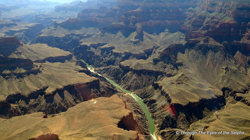
Here are the rest of the helicopter ride pictures.

We were able to see parts of the Grand Canyon from the helicopter that we would not have been able to see from the rim level.  Bill was able to get some amazing pictures from the window of the helicopter in spite of a glare from the sun.IMG_0040IMG_0047IMG_0048IMG_0049IMG_0055

As we flew back towards the airport the song “Drops of Jupiter” played in our headsets.  This was such an amazing experience for both of us and one we will never forget.  We can’t wait to take another helicopter ride!IMG_0063IMG_0067IMG_0074IMG_0079IMG_0080IMG_0087IMG_0090IMG_0091