Category Archives: Waterfalls

waterfalls

Provo, Utah May 20, 2020

We left Panguitch a day late due to high winds with gusts of 55+ mph forecast for the area. We had to drive back over the pass towards Salt Lake City and didn’t want to do that with extreme winds. 

Our next stop was in Provo, pop 119,000 about 45 miles south of Salt Lake City. We were once again treated to beautiful views of snow capped mountains. The first thing we noticed at the campground was all the green trees and grass. After being in southwest Arizona for so long, we had forgotten the sights and smells of green trees and freshly cut grass. IMG_20200520_155442IMG_20200520_155603IMG_20200520_155630

We also noticed tiny white seeds falling from the cottonwood trees. If it had been winter we would have thought it was snow flurries. After an especially windy day the ground was covered in cotton seeds that looked like snow. We learned that this shedding of the cottonwood seeds occurs in late spring and early fall. In the past Bill and I have both had allergies from the cottonwood trees in Arizona. Thankfully this time they didn’t bother us.  IMG_20200526_102720IMG_20200526_102725IMG_20200526_102749

During our time in Provo the weather was very chilly with nighttime lows in the 30’s.

Utah continued to be under a yellow advisory and we were still careful and wore masks when going to the grocery store. Other than grocery shopping we stayed away from stores and public areas. 

When we planned our summer travels last fall we planned to visit the Utah state capitol building in nearby Salt Lake City. When we were in Salt Lake City five years ago we drove by the outside of the capitol but didn’t take the time to tour the inside. Unfortunately, this time the building was closed to the public due to the pandemic. IMG_20200525_132239-EFFECTS

We did manage to visit Bridal Veil Falls, a short drive from the campground. It was a beautiful drive with the snow capped mountains around us. The falls is a beautiful natural 607 foot tall double waterfall in Provo Canyon along the Provo River. In 1961, a tram was built, supposedly one of the steepest in the world which took visitors to the top of the falls. The tram was destroyed in an avalanche in 1996 and was never repaired. Such a shame as that would have really been fun to ride! IMG_20200523_142650IMG_20200523_142641

One afternoon we drove around the campus of Brigham Young University in Provo. Opened in 1877 and with a 634 acre campus, it is one of the largest church related private universities in the country.  IMG_20200523_144655

We saw the 112 foot Centennial Carillon Tower where 52 bells ring at intervals during the day. The university was closed and the campus empty due to the pandemic.  IMG_20200523_150848-EFFECTS

Next door to our campground was an interesting area with antique gas station signs. IMG_20200523_135622IMG_20200523_135812IMG_20200523_135838IMG_20200523_135933IMG_20200523_140056_MP

We even saw Elvis and Marilyn! IMG_20200523_135858

Next up: Brigham City, our last stop in Utah


Ridgway, CO July 28, 2019

After a wonderful time in Rico and Telluride we headed north on the San Juan Skyway to Ridgway State Park. Even though we were going north, we were dropping from 9,000 feet to just under 7,000 feet which meant warmer temperatures. We sure were going to miss the cool temperatures!

Ridgway State Park is located in Ridgway (yes, it doesn’t have an e). Ridgway, Colorado has a population of around 1,000 and an elevation of 6,985.  Beginning in 1891 it was a railroad town until part of the rail line was abandoned in 1953 and then completely abandoned due to a reservoir being built. The original location of the dam for the reservoir would have placed Ridgway underwater. A 1975 decision to put the dam further downstream saved the town, earning it the nickname “The Town That Refused to Die”. Ridgway has the only stop light in Ouray County. 

The Grammy Awards trophy is handcrafted by Billings Artworks in Ridgway. The trophies are hand cast in an alloy called grammium and then hand filed, ground and polished before being plated in 24k gold.

Ridgway and the surrounding area was the setting for John Wayne’s “True Grit” and “How the West Was Won”. In fact more than 100 films have been made in southwestern Colorado. 

Actor Dennis Weaver, from Gunsmoke and McCloud fame had a home in Ridgway and died there in 2006. Weaver was committed to preserving the environment and commissioned an architect to design and build his home from recycled materials such as old automobile tires and discarded cans. The Dennis Weaver Memorial Park in Ridgway is a sixty acre wildlife preserve with several walking trails. 

Ridgway State Park has three campgrounds and our campsite was located in the Pa-Co-Chu-Puk section with full hookups. 

We stopped by the park’s Visitors Center where they had a large display of animals native to the area. IMG_20190727_140437IMG_4836

The highlight of our stay here was the drive we took on the US Highway 550, also called “The Million Dollar Highway”.  I thought it was called this because of the million dollar views but research says the reason is disputed. Some say it is because it took a million dollars to build it in the late 1880’s, while others say it is because the fill dirt contains a million dollars in gold ore. Another idea is that people say you couldn’t pay them a million dollars to drive it during bad winter weather. Regardless of the reason, it is known as one of the most scenic drives in America but is also known as one of the 25 most dangerous roads in America. IMG_4729

US Highway 550 runs from New Mexico and ends/starts at Montrose  Colorado but the most scenic, and dangerous part runs 25 miles between Ouray and Silverton that goes over Red Mountain Pass, elevation 11,018. And that is the part we drove!

The road is cut into the side of a mountain with steep drop offs, narrow lanes, hair pin curves and no guardrails. It takes 100% of the driver’s concentration while passengers hold their breath as they look over the side. Along with 8% grades there are 153 curves! IMG_4742IMG_4778IMG_4755IMG_4811

We first passed through Ouray, known as the “Switzerland of America” and the “Outdoor Recreation Capital of Colorado”. It is a picturesque mountain town at the base of the San Juan Mountains with one main street and no traffic lights. IMG_4715IMG_4707IMG_4710IMG_4717

We stopped by Cascade Falls Park with a lovely waterfall. IMG_4833

Red Mountain Pass at 11,018 feet is one of Colorado’s highest paved passes. IMG_4777

We saw avalanche signs and could see damage to trees that happened during an avalanche. IMG_4766IMG_4765

Along the way we saw waterfalls such as Bear Creek Falls, tunnels and evidence of once active mining in the area. IMG_4730IMG_4720IMG_4827IMG_4762IMG_4764

This area was used by gold and silver miners in the 1870’s.  It produced four million ounces of gold, 21 million ounces of silver and twelve million tons of lead, zinc and copper. It helped fuel the industrial revolution and supplied raw materials to support America’s involvement in two World Wars. 20190728_122602IMG_4822IMG_4770IMG_4824

Our turn around point was Silverton, a former silver mining camp. With a population of 630, its main source of income today is tourism, like Ouray. IMG_4781IMG_20190728_13484520190728_125802IMG_4785IMG_4786

We drove a dirt road that took us to a nice spot overlooking the town and the Christ of the Mines Shrine. 20190728_115943IMG_4791

After lunch at a little barbecue restaurant we headed back home. The road wasn’t quite as scary going the other direction, but we still had the hairpin turns and the occasional steep drop offs. It was the lack of guardrails that made it very unsettling.

Another day we drove a short distance from our campsite to the Dallas Divide Summit, elevation 8,970 ft, to take pictures of the mountains. So beautiful! IMG_4843IMG_4846IMG_4847

One evening we had visitors stop by our campsite. IMG_4854

Next stop: Black Canyon of the Gunnison National Park

Rico & Telluride, CO July 26, 2019

Leaving McPhee Reservoir Recreation Area, we drove an hour on the San Juan Skyway, called “Road to the Sky” to our next destination. Along the way we had beautiful views of the towering 14,000 foot San Juan Mountains and green rolling hillsides. 

We arrived at our campground, Cayton Campground in the San Juan National Forest for a six night stay. We had a very nice electric site along the Dolores River. At night we were lulled to sleep by the sound of softly flowing water. IMG_20190725_153505

The only drawback to this campground was we had absolutely no cell phone service which meant no internet. We were able to get satellite TV so we had news and weather. At an elevation of 9,400 feet, the daytime highs were in the low 70’s and nighttime lows in the mid 40’s.  A wonderful respite from the hot weather we had recently experienced. Each afternoon we had a brief thunderstorm or rain shower. IMG_20190725_153045

Our campsite had 50 AMP power and even though it worked, the 50 AMP power connector was cracked and potentially unsafe. The camp host brought a new one by and Bill offered to replace it. 20190723_123955

Six miles south of our campground was the tiny town of Rico. Twice we drove into town to use the internet access at the public library. Thank heavens for these friendly public libraries that are a big help to travelers like us. IMG_20190725_124100-EFFECTS

Rico was settled in 1879 as a silver mining town. At its peak Rico had a population of nearly 5,000. It had two dozen saloons and a thriving red light district. IMG_20190725_150448IMG_20190725_150425No longer a mining town, today it has a population of 266 and is made up of a main street with an inn, gas station, post office and town hall. 20190725_12072720190725_120802The public library is open four hours a day Monday through Saturday and is located in two rooms of the town hall building. I talked a bit with the librarian who said the public school in Rico closed last year due to declining enrollment. Today the parents have to take their children either 35 minutes north to the town of Telluride or an hour south to Dolores. Parents are responsible for getting their children to and from school. She said most parents work in Telluride and therefore their children go to school there. Quite different from most towns and cities in the United States where children just walk a block or less to catch the local school bus. The librarian said she wonders if the Rico library would ever close and expressed sadness that she no longer has children come by after school. She said the library summer reading program ended a couple years ago. Now she averages six or seven people who visit the library each day, less than fifty a week. The two times we visited we only saw two locals come in to use the library internet. I never saw anyone return a book or check one out. Very sad. We did note that after many many years of significant declining population, the population did rise by 65 people between 2000 and 2010. Maybe there is hope for this sweet little town. 

We visited the Rico post office while we were there and noticed it is also open only four hours a day but it had a steadier stream of traffic. 20190725_120743

On Friday we drove our car north to Telluride for the day. IMG_4611IMG_4622IMG_4625Also once a mining town, what a difference from Rico. With a population of 2,400, Telluride is a busy, active resort community similar to Vail. In the winter it is crowded with skiers staying in the many condominiums, resorts and hotels. In the summer people visit to enjoy the cool weather and gorgeous views. It is nicknamed the “Festival of the Rockies” because of the vast array of cultural events each summer. The name Telluride came from gold telluride minerals found in parts of Colorado. Strangely, telluride minerals were never found in Telluride but zinc, lead, copper, silver and other gold ores were mined there. IMG_4687

One of the best things about Telluride was the FREE gondola rides. We have been on several gondola rides in our travels and they are usually pretty pricey. This is the first free gondola ride we have ever seen and according to Telluride it is the first and only free gondola public transportation in the United States. It was begun in 1996 to address air quality concerns by keeping cars off the eight mile route between Mountain Village and Telluride. Since 1996 it has transported over forty million people. 20190726_142021

We read it is best to park at the free parking garage at Station Village and ride a gondola down to Telluride because street parking is very limited in Telluride. We parked the car at Station Village, elevation 9,545 and rode a gondola to Mountain Village Resort, elevation 9,540. IMG_4664IMG_4632We got off there and got another gondola which took us to Station St Sophia, elevation 10,535 and then continued down to Telluride, elevation 8,750. The whole trip took about thirty minutes. All the gondola workers were extremely friendly and helpful. The tricky thing about gondolas is they never completely come to a stop so you have to quickly jump on and off. Pets, bikes and skis are all allowed on the gondolas. It was interesting to see how the bikes are attached to the outside of the gondolas. 20190726_155906The Big Mountain Enduro bike event was going on during our visit. Bikers ride the gondola up the mountain and they ride bike trails to the bottom. IMG_4636IMG_4639

As we descended to Telluride we could see the town In the distance IMG_464820190726_15273220190726_153028IMG_4649as well as beautiful Bridal Veil Falls, at 365 feet the tallest waterfall in Colorado. IMG_4667IMG_4669

Every Friday they have a Farmers Market with fresh fruits and vegetables, baked goods and beautiful flowers. 20190726_14453020190726_144920We found a geocache at the Galloping Goose, a unique hybrid vehicle that was a truck and train combination.  It was powered by a truck engine that rode on train tracks beginning around 1930. It ran on gasoline and carried both passengers and freight until 1951. We noticed the hybrid buses around town today are nicknamed Galloping Goose.  IMG_4665We really enjoyed walking around Telluride! IMG_467220190726_144419

We caught the gondola back from Telluride to Station St Sophia and got off and walked around the area. In the summer this is a popular area for bike riders to ride up and down the steep slopes. IMG_4676IMG_4679IMG_4686We went in the Nature Center where they had the biggest container of sunscreen I have ever seen. It was freely available to everyone. At 10,535 feet, you burn quickly. By this time our ears were stopped up and I was starting to feel some altitude sickness. I was lightheaded, slightly nauseous and my skin was clammy. We still had to ride two more gondolas to get back to the parking garage. I was dragging by the time we got back to the car. But after drinking an entire bottle of cold water from the cooler, I was feeling much better. We drove into Telluride and had a nice dinner. I think just the act of chewing food helped our ears recover. We both agreed this was the most fun we have had in awhile! 

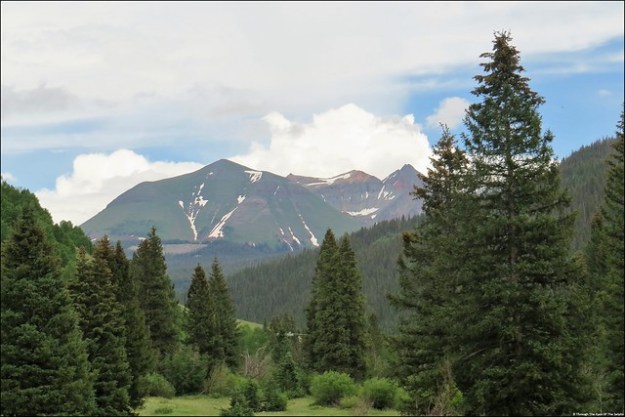
The mountain views and alpine meadows were beautiful. IMG_4696IMG_4697IMG_4703

IMG_4699

Lizard Head Peak

Next up: Ridgway, CO

South Beach Olympic NP, WA AUG 12, 2018

After Forks we had a reservation for one night at a campground in Olympic National Park.  However I read about a first come first serve (no reservations) campground, also in Olympic National Park, with campsites that overlooked the ocean.  This campground is at one of several beaches in Olympic National Park and some of the last protected wilderness beaches in the contiguous United States. Since it was first come first serve we got up early Sunday morning and drove the 45 minutes to South Beach campground. This is one Pacific Ocean viewpoint along US-101. IMG_20180817_121518IMG_20180817_121509

We found the perfect site and asked the current occupants if they were leaving and if we could claim it by putting a folding chair on the picnic table. The current occupant said no problem. In the meantime we pulled into a less desirable site and waited. And waited. For five hours. Even though checkout was 11:00 AM, they finally pulled out around 2:30. With this view I can see why they hated to leave. IMG_3483IMG_3484

We stretched what was originally going to be a one night stay at the other campground to six nights here. Who could resist staying longer at this site with ocean views and the sound of the ocean right outside your window? A short distance from our campsite was a path down to the beach. IMG_20180813_180927IMG_20180813_175803IMG_20180813_175931

And can you believe with our national park senior pass the price was $7.50 a night? We were thrilled. Only drawback was it had no hookups. Small price to pay in our opinion. While we were there it was very hazy and we were under a poor air quality alert for many days. The Seattle TV News said it was due to wildfires in Canada with the air pressure system pushing the air down into our area. IMG_3488IMG_3497IMG_3503

During our six days we spent a lot of time enjoying the beach but one day we drove to another rain forest.  Last week it was the Hoh Rain Forest and this time we visited Quinault Rain Forest south of us in the southwestern edge of Olympic National Park. Last time we were here was 2014.  IMG_3482IMG_3477

We drove the 31 mile loop around Lake Quinault and Quinault River through the Quinault Rain Forest. We took a short hike to the World’s Largest Sitka Spruce. IMG_3461IMG_3460IMG_3466IMG_3462IMG_3464

It is 191 feet tall, diameter of 18 feet, 9 inches and a circumference of 58 feet, 11 inches. It is estimated to be about 1,000 years old.

Along the drive we stopped at Merriman Falls and IMG_3468

Bunch Falls. IMG_3471

We ended the day by hiking the Maple Glade Trail.  We really enjoyed our walk because it was far less crowded and seemed more green and lush than the Hoh Rain Forest we visited less week.  All of Washington state is really hurting for rain. The local news said that in the last 120 days the state has received less than an inch of rain. All areas are under a fire ban. 20180814_12564220180814_130741IMG_3478IMG_3480

Four years ago we took a difficult trail to see the large Quinault Cedar Tree here but we learned that it has now fallen over. IMG_20180814_133046
Here is our pictures from 2014:

IMG_0804IMG_0802

Next up: A visit to Beach 4 and some amazing sea life

Salt Creek Recreation Area, WA July 26, 2018

We left the Port Townsend area and headed west to Salt Creek Recreation Area.  We were last here in 2014. Somehow back then we missed the WW II bunkers at Camp Hayden (built 1942-5).  You can actually drive your car through the bunker! Camp Hayden was used during World War II as a harbor defense military base.  The two concrete bunkers housed 16-inch guns and several smaller bunkers. IMG_20180727_144311IMG_20180727_144556

The huge guns were 45 feet long and shot one-ton projectiles 28 miles. IMG_20180727_144407

The guns were only fired for practice. While in the area we found several geocaches. IMG_20180727_150226

From our campsite at Salt Creek Recreation Area we had a beautiful panoramic view of the Strait of Juan de Fuca, Crescent Bay and Vancouver Island, Canada (British Columbia).  Our front window gave us views of cruise ships and barges passing by until the fog rolled in each day during the evenings. IMG_3255

The international boundary between the United States and Canada runs down the center of the Strait of Juan de Fuca. IMG_20180727_142124IMG_20180727_142145IMG_20180727_145933

On Saturday we drove to nearby Port Angeles to meet a friend of Bill’s who now lives in Washington state. Her family went to the same church as Bill in the 1980’s.  We had a lovely lunch and introduced her to geocaching. IMG_20180728_141938

We saw this wall mural of a old car ferry. Port Angeles has regular ferry service to Victoria, Canada. 20180728_142242

While in the area Bill and I went to the Olympic National Park Visitors Center and drove up to Hurricane Ridge. Due to clouds and haze the view of the glaciers clad mountains was not as good as it was when we were here in 2014.  IMG_20180728_16250720180728_163423

Hurricane Ridge, at 5,242 feet is the most easily accessed mountain area in Olympic National Park. IMG_20180728_162351

Hurricane Ridge got its name from the intense wind often experienced in the area. While we were there it was a nice 70 degrees with light winds. We saw a few deer lounging around. IMG_20180728_163652IMG_20180728_163735

On Tuesday we drove once again into Olympic National Park along the picturesque Crescent Lake.  IMG_3252

Our main purpose was to hike to two waterfalls. The first waterfall was the Marymere Falls, a beautiful 90 foot waterfall we accessed along a one mile walk through the forest. IMG_20180731_121414IMG_20180731_121705IMG_20180731_123106IMG_20180731_122516

We then drove to the next waterfall and hiked another mile to the Sol Duc Falls which splits into four channels as it cascades 48 feet into a narrow, rocky canyon. IMG_20180731_145858IMG_20180731_145701-EFFECTS

It was a wonderful day and we got in almost four and a half miles of hiking. IMG_20180731_151014IMG_20180731_130330

Next stop: Clallam Bay, Washington

Orcas Island, WA July 17, 2018

We continued our stay in Birch Bay, WA and on Tuesday we took the car on the ferry to another one of the San Juan Islands: Orcas Island.  20180717_11083920180717_110906IMG_20180717_110952

The ferry made a brief stop on Shaw Island to pick up a few walk on passengers. It was another great ferry ride with beautiful scenery. 20180717_11133920180717_11145620180717_111729

We arrived at the tiny village of Orcas on the southern shore.  Orcas Island, at 57 square miles, is the largest and most rugged of the San Juan Islands.  Horseshoe-shaped, it has the highest peaks of the underwater mountain chain forming the foundation of the San Juan islands.  

Unlike Friday Harbor on San Juan Island, there is no big tourist area here.  Eastbound, a small village along the waters of Fishing Bay, is the major town with a few restaurants, shops and art galleries. Around the island are several bed and breakfast and small resorts for those desiring a remote get away. Rumor has it that Oprah Winfrey recently bought a house on Orcas Island. IMG_20180717_120204-EFFECTS

The gem of the island is Moran State Park, Washington state’s fourth largest.  The park is 5,252 acres with five lakes, 38 hiking trails and several campsites.  MT Constitution rises 2,409 feet from the Salish Sea and is the highest point in the San Juan Islands.  We drove thirteen miles to the park along forests and hilly farmland with cattle grazing in the fields. IMG_3195

Once we entered the park, the road was winding, narrow and steep to the top.  Almost at the top was Little Summit with a geocache and great views. IMG_3145IMG_3146

At the top is a stone tower replica of Russian watchtowers from the 12th century.  20180717_142915

The view of the San Juan Islands, MT Baker, the Cascade Mountains and Rosario Strait was magnificent.  IMG_3168_stitchIMG_3186IMG_3173

Can you see my prince in the tower? 20180717_142640

This 53 foot stone tower was built by the CCC (Civilian Conservation Corps) and completed in 1936.  It is one of twenty historical buildings built by the CCC in the park.

While in Moran Park we also hiked to Cascade Falls and another smaller falls. IMG_3141IMG_3143

We had a wonderful day on this beautiful island, including finding some geocaches. While geocaching we saw a deer munching on some apples from an apple tree in a yard. IMG_3137

After we left the park we came to a rock wall with some really weird artwork.  Creepy! IMG_3197IMG_3203

Before we knew it, it was time to catch the ferry home. IMG_20180717_161550

We really enjoyed our stay in Birch Bay and nearby Blaine. Blaine is such a quaint little town with a Main Street decorated with flowering hanging baskets and America flags. 20180718_143107

Across the harbor we could see the Canadian town of White Rock. 20180718_142953

Next up: Another ferry ride, this time with the RV, and a new campground

North Cascades NP, WA July 4, 2018

After we returned from two weeks in Alaska we spent several days in Bothell, Washington unpacking, washing clothes and restocking the fridge.

Our next stop was in Anacortes, Washington where we spent the 4th of July holiday.   Anacortes is located on beautiful Fidalgo Island. It is separated from the mainland by a bridge over the Swinomish Channel.

On Friday we visited North Cascades National Park, a 505,000 acre park located in north central Washington.  The park terrain is a result of glaciation with more than 300 glaciers remaining today. The park contains more glaciers than any other area outside of Alaska, containing one quarter of all glaciers in the lower 48 states.   Some refer to the area as the “North American Alps”. As well as glaciers are 500 lakes and ponds and many, many waterfalls. IMG_2885IMG_2878IMG_2888IMG_2895IMG_2906

IMG_2907

IMG_2902

Ross Lake Dam

The first inhabitants in the North Cascades dates to at least 9400 B.C.  The park was established in 1968, making this year its 50th anniversary.  IMG_20180705_132241

STA_2936_stitch

Gorge Creek Falls – 242 foot drop

The North Cascades Highway opened in 1972 which allowed vehicular access through this beautiful park.  We drove part of the highway enjoying the beautiful views throughout the park. We stopped at the Visitors Center and watched several short movies about the park.  We were last here in July, 2014 but it is always fun to go back to our favorite national parks. We followed the Skagit River which is the largest river draining into Puget Sound and the third largest river on the West Coast.   We arrived at beautiful glacier fed Diablo Lake surrounded by glaciated peaks. Diablo Lake is one of three reservoirs from three dams built between 1919 and 1968 which supplies electricity to Seattle.  IMG_2927IMG_2910IMG_2911IMG_2913IMG_2928

On Saturday we met up with Bill’s college friend Todd and his granddaughter who lives nearby.  Todd gave us a tour of the area with some beautiful views of the San Juan Islands, including this one from Mt Erie, elevation 1,273.  We introduced Todd’s granddaughter to geocaching which she loved. 20180707_12215820180707_12235120180707_110014~220180707_105902-EFFECTS

On Tuesday we moved further north to Birch Bay, less than ten miles from the Canadian border.  For the first two days Bill was fighting a cold.

On Thursday we drove to see Mt Baker, one of the beautiful mountains in the North Cascade Range.  

IMG_2944

A View of Mt Baker Driving Toward Artist Point

 We drove through the Mt Baker-Snoqualmie National Forest along the Mount Baker Highway, designated a National Forest Scenic Byway.  IMG_2950IMG_2955IMG_20180712_123217-EFFECTS

Our destination was Artist Point, elevation 5,100 ft., which is the end of the road. This section of road is usually not open until mid July.  The area has an average annual snowfall of 701 inches. IMG_2957IMG_2960IMG_20180712_131514-EFFECTSIMG_2996IMG_3005

IMG_2999

Mt Shuksan, 9,127 FT

IMG_3015

Mt Shuksan, 9,127 FT

Mount Baker is a glacier covered volcano rising 10,781 feet above sea level.  It is the second most active in the Cascade Range, with Mt St Helens being the first.  It was named by Captain George Vancouver for a young officer in his command, Lt. Joseph Baker who first spotted the peak. IMG_3012

The drive was amazing with hairpin curves, amazing scenery, cascading waterfalls and snow.  Piles and piles of snow! The temperature was 66 degrees but there was plenty of snow for people to play in, including Bill who decided to throw snowballs with Mt Baker watching behind him. 20180712_13011120180712_130129IMG_20180712_130046-EFFECTS

Our last view of MT Baker today. IMG_3017

Next up:  A ferry ride

Juneau, AK June 28, 2018

Our next port stop was in Juneau, the capital of Alaska, pop 31,275.  Juneau lies along the Gastineau Channel at the foot of the snow covered Mount Roberts and Mount Juneau. The mountains give a natural protection against cold winds giving Juneau a milder climate, but also isolates Juneau from the rest of Alaska. The only way to reach Juneau is by ship or plane. It was named the capital in 1906.

In 1880, Joe Juneau and Richard Harris discovered gold in this area which started the first gold rush in Alaska. Juneau and Harris laid claim to the area which they named Gold Creek.  They built a town along the banks and in 1881 gold miners voted to name the town Juneau. IMG_20180628_08261620180628_165922-EFFECTS20180628_165857

From our balcony on the ship we could see the Goldbelt Mount Roberts Tramway which is a five minute ride to the 1,800 foot level of Mount Roberts. We didn’t ride the tram because we really didn’t have time and it wasn’t a clear day so the view from the top wouldn’t have been very good. 20180628_165934

On the way to the boat we past a field of Eagles, we could not believe we were seeing that many Eagles at one time in one area. They appeared to be drying their feathers in the morning sun. DSC_0961DSC_0963

While in Juneau we went on another whale watching excursion along the Gastineau Channel of the Inside Passage.  Remember the rough ride on the Haines excursion? This ride was as smooth as silk. Everyone could comfortably walk around and no fear of seasickness. We were so excited to see several humpback whales, including some breaching. They are really quick and so hard to catch on camera. But Bill and Beth were hard at work getting these great pictures! IMG_2662IMG_2675IMG_2679IMG_2697IMG_2703IMG_2706DSC_0035DSC_0051

We also saw bald eagles, more harbor seals and those lazy sea lions enjoying their day. What a life! DSCN6584DSC_0132DSC_0100IMG_2794

After out boat excursion we went by bus to the Mendenhall Glacier and Visitors Center. The glacier is 13 miles long and 1.5 miles wide at its widest point and is fed by the 1,500 square mile Juneau Icefield. It is one of 38 large glaciers that flow from the Icefield. DSCN6603IMG_2833DSC_0178DSC_0173DSCN6594DSC_0180IMG_2836IMG_2831

Nearby is the lovely Nugget Creek Falls. We really wished we had more time here but we were limited to one hour. DSC_0179

When we returned from our excursion Bill and I grabbed some lunch in town and walked up to the state capitol building. All uphill I might add! Of course we had to continue our goal of touring every state capitol building. There is a running joke among Alaskans about how ugly their state capitol building is and they joke it is the 50th prettiest capitol building in the country. Well, they are right. Unlike other capitol buildings, it did not have a guided tour and had one of the most unfriendly and indifferent greeters at the information desk we have ever encountered. We picked up a self guided tour brochure and walked around. Very little to see. The building was constructed in 1931 and underwent a $36 million dollar renovation in 2017.  Outside the building across the street is a statue of William Seward, former secretary of state under presidents Lincoln and Johnson. Seward played a large role in purchasing Alaska from Russia. IMG_2850IMG_2846IMG_2854IMG_2852

Walking back towards the ship we found a couple of geocaches. DSC_0136DSC_0141DSC_0144

Another great day in Alaska!

Haines, AK June 27, 2018

On the third day of our cruise we arrived at our first port city, Haines, pop 1,715.  IMG_20180627_141244DSC_0913IMG_20180627_071535-EFFECTSDSC_0930

Incorporated as a city in 1910, this area has one the largest congregations of bald eagles in the world which feed on salmon in the nearby Chilkat River. And, we saw many!  Every November Haines has an Alaska Bald Eagle Festival. Fort Seward, the site of the first permanent Army post in Alaska, was built in Haines in 1903. IMG_2507DSC_0803

Fishing is done year round in Haines with cod, crab and shrimp,as well as salmon in the summer and halibut year round.

Located in southeast Alaska and the northernmost point of the Alaska panhandle, Haines is one of the few towns in this part of Alaska which is connected by both a highway system and a seaport.

Our main activity while in Haines was a whale watching excursion on a catamaran named Fjordland.  DSCN6510

We saw a couple whales in the distance, as well as sea otters and sea lions. IMG_2598DSC_0783rIMG_20180627_194958

The sea lions were the most entertaining. IMG_2512IMG_2524DSCN6453DSCN6466IMG_2551IMG_2556

The highlight was seeing the beautiful Davidson Glacier. IMG_2626

The ride out was very rough and rocky and I was very glad I had taken Dramamine. Bill and Beth took some great pictures. I don’t know how they managed to get them with the boat rocking so much. I spent a lot of time in my seat because I could hardly stand much less walk around and I didn’t want to get sick. Beth loves lighthouses and was happy to see the Eldred Rock Lighthouse, a picturesque octagonal lighthouse constructed in 1906.  The property is now for sale. IMG_2616IMG_2619

We saw seals near the lighthouse island. DSC_0878

When we returned from our excursion we did take a free shuttle bus around the town with a very friendly and helpful driver. Only one cruise ship visits every week and the town shows their appreciation by providing this free service. We were told that the bus is paid for with tourist port fees. We did stop in a couple small gift shops in town. Haines has a Hammer Museum with a collection of over 1,600 hammers but we didn’t have time to visit. DSC_0914DSC_0926DSCN6531

When we returned to our ship they were in the process of having their monthly crew drill where they employ the lifeboats. Really interesting to watch. IMG_20180627_110600IMG_20180627_110650IMG_20180627_110605

Many thanks again to Beth for some of the pictures and for the great sea lion video where you can actually hear the sounds the sea lions made. See/select the below video:

Bald Eagle Trivia:

  • Bald eagles can fly up to 30 mph DSC_0792IMG_2611
  • They can dive through the air up to 100 mph
  • A bald eagle can spot a fish up to a mile away
  • It is illegal to possess a bald eagle feather unless you are a Native American

Glacier Bay NP, AK June 26, 2018

Our first full day on the ship was a day at sea, June 25.  Besides plenty of time to relax by the pool or deck and of course eat, Holland America has the day filled with classes you can participate in with everything from computer classes to cooking classes to self improvement sessions. Also available is a library, games, trivia, a casino, live music and nightly entertainment. IMG_20180625_225544

We were continuing to enjoy the long days and short nights.  A noise awoke me and it was Bill on our balcony taking pictures of the sunrise. When I asked him what time it was he said 4:30. What??? Seems like it had just set! IMG_2340

Our second day was cruising Glacier Bay National Park. Several national park rangers boarded the ship to spend the day narrating our time in Glacier Bay using the ship’s public address system. The ship didn’t stop, the park rangers took a very small boat to the ship and boarded by climbing ladders. They joked it was an exhilarating way to begin their day! IMG_20180626_113923IMG_20180626_115005

Glacier Bay National Park is only accessible by boat or plane and is made up of 3.3 million acres of mountain peaks rising over 15,000 feet including Mount Fairweather, forests, waterways and glaciers. IMG_20180626_115141IMG_2390IMG_2384IMG_2412

To protect the Park and the endangered humpback whale, only two cruise ships per day may enter the area each day. The park was first a national monument in 1925 and became a national park in 1980. 

Amazingly 250 years ago, Glacier Bay was all glacier and no bay. In 1750 the glacier had reached its maximum.  When Captain George Vancouver sailed here in 1794 the glacier had retreated five miles. By 1879 conservationist John Muir found the glacier had retreated forty more miles and was no longer “a sheet of ice as far as the eye could see” as described by Vancouver. Instead Muir saw ice that had retreated enough to see wilderness areas. Today the glacier is gone, having retreated north and you must travel 65 miles up the bay to view a tidewater glacier. The bay, having been carved by a glacier, is filled with saltwater as the glacier retreated which created a fjord.  Much of the bay is over 1,000 feet deep and is 65 miles long and 2.5 to ten miles wide. STA_2343

There are seven tidewater glaciers which are great rivers of ice that flow to the sea. We could see chunks of ice in the water that had “calved” from the glaciers. IMG_2361IMG_2374

The highlight of our time in Glacier Bay was seeing Margerie Glacier which is about one mile wide with an ice face that is about 250 feet high over the water and with a base about 100 feet below sea level. IMG_2421IMG_2492IMG_20180626133857DSC_0657

The ship spent an hour at this one spot, giving everyone plenty of time to see Margerie. We were even able to see the glacier calving! See/select the below video:

https://www.youtube.com/watch?v=UDuANpJUhOo

Instead of words, the best way to show you Glacier Bay National Park is through pictures. And thanks once again to Beth for sharing her pictures! IMG_2463IMG_20180626_133829IMG_2477IMG_2446

See/select the below video:

https://www.youtube.com/watch?v=XQSRkI7nl-s