Category Archives: New Zealand

April 16, 2015 Mangonui, New Zealand

We arrived at our final New Zealand destination, the tiny town of Mangonui where we stayed in a two bedroom duplex apartment overlooking Doubtless Bay, part of the South Pacific.  It was named by Captain Cook and the name stuck.   When he saw the bay in 1769 he said, “Doubtless, a bay”.  The beach was steps outside our door and we enjoyed walking on the beach.  One morning our neighbor knocked on our door to tell us that some dolphins were in ocean right outside our door.  We stood and watched the six or more dolphins frolicking and playing in the water before they disappeared from sight.        PicsArt_1429159271944PicsArt_1429156087344PicsArt_1429156242188

On Friday we took an all day bus tour of the peninsula.  We drove to Cape Reinga, the northernmost tip of New Zealand is where the Tasman Sea and the Pacific Ocean collide.  If you recall a picture in a previous blog of Bill standing at a sign at the southernmost point of New Zealand.  This sign at the cape shows the northernmost point of New Zealand.  We were able toPicsArt_1429264877979 find a geocache at both places.  At the Cape is a pohuteukawa tree believed to be over 800 years old.  Maori tradition teaches that this tree is where the spirits of the dead leap into the ocean to depart and head homeland.  It is seen as a sacred place and you are not allowed to eat at the Cape.PicsArt_1429262141176PicsArt_1429260322717PicsArt_1429260008457

Another cool place we went is called 90 Mile Beach which is really only 56 miles long.  Here people can actually drive on the beach.  Due to changing tides and the possibility of your car getting swept away or stuck in the sand, rental car companies forbid you driving a rental car on the beach.  This is one reason we decided to go on a bus tour.  Leave the driving and potential PicsArt_1429268037107 headaches to someone else!  The driver drove the bus through a riverbed stream to reach the beach.  He said it was quicksand and if he stopped we would actually sink.  He told us stories of buses and cars sinking in the sand and we had seen pictures online of this happening.  He stopped at a large sand dune area and passed out boogie boards to anyone interested in climbing to the top and surfing down the sand dune.  Some of the younger members of the group took him up on the offer.  Others declined once the driver told us the company would not be responsible for any injuries and described some of the injuries others had suffered while surfing down the steep dune.PicsArt_1429267029599PicsArt_1429271246809PicsArt_1429269867376

It was fun to speed down the beach in the bus with the waves lapping against the shoreline.PicsArt_1429311986648PicsArt_1429268379347

Before we left our landlord made us an interesting offer.  He offered to give us the use of his beautiful house, car, boat and a fuel card with as much fuel as we wanted, in exchange for the use of our RV in the States.  It was easy to say no because we have no plans to visit New Zealand again in the near future.  If any of our RV friends want to take him up on the offer, we will give you his contact information.

We look forward to heading home on April 19th.  We will do one final New Zealand post with our final thoughts when we get home.  We have a couple long travel days ahead.

April 15, 2015 Tutukaka, New Zealand

We left Hamilton and set out for a four hour drive to the final area of New Zealand we had yet to visit, the remote Northland.  Rain followed us, heavy at times and intermittent at best.  We passed through Auckland, the city where we had landed seven weeks earlier.  Traffic in this area was heavy and we slowed to a crawl around the city.  We had literally come full circle, starting in Auckland seven weeks ago, traveled south down the east side of the North and South Islands and then north up the west side of the South Island.  Now in our final week we would circle north of Auckland on the east side of the island and then west down the other side and back to the Auckland airport.

Other than the rain it was a pleasant drive.  The Northland area of the North Island is known as “Wilderness North” with more than 100 bays and beaches as well as forests, sand dunes and serene lakes.  It is New Zealand’s narrowest region.  It is a long narrow peninsula with no place more than 44 miles from the sea and is more tropical in climate.  Northland is where the Maori and Europeans first decided to settle and this area is known as the “Birthplace of the Nation”.  Some of the country’s oldest buildings are in this area.

We arrived at our first destination for a two night stay in Tutukaka.  Our motel was located on a cliff with spectacular views of the Pacific Ocean.  The Tutukaka coast area is rated as one of the Top Coastal Destinations on the Planet by National Geographic Traveler.  We could certainly see why with these views!PicsArt_1429148849311PicsArt_1429146650499

After a long day of rain as we drove up to the motel we looked out over the ocean and saw a beautiful rainbow, our first one in New Zealand.  We registered, went to our room and unloaded the car and then went for a walk.  Another beautiful rainbow awaited us and after admiring the view we stopped along the fence to greet some curious sheep.PicsArt_1429149022238PicsArt_1429147489250PicsArt_1429147946809

We loved our motel apartment, a two story apartment with floor to ceiling glass windows overlooking the ocean on both levels.  The upstairs bedroom had a nice balcony. Our only complaint was the only bathroom was on the first floor.  I could really get used to those cliff side ocean views!  The weather during our stay here was uncertain with rain one minute and sun the next, but the rainbows made it worth the rain!!PicsArt_1429169375887PicsArt_1429149511100

We made a trip to Waipoura Kauri Forest to see the world’s tallest and largest living kauri tree.  It is named Take Mahuta meaning Lord of the Forest.  It is one of the most ancient trees, having sprung from seed around 2,000 years ago.  It is 170 feet tall with a girth of 46 feet.PicsArt_1429149745283 PicsArt_1429151914748While there we also hiked to see Te Matua Ngahere, meaning Father of the Forest, the second largest known living kauri tree with a height of 95 feet and a girth of 54 feet.  (Keep in mind neither of these trees are as old or large as the California Redwood/Sequoias.) PicsArt_1429150399301PicsArt_1429150532497

At the parking lot where we hiked to the trees there was a man in a truck with a sign saying for $2.00 he would be sure your car was safe.  At first we thought he was just trying to take advantage of tourists, but two official New Zealand government signs said there had been a history of car thefts at this car park.  The 2.00 charge was for his time.  Considering there were at least a dozen cars in the car park and cars were constantly coming and going, he probably did very well.  During high tourist season he probably brought in quite a bit of loot for himself each day.  All he appeared to do was sit in his truck and collect $2.00 as each person walked by.  Didn’t even have to get out of his car. Over the past two months we have seen quite a few signs in tourist car parks warning of break ins, but this was the first time we paid for a watch dog.

Some observations:

  • Diesel fuel is cheaper than regular but vans and trucks have to pay an extra tax to the government to keep up the roads.
  • Their natural gas field is about to run out.
  • In New Zealand they have the Lions Club, Rotary Club and Salvation Army.  We saw Salvation Army in almost every town we went in, even the smaller ones.

April 11, 2015 Hamilton, New Zealand

We enjoyed our stay in New Plymouth regardless of the rainy weather.  Our last night there Bill was able to connect with some Kiwi ham radio operators on his hand held ham radio he brought with him.  He really enjoyed chatting with them.

The next morning the rain continued and we drove to Otorohanga for an overnight stay on the way to Hamilton.  We don’t usually stay at bed and breakfast lodgings, but this place had excellent reviews and the choices in tiny remote Otorohanga were very limited.  This bed and breakfast was located in the countryside and the proprietors had chickens, horses, a donkey, dog and cat.  We had a nice room with an outside entrance and private bath.  Breakfast was included in the price of the room so the next morning Bill enjoyed Eggs Benedict made with fresh eggs and I chose croissants with homemade jam.  It was nice that the proprietor was a chef by trade.

The next morning we headed to Hamilton for a three night stay.  Not far from the bed and breakfast lodging we came upon a field of several ostriches.  One was particularly friendly and quickly came over to see us.PicsArt_1428824829414 The weather was horrible for most of the drive to Hamilton with heavy downpours and wind.  We planned on visiting a Natural Bridge and a waterfall, both of which required a small hike.  We refused to let the weather defer our plans so we put on rain gear and trudged on.  We knew we couldn’t say “we would do it tomorrow” or “next time”.  It was now or never and we refused to let the rain stop us.

Our first stop was Mangapohue Natural Bridge.  A walk over several suspended catwalks and a swinging bridge led us to a beautiful limestone double archway.  Due to the lack of sunlight on this rainy day and the cave like interior, it was hard to get pictures to do the natural bridge justice. AfterPicsArt_1428825077344PicsArt_1428825293060 a short drive further down the road we came to the trail leading to Marakopa Falls, advertised as one of the most picturesque falls on the north island.  This one hundred foot waterfall was spectacular, made even more so by the heavy rains.PicsArt_1428825424436PicsArt_1428825669990

We were traveling on back roads and passing through small towns.  Our bed and breakfast proprietor did suggest we stop at one tiny restaurant that had great pies.  In New Zealand, pie always means a meat pie, similar to a chicken or turkey pot pie in the States.  There pies are usually beef, steak, lamb or kidney.  They never have fruit pies and you never see a slice of fruit pie on the menu in restaurants.  I find this so strange since they have so many orchards and farms here.  We stopped at the pie shop and Bill chose a steak and cheese pie which he said was “okay”.  I think he expected more since the motel proprietor said they always stop there and buy pies when they pass through the area and commented on how good they were.

We arrived in Hamilton still wet from our hiking excursions and glad to reach the hotel since the weather continued to be wet and miserable.  We have been really really lucky with the weather so far so we can’t really complain. Hamilton is a large college city with a vibrant downtown area with many restaurants to chose from.   Like most downtown areas with an abundance of restaurants within a small area, we had to circle around for awhile looking for a place to park.

Besides having several grocery stores they also had a Dunkin Donuts, our first since arriving in New Zealand.  We were excited and went there for breakfast one morning.  It was a bitter disappointment.  They don’t use Dunkin Donuts coffee blend which was a huge disappointment to Bill.  We buy Dunkin Donuts to fix at home in the States and he was looking forward to some coffee that tasted like home.   Instead he got the same stuff he gets everywhere.  Second disappointment was the price.  $12.50 for a half dozen.  Third disappointment was they were stale.  Bill mentioned this to the clerk and she said they are made at the Dunkin Donuts in Auckland an hour away and trucked in to Hamilton.  On top of that they freeze them.  So after almost two months we are still waiting for a good donut and a decent cup of coffee.

Our main reason for coming to Hamilton was to take the tour of Hobbiton in the nearby town of Matamata.  We drove on Saturday to Matamata for our 12:30 tour.  The Hobbiton bus took us thirty minutes into the countryside to the Alexanders’ spectacular 1,250 acre sheep and beef farm. PicsArt_1428827939323PicsArt_1428825946475PicsArt_1428826131629 This farm was selected by Sir Peter Jackson as the setting for many scenes for the “Lord of the Rings” movies.  The bus took us on a narrow winding road constructed by the New Zealand army so that the set could be constructed.  Sir Peter Jackson sent the Alexander family on an all expense paid vacation for three months and took up residence in their house where Jackson and his team went over daily film takes and conducted business.  Sir Jackson was a stickler for detail.  He didn’t like the sheep on the farm and brought in black face sheep from England.  He had members of the crew walk each day on the path to and from the various clotheslines so the path would look worn down.  He had a huge artificial tree built with over 250,000 fake leaves. When he didn’t like the color green of the leaves he had each leaf repainted to the shade of green he wanted.PicsArt_1428826841017PicsArt_1428826357250PicsArt_1428826981174

After the filming ended the sets were all taken down.  Then in 2009 the sets were all permanently rebuilt for the filming of ” The Hobbit Trilogy”.  PicsArt_1428826231025PicsArt_1428826300832PicsArt_1428826582829PicsArt_1428827150135Today daily tours are given of the movie set.  We had a great tour and at the end of the tour we stopped by the Green Dragon for a complimentary alcoholic beer or non alcoholic ginger beer.  PicsArt_1428827238082PicsArt_1428827790143We were so fortunate that the rain had stopped overnight and it was a beautiful sunny day.

On our last day in Hamilton we found a geocache, walking on a path covered with fallen leaves with leaves softly falling around us in the breeze.  Autumn in New Zealand and springtime awaiting us back home!  One week to go!

April 8, 2015 Wellington, Wanganui, New Plymouth, New Zealand

We left the South Island on Easter Sunday and traveled on the car ferry back to the North Island where we will stay for two weeks before flying home.  We have already toured the east coast of the North Island, driven east to west around the South Island, and now we will drive around the central and west side of the North Island to complete our journey.

The ferry ride was very unpleasant for me.  It started off fine but once we left the channel and got out into the ocean, the choppiness of the water and rocking of the boat made me feel very nauseous, even with two Dramamine in my system.  I spent the last two thirds of the trip sitting outside on one of the upper decks freezing with the cold and wind, but the cold air helped to fight the nausea.  How I envy people who read in moving vehicles and sit in the back seat of a car without getting sick!!

We arrived in Wellington late in the day and found an Italian restaurant within walking distance of our motel that was open on Easter.  The next day before heading out of town we drove around the Wellington Harbor for a last look at this charming capital city.  We were once again captivated by all the houses crowded on the hillsides and surprised to find surfers in the water around the harbor area.PicsArt_1428491181734PicsArt_1428492132046PicsArt_1428492032955PicsArt_1428491672401

We left Wellington and headed along the coast to Wanganui for a one night stay.  The next morning we drove to New Plymouth.  We took a slight detour to visit Egmont National Park where we took a short hike to Dawson Falls.  PicsArt_1428493453500PicsArt_1428493312626Since it was a cloudy day threatening showers, we did not have a clear view of Mt Taranaki in the distance.  Mt Taranaki is the North Island’s most majestic peak.  It is not often you see a conical volcano rising abruptly from sea level surrounded by beautiful beaches!PicsArt_1428493037055PicsArt_1428492499883

We spent two nights in New Plymouth.  We had planned to spend some time walking the beach there but our only full day in the town brought heavy rains.  The rain gave us a good excuse to have a nice “at home” day to relax and watch some tv, work on the blog and rest.PicsArt_1428493596854

Some observations:

  • New Zealand is an agricultural and dairy farming country.  So why are milk, fruits and vegetables so expensive?

March 31, 2015 Franz Josef Glacier and Greymouth, New Zealand

We left Queenstown and drove on the Haast Highway over Haast Pass, stopping along  the way to grab a shot of the Depot Creek Waterfall.  Since it was a long drive to our next destination, we stayedPicsArt_1428055408110 one night in the one horse town of Haast in the middle of nowhere,  and here is the horse to prove it. PicsArt_1428055531406 Haast had just one tiny antique looking gas pump, a couple motels and two restaurants with very limited menus.  One restaurant was the hotel restaurant.  After checking the menu we decided to drive to the other one down the street.  This restaurant had antlers hanging from every available space in the rafters throughout the restaurant.  Must have been over a hundred.  Eating while looking at partial deer carcasses and a limited menu convinced us to go back and eat at the hotel restaurant.  The sign on the restaurant door said “Beyond Your Wildest Expectations”.  We laughed.  Yep, pretty much described the town!  We did drive down to the beach for a look at the Tasman Sea before PicsArt_1428055703378heading inland. The Tasman Sea is a small sea of the South Pacific between Australia and New Zealand.  Since it was supposed to be chilly that night and I am very cold natured, we tried turning on the heat in the room with no response.  We asked at the front desk about the heat and they said it was controlled for the whole building by one control and they hadn’t turned it on for the winter yet.  When we asked about the electric blankets they advertised having, they said they never had electric blankets. They did give us a small radiator heater to take back to the room.  Kind of like a night in the Twilight Zone.

The next morning we continued on to “Glacier Country” and entered Westland Tai Poutini National Park for a three night stay at a town called Franz Josef Glacier.  PicsArt_1428055988695We came here to see the Franz Josef and Fox Glaciers.  We drove first along the seashore and then headed inland up the mountain pass through a rain forest setting with ferns and heavy tree cover.  The forests and woods on New Zealand are very thick.  The tiny town of Franz Josef reminded me of a ski village since it is tucked in the rainforest foothills of the southern Alps.  The town had one gas station, one grocery store and several restaurants.  No fast food here, not even a Subway. The gas here was about fifteen cents more per liter than we have paid anywhere else.

Our motel here was made up of ten little cottages and we enjoyed our cottage in the rain forest with a view of the snow capped mountains from our windows.PicsArt_1428315789605

There are around 140 glaciers that flow from the Southern Alps, however only Franz Josef and Fox Glaciers penetrate as far as the lush lower rainforests only 1,000 feet above sea level.

If you asked any ranger in a national park in the United States or New Zealand they would tell you that due to global warming, the glaciers are retreating at an alarming rate.  They say they are getting too much rain instead of snow in the winter and they will show you pictures of previous winters to prove it.  Yet there areas of the U.S. for example that are receiving record breaking cold temperatures and snowfall.  Global warming or not?  The whole debate gives us a headache.  We can only tell you what we see with our own eyes and let you decide.

As you look at the pictures of our hikes to see the glaciers, keep in mind we are hiking on land once covered by glaciers.  We saw signs showing us where glaciers once were not many years ago.  We passed several areas that used to be viewpoints but as the glaciers retreat, the hike is lengthened and the viewpoints moved in order to continue to see the glaciers.

We drove to a viewpoint where we could see Mt Cook, Mt Tasman and the Fox Glacier.  PicsArt_1428134533958PicsArt_1428134623641PicsArt_1428134687900PicsArt_1428135738823We then drove to the beginning of the Fox Glacier Valley Track to see Fox Glacier up close (meaning 200 meters away).  Fox Glacier is fed by four alpine glaciers and it falls 8,530 feet over eight miles. The hike was longer and steeper than we expected, with rock hopping over four streams and a very steep climb at the end on a rocky path.  Neither Fox or Franz Josef Glaciers are pristine white.  In fact they look quite dirty from the dirt and rocks that fall on them.PicsArt_1428136279437PicsArt_1428136800233PicsArt_1428137282498PicsArt_1428198835506PicsArt_1428136959959

The next day we did the Franz Josef Glacier Valley Track, a slightly longer hike but less steep and without any rock hopping over streams.  What made this hike special were the beautiful waterfalls we passed along the way to the glacier viewing area.PicsArt_1428139836990PicsArt_1428199739506PicsArt_1428199297771PicsArt_1428200164457PicsArt_1428200299322PicsArt_1428200542769

Our time here went by very quickly.  On our last day the owner of the motel brought us a basket of scones, still warm from the oven with butter, strawberry and raspberry jam.  They were delicious and we wolfed them down.

Leaving Franz Josef, we drove to Greymouth, stopping at Hokitika Gorge for a quick hike to the swinging bridge and a couple pictures.  PicsArt_1428315863987PicsArt_1428315966924PicsArt_1428315912045We stayed overnight at a lovely motel owned by a couple originally from the Netherlands.  We arrived in Greymouth on Good Friday and discovered almost everything closed for the holiday.  The two grocery stores in town, the shops and restaurants all closed.  It reminded me of what Christmas was like fifty years ago.  We found a McDonalds open and had dinner there.  While sitting there eating, a jeep pulled up giving us a full view of a dead deer draped over the spare tire on the back.  Didn’t bother Bill but a real appetite suppressant for me!

The next day we drove to Westport.  There are approximately 26 towns in the world called Westport, with many of them being in North America.  This is the only Westport in the southern hemisphere.

On the way to Westport we stopped by the Punakaiki coastal rocks which resemble huge stacks of pancakes and therefore are called Punakaiki Pancake Rocks.  These limestone rocks were formed thirty million years ago and have been sculpted by mildly acidic rain, wind and sea water.  The pancake effect was caused by immense pressure on alternating soft and hard marine life and plant sediment.  By the time we arrived at Pancakes Rocks there was a steady rain and gale force winds so strong it was impossible to keep an umbrella from turning inside out.  I could have possibly flown like Mary Poppins if I had tried to open one.  We put on raincoats and ponchos and refused to let the storm stop us.  We followed a nice paved trail that wound along the rocks with informational signs.  One sign said the rocks are gradually being eroded away by sea and wind.  By the time we returned to the car we were thoroughly soaked from the thighs down.  Unfortunately we still had an hour drive to Westport in wet clothes on a chilly day.  Amazingly even under these weather conditions  Bill was able to get some great pictures of the rocks.PicsArt_1428201370094PicsArt_1428201140224

This overnight stay in Westport ended our visit to the South Island.  We will take the car ferry back to Wellington Easter Day.  We will spend an additional two weeks on the North Island before flying home.

Some observations:

  • Almost all the motels we have stayed at are owner operated.  Along with fresh milk they offer laundry facilities.  Sometimes the laundry facilities are pricey, sometimes cheap and occasionally the washers are free and you can hang the laundry on their line or pay to use the dryer.
  • Internet has been much better than we expected and has been free at the motels.  Often it is unlimited and some limit the amount of usage.  It has enabled us to keep up with the blog and publish posts more often than we expected.
  •  We have noticed a lot of backpacker hitchhikers on the South Island.  Someone told us many of the restaurants employ backpackers on a short term basis while they are passing through the area.  They will work long enough to earn money for food and supplies before moving on.  All the servers in our restaurants have been young people.
  • Most restaurants add a 15% to 20% surcharge to your bill on public holidays, including Good Friday, Easter, and the Monday after Easter.
  •  While in Franz Josef we met several people from Florida on our glacier hikes including one who lives in Miami as well as several University of Florida graduates.  We also met people from Idaho, England and Australia.  There are a lot of Australians here on holiday.

March 28, 2015 Queenstown New Zealand

Queenstown is a hilly picturesque town along the shores of pristine Lake Wakatipu.  As if that wasn’t enough, it is surrounded by majestic mountains which are reflected in the water on a sunny day.  Like many other New Zealand towns, homes dot the hillsides.  Queenstown is knownPicsArt_1427946231934 as the “Adventure Capital of the World” since there are so many outdoor activities available to choose from.  It has a reputation for being the premier four season destination in the Southern Hemisphere and the world’s southern most wine producing region.  Queenstown is the birthplace of jet boating and bungy jumping.

We were not feeling particularly adventurous since it was drizzling and chilly when we got there.  It cleared up the next day but continued to be very chilly.  Autumn comes early to the South Island.tmp_20609-Queenstown tree-2006952504

While in Queenstown we drove one day to Glenorchy along the shoreline of Lake Wakatipu with breathtaking views.  The Queenstown area, especial Glenorchy, has been the backdrop for movies such as Lord of the Rings, the Hobbit trilogy, the Lion the Witch and the Wardrobe, 10,000 B.C., Wolverine, and Prince Caspian.PicsArt_1427946109729PicsArt_1427946191873

We also drove to the Kawarau Bridge Bungy Center.  In 1988 AJ Hackett and Henry Van Asch started the world’s first bungy jump facility in New Zealand.  This helped Queenstown become known as the adventure capital of the world.  We were able to stand on a large viewing platform and watch several people make the big leap.PicsArt_1427946577013PicsArt_1427946896046PicsArt_1427947072718PicsArt_1427947308639PicsArt_1427947236231PicsArt_1427947406658PicsArt_1427947478446PicsArt_1427947593831PicsArt_1427947802348PicsArt_1427947921007PicsArt_1427947713416PicsArt_1427947921007PicsArt_1427947713416PicsArt_1427947975236

Queenstown has plenty of tourists and traffic compared to other South Island towns.  They have a town center area with tons of shops and restaurants and it is a challenge to find parking during the day since we did not see any parking garages or public lots.  You can ride a gondola tmp_20609-Queenstown 1790877301and there are vendors everywhere trying to sell you any kind of adventure you can imagine.  It was common to see street performers and one evening we saw a young man in nothing but a thong singing very badly while being encouraged by a group of friends.  Our last night in Queenstown we went to a pizzeria for dinner.  We wondered why the crowds along the streets and in our restaurant were so rowdy.  We soon realized that New Zealand was playing Australia in the 2015 World Cup Cricket championship game.  We watched some of the game from our table.  Cricket is a strange game and the only way we knew what was happening was if the crowd cheered or groaned.  New Zealand lost, by the way, by seven wickets whatever that means.

Some observations:

  • New Zealand has its own version of American Idol (called X Factor), Dancing With the Stars and The Bachelor.  We also can watch the United States American Idol here on a delayed broadcast of several hours.
  • Kiwis love antique cars.  Wherever we are it is not unusual to see people driving around in them.  They love to take them out on the open road on a regular basis.
  • Even Bill is really tired of New Zealand food, especially New Zealand restaurant food.  We are both longing for American food right now!  Bill had goat for dinner tonight.  Sigh….
  • New Zealand has a ton of lakes, waterfalls and one lane bridges.

March 25, 2015 Te Anau & Fiordland National Park, New Zealand

Yes, it was absolutely worth the wait in the cold rain to see the penguins, but we left them behind and headed to Te Anau.  This small town is beautifully situated beside Lake Te Anau, which at 110 feet deep and 40 miles long is the largest lake in the South Island and the second largest lake in New Zealand.  Most people come to Te Anau due to its proximity to Fiordland National Park.PicsArt_1427615306068

Fiordland National Park , New Zealand’s largest, is one of the last true areas of remote wilderness in the world.  It lies in the southwest corner of the South Island and is made up of three million acres.  Fiordland National Park is an amazing combination of valleys, glacial lakes and magnificent fiords, having been carved by glacial action over thousands of years.PicsArt_1427615582629

On our first day we drove from Te Anau to Milford Sound.  Rudyard Kipling visited Milford Sound in the early 1900’s and called it the Eighth Wonder of the World.  This Sound, located in Fiordland National Park, the northernmost fiord in the park, is a 10 mile long fiord over 1,312 feet deep.  The area receives over 22 feet of rain a year (over an inch a day average).  In the distance you can see mile high Mitre Peak.PicsArt_1427615780661

It was such a pleasant beautiful drive and we stopped at various viewpoints along the way.  Our favorite was Lake Gunn with its gorgeous reflection of lake, mountain and sky.PicsArt_1427615458593PicsArt_1427617260802

We had to go through Homer Tunnel, a one lane tunnel built in 1954 that is a little under a mile long.  We waited in line with all the tour buses and cars for the traffic light to turn green signaling we could enter the tunnel.  It felt more like driving through a cave than a tunnel with dim lighting.  So amazing how they blasted such a long tunnel through the side of the mountain. This ten percent inclined tunnel was carved from both ends simultaneously, and they met perfectly.PicsArt_1427615669230PicsArt_1427616254086

In Milford Sound we had our first encounter with the dreaded sandfly.  We had heard they are very bad on the west coast of the South Island and fortunately brought bug spray with us.  Within seconds of stepping out of the car I had five attacking one leg.  They have an intense bite and leave itching skin.  The bug spray has works pretty well so far.

The next day we had booked in advance a day cruise into Doubtful Sound.  We were supposed to go on Thursday, but due to a doubtful weather forecast (pun intended) we were able to reschedule for Friday.  Doubtful Sound, also in Fiordland National Park, is three times longer and ten times larger than Milford Sound.  It is the second largest fiord of the fourteen fiords in the park.

The area was named Doubtful Harbor in 1770 by Captain James Cook because he thought it was doubtful there was sufficient wind to maneuver his vessel into the narrow reaches of the water.  Early explorers wrongly called them sounds instead of fiords.  Sounds are caused by river erosion whereas fiords are carved and gouged out by glaciers.  This probably happened because most of the explorers were English and had never seen fiords before.PicsArt_1427618535277PicsArt_1427618486530PicsArt_1427618762216PicsArt_1427622680614PicsArt_1427621879966PicsArt_1427621780193PicsArt_1427618262431PicsArt_1427618003280

Our cruise started out early in the day when the tour company picked us up at our motel and bused us over to Manapouri where we boarded a boat for an hour ride across Lake Manapouri.  It was a beautiful ride with gorgeous views of the lake and mountains.PicsArt_1427617960648

Once we reached the other side of the lake we boarded a bus which took us through the rain forest over Wilmot Pass.  The only way to reach Doubtful Sound is to cross Lake Manapouri and cross Wimot Pass.  This steep, winding fourteen mile  road is New Zealand’s most expensive road and one of its most remote.  It was built in the 1960’s to provide access for heavy equipment during construction of a power station.  Floods, snows, mud and landslides lengthened the project from 12 months to 2 years.  We had a great bus driver who did a wonderful job maneuvering the mountainous road while keeping us entertained with information about the area.PicsArt_1427617740955PicsArt_1427617873570

The bus dropped us off at the dock at Deep Cove where we boarded a catamaran for a three hour cruise around Doubtful Sound.  At one point we briefly entered the Tasman Sea.  It was pretty chilly but we spent a lot of time on the deck enjoying the views.  We saw a pod of bottlenose dolphins.  There is a pod of about sixty that hang out in the Sound and seldom leave.  These dolphins are among the southernmost in the world.  They enjoyed playing around the boat, occasionally leaping in the air.  They were quick and hard to capture on camera.  We also saw one yellow eyed penguin swimming in the water.  Now we know what those penguins do all day while we are onshore waiting for their return.PicsArt_1427621208896PicsArt_1427621489576PicsArt_1427619519662PicsArt_1427624220489

The catamaran then dropped us back to Deep Cove where we once again rode the bus over Wimot Pass to the boat which took us back across Lake Mansour then to the last bus and back to the motel.  A marvelous ten hour day.  The tour company, Real Journeys, did an exceptional job and all their employees on the buses and boats were very friendly and helpful   They all truly seemed to enjoy their jobs.  And since there is no tipping in New Zealand no one was waiting during any part of the trip with their hand out expecting a tip.

We enjoyed meeting and talking with couples from Australia and France on the trip.

Te Anau, Fiordland National Park and all the area around it is truly a beautiful beautiful place!

Some observations:

  • Diesel fuel is cheaper than gasoline at the fuel pumps.
  • The South Island is more mountainous than the North Island and has fewer people and more sheep, cattle and deer.
  • The South Island is colder, rainier and has many more bugs, especially sand flies.
  • The South Island has more tourists and Americans than we encountered on the North Island.
  • The South Island has more souvenir shops but less fast food restaurants.  Many smaller towns have a Subway restaurant but no other fast food.

March 22, 2015 Dunedin and Invercargill, New Zealand

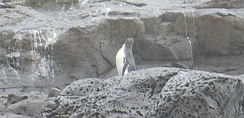
After our visit to Mount Cook we stayed overnight in Timaru.  The next morning we drove towards Dunedin.  Along the way we passed the 45 parallel south which meant we were now closer to the South Pole than the PicsArt_1427353374559equator. We stopped at Katiki Point because our tour  book said we might be able to spot some yellow eyed penguins, the rarest and most endangered penguins in the world and native to New Zealand.   One of our goals while in New Zealand was to see penguins, preferably in the wild in their natural habitat.
We parked and began to walk along the beautiful coastline toward the point.  Suddenly Bill stopped and motioned toward a bushy area.  There, a few feet away, were two yellow eyed penguins.  So exciting!!  They are now at the time of year when they are molting, so they looked a little different from what you might PicsArt_1427256961287expect.  At first we barely moved and didn’t utter a sound for fear of scaring them away.  Once Bill took some pictures we moved closer down the path and they didn’t appear at all afraid of us.  This area is a highly protected reserve and we think they have become accustomed to people and know they have nothing to fear.  The area is under video surveillance and everyone is expected to follow the rules or face stiff penalties.
We proceeded down the trail and came upon one more penguin closer to the rocky shoreline.  What was really neat was there was also a fur seal not far from the penguin so we were able to get a picture of them together.PicsArt_1427257185593PicsArt_1427257249842
We walked to the end of the point passing by huge fur seals lounging on the rocks and upper hillsides.  We could have literally stepped over the seals and they would have cared less.  We enjoyed the view at the end of the point and walked back to the car, so pleased with our penguin discoveries.PicsArt_1427257784210PicsArt_1427257845710

Along the way to Dunedin we saw breathtaking views of the ocean with sheep grazing along the cliffs and people on horseback riding on the beach.   As we crested the top of a steep hill, we had a breathtaking view of the Dunedin nestled next to the ocean.  The first European settlers were Scottish settlers who arrived in 1848. It was originally named New Edinburgh but the name was changed to Dunedin which is an old Celtic name for Edinburgh.

“The people are Scotch.  They stopped here on their way from home to heaven, thinking they had arrived.” Mark Twain
Nearby goldfields generated wealth in the area and New Zealand’s first university, the University of Otago, was established here.  The discovery of gold encouraged the arrival of Chinese miners and by 1871 there were over 4,000 Chinese miners in the area.  Many settled permanently in Dunedin and are an important part of the community today.
We arrived in Dunedin late in the day since our penguin adventure took longer than expected.  We didn’t really have much time to explore the city before dark.  We did drive to Baldwin Street which is named in the Guiness Book of Records as the steepest street in the world.  The street runs from 98 feet above sea level to 330 feet above sea level with a slope of between 20% to 35%. The lower part of the street is asphalt but the upper reaches of the street, which is the steepest, is surfaced in concrete for safety on frosty mornings.2015-03-28_04-36-142015-03-28_04-35-56
Dunedin is often called the eco-capital of the world because of all the nature and wildlife in the area.  The Dunedin Railway Station is said to be the most photographed building in New Zealand.
I wish we had had more time to explore this charming city with its beautiful old Victorian and Edwardian buildings.
Next we headed to Invercargill.  Along the way our tour book suggested we stop by Nugget Point Lighthouse, which is the most photographed lighthouse on the South Island and a location often seen on postcards andPicsArt_1427258167378PicsArt_1427258384986 brochures of New Zealand.  The book said it was possible to see penguins here, though the best time to see them was between 5 and 6 PM  We saw a hide which is a little structure where people can hide so they can see the penguins but they don’t see us. It was early afternoon and we didn’t want to wait around that long since we still had a long drive to Invercargill.  We did trudge to the end of the trail where the lonely lighthouse sat on the edge of a PicsArt_1427258454378rocky cliff.  We enjoyed talking with a couple visiting from England.
Our time in Invercargill was short but Bill did have time to visit the E Hayes Motorworks Collection where there is a remarkable vintage motorcycle and car collection, but more importantly the world’s fastest motorcycle.  Ben Munro, built the World’s Fastest Indian, was born near Invercargill.  In 1920 he bought a Indian motorbike for $120 which he modified and tuned to a record of 190.07 mph, a world record.PicsArt_1427258753624PicsArt_1427258809437PicsArt_1427258654232PicsArt_1427258519862in 2005 the movie “The World’s Fastest Indian” was released and starred Anthony Hopkins as Burt Munro.
Also while in Invercargill we spent one day on another penguin hunting adventure.  Using the tour book tip of best places to look, we first headed to the most southern point in all of New Zealand. Here we were the closest we would get to Antarctica.  While hiking to the point we walked in a field of sheep who at one point trotted ahead of us as if showing us the way.  I tried to get a picture of them up close with Bill but they were very skittish.PicsArt_1427258895661PicsArt_1427258977231PicsArt_1427259017269PicsArt_1427259083780
We intentionally set out late in the day because the best time to see penguins is around dusk when they swim back to shore to their nest after being at sea ALL DAY.  We joined a throng of people waiting anxiously PicsArt_1427259121841for their arrival in a roped off area with a DOC (Department of Conservation) employee there to be sure everyone followed the rules.  We had to stay behind the yellow ropes and no flash photography because they think it hurts the penguins eyes.  We waited an hour PicsArt_1427259916676and a half in a very cold drizzle until we were rewarded with one penguin fairly far away.  Just as we were about to give up someone spotted another one closer.  He washed up on shore and then proceeded to hop across some rocks and then stop and preen.  After watching him for awhile it was getting dark, we were pretty wet and really cold, and we had over an hour’s drive back to the motel.  Was it worth the hour and a half wait in the cold and rain?  Absolutely!!PicsArt_1427445322474PicsArt_1427444362975PicsArt_1427446952935PicsArt_1427445192178
Some observations:
We noticed many trucks with an engine breathing apparatus (snorkel).  Evidently they like to take their trucks and play in the water and need this engine snorkel.PicsArt_1427258088107
You occasionally see a business or house for sale, you never see land for sale.
It is strange to see deer fenced in.  We are used to seeing them only running wild.  Bill has enjoyed eating lamb and venison in New Zealand. Wild deer can be hunted year round.
The motel guest laundry and laundromats use cold water only.  This totally freaks out a germ freak like me!
We are enjoying meeting and talking with people from other countries around the world.  There are many tourists here from Australia, France, Germany and Japan.

March 20, 2015 Aoraki Mount Cook National Park New Zealand

PicsArt_1427254694639

Aoraki Mount Cook 12,316 FT

We had not originally planned on visiting this national park, but after reading about it we realized we were about to miss a real treasure so we changed some reservations and altered our itinerary to allow us to spend a day and night in the park.
In 1851 Captain J. L. Stokes, while mapping the West Coast of New Zealand, sighted a huge mountain which he named Mount Cook after Captain James Cook.  The Maori called the mountain “Aoraki” which means cloud piercer.  In 1998 Mount Cook was renamed Aoraki Mount Cook to incorporate its Maori heritage.  Aoraki Mount Cook is the only place to have its English name preceded by its Maori name.
Aoraki Mount Cook National Park became a park in 1953 and is 270 square miles, with 40% of the area glaciers.  The park has 27 mountains with 140 peaks more than 600 feet high.  Mount Cook at 12,316 feet is the highest in New Zealand.  The park is a gorgeous combination of grasslands, huge river valleys, lakes and snow/glacier covered mountains.PicsArt_1427254251912PicsArt_1427254588800PicsArt_1427254635447PicsArt_1427254517456
Sir Edmund Hillary is New Zealand’s most famous New Zealander.  It was at Mount Cook in 1948 that he climbed his first major mountain, including the difficult south face of Mount Cook.  Hillary trained here for his Everest and Antarctica expeditions.PicsArt_1427255469862
We splurged and stayed overnight at the Aoraki Mount Cook Village – Heritage Hotel with a breathtaking view of Mount Cook from the balcony in our room.PicsArt_1427254836515PicsArt_1427254879336PicsArt_1427255062679
Before heading home the next day we decided to hike the Tasman Glacier Lake Trail which gave  us a view of Tasman Glacier Lake with small icebergs.  Our non-trusty tour book called it an easy 15 minute walk each way.  When are we going to learn not to trust that book?  The hike started out easy enough and we enjoyed meeting a couple from South Carolina along the way.  About a third of the way up the trail we started to come to some rocks to climb on.  Uh oh!  The climb got steeper with a greater number of rocks.  I do okay with steep trails, but I don’t do well with rocks.  I would have never made it to the top without my walking sticks and Bill’s patience and helping hand.  I felt like quite the wimp as young children sailed past me over the rocks and young people rerouted around me.  By the time we got to the top I was sufficiently traumatized and stood frozen to the spot while Bill took pictures of the lake.  The icebergs over the years have dwindled.
While Tasman Glazier is New Zealand’s largest glacier and icebergs periodically tear away from the face of the glacier into the rapidly growing lake,  the effects of global warming and other climatic processes are taking their toll on glaciers.  The Tasman Glacier is melting and calving at an exponentially increasing rate.  In recent years the Tasman Glacier has changed from mainly melting to a calving (pieces breaking from the glacier) and melting resulting in a lake that is rapidly increasing in size.
After Bill enjoyed the view and I pondered how in the world I would ever get down, we began our descent.  Did I mention we also had winds of around 30 mph during the ascent and descent?  Actually the descent wasn’t nearly as bad as climbing up had been but I was relieved to see the car in view.  This was my most difficult hike ever and I was proud of myself for doing it.PicsArt_1427256234540PicsArt_1427255799129PicsArt_1427256558840PicsArt_1427256491055
Some observations:
It feels strange seeing the leaves begin to change color and the farmers clearing their fields as autumn begins in New Zealand.
The drivers in New Zealand are very courteous.  If you turn on your signal to change lanes they immediately back off and allow space for you.  Merging is called “Zip” on traffic signs because you are supposed to merge alternating one lane at a time like a zipper.
Cost of living here is very high.  There is a GST (Goods and Services Tax) of 15% added to all goods and services purchased in New Zealand.
There is no industry in New Zealand so everything is brought in.  For example they ship their logs to Japan where they are made into paper products and shipped back to New Zealand.  Products may be labeled made FROM New Zealand products but it doesn’t say made IN New Zealand.  Everything in New Zealand is centered around farming and horticulture.  One man Bill talked with said a Ford F150 pick up truck here would cost about $95,000 New Zealand dollars.  The man has family in Dallas, Texas that he goes to visit and he said he is amazed how cheap everything is in America.

March 17, 2015 Christchurch, New Zealand

 We left Nelson and headed to Kaikoura.  During the two hour drive we saw many fields of sheep and cattle, as well as several fenced fields with large herds of deer and a field of llamas.  Venison is a popular item on menus here.
Shortly before reaching Kaikoura we stopped at Ohau Point where there were a large number of seals of all ages and sizes on the rocks and in the water.  People were able to walk down on the rocks and get up close and personal with the seals.  They had no fear of people and we hope that people respect the marine life rule: look but don’t touch.  While looking at the seals we talked with a family from New York State.  Always great to meet people from back home!!PicsArt_1426847688649PicsArt_1426845913329PicsArt_1426845997163PicsArt_1426846543154PicsArt_1426846327099PicsArt_1426846766240PicsArt_1426846945101PicsArt_1426847177841
We loved our motel room in Kaikoura.  For the equivalent of $106 American dollars we had a large room with a view of the ocean and small kitchenette, but best of all was the bathroom.  It had heated towel racks, a heated floor and a heater when you turned on the fan so the air was warm when you stepped out of the shower.  Loved, loved, loved it!PicsArt_1426848577753
After a short one night stay in Kaikoura we headed to Christchurch, the largest city on the South Island with a population of 340,000.  The first recorded settlers here were Maori, with European settlers arriving in 1840.  In 1850 the first organized group of English immigrants arrived on four ships and are considered the city founders.  In 1856 it was declared a city and land was set aside to build the first dwelling, a cathedral.
It is called the “Garden City” but today it is very much a city under extensive regrowth and change.  The people of Christchurch are an extremely strong, resilient people full of hope and strength and resolve.  You see, since 2010 Christchurch has been shaken by over 10,000 earthquakes.  One earthquake was 7.1 magnitude, three earthquakes over 6 magnitude, fifty-seven over 5 magnitude, and many thousand more.  The 7.1 earthquake occurred in 2010, but the 6.1 earthquake in February 2011 did the most damage since it was shallow and close to the city center.  The 2011 earthquake killed 185 people and brought down many buildings already weakened from the 2010 quake.PicsArt_1426933713089PicsArt_1426932952379PicsArt_1426932886793
The destruction was evident to us as we walked and drove around the city.  Complete city blocks in the downtown area are now vacant after the destroyed buildings were razed.  In the face of all this tragedy the people have risen to meet the challenge.  Two perfect examples are the Cardboard Cathedral and Re:Start.
When the original Angelica Christchurch Cathedral was badly damaged in the quake, the people of Christchurch, just like the city founders before them, found a way to build a church.  Japanese architect Shigeru Ban designed one of his famous “Emergency architecture” buildings in which a cathedral was built from 96 cardboard tubes, timber beams, structural steel and a concrete pad.  The cathedral opened in August 2013 and is a symbol of innovation, hope, and inspiration.  It is built to last for fifty years while the new permanent cathedral is designed and built.PicsArt_1426933949477PicsArt_1426933846113PicsArt_1426932273487PicsArt_1426931491835PicsArt_1426931983052PicsArt_1426931584830
Another example of the tenacity of the people is Re:Start.  After the quake destroyed their stores in the downtown area, business owners brought in converted steel shipping containers and operated business from these containers.  While many containers remain, we read that the containers are gradually disappearing as more permanent stores are being built.  We walked through the shopping area and had lunch at one of the vendors set up near the containers.  Bill had a lamb souvlaki which he said was very good.PicsArt_1426933050726PicsArt_1426933114187PicsArt_1426933266856PicsArt_1426933387410PicsArt_1426933449255PicsArt_1426933539195
There was evidence everywhere of construction as the city is hard at work rebuilding.  It is somewhat sad to see all the beautiful old buildings razed to make way for the larger new ones because the real charm of the city lies in these past structures.
As we walked their streets, ate in their restaurants, shopped in their stores, stayed at their motel, we were always met with smiling, friendly, cheerful people.  It was our pleasure to meet them.  They are an inspiration!
The next day we took a day trip to Arthur’s Pass which is the highest pass over the Southern Alps, connecting the east and west sides of the South Island.  The Southern Alps is a mountain range which runs along the western side of the South Island and forms a natural dividing range along the entire length of the South Island.  Arthur’s Pass is both a national park formed in 1929 and a small village where we had lunch at a small cafe.PicsArt_1427016427893PicsArt_1427016648557
After lunch we hiked to Devil’s Punchbowl, a 430 foot waterfall.  We use a tour book which we have found tends to underestimate the difficulty of the hikes, and this was another example.  This hike was marked as an easy though steep hike to the waterfall.  Not quite!  We met a couple coming back from the hike and the woman shook her head and sighed and mentioned 289 steps. Didn’t seem a big deal to us until we had started the hike and discovered that some of the 289 steps were cut into the earth and/or high steps which really presents a challenge for my short legs.  It was hard for me but the view at the top was amazing.  While there we met people from Seattle and Tampa, Florida.  For some reason we are meeting many more Americans on the South Island.PicsArt_1427015467225PicsArt_1427015243071PicsArt_1427014879996PicsArt_1427014239506
Some observations:
Most motels have guest laundry and if you don’t want to use the dryers they often have clothes lines outside.  Clothespins are called pegs.
Emergency is 111 not 911.
Reservations are called bookings.  When you go to a restaurant they may ask if you have a booking.
All New Zealand tap (faucet) water is among the world’s best and safe to drink.
On both the North and South Islands the motels all keep electric blankets on the bed.  The blankets are put under the sheet not on top of the sheet.  If you are not careful you will lay on one of the controls which is uncomfortable.  The first time we felt it we thought the springs were coming through the mattress.  We find having the blanket under the sheet where you lay on it with the wires odd.
The cold and hot water faucets are reversed with the cold water on the left and hot water on the right.
They include French fries (chips) with everything on the menu.  Bill ordered chicken parmesan last night and it included chips (no spaghetti). Bill asked if they would substitute mixed vegetables for the chips.  We are both really tired of French fries even though the fries here are always good.  I never thought I would say I am tired of potatoes, but I am!