Author Archives: William Selph

Lost in Saigon, Vietnam JAN 23, 2020 Part 2

The next stop was the former South Vietnamese Presidential Palace, now called Reunification Hall or Independence Palace. It was here on April 30,1975 the North Vietnamese burst through the gates in tanks, signaling the end of the Vietnam War. IMG_20200123_100347IMG_20200123_100309IMG_20200123_101127
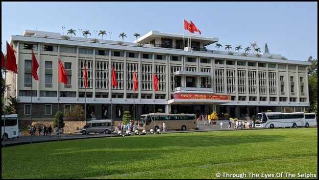
We had to climb many steps inside and it was stifling hot in the  unairconditioned building. At 95 degrees, I was close to becoming overwhelmed by the heat. Inside were reception and dining rooms, the President’s private quarters and in the basement the old American made telecommunications equipment and strategic military maps still in place. IMG_20200123_100854~2IMG_20200123_101007IMG_20200123_101440IMG_20200123_101447IMG_20200123_101525IMG_20200123_101653IMG_20200123_102816IMG_20200123_102607_MP

Regardless of how hot and tired we were we had one more stop before lunch. This was at the History Museum with a collection of artifacts illustrating the evolution of the cultures of Vietnam. We did find a small gift shop where we were able to buy soft drinks which we quickly drank down in several gulps. IMG_20200123_105554IMG_20200123_111455IMG_20200123_125157

It was now time for lunch and we were all more than ready, more from the need to rest in air conditioning rather than from hunger. We had lunch at a very nice five star restaurant with a buffet of Vietnamese delicacies.

When we went to the Happy Room we noticed a Smoking Room. We saw these at the Tokyo Airport and other places in Asia. If the cigarettes don’t kill you, the second hand smoke surely will! IMG_20200123_125126

Next we stopped at a lacquer ware workshop to see how they make the beautiful lacquer based paintings and other objects. They actually use pieces of egg shells to color the paintings.IMG_20200123_133152IMG_20200123_133630IMG_20200123_133812

Finally to finish the day we drove by the beautiful Notre Dame Cathedral dating back to the 19th century and stopped at the post office with its lovely architecture. IMG_20200123_142155~2IMG_20200123_142536

On the drive today Tony shared with us some of his thoughts on Vietnam. He said the government is very corrupt with lots of bribes. The people have to work very hard for an average salary of equivalent to $200 a month. The suicide rate among young people is very high. Alcohol and drug problems are widespread. He said there is a very large discrepancy between those who are wealthy and those who have nothing. While Vietnam has McDonald’s and Starbucks and KFC, most of the people have no money to pay for such things. There is no Social Security, no Medicare. He said the Vietnamese people love Americans and he named all the U.S. presidents who have visited and how many times they have visited. Around two thirds of the Vietnamese people living today have been born since the war was over in 1975. IMG_20200123_144853IMG_20200123_145212~2IMG_20200123_145502

The lights here have timers to tell you when they are going to change.

IMG_20200123_152334

After an hour drive back to the ship we were once again greeted with the much appreciated cold towels and lemonade. We rested for an hour before going out on the deck to see a special Vietnamese dragon dance put on for us by a group of thirty young men. A sort of thank you for visiting, please come back again farewell. After their performances they sat patiently on the pavement and waited for us to leave. The ship was delayed almost thirty minutes leaving as we waiting to clear Vietnam customs. As we finally began to pull away from the dock, the young men jumped up and began to dance again and wave goodbye. A lovely farewell to our first stop in Vietnam. IMG_20200123_173020IMG_20200123_173138IMG_20200123_173419IMG_20200123_173640IMG_20200123_173743IMG_20200123_173700IMG_20200123_175100


UPDATED: Petaluma, CA OCT 6, 2018

In the last blog post we left off with the dilemma of a screw in one of our four back tires. Since it was inadvisable to continue down the coastal road, we were headed from California SR 1 to US 101 in the hope of making it to a tire repair center before the tire went flat. We sure didn’t want a blow out on one of the narrow curvy and coastal steep roads.

I drove the car and we started out slowly with Bill listening for any beeps on the tire monitor system signaling a problem. We backtracked on SR 1 to SR 128. So far, so good. Then came SR 253 which was recommended for us to take to US 101. The southern end of SR 128 is also not advised for large vehicles.  Highway SR 253 was the scariest drive of the day with descents of 8% and 10% grades. Really steep, but at least they were not uphill. Not good on the best of days and downright nerve wracking with a potential tire problem. Reaching US 101 never felt so good.

When we had a good phone signal Bill was on the phone with several tire companies. Of course none of them had the RV tire in stock and certainly would not recommend removing the screw without a tire to replace it. We continued on, and after almost six hours of driving with rest stops and lunch we arrived at the Petaluma Elks Lodge, a wonderful lodge with full hookups. Jeff, the friendly camp host, was extremely helpful in getting us set up there. Amazingly the tire had not lost air even though Bill noticed a disturbing crack in the tire in addition to the screw.  We were definitely blessed to have made it safely. We knew we would have to wait it out until at least Monday.

On Sunday Bill went to sit in on a taping of TWIT (This Week In Tech), one of his favorite tech podcasts which is taped right in a studio in Petaluma. We were last in Petaluma in 2014 and he also sat in on a taping then. After a stressful day on Saturday, he certainly enjoyed the diversion and had lots of fun. IMG_20181007_142830aIMG_20181007_153507IMG_20181007_140107IMG_20181007_172924

Back on the phone Monday morning Bill found a tire company who could order us the tire. And since the tires were over five years old with almost 44,000 miles on them, we decided to replace all four back tires. We had replaced the two front tires last year. A definite bright spot was the screw was not in one of our new tires.

The tires came in on Wednesday and that day was spent getting the new tires installed and then settling back in at the Elks Lodge.

Before the tire drama our original plan was to stay at a RV park in Pacifica outside of San Francisco for four days. With the delay for the tires to be ordered and installed, we had to cancel our Pacifica plans. I explained the tire situation to the lady at Pacifica and she graciously refunded all our money since we had prepaid the full amount. We were disappointed but we had visited San Francisco in 2014 and done all the touristy things including riding the cable cars, visiting Pier 39 and Alcatraz and driving on Lombard Street, aka “The Crookedest Street in the World”. Over the past couple weeks we have been watching the San Francisco local news. While it is without a doubt located in a beautiful area, it definitely appears to be a city in crisis. With garbage in the streets, rising crime rate (especially car break-ins) , homeless population as well as drug use, it is a city in deep trouble.

One thing we had looked forward to doing again was walking on the beautiful Golden Gate Bridge. Since Petaluma was a 35 minute drive to the north end of the 1.7 mile long Bridge, we decided to drive there on Thursday. We drove to the north vista point and parked the car in a free visitor parking area. We were nervous about leaving the car because of all the news reports of recent break-ins in broad daylight throughout the San Francisco area.  Signs in the parking lot warned of break-ins. From there it was a quick walk to the Bridge. IMG_20181011_135628IMG_4307IMG_431520181011_142525

IMG_4345

Alcatraz Island

We walked to the halfway point, enjoying the spectacular views of San Francisco, Alcatraz and the San Francisco Bay.  There were lots of tourists walking and bike riding on the Bridge. IMG_4330IMG_4342IMG_4339IMG_20181011_150326IMG_4334 In the water we saw sea lions, including this one with a big fish in his mouth. Several sea gulls were diving down fighting him for the fish. IMG_4357IMG_4393IMG_4395 On the other side of the Bridge we could see the Pacific Ocean and a viewpoint which we later drove to with the most magnificent views of the Bridge and city. 

IMG_4346

Looking toward the bridge viewpoint

IMG_4396IMG_20181011_155935 As World War II approached, the Army made further improvements to the Harbor Defenses of San Francisco. They had plans to install a 16-inch gun high on the hill but when the gun arrived the decision was made to abandon the plan. Thus leaving this concrete mount and tunnels. IMG_4404 It had been an easy quick 35 minute drive to the Bridge that morning but later that afternoon it was a slow stop and go, hour and fifteen minute drive back home.

After getting new tires we were ready to get back on the road and continue our travels. While heavy traffic doesn’t bother Bill, I wasn’t looking forward to the drive around San Francisco and through San Jose. We had three route options and after asking for advice from locals we chose the route which took us furthest around San Francisco rather than over the Golden Gate Bridge or through the bay area. Leaving the Elks Lodge we meandered through some vineyards and eventually on the interstate. 20181012_095229 The worst traffic was around Walnut Creek. We continued around the bay to San Jose, the center of the Silicon Valley. All in all the traffic wasn’t nearly as bad as I had feared. 20181012_113350 We reached Morgan Hill and were almost at our campground destination when we were stopped by a sign saying the road had a bridge ahead which was restricted to traffic under seven tons. Oops! I called the campground to get their advice only to have no one answer at either number. Not willing to take a chance, we had to find an alternate route nineteen miles out of our way and many narrow passages. When we arrived at the campground and asked about the bridge restriction they told us that was just something the locals put up to keep big trucks off the road. Grrrrr…..

We are now safely at Morgan Hill, California for four days.

Next up:  Back to the coast

UPDATED: Brookings, OR SEPT 14, 2018

After five months along the Oregon and Washington coast, we headed south to Brookings, our final stop in Oregon.  Even though we waited until almost noon to leave, there was still a heavy fog/sea mist hovering over the area. The drive from Bandon to Brookings is a very scenic and beautiful drive but because of the fog we were unable to see any of the coastline.  We passed over the Isaac Lee Patterson Bridge, over the Rogue River. 20180914_141347Oregon sure has some beautiful bridges! The picture doesn’t show the heavy fog which could be seen just by looking to the right toward the water.

We spent a week in Brookings at Harris Beach State Park, one of the most popular Oregon state parks.  We were last here in May, 2014. Due to its relatively mild climate and the fact that it gets more sun than any other Oregon coastal town because of its south facing position, Brookings is often referred to as “The Banana Belt of Oregon”.  Flowers bloom all year and 90% of the country’s Easter lilies are grown here. It is also home to many myrtle trees and coastal redwoods. IMG_4167IMG_20180921_094946-EFFECTS

One day we drove back up the coast along the Samuel H. Boardman State Scenic Corridor which parallels the Oregon Coast Trail, a 362 mile hiking trail along the entire coast of Oregon.  We stopped at several scenic overlooks including Arch Rock. IMG_4143IMG_4144IMG_4145IMG_4149IMG_4151IMG_4154

We wanted a picture of the Thomas Creek Bridge since it is the highest in Oregon but the bridge was having major construction.  We did find a path which was described as leading to a bridge vista point. A sign said the trail was severely eroded and caution was needed so I stayed behind while Bill walked down to get a picture .  Unfortunately trees have blocked much of the view. IMG_4165

While in Brookings we did a little more weekly shopping to take advantage of Oregon’s no sales tax.  We have enjoyed not paying sales tax but their ten cent deposit on all cans and bottles has been a bit of a pain.  This view in town shows the sea mist wafting through the area creating a smoky looking haze. 20180917_131143

Most evenings the fog prevented us from viewing good sunsets but we did manage to catch one. IMG_4114IMG_4120IMG_4122

Next up:  Eureka, CA

Tent Rocks National Monument, NM SEPT 26, 2017

On Tuesday we drove just a few miles down the road to the Kasha-Katuwe Tent Rocks National Monument.  The 4,645 acre Park was established in 2001 after being designated an Area of Critical Environmental Concern and is managed by the Bureau of Land Management.  IMG_20170926_104514

In order to access the Park you need to drive through the Pueblo de Cochiti Reservation.  Kasha-Katuwe means “white cliffs” in the native language of the Pueblos.  There is evidence of human occupation in the area for over 4,000 years with the first Pueblos in the 14th and 15th centuries. The cone or tent shaped rock formations were created 6 to 7 million years ago from volcanic eruptions of the Jemez volcano that left pumice, ash and volcanic rock over 1,000 feet thick.  The tent rock shapes can be up to 90 feet tall.  IMG_20170926_105103IMG_20170926_112330

Here we hiked two trails.  The first trail, the Slot Canyon Trail, was a difficult trail involving some difficult scrambling over rocks and rock climbing.  IMG_20170926_112341IMG_20170926_112403IMG_20170926_112552IMG_20170926_112908IMG_20170926_113609IMG_20170926_113748IMG_20170926_114018IMG_20170926_114603IMG_20170926_114706IMG_20170926_114800IMG_20170926_114826
I really enjoyed walking in the Slot Canyon but at one point I just didn’t have enough upper body strength and had to give up and let Bill go ahead while I waited.
IMG_20170926_114832IMG_20170926_114907IMG_20170926_114931

The second trail, the Cave Loop Trail was a shorter and easier trail.  IMG_20170926_122947IMG_20170926_123136IMG_20170926_123145IMG_20170926_123254IMG_20170926_123225IMG_20170926_123314IMG_20170926_123355IMG_20170926_123806

Bill found a snakeskin but luckily not the owner!  IMG_20170926_122942

We met a very nice couple from Ohio on the trail and enjoyed talking with them along the way.  Before heading home we drove to the Veterans’ Memorial Scenic Overlook with a beautiful view of the picturesque Peralta Canyon and Jemez Mountain peaks.IMG_20170926_124034IMG_20170926_124706IMG_20170926_132648IMG_20170926_132713IMG_20170926_134515

Next up: Albuquerque and the Albuquerque International Balloon Fiesta.IMG_20170926_104809

REVISED: St Louis, MO Part 3 May 24, 2017

This replaces previous post of the same name; three videos are available below.
On Tuesday we took the RV to get two new front tires which took a good part of the day.  On Wednesday morning we were ready to head out for some more St Louis sightseeing.  Our plan for the day was to visit Forest Park where there were several places we wanted to see.

IMG_20170524_103109Forest Park is one of the largest municipal parks in the United States (larger than Central Park) and covers 1,300 acres.  This park was the site of the 1904 World’s Fair.  First we stopped at the Visitors Center to purchase a $2.00 all day trolley pass that would allow us to hop on and off at various places in Forest Park.IMG_20170524_165938

IMG_20170524_101553We hopped on the trolley and our first stop was at the St Louis History Museum.  A free museum, it was built on the site of the main entrance to the 1904 World’s Fair.  It was originally built as the first national monument to Thomas Jefferson and honors Jefferson’s role in the Louisiana Purchase, preceding the Jefferson Memorial in Washington DC.  IMG_20170524_101857Exhibits feature the history of St Louis from 1764 to the present day.  While we were there they were having a special exhibit on Route 66 called “Route 66: Main Street Through St Louis”.  Route 66 was known as the “Mother Road” and the “Main Street of America”.  We really enjoyed seeing the exhibits on the important role this famous road had in American history.    IMG_20170524_103411IMG_20170524_104326IMG_20170524_104602IMG_20170524_104735IMG_20170524_104829IMG_20170524_105124

IMG_20170524_105611

Do you know what these are? (Answer at end of Blog)

They also had a replica of the Spirit of St Louis airplane. This Spirit of St Louis Sister Plane was used in the 1957 Jimmy Stewart movie.IMG_20170524_110201

We rode the trolley to our next stop, the St Louis Science Museum, another free museum and one of only two free science centers in the United States.  Advertised as one of the largest in the country, one of the top five Science Museums in the country and one of the most visited in the world with 700+ permanent galleries as well as a planetarium and OMNIMAX Theater, our expectations were really high and we were somewhat disappointed.

IMG_20170524_115013IMG_20170524_121921 It was a great science center for children but did not have much for adults.  Unfortunately we just missed a King Tut exhibit set to open May 27th.  Our favorite thing was the pedestrian bridge over the interstate connecting the north and south sections of the Center.  The bridge had glass windows in the floor where you could look down and see the vehicles pass underneath you. They also had windows with radar guns so you could clock the speed of the vehicles as they passed by.

select video above also

Select video above

We took the trolley back to our car and drove a short distance to Pickles Deli, a highly rated deli where Bill got his favorite Reuben sandwich.  On the way out of Forest Park we stopped to take a picture of a Confederate​ statue.  We noticed a news van and some people milling round.  Ironically minutes later on the way to the deli we were listened to the local radio station and heard that this very statue was vandalized the evening before.  Like many other Confederate statues across the country today, discussions are being held about removing this Confederate statue from Forest Park.IMG_20170524_123407IMG_20170524_123335

On the way back to Forest Park we drove by the beautiful Cathedral Basilica of Saint Louis, built between 1907 and 1914.  We didn’t have time to go inside but that is definitely on our list for next time.IMG_20170524_132228

Our final stop of the day was the St Louis Zoo. This zoo is free and is advertised as one of the top zoos in the United States and was voted America’s top free attraction.  This zoo really wowed us and we really enjoyed our time here and was quite impressed.  During our time in St Louis we were really impressed with all the free museums and other places that usually charge an admission in other cities.  Well done, St Louis!IMG_20170524_144333IMG_20170524_144452

The zoo has over 24,000 animals, many of them rare and endangered.

IMG_20170524_144729

Golden Lion Tamarin

IMG_20170524_155952IMG_20170524_153157IMG_20170524_154133IMG_20170524_145239IMG_20170524_152131IMG_20170524_145440IMG_20170524_145908IMG_20170524_162154

We did pay to ride the Emerson Zooline train which is the nation’s largest miniature rail line, providing a 1.5 mile long narrated tour through the 90+ acre park.  The train engines are one third size replicas of the Iron Horse, the historic steam locomotive that helped build the transcontinental railway.  We passed through two tunnels as we traveled around the park.IMG_20170524_140416

We loved seeing all the animals but our favorites were the giraffes, hippos and penguins.  We were amazed at how close we got to the animals and were especially thrilled with the large number of penguins.IMG_20170524_150803IMG_20170524_150756IMG_20170524_163202

Select video above

IMG_20170524_154713IMG_20170524_154900IMG_20170524_155154IMG_20170524_155228

By the time we got back to the car our Garmin pedometers said we had walked over seven miles. What a great day!

Next:. Our last day in St Louis and a camel ride!
Answer: Speakers used at a drive-in theatre.

July 8, 2015 Buffalo Bill Center – Cody WY

IMG_20150707_172649Cody has a wonderful museum called the Buffalo Bill Center of the West.  It is actually five museums all under one roof on over seven acres.  You could easily spend an entire day there seeing the Buffalo Bill Museum, the Draper Natural History Museum, the Cody Firearms Museum, the Plains Indian Museum, and the Whitney Western Art Museum.IMG_0308

IMG_0322

North African Miquelet Jezail given to Jefferson in 1805 This gift influenced the inclusion of the lyrics “to the shores of Tripoli” in the Marine’s Hymn

Bill loved visiting the Cody Firearms Museum which has one of the largest firearms collections in the world.  They had firearms on loan from the Smithsonian as well.  They had firearms Bill had never seen.  IMG_0320I especially enjoyed seeing a musket once owned by Thomas Jefferson as well as a gun owned by Annie Oakley and several former U.S. Presidents.  I loved seeing the guns IMG_0310IMG_0311IMG_0312IMG_0309IMG_0313IMG_0316used on the TV set by Ben Cartwright and his sons on Bonanza as well as the Lone Ranger. Some interesting people in the development of firearms:

  • Oliver F. Winchester was a successful shirt manufacturer established Winchester Repeating Arms Company in 1866
  • John M. Browning (1855 – 1926)
    • was the most ingenious and prolific arms designer America has produced
    • his designs were manufactured under patent assignment by noted firms like Winchester, Colt and Remington
    • from 1884 to 1901 he worked for Winchester and sold all his patents to them
    • he designed the Colt Model 1911, “Army .45”

We also spent a lot of time in the Buffalo Bill Museum which had many exhibits about the life of Buffalo Bill, including movie footage of one of his Wild West shows.  He took his Wild West shows to England and Europe, once performing for Queen Victoria.IMG_0329IMG_0315

The Buffalo Bill Center of the West is often called the Smithsonian of the West and we could see why!

IMG_0326

Crazy Horse

IMG_0327

Sacagawea

We really enjoyed our short time in Cody.  There were things we didn’t have time to see and added Cody to our list of places we would like to return to someday.

March 22, 2015 Dunedin and Invercargill, New Zealand

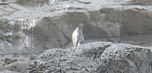
After our visit to Mount Cook we stayed overnight in Timaru.  The next morning we drove towards Dunedin.  Along the way we passed the 45 parallel south which meant we were now closer to the South Pole than the PicsArt_1427353374559equator. We stopped at Katiki Point because our tour  book said we might be able to spot some yellow eyed penguins, the rarest and most endangered penguins in the world and native to New Zealand.   One of our goals while in New Zealand was to see penguins, preferably in the wild in their natural habitat.
We parked and began to walk along the beautiful coastline toward the point.  Suddenly Bill stopped and motioned toward a bushy area.  There, a few feet away, were two yellow eyed penguins.  So exciting!!  They are now at the time of year when they are molting, so they looked a little different from what you might PicsArt_1427256961287expect.  At first we barely moved and didn’t utter a sound for fear of scaring them away.  Once Bill took some pictures we moved closer down the path and they didn’t appear at all afraid of us.  This area is a highly protected reserve and we think they have become accustomed to people and know they have nothing to fear.  The area is under video surveillance and everyone is expected to follow the rules or face stiff penalties.
We proceeded down the trail and came upon one more penguin closer to the rocky shoreline.  What was really neat was there was also a fur seal not far from the penguin so we were able to get a picture of them together.PicsArt_1427257185593PicsArt_1427257249842
We walked to the end of the point passing by huge fur seals lounging on the rocks and upper hillsides.  We could have literally stepped over the seals and they would have cared less.  We enjoyed the view at the end of the point and walked back to the car, so pleased with our penguin discoveries.PicsArt_1427257784210PicsArt_1427257845710

Along the way to Dunedin we saw breathtaking views of the ocean with sheep grazing along the cliffs and people on horseback riding on the beach.   As we crested the top of a steep hill, we had a breathtaking view of the Dunedin nestled next to the ocean.  The first European settlers were Scottish settlers who arrived in 1848. It was originally named New Edinburgh but the name was changed to Dunedin which is an old Celtic name for Edinburgh.

“The people are Scotch.  They stopped here on their way from home to heaven, thinking they had arrived.” Mark Twain
Nearby goldfields generated wealth in the area and New Zealand’s first university, the University of Otago, was established here.  The discovery of gold encouraged the arrival of Chinese miners and by 1871 there were over 4,000 Chinese miners in the area.  Many settled permanently in Dunedin and are an important part of the community today.
We arrived in Dunedin late in the day since our penguin adventure took longer than expected.  We didn’t really have much time to explore the city before dark.  We did drive to Baldwin Street which is named in the Guiness Book of Records as the steepest street in the world.  The street runs from 98 feet above sea level to 330 feet above sea level with a slope of between 20% to 35%. The lower part of the street is asphalt but the upper reaches of the street, which is the steepest, is surfaced in concrete for safety on frosty mornings.2015-03-28_04-36-142015-03-28_04-35-56
Dunedin is often called the eco-capital of the world because of all the nature and wildlife in the area.  The Dunedin Railway Station is said to be the most photographed building in New Zealand.
I wish we had had more time to explore this charming city with its beautiful old Victorian and Edwardian buildings.
Next we headed to Invercargill.  Along the way our tour book suggested we stop by Nugget Point Lighthouse, which is the most photographed lighthouse on the South Island and a location often seen on postcards andPicsArt_1427258167378PicsArt_1427258384986 brochures of New Zealand.  The book said it was possible to see penguins here, though the best time to see them was between 5 and 6 PM  We saw a hide which is a little structure where people can hide so they can see the penguins but they don’t see us. It was early afternoon and we didn’t want to wait around that long since we still had a long drive to Invercargill.  We did trudge to the end of the trail where the lonely lighthouse sat on the edge of a PicsArt_1427258454378rocky cliff.  We enjoyed talking with a couple visiting from England.
Our time in Invercargill was short but Bill did have time to visit the E Hayes Motorworks Collection where there is a remarkable vintage motorcycle and car collection, but more importantly the world’s fastest motorcycle.  Ben Munro, built the World’s Fastest Indian, was born near Invercargill.  In 1920 he bought a Indian motorbike for $120 which he modified and tuned to a record of 190.07 mph, a world record.PicsArt_1427258753624PicsArt_1427258809437PicsArt_1427258654232PicsArt_1427258519862in 2005 the movie “The World’s Fastest Indian” was released and starred Anthony Hopkins as Burt Munro.
Also while in Invercargill we spent one day on another penguin hunting adventure.  Using the tour book tip of best places to look, we first headed to the most southern point in all of New Zealand. Here we were the closest we would get to Antarctica.  While hiking to the point we walked in a field of sheep who at one point trotted ahead of us as if showing us the way.  I tried to get a picture of them up close with Bill but they were very skittish.PicsArt_1427258895661PicsArt_1427258977231PicsArt_1427259017269PicsArt_1427259083780
We intentionally set out late in the day because the best time to see penguins is around dusk when they swim back to shore to their nest after being at sea ALL DAY.  We joined a throng of people waiting anxiously PicsArt_1427259121841for their arrival in a roped off area with a DOC (Department of Conservation) employee there to be sure everyone followed the rules.  We had to stay behind the yellow ropes and no flash photography because they think it hurts the penguins eyes.  We waited an hour PicsArt_1427259916676and a half in a very cold drizzle until we were rewarded with one penguin fairly far away.  Just as we were about to give up someone spotted another one closer.  He washed up on shore and then proceeded to hop across some rocks and then stop and preen.  After watching him for awhile it was getting dark, we were pretty wet and really cold, and we had over an hour’s drive back to the motel.  Was it worth the hour and a half wait in the cold and rain?  Absolutely!!PicsArt_1427445322474PicsArt_1427444362975PicsArt_1427446952935PicsArt_1427445192178
Some observations:
We noticed many trucks with an engine breathing apparatus (snorkel).  Evidently they like to take their trucks and play in the water and need this engine snorkel.PicsArt_1427258088107
You occasionally see a business or house for sale, you never see land for sale.
It is strange to see deer fenced in.  We are used to seeing them only running wild.  Bill has enjoyed eating lamb and venison in New Zealand. Wild deer can be hunted year round.
The motel guest laundry and laundromats use cold water only.  This totally freaks out a germ freak like me!
We are enjoying meeting and talking with people from other countries around the world.  There are many tourists here from Australia, France, Germany and Japan.

March 20, 2015 Aoraki Mount Cook National Park New Zealand

PicsArt_1427254694639

Aoraki Mount Cook 12,316 FT

We had not originally planned on visiting this national park, but after reading about it we realized we were about to miss a real treasure so we changed some reservations and altered our itinerary to allow us to spend a day and night in the park.
In 1851 Captain J. L. Stokes, while mapping the West Coast of New Zealand, sighted a huge mountain which he named Mount Cook after Captain James Cook.  The Maori called the mountain “Aoraki” which means cloud piercer.  In 1998 Mount Cook was renamed Aoraki Mount Cook to incorporate its Maori heritage.  Aoraki Mount Cook is the only place to have its English name preceded by its Maori name.
Aoraki Mount Cook National Park became a park in 1953 and is 270 square miles, with 40% of the area glaciers.  The park has 27 mountains with 140 peaks more than 600 feet high.  Mount Cook at 12,316 feet is the highest in New Zealand.  The park is a gorgeous combination of grasslands, huge river valleys, lakes and snow/glacier covered mountains.PicsArt_1427254251912PicsArt_1427254588800PicsArt_1427254635447PicsArt_1427254517456
Sir Edmund Hillary is New Zealand’s most famous New Zealander.  It was at Mount Cook in 1948 that he climbed his first major mountain, including the difficult south face of Mount Cook.  Hillary trained here for his Everest and Antarctica expeditions.PicsArt_1427255469862
We splurged and stayed overnight at the Aoraki Mount Cook Village – Heritage Hotel with a breathtaking view of Mount Cook from the balcony in our room.PicsArt_1427254836515PicsArt_1427254879336PicsArt_1427255062679
Before heading home the next day we decided to hike the Tasman Glacier Lake Trail which gave  us a view of Tasman Glacier Lake with small icebergs.  Our non-trusty tour book called it an easy 15 minute walk each way.  When are we going to learn not to trust that book?  The hike started out easy enough and we enjoyed meeting a couple from South Carolina along the way.  About a third of the way up the trail we started to come to some rocks to climb on.  Uh oh!  The climb got steeper with a greater number of rocks.  I do okay with steep trails, but I don’t do well with rocks.  I would have never made it to the top without my walking sticks and Bill’s patience and helping hand.  I felt like quite the wimp as young children sailed past me over the rocks and young people rerouted around me.  By the time we got to the top I was sufficiently traumatized and stood frozen to the spot while Bill took pictures of the lake.  The icebergs over the years have dwindled.
While Tasman Glazier is New Zealand’s largest glacier and icebergs periodically tear away from the face of the glacier into the rapidly growing lake,  the effects of global warming and other climatic processes are taking their toll on glaciers.  The Tasman Glacier is melting and calving at an exponentially increasing rate.  In recent years the Tasman Glacier has changed from mainly melting to a calving (pieces breaking from the glacier) and melting resulting in a lake that is rapidly increasing in size.
After Bill enjoyed the view and I pondered how in the world I would ever get down, we began our descent.  Did I mention we also had winds of around 30 mph during the ascent and descent?  Actually the descent wasn’t nearly as bad as climbing up had been but I was relieved to see the car in view.  This was my most difficult hike ever and I was proud of myself for doing it.PicsArt_1427256234540PicsArt_1427255799129PicsArt_1427256558840PicsArt_1427256491055
Some observations:
It feels strange seeing the leaves begin to change color and the farmers clearing their fields as autumn begins in New Zealand.
The drivers in New Zealand are very courteous.  If you turn on your signal to change lanes they immediately back off and allow space for you.  Merging is called “Zip” on traffic signs because you are supposed to merge alternating one lane at a time like a zipper.
Cost of living here is very high.  There is a GST (Goods and Services Tax) of 15% added to all goods and services purchased in New Zealand.
There is no industry in New Zealand so everything is brought in.  For example they ship their logs to Japan where they are made into paper products and shipped back to New Zealand.  Products may be labeled made FROM New Zealand products but it doesn’t say made IN New Zealand.  Everything in New Zealand is centered around farming and horticulture.  One man Bill talked with said a Ford F150 pick up truck here would cost about $95,000 New Zealand dollars.  The man has family in Dallas, Texas that he goes to visit and he said he is amazed how cheap everything is in America.

March 17, 2015 Christchurch, New Zealand

 We left Nelson and headed to Kaikoura.  During the two hour drive we saw many fields of sheep and cattle, as well as several fenced fields with large herds of deer and a field of llamas.  Venison is a popular item on menus here.
Shortly before reaching Kaikoura we stopped at Ohau Point where there were a large number of seals of all ages and sizes on the rocks and in the water.  People were able to walk down on the rocks and get up close and personal with the seals.  They had no fear of people and we hope that people respect the marine life rule: look but don’t touch.  While looking at the seals we talked with a family from New York State.  Always great to meet people from back home!!PicsArt_1426847688649PicsArt_1426845913329PicsArt_1426845997163PicsArt_1426846543154PicsArt_1426846327099PicsArt_1426846766240PicsArt_1426846945101PicsArt_1426847177841
We loved our motel room in Kaikoura.  For the equivalent of $106 American dollars we had a large room with a view of the ocean and small kitchenette, but best of all was the bathroom.  It had heated towel racks, a heated floor and a heater when you turned on the fan so the air was warm when you stepped out of the shower.  Loved, loved, loved it!PicsArt_1426848577753
After a short one night stay in Kaikoura we headed to Christchurch, the largest city on the South Island with a population of 340,000.  The first recorded settlers here were Maori, with European settlers arriving in 1840.  In 1850 the first organized group of English immigrants arrived on four ships and are considered the city founders.  In 1856 it was declared a city and land was set aside to build the first dwelling, a cathedral.
It is called the “Garden City” but today it is very much a city under extensive regrowth and change.  The people of Christchurch are an extremely strong, resilient people full of hope and strength and resolve.  You see, since 2010 Christchurch has been shaken by over 10,000 earthquakes.  One earthquake was 7.1 magnitude, three earthquakes over 6 magnitude, fifty-seven over 5 magnitude, and many thousand more.  The 7.1 earthquake occurred in 2010, but the 6.1 earthquake in February 2011 did the most damage since it was shallow and close to the city center.  The 2011 earthquake killed 185 people and brought down many buildings already weakened from the 2010 quake.PicsArt_1426933713089PicsArt_1426932952379PicsArt_1426932886793
The destruction was evident to us as we walked and drove around the city.  Complete city blocks in the downtown area are now vacant after the destroyed buildings were razed.  In the face of all this tragedy the people have risen to meet the challenge.  Two perfect examples are the Cardboard Cathedral and Re:Start.
When the original Angelica Christchurch Cathedral was badly damaged in the quake, the people of Christchurch, just like the city founders before them, found a way to build a church.  Japanese architect Shigeru Ban designed one of his famous “Emergency architecture” buildings in which a cathedral was built from 96 cardboard tubes, timber beams, structural steel and a concrete pad.  The cathedral opened in August 2013 and is a symbol of innovation, hope, and inspiration.  It is built to last for fifty years while the new permanent cathedral is designed and built.PicsArt_1426933949477PicsArt_1426933846113PicsArt_1426932273487PicsArt_1426931491835PicsArt_1426931983052PicsArt_1426931584830
Another example of the tenacity of the people is Re:Start.  After the quake destroyed their stores in the downtown area, business owners brought in converted steel shipping containers and operated business from these containers.  While many containers remain, we read that the containers are gradually disappearing as more permanent stores are being built.  We walked through the shopping area and had lunch at one of the vendors set up near the containers.  Bill had a lamb souvlaki which he said was very good.PicsArt_1426933050726PicsArt_1426933114187PicsArt_1426933266856PicsArt_1426933387410PicsArt_1426933449255PicsArt_1426933539195
There was evidence everywhere of construction as the city is hard at work rebuilding.  It is somewhat sad to see all the beautiful old buildings razed to make way for the larger new ones because the real charm of the city lies in these past structures.
As we walked their streets, ate in their restaurants, shopped in their stores, stayed at their motel, we were always met with smiling, friendly, cheerful people.  It was our pleasure to meet them.  They are an inspiration!
The next day we took a day trip to Arthur’s Pass which is the highest pass over the Southern Alps, connecting the east and west sides of the South Island.  The Southern Alps is a mountain range which runs along the western side of the South Island and forms a natural dividing range along the entire length of the South Island.  Arthur’s Pass is both a national park formed in 1929 and a small village where we had lunch at a small cafe.PicsArt_1427016427893PicsArt_1427016648557
After lunch we hiked to Devil’s Punchbowl, a 430 foot waterfall.  We use a tour book which we have found tends to underestimate the difficulty of the hikes, and this was another example.  This hike was marked as an easy though steep hike to the waterfall.  Not quite!  We met a couple coming back from the hike and the woman shook her head and sighed and mentioned 289 steps. Didn’t seem a big deal to us until we had started the hike and discovered that some of the 289 steps were cut into the earth and/or high steps which really presents a challenge for my short legs.  It was hard for me but the view at the top was amazing.  While there we met people from Seattle and Tampa, Florida.  For some reason we are meeting many more Americans on the South Island.PicsArt_1427015467225PicsArt_1427015243071PicsArt_1427014879996PicsArt_1427014239506
Some observations:
Most motels have guest laundry and if you don’t want to use the dryers they often have clothes lines outside.  Clothespins are called pegs.
Emergency is 111 not 911.
Reservations are called bookings.  When you go to a restaurant they may ask if you have a booking.
All New Zealand tap (faucet) water is among the world’s best and safe to drink.
On both the North and South Islands the motels all keep electric blankets on the bed.  The blankets are put under the sheet not on top of the sheet.  If you are not careful you will lay on one of the controls which is uncomfortable.  The first time we felt it we thought the springs were coming through the mattress.  We find having the blanket under the sheet where you lay on it with the wires odd.
The cold and hot water faucets are reversed with the cold water on the left and hot water on the right.
They include French fries (chips) with everything on the menu.  Bill ordered chicken parmesan last night and it included chips (no spaghetti). Bill asked if they would substitute mixed vegetables for the chips.  We are both really tired of French fries even though the fries here are always good.  I never thought I would say I am tired of potatoes, but I am!